From: AAAI Technical Report SS-00-04. Compilation copyright © 2000, AAAI (www.aaai.org). All rights reserved.
Some Aspects
of
Scouting
Smart
Environments
JSrg Baus, Andreas Butz, Antonio Kriiger~ Marco Lohse, Cyrille
Breihof
Collaborative Research Center 378
University of Saarbriicken
PO-Box 151150
66041 Saarbrficken
Germany
[bans,butz,krueger,mlohse,breihof]@cs.uni-sb.de
http://w5.cs.uni-sb.de/~
[baus,butz,kriiger,mlohse,breihof]
Abstract
Wediscuss a virtual presenter in the form of a
3D avatar whose task it is to show people a way
through a (3D model of a) public building. Our
thesis is that whenlooking for waydescriptions,
seeing such a walkthrough guided by a virtual
scout is easier to rememberthan a purely textual
description of the wayor tile kind of annotated
floor plans used widely in today’s public buildings.
Furthermore, we discuss sometechnical aspects of
how such a scout can be constructed and what
underlying data and processes are needed for the
automated generation of guided waydescriptions.
Oneof our maingoals is to give the avatar the possibility to react to her spatial environmentin an
appropriate matter, e.g. pointing to relevant objects and following a path that can be easily memorized by tile viewer. Tile walkthroughsdescribed
here will be used within a building navigation system that also includes navigation via a handheld
device, (such as a PDA,)once tile user has left
the information booth. Both the 3D visualization
at the info booth and the more sketch-like presentation on the PDAare generated from the same
data and by the same system, and thus can refer
to each other for a muchmore consistent overall
appearance.
Introduction
Today’s your lucky day. You have just arrived in a
city you’ve never been to before at an airport you don’t
know. You want to catch your connecting flight and buy
some international
newspapers on the way. If you’re
lucky, you end up standing in front of a huge environment map mounted to the wall, where your actual position is marked as a red spot. Nowyou have to find a
newspaper store and your destination gate on the map,
either by "brute force" searching over the map or by
looking them up alphabetically
in the legend. From
the legend you will get hints, such as "AI" and "B5",
which are grid cells on the map, where you have to look
further for your destination.
Copyright (~) 2000, AmericanAssociation for Artificial
telligence (www.aaai.org). All rights reserved.
In-
39
Meanwhile time doesn’t stand still and you have to
catch that connecting flight. OK, back to the map! The
newspaper store and gate are found. Now you have to
search for a way from the red spot to those points. After
you have found it, memorize it! You can use different
techniques: Start looking for landmarks, salient objects
in the environment on the way, especially at decision
points where you have to turn, memorizing the sequence
of turns, ... For scientists, this is "building a cognitive
map" of the environment, but don’t forget that flight
you ought to catch! Hurry up a little!
As you haste along the hallways, your slowly fading
cognitive map helps you to orient yourself in the environment. You finally manage to get your newspaper
and reach your destination gate just before boarding is
closed. If you were not so lucky, you might have forgotten which way to turn after leaving the store and
you’ll have to ask someone for advice or start looking
for a map again. A peek at your wristwatch doesn’t
help either...
Enough of this! Nowlet’s take a step into a parallel
universe, where after leaving the plane, you walk right
up to an information booth and pull out your electronic
organizer. Its infrared port connects to the booth and
within a second a gentle voice says: "Hello Mrs. Smith,
I see you want to catch your connecting flight on gate F17." (The organizer knew this from an infrared port in
your airline’s
onboard multimedia system, in case you
wonder...) "That’ll probably take you five minutes, but
you have twenty minutes left,. Is there something else
I can do for you along your way?" From the shopping
menu just popped up on the screen you select "newspapers" and the voice says: "OK, I’ll show you the
shortest way. Just follow me!"
Next thing you see on the booth is a 3D view of the
hallway you’re actually standing in, matching almost
exactly what you’re seeing when you look up. Your
scout starts walking along the hallway and as your eyes
follow her, the route she’s taking gives you a direct visual experience of the route you’re supposed to take
yourself. The camera might cut back and forth between
an overview position and the scout’s view. On the way
your scout will turn her head and, pointing to her left,
will say: "Here’s your newspaper store, and, by the way,
restrooms are just next door...", whereupona door in
the 3D view is highlighted. After she has reached the
connecting gate and shortly briefed you on the further
use of your organizer, you start your ownwalk to the
store. After choosing your favorite newspaper and a
quick excursion to the restrooms, of course you have
forgotten which way to turn. Those huge airports are
still confusing you, but with a quick look at your organizer you’re back on the track and assured that you’re
well on time. As you reach the gate, boarding is just
about to start...
Please bear with us for this lengthy introduction, but
we believe that it summarizesmanyof the aspects relevant to the successful design of building information
and navigation systems. In this paper we will focus on
howto construct a virtual scout and a fitting environment in order to generate guided walkthroughs in the
aforementioned way.
The REAL stuff
In the REAL
project we investigate the developmentof
a resource adaptive navigational help system with the
capacity to adapt to various restricted resources (cognitive or technical) during the generation of multimodal
route descriptions. The resource adaptive generation of
graphics/animation for different classes of output devices implies dealing with limited technical resources
on one hand and taking into account a user’s limited
cognitive resources to decode and understand the presentation on the other. The upper end of the scale is
represented by a 3D walkthrough guided by a virtual
scout accompaniedby spoken or written text and meta
graphics complementingeach other, while the lower end
is represented by simple sketches of the environment
and arrows indicating the direction.
For this paper we’d like to concentrate on the generation of the 3D visualization. It combinesan animation of a virtual presenter with accompanyingtext and
meta-graphics in order to describe the route itself and
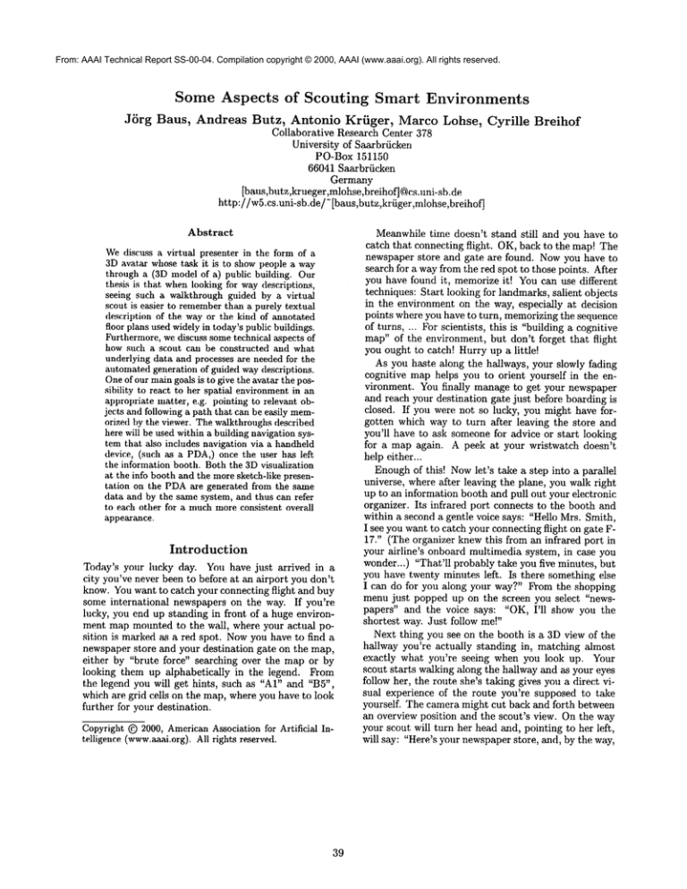
relevant parts of the environmentat the sametime (see
Fignrel). Youcan watch this presentation from different viewpoints, zoomout to get an overview or zoom
in to continue the presentation from the virtual presenter’s view of the scene. In case of time pressure, the presentation will speed up and the system will reduce the
amountof details presented in the virtual walk-through.
This can be achieved for exampleby abstraction techniques (Kriiger 1999) that generate visually clearer and
simpler route sketches.
This also helps to avoid giving a delayed passenger
very long and detailed directions which are very hard
to memorizeand to follow correctly in the remaining
time. In addition to stationary information booths we
are also considering information presentation for mobile
systems, such as PDAswith limited technical resources.
At the information booth you will obtain the display
application for your PDAover an infrared connection,
make choices where you want to be guided, or what
kind of information you are additionally interested in.
4O
rou
Figure 1: A snapshot of a virtual walkthrough
The presentation has to be tailored to these devices’
limited display capacities by generating route descriptions in a simple sketch-like form. After leaving the
booth the PDAfilters the corresponding information
out of a data stream broadcast by infrared transmitters spread throughout the building. The underlying
protocol we developedguarantees a fast availability of
simple or abstract information, while more details are
accumulated as the user stays within the range of one
transmitter (Baus, Butz, &Krfiger 1999). A passenger
in a hurry might only see an arrow pointing in the direction of her destination, while someonepausing at a
place will soon have an environmentmapavailable with
additional information about shops or restrooms.
The construction of a presentation involves at least
the following steps: determination of newinformation,
determination of a presentation structure, conveyingof
the information/presentation. In addition, the information has to be presented taking the maximum
benefit of
particular strengths of each presentation medium,taking into account the information to be presented as well
as the current environment/context. We’dlike to focus
especially on
¯ limited resources on both sides of the communication
channel, that are technical limitations of the sender
(computer) and cognitive limitations of the receiver
(user).
¯ variable resource restrictions that are unknown
in ad-
vance and are coming up during the presentation.
In this paper we discuss the technical framework that
enables us to deal with both of these issues. Instead of
planning all actions of the virtual scout down to every detail, only an abstract plan of the presentation
is prepared (e.g. reflecting the path and the resource
limitations that are known in advance). The final presentation is then derived by a kind of simulation of an
incremental route description, performed by the virtual
presenter as she’s moving along her path scouting the
surroundings. For this purpose we suggest to represent
the relevant task knowledge as annotations to the objects of the domain. The presenter is made sensitive to
the smart environment around her, thus getting only
the relevant information depending on her task and position.
In the following sections we will concentrate on the
relevant knowledge in the scenario at hand and how this
knowledge can be incorporated into the environment.
Building
smart
environments
In the given visualizations we have to cope with various
time constraints and large and complex environments.
Can we represent the environment in a way in which
well designed objects and spaces can help us in performing the task (comparable to our real world)?
Even human beings rely upon the real world to tell
them what to do and why; well-designed objects
and spaces can help us in performing daily tasks by
containing clues to their meanings and operations.
(Doyle & Hayes-Roth 1997).
We expect to find clues that give us the information
we need as we need it. Instantly, they make us limited
experts in the domain. In a properly designed world
knowledge is immediately retrievable, and it’s only necessary to interpret the world. A good design facilitates
the immediate understanding, easing the user’s cognitive load. In order to design such a world in the virtual
we will show how to represent and establish reference
frames that enable us to talk about the space the avatar
is in. l~lrthermore we will discuss the general properties of objects in the domain, including buildings and
street networks as these play an important role in route
descriptions. Finally we will explain in more detail how
the avatar presents route descriptions and information
about her environment.
Reference
frames
in route
descriptions
Whentalking about space we always need to establish
a reference frame. A reference frame in our computational model is specified by three characteristics:
1. The origin of the coordinate system (independent of
the kind of coordinate system).
2. The handedness of the coordinate
the relations between axes.
system specifying
41
Throughout this paper we will use the following terms,
when we talk about different frames of reference (FOR)
(for a more detailed discussion see (Klatzky 1998)):
¯ allocentric/extrinsic:
A FORwith a fixed coordinate
system imposed by external factors such as a geographic space.
¯ egocentric: This is the agent’s FOR. The location of
points is defined with respect to an intrinsic axis of
oneself’s (or one’s avatar’s) orientation and physical
configuration.
When we move, this is the FOR we
take with us in every step and its allocentric location
changes constantly.
¯ intrinsic: In this FORinherent properties of the reference object (topology, size, shape) determine the
coordinate system. Buildings (or building sections,
such as shops or offices) have an intrinsic or prominent front, usually where the entrance is. The agent’s
egocentric FORis a special case of an intrinsic FOR,
where the reference object is the agent. In addition,
assuming the agent is in front of a building, the building’s intrinsic FORcan be used as an allocentric one
with its own reference direction.
Route descriptions should help the addressee in constructing
a cognitive map of the environment. They
describe the way to follow including landmarks, regions, and mention spatial relations between objects in
the current environment. Verbalization is given step
by step and the addressee undertakes a virtual journey through the environment (see (Schmanks 1998;
Maass & Schmauks 1998)).
In our case we’d like to visualize the virtual journey,
i.e. a course of motion in a given environment. In the
visualization we focus on this course of motion from a
mostly egocentric frame of reference. Elements in tb.e
environment are localized relative to the agent’s position or relative to each other from a point of view called
route perspective (Tversky 1993). This kind of perspective is helpful to convey route-knowledge, knowledge about path segments and landmarks. For the
transfer of survey knowledge, information about regions
or the structure of the environment e.g., in order to
help the addressee taking a short cut, often another
point of view is chosen. Elements of the scene are referred to in an allocentric FORcorresponding to a survey perspective of the environment (see (Tversky 1993;
Herrmann et al. 1997)). In this case we have to choose
a suitable viewpoint to look at the scene, for example a
"birds-eye" or "top-down" view on a map. In addition
to the animation of a virtual walkthrough, we want to
animate the virtual presenter, as a guide to help users
in understanding and navigating the environment. A
virtual humanpresenter is largely enriching the repertoire of available presentation options which can be
used to effectively
communicate information (Andr6
Rist 1996). The presenter is used to guide the user
through the presentation, attract the user’s attention
and convey additional
conversational
and emotional
signals. For the description of a software agent able
to generate multimodalincremental route descriptions
without a virtual presenter and the ability to choose
different viewpoint/camerapositions see (Maa.ss 1996;
Maass, Bans, &Paul 1995)
General object properties
Our representation of the environmentconsists of a hierarchy of objects. Objects can be divided into two
groups: mobile and static. An object representation
consists of three parts: geometry, appearance and annotations. At the very least an object must have a
geometry, an appearance and one annotation, which is
its unique name. The geometry and appearance representation is object centered and hierarchical. By hierarchical we meanthat objects can be decomposedinto
parts and subparts. Geometryand appearance will be
used to visualize the environment. Annotations are the
clues that "give us the information we need as we need
it". An object might have ms manyannotations as we
need to provide meaningful content in different tasks.
The list of annotations maycontain:
* The object’s location in world coordinates, an allocentric frame of reference
¯ Referencesto the object’s subparts, given by the subobjects’ unique names
¯ Linguistic/textual information, useful for verbal descriptions of the objects, such as: "the white house"
¯ Information on howto depict the object in 2D graphics, e.g. an iconic representation of the entity for the
visualization of those entities in a 2Dgraphics.
¯ Information howto highlight the object
¯ Information about the different coordinate systems
attached to the object. Objects can have different
coordinate systems suitable for different localization
tasks, such as: "stand in front of the bookshelf. The
bookis located in the upper left corner."
¯ functional annotations, e.g. functions to computedifferent coordinates from the object’s 3D-model,e.g.
center, 2D bounding box, 3D bounding box. These
concepts can be used in the computationof different
spatial relations (for a closer look see (Gapp1994)).
In fact it could be any query to a knowledge or
database you need in your application in order to
provide meaningful content.
¯ Scheduling bounds. Scheduling boundsspecify a spatial boundary in which a behavior can take place.
The region within this boundaryis called a scheduling
region. A behavior is not active unless the activation
volume (the scheduling bound of the avatar) intersects with the behavior’s scheduling region. If there
is an intersection, the behavior becomes"alive" or
enabled.
An enabled behavior can also receive stimuli and
respond to those stimuli performing certain actions.
Stimuli are used to schedule/trigger any kind of action
42
described in the behavior as long as the behavior is enabled. Behaviorsare useful for informationretrieval, interaction and animation. They provide a link between a
stimulus and an action described by the behavior. Furthermore, combinations of stimuli and combinations of
actions are possible. Onescheduling bound can trigger
different behaviors or different scheduling boundscan
schedule one behavior. Let’s look at a behavior that
only needs to be scheduled if the viewer is nearby. It
should be enabled if the avatar’s activation region intersects with the behavior’s scheduling bounds. On the
other hand behavior boundingenables costly behaviors
to be skipped if the viewer isn’t nearby. In other words,
if there is no one in the forest to see a tree falling, it
does not needto fall.
Representing street networks
Following (Tversky & Lee 1998) a path of motion can
be divided into segments. Eachsegmentconsists of four
parts belonging to different categories: starting point,
reorientation(direction),
path/progression and ending
point,. Paths are continuous. The ending point of one
segment serves as a starting point for the next. Segments correspond to changes of direction in the route
and routes can be schematized as a network of nodes
and links. It is straightforward to represent a network
of streets (or hallways, for that matter) as an annotated
graph consisting of edges and nodes, edges representing
streets and nodes crossings. Street items, streets and
crossings are static objects. For streets the annotations
contain:
¯ References to the neighboring street items at both
ends, another street segment or a crossing
¯ Referencesto objects located at the street item (e.g.,
buildings)
¯ A function to computethe middle line of the street
using the item’s geometryspecification and its location in world coordinates. This allows us to move
along the street on the middleline.
¯ A scheduling bound
The annotations of a crossing include:
¯ References to the neighbors, usually streets
¯ References to buildings at the crossing
¯ A functions to computea connection from the middle
line of attached streets to the center of the crossing
¯ A scheduling bound
Using a search algorithm on graphs will give us a
path form Point A to Point B as a list of edges and
nodes. Together with the functional annotations of
street items, we are able to derive a continuous path.
Such a path can be transformed to a first description
of a route: forward, right, forward ... right, forward,
halt. Mostpeople will find such a description hard to
memorize, but it might be suitable to take with you
on a piece of paper or your PDA.On the PDAwe can
visualize such a description by arrows pointing in the
direction to go. At the information booth you would
see a raw visualization of the course of motion, without buildings. To incorporate additional information in
such a description we need information about objects
along the course of motion, which might be used as
landmarks.
Representing buildings
Buildings(building sections, etc.) are static objects.
addition to their obligatory representation (geometry,
appearance and object name) they include the complete list of general annotationsfor objects (see above).
This is because buildings maybe very complexand have
hierarchical structure. They mayconsist of manysubparts, references to subparts of the building, references
to rooms in the building, which mayhave references
to their furniture and so on. They also contain different coordinate systems and information (in objects coordinates), howthese coordinate systems are attached
to the building, e.g., specifying the building’s prominent/intrinsic front and information on howcoordinate
systems are scaled. This latter information depends on
the object’s size and the context of the environment.
For example the meaning of the word "near" describes
different regions dependingon the object’s size. "Near
the empire state building" denotes a different region
than "the electron is near the nucleus". Another example concerning context: Your nearest neighbor in
Australia might be 300 miles away from you, while in
Manhattanthis is usually not the case. For a detailed
discussion of these concepts see (Gapp1994). With this
information about objects along a path from A to B we
are able to:
1. Determinethe geometries we need to display (or load
in the first place). In the case of a large and complex environmentthis obviously helps saving computational resources.
2. Present a "top-down" view on only the path in question (including its buildings) on a PDAand at the
information booth.
3. Visualize a virtual walkthroughwith buildings in the
environment.
4. Give verbal or textual descriptions using the linguistic/textual annotations
5. Use all the fimctional annotations of the relevant objects, particularly query knowledge/databases
In the next section we describe the representation of
the virtual presenter and how we use the aforementioned scheduling boundsto makethe virtual presenter
"aware" of her current environment.
The virtual presenter
The virtual presenter differs from all other objects.
First it is representedas a mobileobject. Also, in situat, ions in whichwehave to speed up the presentation of
43
the virtual walkthrough to a level at which the animation of the presenter isn’t tractable or useful anymore,
we can omit her visualization, but only her visualization. The invisible virtual presenter herself stays alive,
still offering her abilities to scout the environment.The
virtual scout with her egocentric frame of reference is
shownin figure 2. Using this coordinate system to es-
front
\eFt
right
Figure 2: The virtual presenter and the coordinate system establishing the egocentric frame of reference
tablish the egocentric frame of reference we are able
to obtain a qualitative representation of space1. This
coordinate systemdifferentiates four distance relations:
here, near, far, very far (from dark grey to white in
the picture), where each successive range reaches twice
as far as the previous one. Furthermore it differentiates between eight primary directions. For each object
referred to with respect to this coordinate system the
object’s distance and directions to the origin of this
system will be discretized in 4 levels of distances and
8 values for direction. This is a transformation from
a quantitative representation of an object’s location to
a qualitative representation. For example("building134" 6.0 45) becomes("building-134" far front-right)
which can be easily transformed into a description using building-134’s linguistic annotations: "There is a
white house left in front of you." Whenwe transform
quantitative representations into qualitative ones and
verbalize them, we loose information. The localization
will be vague. This loss of information can be compensated for by highlighting or labeling the object in
the walkthrough. Perhaps we can point at it. Pointing
could be defined as a behavior of the virtual scout. The
scout herself has to meet several requirements. According to her functional roles in the presentation, she must
be "familiar" with a range of presentation gestures and
rhetorical body postures (e.g. standing upright) and
1 Fora discussionof different representationsof spacesee
(Freksa, Habel, &Wender1998).
should adopt a reasonable and lively behavior without being distracting or obtrusive. Here we propose
a high level declarative specification of the presenter’s
top level behaviors: follow-path(list-of-street-items),
show-object(building). These behaviors can be used
automatically generate the virtual presenter’s animation. For a purely synthetic actor (i.e. not controlled
by a human,) the system must generate the right sequence and combination of parameters to create the
desired movements.In order to achieve this, we propose a hierarchical structure of behaviors whereour top
level behaviors are assembledfrom other behaviors.
¯ follow-path(list of-street-items): a navigational behavior which enables the presenter to follow a path
computedby a search algorithm. It is scheduled by
the scheduling boundsof street items. This behavior
should make the virtual presenter’s movementappear
smooth, continuous and collision free. To achieve
this natural movementthe virtual presenter’s navigational behavior generates a spline that interpolates
the discretized path from the virtual presenter’s current location in the environment through a list of
successive control points to the target destination.
The computation of control points can be done with
the help of the street items’ functional annotations.
The navigational behavior consists of different other
behaviors, for examplebehaviors for leg movement.
¯ show-objects(building): This behavior consists of
look-at(building) and/or a point-at(building) behavior. Thesebehaviors will be scheduledby the object’s
scheduling bounds. The point-at behavior is built
from different other behaviors to movethe presenters arm. These behaviors enable the scout to point
and/or glance at an object. The point to look and/or
point, at can be computedusing the appropriate function from the object’s functional annotations.
It should be stated that all the actions constituting the
different behaviorscould be done in parallel and at different speeds. Knowingminimal and maximal speeds
for the different behaviors/actions allows us to give the
virtual scout the command:follow-path(from-a-to-b)
and the scout will perform the task alone without system intervention, by querying the smart environment.
A show-object behavior without a parameter will also
be implemented.This involves searching for landmarks
suitable for route descriptions and incorporating them
in the description. Howto solve this special task is
described in detail in (Maass1996).
Conclusions
and future
work
In this paper we have presented someaspects of building a resource adaptive 3D route description system.
Weparticularly focused on details about howto represent spatial configurations of the domainthat are important for the task. The actions performed by the
virtual presenter (e.g., movingalong the path, pointing at objects and turning her head) are planned on
an abstract level. The final presentation is determined
44
by the limitations (e.g. time restrictions) coming
during the presentation. Thus the presentation will be
tailored to the context without replanning it.
The methods used to install the objects’ frames of
reference and to derive information about simple spatial prepositions are derived from former empirical work
that has beencarried out in this field. In order to apply
more complex prepositions (e.g. path relations, such
as "along") to our scenario, we have recently carried
out experiments that are still under evaluation. Hopefully the results will help to improvethe selection of the
avatar’s path, so that a viewer can memorizethe shown
information easier.
Anothersubject of further investigation is the question, downto which level the planner should specify
the description of the presentation. One answer might
be the design of a mulitresolution planer that provides
different elaborations of one presentation plan amongst
which the system can choose the one that fits the given
restrictions best.
Wealso started work on the implementation of the
information booth and the palmpilot scenarios recently
(see the systemsnapshotsin this paper) and will be able
to test the plausibility of the system’s output soon.
Acknowledgments
Three of the authors are members of the Collaborative Research Center 378 "Resource adaptive cognitive processes" partially funded by the DFG(Deutsche
Forschungsgemeinschaft).
References
Andre, E., and Rist, T. 1996. Coping with temporal
constraints in multimedia presentation planning. In
Proceedingsof the 1Sth National Confrenceon Artificial Intelligence, 142-147.
Baus, J.; Butz, A.; and Kr/iger, A. 1999. One way
interaction: interactivity over unidirectional links. In
Proceedings of 13 workshopon Adaptive Design of Interactive Multimedia Presentations for Mobile Users,
Sunday, March 7, 1999. www.i3net.org.
Doyle, P., and Hayes-Roth, B. 1997. Agents in Annotated Worlds. Technical Report KSL97-09, Kowledge
Systems Laboratory, Department of ComputerScience
Stanford University.
Freksa, C.; Habel, C.; and Wender, K., eds. 1998.
Spatial cognition - An interdisciplinary approachto
representation and processing of spatial knowledge.
Springer.
Gapp, K.-P. 1994. Basic Meanings of Spatial Relations: Computation and Evaluation in 3D Space. In
Proceedings of AAAI-94.
Herrmann, T.; Schweizer, K.; Janzen, G.; and Katz,
S. 1997. Routen- und 0berblickswissen. Konzeptuetle
l)berlegungen. Bericht Nr.1 des MannheimerTeilprojekts ’Determinanten des Richtungseffekts’ im
Schwerpunktprogramm ’Raumkognition’,
Universit£t
Mannheim, Lehrstuhl Pschychologie III.
Klatzky, R. 1998. Allocentric and Egocentric Spatial
Representations: Definitions, Distinctions, and Interconnections. In Freksa, C.; Habel, C.; and Wender, K.,
eds., Spatial cognition - An interdisciplinary approach
to representation and processing of spatial knowledge.
Springer. 1-17.
Krfiger, A. 1999. Automatische Abstraktion in 319Graphiken. Ph.D. Dissertation, Universit~t des Saarlandes.
Maass, W., and Schmauks, D. 1998. MOSES: Ein
Beispiel fiir die Modellierung r~umlicher Leistungen
durch ein Wegbeschreibungssystem. Zeitschrift
fiir
Semiotik 20 91-103.
Maass, W.; Baus, J.; and Paul, J. 1995. Visual grounding of route descriptions in dynamic environments. In
Proceedings of the AAAI Fall Symposium on Computational Models for Integrating Language and Vision.
MIT, Cambridge.
Maass, W. 1996. Von visueUen Daten zu inkrementellen Wegbeschreibungen in dreidimensionalen
Umgebungen: Das Modell eines kognitiven Agenten.
Ph.D. Dissertation, Universit£t des Saarlandes.
Schmauks, D. 1998. Kognitive
und semiotische
Ressourcen fiir die Wegfindung.
Kognitionswissenscha~, Sonderhe~ zum Sonderforschungsbereieh
(SFB) 378.
Tversky, B., and Lee, P. U. 1998. How Space Structures Language. In Freksa, C.; Habel, C.; and Wender, K., eds., Spatial cognition - An interdisciplinary
approach to representation and processing of spatial
knowledge. Springer. 157-177.
Tversky, B. 1993. Cognitive Maps, Cognitive Collages,
and Spatial Mental Models. In Spatial Information
Theory. A Theroretieal Basis for GIS, COSIT’93, 1424.
45

