Forests and Water How does a Watershed Work? References
advertisement

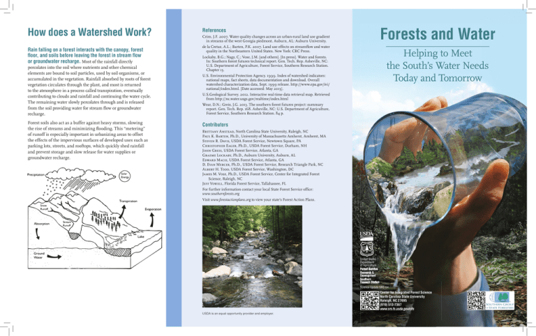
How does a Watershed Work? References Rain falling on a forest interacts with the canopy, forest floor, and soils before leaving the forest in stream flow or groundwater recharge. Most of the rainfall directly de la Cretaz, A.L.; Barten, P.K. 2007. Land use effects on streamflow and water quality in the Northeastern United States. New York: CRC Press. percolates into the soil where nutrients and other chemical elements are bound to soil particles, used by soil organisms, or accumulated in the vegetation. Rainfall absorbed by roots of forest vegetation circulates through the plant, and most is returned to the atmosphere in a process called transpiration, eventually contributing to clouds and rainfall and continuing the water cycle. The remaining water slowly percolates through and is released from the soil providing water for stream flow or groundwater recharge. Forest soils also act as a buffer against heavy storms, slowing the rise of streams and minimizing flooding. This “metering” of runoff is especially important in urbanizing areas to offset the effects of the impervious surfaces of developed uses such as parking lots, streets, and rooftops, which quickly shed rainfall and prevent storage and slow release for water supplies or groundwater recharge. Forests and Water Crim, J.F. 2007. Water quality changes across an urban-rural land use gradient in streams of the west Georgia piedmont. Auburn, AL: Auburn University. Helping to Meet the South’s Water Needs Today and Tomorrow Lockaby, B.G.; Nagy, C.; Vose, J.M. [and others]. [In press]. Water and forests. In: Southern forest futures technical report. Gen. Tech. Rep. Asheville, NC: U.S. Department of Agriculture, Forest Service, Southern Research Station. Chapter 13. U.S. Environmental Protection Agency. 1999. Index of watershed indicators: national maps, fact sheets, data documentation and download. Overall watershed characterization data, Sept. 1999 release. http://www.epa.gov/ivi/ national/index.html. [Date accessed: May 2013]. U.S.Geological Survey. 2012. Interactive real-time data retrieval map. Retrieved from http://nc.water.usgs.gov/realtime/index.html Wear, D.N.; Greis, J.G. 2013. The southern forest futures project: summary report. Gen. Tech. Rep. 168. Asheville, NC: U.S. Department of Agriculture, Forest Service, Southern Research Station. 84 p. Contributors Brittany Anstead, North Carolina State University, Raleigh, NC Paul K. Barten, Ph.D., University of Massachusetts Amherst, Amherst, MA Steven R. Davis, USDA Forest Service, Newtown Square, PA Christopher Eager, Ph.D., USDA Forest Service, Durham, NH John Greis, USDA Forest Service, Atlanta, GA Graeme Lockaby, Ph.D., Auburn University, Auburn, AL Edward Macie, USDA Forest Service, Atlanta, GA D. Evan Mercer, Ph.D., USDA Forest Service, Research Triangle Park, NC Albert H. Todd, USDA Forest Service, Washington, DC James M. Vose, Ph.D., USDA Forest Service, Center for Integrated Forest Science, Raleigh, NC Jeff Vowell, Florida Forest Service, Tallahassee, FL For further information contact your local State Forest Service office: www.southernforests.org Visit www.forestactionplans.org to view your state’s Forest Action Plans. United States Department of Agriculture Forest Service Research & Development Southern Reseach Station Science Update SRS-64 Center for Integrated Forest Science North Carolina State University Raleigh, NC 27695 (919) 513-7367 www.srs.fs.usda.gov/cifs USDA is an equal opportunity provider and employer. What is a Watershed? A watershed is the geographic area that feeds rainfall and snowmelt into streams, rivers, and lakes. They can be very small or very large, depending on the waterbody they feed. A large river, for example, has a very large watershed, but that watershed is comprised of the many smaller ones that feed its tributaries. Watersheds can be delineated on maps, measured and monitored and managed for a variety of purposes. Ultimately, most watersheds in the Southern United States drain into the Atlantic Ocean or the Gulf of Mexico. The map below shows characterization of water quality in the South as it relates to the major watersheds. Characterization of Water Quality in the South n Better water quality (30%) n Less serious water quality problems (36%) n More serious water quality problems (15%) n Insufficient Data (19%) Source: Index of Watershed Indicators data (U.S. Environmental Protection Agency 1999). Forested watersheds are nature’s water purification facilities. Forest watersheds are the source of clean drinking water for over 180 million people in the United States. Unfortunately, the future of this natural source of high quality water that southerners enjoy and depend on is threatened. Conversion and loss of forest cover to other land uses is diminishing nature’s ability to satisfy people’s needs and those of aquatic wildlife and plants. Fortunately, effects of this trend can be minimized by careful forest management and welltargeted forest conservation. Comparison of Streamflows in Urban and Forested Watersheds FOREST WATERSHED URBAN WATERSHED A B High infiltration rates and deep soil water storage in forested watersheds buffer the impacts of heavy rainfall on streamflow (or discharge). The graph above shows that stream discharge from the urban watershed has much higher flows during storms than the forested watershed, primarily due to higher levels of impervious surfaces such as streets, rooftops, and parking lots (adapted from Crim 2007). Where land use change occurs, designing drainage systems to encourage infiltration can help maintain stable streamflow and high water quality (adapted from del le Craz and Barten 2007). “A” represents water movement through a forest where most rainfall infiltrates into the soil providing water for streams that is clean and stable. “B” represents typical development where water flows along impervious surfaces carrying sediment and other pollutants directly into the stream. Without soil storage, these streams are much more flashy and prone to flooding. “C” represents a design where more forest cover is maintained and water from impervious surfaces and directed to areas where soil infiltration can occur. No other land use provides clean water like forests. These water The demand for water from forests will increase in the future. supply benefits come from all forests, whether young or old, pine or hardwood. Sediment, nutrients, and other pollutants, including bacteria and other pathogens are almost always higher from other land uses, especially urban areas. Once forests are established, they continue to provide clean and reliable sources of water for decades. Fortunately, they can also be managed for a variety of products and priorities (e.g., timber, wildlife, recreation) without negatively impacting water resources. Foresters use a variety of techniques, called Best Management Practices, that allow roads, hiking trails, prescribed fire, timber harvesting, and other management activities to be conducted without impacting water resources. Over the coming decades, a combination of human population growth, land use change, and climate change and variability is forecasted to increase the demand for high quality water and threaten its availability (Southern Forest Futures Project Summary Report, Wear and Greis 2013). These increased demands will be especially important in urban and urbanizing areas. With expected population increase of 30% in the South over the next 50 years, it is clear that the finite amount of water provided by rainfall will become increasingly scarce in the future. Water shortages and competition for water have already emerged in several states in the South, and are likely to increase over time. The net result is that as the South’s landscape and population changes, forested watersheds will be even more important for protecting and providing water resources to meet public needs. Who benefits from the water derived from forested watersheds? We all do. In the South, 5 million private landowners are the primary stewards of our forests and watersheds; together they own about 200 million acres of forest lands that help ensure a sustainable supply of high quality water for the public. As concern for reliable and high quality water supplies grows in cities and surrounding communities, water suppliers and municipalities are turning their attention to upstream watersheds and beginning to explore ways to protect them. Up to now, water quality benefits provided by privately owned forested watersheds have been free to the public, as land owners are rarely compensated for the clean water they provide by practicing good forest management. But increasing land prices, tax burdens, and other factors are necessitating new and innovative approaches to compensate landowners and encourage forest retention for the public’s benefit. Success of these efforts will undoubtedly determine the long term fate of forestland in the South. Protecting forests and using good forest watershed management can help meet the South’s water needs. The best way to provide clean and abundant water in the future is to keep as much existing forestland as possible in forest cover, and to manage it carefully. In addition to timber sale proceeds, compensation for providing clean and well-timed water for public use is being studied and employed around the country. Implementation of such mechanisms as tax incentives, payment by water utilities for forest conservation, cost-share programs for watershed improvements and protection, or purchase of long term easements offer great promise that the South’s water supplies can be assured for years to come. Your local State Forest Service office can provide advice on best forest management practices for your land: www.southernforests.org. C

