Community Satellite Processing Package (CSPP): Recent Progress and Future Updates
advertisement
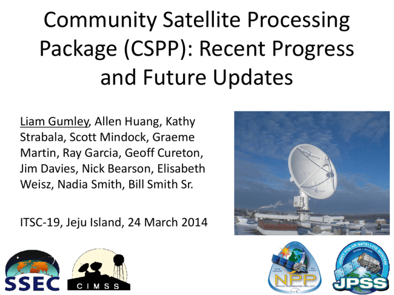
Community Satellite Processing Package (CSPP): Recent Progress and Future Updates Liam Gumley, Allen Huang, Kathy Strabala, Scott Mindock, Graeme Martin, Ray Garcia, Geoff Cureton, Jim Davies, Nick Bearson, Elisabeth Weisz, Nadia Smith, Bill Smith Sr. ITSC-19, Jeju Island, 24 March 2014 What is CSPP? CSPP (Community Satellite Processing Package) is a collection of software systems for processing direct broadcast data from polar orbiting meteorological satellites, including: Suomi NPP, POES, Metop, Terra, Aqua. Funded by NOAA via JPSS Project (thanks to Mitch Goldberg). Developed and supported by CIMSS/SSEC, UW-Madison. The first CSPP release occurred on March 14, 2012. 4/15/2014 2 Supported Satellites and Sensors CSPP includes support for Suomi NPP and JPSS, POES, Metop, Terra, Aqua, and eventually FY-3. • For Suomi NPP, supported sensors include VIIRS, CrIS, ATMS (SDRs and a subset of EDRs) • For POES and Metop, supported sensors include AVHRR, IASI, AMSU-A, MHS (Level 2 products only; Level 1 processing provided by AAPP). • For Aqua and Terra, supported sensors include MODIS and AIRS. 4/15/2014 3 CSPP Software Philosophy CSPP software must: • Create useful products for the DB community, • Include up-to-date algorithms, • Be pre-compiled for 64-bit Linux, • Be easy to install and operate, • Include test data for verification, • Have prompt user support, • Run efficiently on modest hardware. 4/15/2014 4 Current CSPP Software (2014/03) 1. Suomi NPP CrIS, VIIRS and ATMS SDR (geolocation and calibration) 2. Suomi NPP VIIRS EDR (cloud mask, active fires, surface reflectance, NDVI, SST, aerosol optical thickness) 3. CrIS, IASI, and AIRS Dual Regression Retrieval 4. VIIRS SDR GeoTIFF and AWIPS Reprojected Imagery 5. Microwave Integrated Retrieval System (MIRS) 6. HYDRA2 Multispectral Data Analysis Toolkit 7. Suomi NPP Imagery EDR (projected imagery for AWIPS) 4/15/2014 5 CSPP Release History (2014/03) March 21, 2014 (CSPP Suomi NPP Imagery EDR Software Versions 1.1) March 20, 2014 (CSPP Microwave Integrated Retrieval System (MIRS) Software Version 1.0) March 19, 2014 (CSPP Suomi NPP HYDRA2 Multispectral Data Analysis Toolkit Version 1.0) February 14, 2014 (CSPP Suomi NPP VIIRS EDR Software Version 1.2.1) December 18, 2013 (CSPP Suomi NPP CrIS, VIIRS and ATMS SDR Software Version 1.5) December 18, 2013 (CSPP Suomi NPP VIIRS EDR Software Version 1.2) October 18, 2013 (CSPP VIIRS SDR GeoTIFF and AWIPS Reprojection Software Version 1.1) April 29, 2013 (CSPP CrIS, AIRS and IASI Dual Regression Retrieval Software Version 1.1) February 22, 2013 (CSPP VIIRS SDR GeoTIFF and AWIPS Reprojection Software Version 1.0) February 8, 2013 (CSPP Suomi NPP VIIRS Cloud Mask and Active Fires EDR Software Version 1.0) February 8, 2013 (CSPP Suomi NPP CrIS, VIIRS and ATMS SDR Software Version 1.3) November 26, 2012 (CSPP CrIS, AIRS and IASI Dual Regression Retrieval Software Version 1.0) October 4, 2012 (CSPP Suomi NPP CrIS, VIIRS and ATMS SDR Software Version 1.2) May 4, 2012 (CSPP CrIS UW Retrieval Software Version 1.0) September 24, 2013 (CSPP CrIS, AIRS and IASI Dual Regression May 2, 2012 (CSPP Suomi NPP CrIS, VIIRS and ATMS SDR Software Version 1.1) Retrieval Software Version 1.2) July 8, 2013 (CSPP Suomi NPP CrIS, VIIRS and ATMS SDR Software Version 1.4) July 8, 2013 (CSPP Suomi NPP VIIRS EDR Software Version 1.1) 4/15/2014 March 14, 2012 (CSPP Suomi NPP VIIRS and ATMS SDR Software Version 1.0) 6 1. SNPP VIIRS, CrIS, and ATMS SDR • Converts RDR files (CCSDS packets) to SDR files (geolocation and calibrated radiances and reflectances) • Based on operational algorithms and lookup tables (IDPS version Mx7.2) • CSPP version added features include multicore processing, automated LUT updates, granule aggregation, HDF5 compression. • Supports CrIS full spectral resolution data. See poster 1p.07 by Scott Mindock. 4/15/2014 7 2. SNPP VIIRS EDR • Creates geophysical products from VIIRS radiances and reflectances. • Based on operational algorithms and lookup tables (IDPS version Mx7.2). • Products include cloud mask, active fires, surface reflectance, NDVI, SST, AOT. • CSPP version added features include selectable products, multi-core processing, automated ancillary data download, granule aggregation, HDF5 internal compression. 4/15/2014 See poster 1p.18 by Geoff Cureton 8 CSPP Products from SSEC Direct Broadcast VIIRS SDR 4/15/2014 VIIRS Cloud Mask CrIS SDR VIIRS NDVI ATMS SDR VIIRS AOT 9 3. CrIS/IASI/AIRS Retrievals • Computes profiles of atmospheric temperature, moisture, and ozone. • Computes cloud top products (height, pressure, emissivity) surface parameters. • Common fast regression algorithm for CrIS/IASI/AIRS by Smith/Weisz/Smith. • Products are created for every FOV, clear and cloudy. See presentation 8.03 by Nadia Smith 4/15/2014 10 4. VIIRS SDR Projected Imagery • Creates VIIRS imagery on a user-defined grid and projection. • Reads multi-granule VIIRS SDRs as input (Mband, I-band, and DNB). • Saves images in GeoTIFF and AWIPS formats. • Used operationally at SSEC and GINA to create products for National Weather Service Forecast Offices. 4/15/2014 11 Low Cloud/ Fog Seen by VIIRS DNB at Night AREA FORECAST DISCUSSION NATIONAL WEATHER SERVICE SAN FRANCISCO BAY AREA 443 AM PDT FRI MAR 14 2014 .DISCUSSION...AS OF 4:10 AM PDT FRIDAY...THE DRY TAIL END OF A WEATHER SYSTEM MOVING IN TO THE PACIFIC NORTHWEST IS APPROACHING OUR DISTRICT...AND RESULTING IN ENHANCEMENT OF THE MARINE LAYER AND A RETURN OF THE MARINE STRATUS. LATEST GOES FOG PRODUCT IMAGERY...AND IN RATHER SPECTACULAR DETAIL JUST REC'D SUOMI VIIRS NIGHTTIME HIGH RES VISUAL IMAGE...SHOW COVERAGE ALONG MUCH OF THE COAST FROM PT REYES SOUTH TO THE VICINITY OF THE MONTEREY PENINSULA...AND A BROAD SWATH EXTENDING INLAND ACROSS SAN FRANCISCO AND THROUGH THE GOLDEN GATE TO THE EAST BAY. LATEST BODEGA BAY AND FT ORD PROFILER DATA INDICATE A MARINE LAYER DEPTH OF ABOUT 1300 FT. SOME THIN HIGH CLOUDS ARE ALSO PASSING THROUGH ABOVE. 4/15/2014 ITSC-19 CSPP Gumley 12 5. Microwave Integrated Retrieval System • Retrieves atmospheric profile and surface parameters from ATMS, AMSU-A, and MHS sensor SDR and Level 1B data. • Development is led by Sid Boukabara at the NOAA NESDIS Center for Satellite Applications and Research (STAR). • Supports ATMS SDR from CSPP or CLASS, and Metop/NOAA AMSU-A and MHS from AAPP v7. 4/15/2014 13 MIRS Product List Official Validated Products: Temperature profile over open water ocean Humidity profile over open water ocean Humidity Profile over non-coastal Land Total Precipitable Water (TPW) over open water ocean Total Precipitable Water over non-coastal land Land surface temperature Surface Emissivity over land and snow Surface Type Classification Snow Water Equivalent (SWE) Sea Ice Concentration (SIC) Snow Cover Extent (SCE) Vertically-Integrated Non-precipitating Cloud Liquid Water (CLW) over open water ocean Vertically-Integrated Graupel Water Path (IWP) Vertically-Integrated Rain Water Path (RWP) 4/15/2014 Rainfall Rate (RR) over open water ocean and non-coastal, non-snow-covered land surface types Experimental Products (not fully validated): Cloud Liquid Water Profile (CLWP) over ocean Surface Temperature (skin) extended to snowcovered land surface type Surface Temperature (skin) extended to open ocean water Effective grain size of snow (over snowcovered land surface) Multi-Year (MY) Type Sea Ice Concentration First-Year (FY) Type Sea Ice Concentration 14 MIRS Products from ATMS DB Surface Temperature with Rain Mass Profile Total Precipitable Water with contours of Cloud Liquid Water S-NPP/ATMS 2014-01-23 18:19Z 4/15/2014 15 6. Hydra2 Multispectral Data Toolkit • Allows interactive display of Level 1B and Level 2 products from multispectral imagers (VIIRS, MODIS), high spectral resolution sounders (CrIS, IASI, AIRS), and microwave sounders (ATMS, AMSU). • Designed to be easy to learn and use, especially for students. • Supported on Windows, OS X, and Linux. See poster 1p.19 by Tom Rink 4/15/2014 16 Hydra2 Screenshots (SNPP 2012/08/30 04:16Z) Hydra 2 display of collocated VIIRS and ATMS Hydra 2 display of CrIS 4/15/2014 17 7. VIIRS Imagery EDR • Creates projected VIIRS image data on a Ground Track Mercator grid. • Product can be directly ingested into NWS AWIPS2. • Supports I-band resolution (375 meters). • Provides VIIRS Near Constant Contrast (NCC) product for Day/Night Band. 4/15/2014 18 VIIRS Imagery EDR I-Band 1 in AWIPS-II Processed using CSPP Software including conversion to NetCDF4 19 March 2014 VIIRS Imagery EDR I-Band 3 in AWIPS-II Processed using CSPP Software including conversion to NetCDF4 19 March 2014 CSPP/IMAPP Users Group • Held May 21-23, 2013 in Madison, WI, USA. • Presentations from NOAA, NASA, Met Office, Meteo France, Landgate, SMHI, EUMETSAT, CONABIO, DWD, GINA, and SSEC. • More than 40 attendees; 29 oral presentations. • Next one in 2015? Perhaps in Europe? 4/15/2014 21 CSPP Website 4/15/2014 http://cimss.ssec.wisc.edu/cspp/ 22 Coming Soon #1: CLAVR-X • Computes cloud parameters (cloud top height, pressure, phase, …) and surface parameters from multispectral imager data. • Development led by Andy Heidinger. • Supports VIIRS, MODIS, and AVHRR. – VIIRS SDRs from CSPP or IDPS/CLASS – MODIS Level 1B from SeaDAS or MODAPS – AVHRR Level 1B from AAPP v7 • NOAA plans to make CLAVR-X the operational cloud algorithm for SNPP and JPSS. 4/15/2014 23 CLAVR-X products from VIIRS DB 4/15/2014 VIIRS SVM07 Cloud Mask Cloud Phase Cloud Top Pressure 24 Coming Soon #2: NUCAPS • Creates profiles of temperature, moisture, ozone, and other trace gases; cloud and surface products; and other products all from cloud cleared radiances. • Development led by Chris Barnet. • Also supports IASI/AMSU/MHS and AIRS/AMSU. • NOAA plans to make NUCAPS the operational sounding algorithm for SNPP and JPSS. See presentation 1.06 by Chris Barnet 4/15/2014 25 Coming Soon #3: CSPP GEO • NOAA GOES-R Project is funding the development of a DB package for GEO satellites. • Will create cloud and surface products from DB data (e.g., GRB from GOES-R). • Supported satellites/sensors will include GOES-R ABI, GOES-N Imager, and Himawari-8. • Algorithms will be based on GOES-R versions; implemented in GEOCAT. See poster 2p.03 by Graeme Martin 4/15/2014 26 Credits CSPP team at UW/SSEC/CIMSS. Algorithm Developers. JPSS Project. DB User Community! Liam.Gumley@ssec.wisc.edu 4/15/2014 27
