The Not-So-Secret Code
1 of 5
http://www.planning.org/planning/member/2006jan/code.htm?project=Print
Print Now
January 2006
SPECIAL SECTION ON NEW URBANISM
The Not-So-Secret Code
Across the U.S., form-based codes are putting new urbanist ideas into practice.
By Philip Langdon
Coming up with a new kind of zoning was not the first thing officials in Mississippi's Gulf Coast communities had
on their minds after Hurricane Katrina left their region a shambles.
There were many more pressing problems — including disposing of 540 million
cubic feet of debris. Nonetheless, several of the coastal communities along the
120-mile stretch from Waveland to Pascagoula may be joining the growing
number of local governments that are adopting the form-based codes
advocated by new urbanist planners and architects as a way to shape a more
compact, pedestrian-oriented style of development.
On October 11, some 120 new urbanists from 22 states and three foreign
countries set up shop in the ballroom of a damaged casino hotel on the Biloxi
beachfront. Working side by side with local planners, architects, and public
officials, the group spent the next week crafting visions of the Gulf Coast's
future. By the time the Mississippi Renewal Forum concluded a week later,
many Gulf Coast leaders were talking seriously about enacting the new forms
of zoning codes.
The conventional zoning and subdivision regulations now in place in
Mississippi's coastal communities have encouraged a separate-use,
automobile-dependent pattern of settlement, Jeff Taylor, deputy director of
the Southern Mississippi Planning and Development District, a regional
planning group serving 15 counties, said in an interview.
That mode of development is becoming untenable, he added. Municipalities need to find ways to reduce reliance
on driving, and they need to build mixed use communities that would be more convenient for residents and
arguably also better for the area's economy. Taylor and others see form-based coding as a tool that can help
communities attain these goals.
The day after the Biloxi charrette concluded, the small city of Flowood, about 150 miles inland (near Jackson),
became the first Mississippi community to adopt a form-based code. It approved a customized version of the
SmartCode, which was introduced by Duany Plater-Zyberk & Company of Miami in 2002 and continually refined
since then. Chad Emerson, a law professor at Faulkner University in Montgomery, Alabama, tailored the
SmartCode to Mississippi laws and to the requirements of Flowood, a business center and bedroom community
whose population of 4,750 is on the rise.
The process was initiated by developer Richard Ridgway, who wanted to build a 130-acre project that would
include a center containing housing on top of retail, shops set close to the sidewalks, and on-street parking rather
than parking lots.
At Ridgway's urging, Emerson gave a presentation to the board of aldermen about a code that would facilitate
pedestrian-scale, mixed use development, and met several times with the city's lawyers, adapting the SmartCode
to local ordinances and practices. "Three months later, the SmartCode was completed and put before the board of
alderman, where it passed unanimously — without a single negative comment from the local community," says
Emerson.
"If you keep the same codes you had before the hurricane, not only can the same storm damage occur again, but
the same sprawling development patterns can occur again," Sandy Sorlien warned during the Renewal Forum, an
11-community charrette authorized by Mississippi Gov. Haley Barbour.
3/15/2006 9:54 PM
The Not-So-Secret Code
2 of 5
http://www.planning.org/planning/member/2006jan/code.htm?project=Print
Sorlien, a photographer who has worked with Duany Plater-Zyberk on several updates of the SmartCode, noted
that the code is becoming easier and cheaper for municipalities to use. The latest rendition, Version 7.5, is now
available free of charge to local governments in Mississippi and elsewhere.
The charrette teams recommended new codes in nine of the 11 coastal cities. Several of them have since sent
their planners, planning board members, or elected officials to instruction sessions in Alexandria, Virginia, and
elsewhere.
Gulfport (pop. 70,000), the largest city on the Mississippi coast, and Ocean Springs (pop. 18,000) are two that
have shown an especially strong interest in new codes. "We're very excited about it — and we're cautious, too,
because it's so different from the Euclidean zoning that everyone is accustomed to," says Donovan Scruggs,
planning director of Ocean Springs. The most likely scenario, Scruggs says, is that Ocean Springs will use a
form-based code in some of the areas destroyed by the hurricane.
As Mississippi goes, so goes the nation. At least that's what some advocates of form-based codes are hoping.
Why change?
The desire for a new kind of code has been fed by flaws in the codes that most communities have been using for
the past several decades. (See "Form First," by Peter Katz, November 2004.) One flaw is the inability of
conventional codes to define and create "character," says Paul Crawford, FAICP, who directed planning and
building for San Luis Obispo County, California, before becoming a principal in the consulting firm of Crawford,
Multari & Clark.
Most municipal codes give builders "utterly inadequate direction" about what their projects should look like and
how they should form public spaces, he says. As a result, most communities "have to beat each project into
shape one at a time through discretionary review processes" — a contentious and time-consuming way of doing
things.
Conventional codes, Crawford says, "focus excessively on fine distinctions between land uses, and not much on
urban design." They regulate through setback requirements, floor area, limits on building height, and the like.
Sometimes those regulations suffice, but rarely do they make public spaces (such as streets, sidewalks, and
plazas) feel like appealing "outdoor rooms" — places whose proportions generate a pleasing sense of enclosure.
Conventional codes tend to push differing uses apart, says Crawford, whereas urban spaces often gain allure and
vitality by having housing, offices, restaurants, stores, and cultural and civic uses brought close together in
dense, mixed use centers. The result could be a boost in tax revenue.
"It's value capture," adds Scott Polikov, AICP, of the Gateway Planning Group in Austin, which helped write a
variant on the SmartCode for Leander, Texas, the fastest growing city in the Austin region. According to Polikov,
the mandatory code, adopted by local voters September 22, is the first application of the SmartCode in the state.
It replaces conventional zoning and subdivision codes in a 2,000-acre area owned by seven separate landowners.
The land, at the northwest terminus of a planned commuter rail line approved by area voters in November 2004,
is now part of a transit-oriented development sector.
Polikov projects that the SmartCode's provisions will generate twice as much development, $2 billion worth, as
would occur under conventional zoning. The city government and the Capital Metropolitan Transportation
Authority collaborated with major landowners on the planning and code initiative, with landowners paying much
of the cost.
The TOD initiative prompted Leander to revise its existing code, which it did in September, adopting a composite
zoning code (which planner David Hutton, AICP, describes in this issue). The composite ordinance does not apply
in the TOD area except when a landowner wants to rezone fewer than four lots in Old Town (the city's
downtown).
Where it all began
To some extent, the form-based codes now being adopted are an evolution of
the design codes initially devised for greenfield projects. For DPZ's Seaside,
Florida, which started in the early 1980s, and later for dozens of Traditional
Neighborhood Developments (TNDs), designers produced codes requiring
buildings to stand close to the street, to have front porches, and to maintain a
degree of architectural consistency.
3/15/2006 9:54 PM
The Not-So-Secret Code
3 of 5
http://www.planning.org/planning/member/2006jan/code.htm?project=Print
A chief goal was the creation of sociable streets and passages. "It's about
spatial, physical characteristics — what it feels like to walk down a street in a
place," says Neal Payton of Torti Gallas and Partners, a Silver Spring,
Maryland, firm that has designed many new urbanist developments.
Those codes have become known as "form-based codes" because they concentrate more on shaping the form of
the built environment — the building exteriors, the placement of buildings on their lots, and the nature of streets
and public spaces — than on uses.
Codes in TNDs are often enforced by developers at first, and later by home owners associations. The local
government may have little or no role in implementing and administering the code. But this is changing. As new
urbanism has gained acceptance among planners, there has been a proliferation of government-administered
form-based codes. Municipalities use these codes to shape development in downtowns, in aging commercial
strips, in historic districts, and around mass transit stations, among other places.
California is a hotbed of form-based codes. They have won adoption in the cities of Sonoma, Petaluma, Azusa,
Ventura, and Hercules, according to Crawford. They are being prepared or considered in at least five other
California communities: Palo Alto, Cotati, Grass Valley, Paso Robles, and downtown Newhall (part of the city of
Santa Clarita). Sacramento is updating its general plan, which could set the stage for establishing a form-based
code in the state capital. "We're constantly being invited by municipalities to give presentations," says Crawford.
But other states are catching up. Torti Gallas recently helped the city of Temple Terrace, Florida, draw up a
form-based code for a 225-acre area that local officials hope to transform into a relatively dense downtown. In
Virginia two years ago, Ferrell Madden Associates of Washington, D.C., and Dover Kohl & Partners of Coral
Gables, Florida, worked with Arlington County on a code for 3.5 miles of the Columbia Pike, trying to turn "an
aging, auto-oriented, suburban, commercial strip back into the more vibrant, pedestrian-friendly, 'Main Street'
destination that it originally was and could be yet again," according to a county planning statement.
Everyone's favorite example
After years of trying other ways to preserve and add onto the historic fabric of its downtown, Saratoga Springs
(pop. 36,000) in Upstate New York finally adopted a form-based code in 2003. The code was devised for the city
by consultant Joel Russell of Northampton, Massachusetts, and Environmental Design & Research of Syracuse,
New York.
For more than two decades, the resort community had attempted to enhance the urban qualities of Broadway, its
grandly proportioned main downtown thoroughfare. Old buildings underwent renovation or restoration, but new
construction lagged except for the Congress Park Centre, a mixed use block that began in 1994 under a planned
unit development ordinance.
The five-story center is transforming six acres that once contained a single-story Woolworth's strip shopping
center with a parking lot in front. Above its first-floor shops are offices and balconied apartments. "Several more
buildings, including parking in the middle of the block, are coming," says Geoff Bornemann, Saratoga Springs's
planning director.
By the time construction of Congress Park was under way, the city had realized that pedestrian-friendly, mixed
use development could be encouraged through a form-based code. "It was a logical progression," says
Bornemann. That's when it hired Russell and EDR. They drew up a document establishing three districts, using
Duany's concept of the "transect" — the systematic gradation of a community from its most urban to its most
rural sector.
The SmartCode calls for six transect zones, from T-1 (natural) to T-6 (urban core). It is up to each community to
decide whether to demarcate all six zones and where to establish each zone. Saratoga Springs chose to use the
transect and the form-based code only in the denser parts of the community's 28 square miles. The downtown
became the T-6 zone. Areas adjoining downtown became T-5 (urban center) or T-4 (general urban).
Saratoga Springs carried out the rezoning process "on a shoestring budget, using volunteer committee members
and existing planning staff," Bornemann says. The consultants then were hired to help the city amend its zoning
ordinance and introduce the form-based code.
Some municipalities use a "visioning process to reach agreement on how development should be shaped. At
these sessions, often a week-long charrette, sketches and other visualizations help citizens and planners alike
determine how high the buildings should rise, how close they should come to the street, and how to modulate
3/15/2006 9:54 PM
The Not-So-Secret Code
4 of 5
http://www.planning.org/planning/member/2006jan/code.htm?project=Print
development from block to block or neighborhood to neighborhood.
In Saratoga Springs, Geoff Bornemann says, "the key mandated items are that buildings must be close to the
street, must occupy most of the frontage of their property, and must be two real stories but less than 70 feet
high. We wanted true mixed use neighborhoods, and we wanted new development [in the older areas] to look
like the traditional neighborhoods."
Getting it
One advantage of form-based codes is that after some study at the outset,
they are simple to comprehend. "It's a whole lot easier to understand than
conventional zoning codes, where you keep getting referred to a different
page," said Laura Hall of Fisher & Hall Urban Design in Santa Rosa, California,
at the Mississippi forum. Hall is working on a code for Pass Christian (pop.
6,800).
"My experience is that the term and the concept initially appear arcane, but
once you walk people through the concept, they get it," says Paul Crawford.
Whereas conventional codes rely largely on words, form-based codes are
supplemented with drawings that most people find extremely helpful.
Illustrations in the Temple Terrace, Florida, downtown code, for example,
show a variety of design techniques that address the street and achieve the
city's goals. There are illustrations for frontage types, massing, dooryards, arcades, windows, doors, planters,
paving, and other elements that affect the public environment.
New urbanist planners say that applying the transect concept — making decisions on such matters as which areas
are to be classified as "urban core," "sub-urban," and so on — is not as difficult as some might think. The
SmartCode requires that the community be laid out as "pedestrian sheds" with a quarter-mile radius. Each
pedestrian catchment area must contain at least one civic space or commercial institution. That aspect of
neighborhood planning does not appear in all form-based codes, however.
What is challenging about form-based coding, says Joel Russell, is specifying the forms of buildings and streets
that are to be required within each zone. The code "is very place-specific," he points out. "If you're doing a good
job, you might need 12 street types. You're going to call for different building types."
In many cases, he admits, the level of physical detail in a form-based code exceeds that of a conventional
land-use plan. That's why Russell believes it's "prohibitively expensive" to do form-based coding for an entire
community, unless it's a very small place. "Most of what a form-based code regulates is at the neighborhood
scale or smaller," says Peter Katz, a lead organizer of the recently established Form-Based Codes Institute in
Alexandria, Virginia.
In California, form-based codes are being used in what the state calls a "specific plan" — a plan for a particular
section of a city, frequently a redevelopment area. In states where form-based codes are not authorized for
mandatory general use, a municipality may nevertheless apply them in renewal or redevelopment areas.
California, Connecticut, Pennsylvania, and Wisconsin have enacted enabling legislation that allows municipalities
to adopt form-based codes and require compliance with them throughout their jurisdiction, not just in urban
renewal districts. Similar legislation is expected to be proposed this year in Mississippi.
Which side are you on?
There's considerable debate on whether to make codes optional or mandatory. Alabama law professor Chad
Emerson favors an "optional overlay" code, one that may be used in part or all of a community if a developer
chooses to employ it rather than being regulated by the conventional zoning ordinance. Emerson says he has
been able to get optional codes adopted in Mississippi and Alabama towns in six to nine months, since no
landowners are forced to use them. A mandatory code, by contrast, may take years to win a local government's
approval. He thinks that since mixed use, new urbanist developments are becoming popular in the South, many
developers will decide it's good business sense to use a form-based code.
Others contend that some locations, such as downtowns and areas around commuter rail stations, are so
important that a form-based code should be mandatory. On the basis of what he's seen in Texas and elsewhere,
Polikov argues that a wise approach is "to identify key corridors and sectors for new development and
redevelopment, completely redo the master plan, and apply a mandatory code."
3/15/2006 9:54 PM
The Not-So-Secret Code
5 of 5
http://www.planning.org/planning/member/2006jan/code.htm?project=Print
However, Polikov doesn't favor making the code mandatory for an entire municipality. Doing so may trigger
strong opposition from people who prefer a less urban style of development — thereby causing the code to be
defeated, postponed for years, or watered down.
Incentives such as fast permitting and higher density are often offered to make pedestrian-oriented, mixed use
development enticing to developers. In fact, in communities where the real estate fundamentals are favorable,
developers seem happy to work within form-based codes. Bornemann says 12 major projects, worth $182 million
and containing 850,000 square feet, have been approved since Saratoga Springs became the first Upstate New
York city to institute form-based coding.
Laura Hall says more than $100 million worth of development has been constructed or announced in a 400-acre
section of central Petaluma since adoption of a SmartCode there in July 2003. "The SmartCode reduced the
entitlement time from two years to 5.5 months," she notes. On the Columbia Pike, about a dozen projects,
collectively worth more than $1 billion, have been approved or have entered some stage of approval or
conceptual development since establishment of the code in February 2003.
Russell says there are at least two ways to shift the cost of devising a form-based code to developers. One way is
to require the developer to prepare the code. But, he adds, "that involves some risk of the developer not doing a
good job." The second way is to have the municipality devise the plan through a charrette and then, when the
developers request permits, charge them a fee for doing the plan. "A developer is often willing to do that because
it saves a lot of time," he says.
A caveat
All this is not to say that a form-based code solves every problem — or that conventional zoning, with its
regulation of uses, is rendered unnecessary by well-shaped buildings and streets. Even in the areas regulated by
a form-based code, the local government typically exerts some control over uses. In Saratoga Springs, for
example, a special-use permit is required in the "urban center" and "general urban" neighborhoods.
Still, the rise of form-based codes has generated optimism among many urban designers. Local governments
finally appear to have a tool capable of fostering settlements with lasting appeal. "If all you have to code with is
height, setback, use, and quantity, you're going to have communities with a coarse character," says Neal Payton.
With the more fine-grained regulation supplied by a form-based code, he believes, "you can get the
characteristics you want."
Philip Langdon is senior editor of New Urban News and a frequent contributor to Planning.
Resources
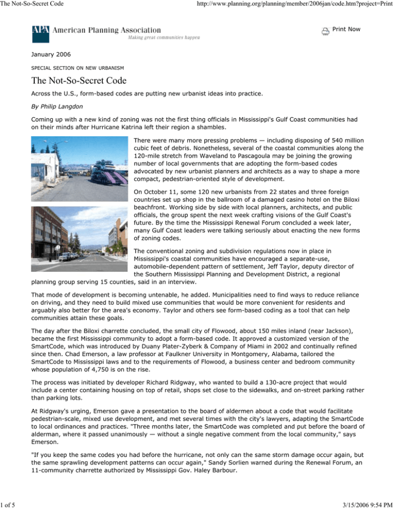
Images: Top — Central Petaluma before (top) and after the city adopted a version of the SmartCode in 2003.
Petaluma is one of the five California jurisdictions that have approved form-based codes. Photos courtesy Fisher &
Hall Urban Design. Middle — More than $100 million worth of development has been constructed or announced
along the Petaluma River since the code was introduced, says consultant Laura Hill. Bottom — A newly adopted
form-based code in Leander, Texas, calls for denser development in an area near the terminus of both a planned
commuter rail line and a planned toll road. The city collaborated on the code with the Capital Metropolitan
Transportation Authority. Images courtesy Gateway Planning Group.
SmartCode. Available on the web at www.placemakers.com.
Workshops. Click here for information on AICP's New Urbanism Workshop. Instruction on form-based coding is
offered in Alexandria, Virginia, by Virginia Tech's Academy for the New Urbanism in partnership with the nonprofit
Form-Based Codes Institute.
©Copyright 2006 American Planning Association All Rights Reserved
3/15/2006 9:54 PM

