12.520 Problem Set 5 Due
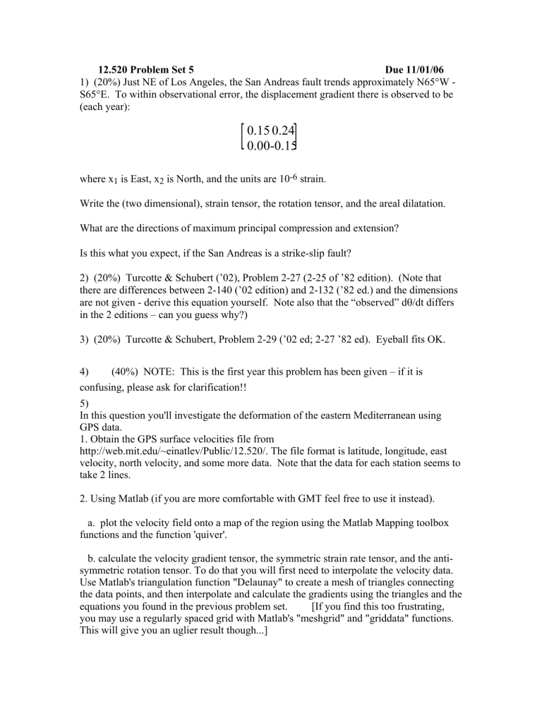
1) (20%) Just NE of Los Angeles, the San Andreas fault trends approximately N65°W -
S65°E. To within observational error, the displacement gradient there is observed to be
(each year):
0.15 0.24
0.00-0.15
where x
1
is East, x
2
is North, and the units are 10 -6 strain.
Write the (two dimensional), strain tensor, the rotation tensor, and the areal dilatation.
What are the directions of maximum principal compression and extension?
Is this what you expect, if the San Andreas is a strike-slip fault?
2) (20%) Turcotte & Schubert (’02), Problem 2-27 (2-25 of ’82 edition). (Note that there are differences between 2-140 (’02 edition) and 2-132 (’82 ed.) and the dimensions are not given - derive this equation yourself. Note also that the “observed” d
θ
/dt differs in the 2 editions – can you guess why?)
3) (20%) Turcotte & Schubert, Problem 2-29 (’02 ed; 2-27 ’82 ed). Eyeball fits OK.
4) (40%) NOTE: This is the first year this problem has been given – if it is confusing, please ask for clarification!!
5)
In this question you'll investigate the deformation of the eastern Mediterranean using
GPS data.
1. Obtain the GPS surface velocities file from http://web.mit.edu/~einatlev/Public/12.520/. The file format is latitude, longitude, east velocity, north velocity, and some more data. Note that the data for each station seems to take 2 lines.
2. Using Matlab (if you are more comfortable with GMT feel free to use it instead).
a. plot the velocity field onto a map of the region using the Matlab Mapping toolbox functions and the function 'quiver'.
b. calculate the velocity gradient tensor, the symmetric strain rate tensor, and the antisymmetric rotation tensor. To do that you will first need to interpolate the velocity data.
Use Matlab's triangulation function "Delaunay" to create a mesh of triangles connecting the data points, and then interpolate and calculate the gradients using the triangles and the equations you found in the previous problem set. [If you find this too frustrating, you may use a regularly spaced grid with Matlab's "meshgrid" and "griddata" functions.
This will give you an uglier result though...]
c. plot the invariant of the strain rate tensor and the rotation tensor on the map.
Comment on which varies more. d. Based on your maps - is the deformation mainly focused along narrow fault zones between rigid blocks, or is it distributed rather smoothly?
e. locate the approximate location of the North Anatolian fault based on localization of high strain.

