DRAFT Hucks Prosperity E
advertisement
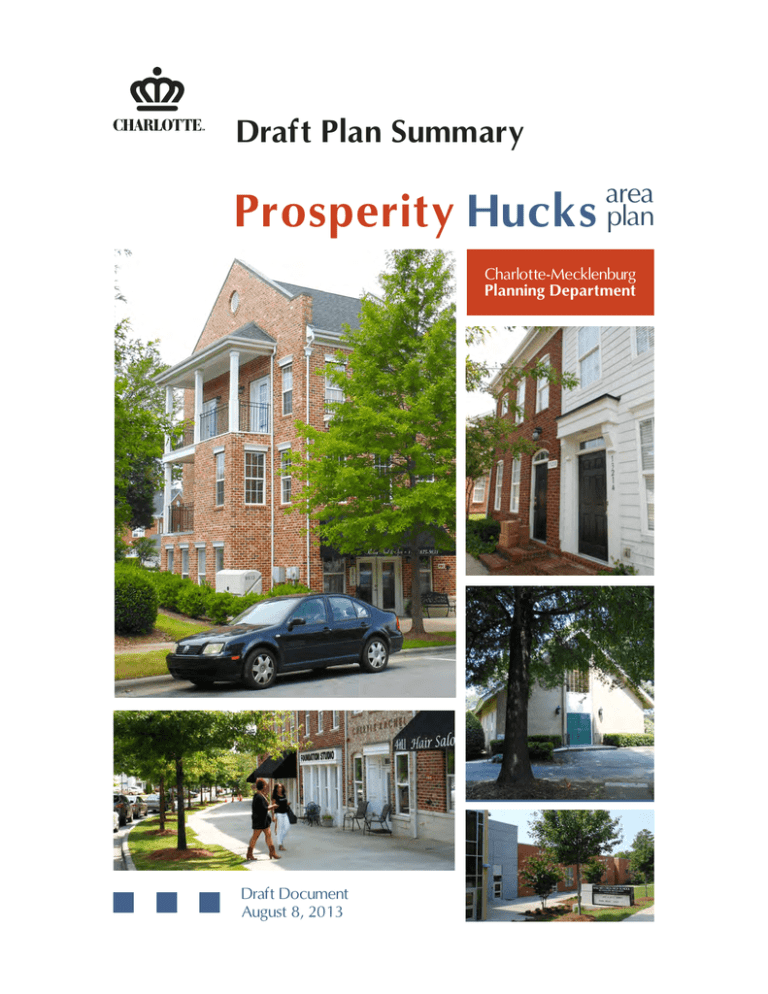
E DRAFT Draft Plan Summary Prosperity Hucks area plan Charlotte-Mecklenburg Planning Department Draft Document August 8, 2013 Plan Highlights Purpose of the Plan The Time is Now The Prosperity Hucks Area Plan establishes a community-supported vision and provides detailed policy direction to shape the character and pattern of development for this growing area of Charlotte. This vision builds upon Charlotte’s Centers, Corridors and Wedges Growth Framework by defining the unique character of the Prosperity Hucks area within the context of the City’s overall growth framework. This Draft Plan Summary document provides an overview of the plan along with detailed policy recommendations. The construction of the I-485 interchange is nearing completion (2015) and further investment in the extension of Prosperity Church Road is underway. This new infrastructure and resulting access will make this area an attractive location for new development. While some development of the center has occurred, much of the area remains undeveloped and dramatic change is anticipated. This plan establishes the vision and intended character of this area in a time of unique change. It serves to guide public and private investment in the center, while protecting and enhancing the surrounding neighborhoods, in order shape a special place in the Charlotte region. This is a special time for the Prosperity Hucks area. The completion of the I-485 interchange and its supporting transportation infrastructure will dramatically reposition this area within the region. This public investment in infrastructure will bring with it new opportunities for private investment and development. This is not however a typical interchange. This unique interchange concept establishes a network of connections which distributes access in order to create a series of smaller-scaled streets and blocks, and establish a walkable, pedestrian-scaled pattern for new development to follow. Building on a Unique Vision This plan has been many years in the making. It builds upon the Prosperity Church Road Villages Plan from 1999, which set forth the unique concept for the Prosperity Church Road/I-485 interchange. It establishes a framework for a walkable, urban, mixed use center that supports and is connected to the surrounding neighborhoods. This development pattern is made possible by a unique street network specifically designed to facilitate walkable urban form. To achieve this, the interchange is designed with three bridge crossings of I-485 within 1/4 mile of each other, to disperse the traffic onto three pedestrian-oriented minor thoroughfares. From there, traffic is to be dispersed further on a network of collector and local streets. The result is a network Illustrations from the 1999 Prosperity Church Road Villages of appropriately scaled streets that are pedestrian Plan, showing the concept for the three bridges crossing the friendly and support a wide range of street–oriented interstate. uses and development. b Prosperity Hucks area plan DRAFT PLAN SUMMARY Active street-level uses and pedestrian-scaled streetscapes create a vibrant urban environment. Walkable streets that encourage a range of travel modes and pedestrian-oriented mixed-use development. I-485 ty peri rch Chu Residential neighborhoods d Roa Pros Basham Road s Pro peri Gibbs Road ty R idge Roa d Pedestrian-oriented streets Public open spaces Multi-family housing options Street oriented retail Mixed use development The vision for Prosperity Hucks is centered on a walkable urban village that supports the surrounding neighborhoods. Parks and public spaces enhance quality of life and provide places for public gatherings and festivals. A range of housing options within the village center provide walkable lifestyle choices. Prosperity Hucks area plan DRAFT PLAN SUMMARY c Lower Density Residential Center (Residential) Center (Mixed Use) Parks/Open Space Institutional Huntersville ok Wil db ro Cr ee kP y Dr Rd Be Rd Rd Cre ek W P olk And Whit rit y Malla rd e ro sp e n yL Rd d d d ler R eh Rd way e en Gr W Ma llar dC ree kC 85 hu rch W Su ga r C reek R dR ar n Hucks sl e or ur c h Ch d r O sk Ba P * sR Av v er Dr t Hucks R d Ex to ille L vie n Sutton w ck d I-485 Hy De ere Hu n b rg R u Py Av ge Rd lam Park Dr ek hn s Jo Rd ne on D Spring Rid ow m ear Christ e eet Ext sp er Ridge Rd ity Br Rd on Av Curt Walt ge Pro Beauvista Dr C re Str Rid Prosperity Churc hR d Highl and Dr Bell's M ill D Ar b o r rvista Fai la nd McC he sn ey e tfi Ea s H ig h Dr ld Rd Continuous street connection to be determined C r Dr * Greenway Rd Data Source: City of Charlotte, Mecklenburg County, data as of July 2013 Produced By: Charlotte-Mecklenburg Planning Department Map 3 .. . d GIS Charlotte .. Prosperity Hucks Area Plan . ... Miles . Concept m or e tha n maps 0 0.25 0.5 1 Vision The preferred future for the plan area is highlighted in the following vision statement, based on the input from the community: The vision for the Prosperity Hucks area is to create a unique and sustainable community that is a great place to live, work, and play. The blend of neighborhoods; along with an emerging Mixed Use Activity Center; plus an array of civic and institutional facilities will provide for a thriving community. The vision incorporates the following elements: • Village Center will be a neighborhood serving Mixed Use Activity Center complementing and enhancing the surrounding neighborhoods; with a rich variety of retail, office, entertainment and multi-family residential uses in a welldesigned and appropriately scaled form. • Neighborhoods are the backbone to the stability of the area and will be essential in preserving the distinctive character of the community. Continuing development in and around the neighborhoods will take into account its impact on the quality of life of area residents and protect the tree canopy. • Transportation infrastructure will be developed to connect neighborhoods, Village Center and other destinations within and beyond the plan area; it should safely accommodate pedestrians, bicyclists, transit users, and motorists. • Open Space will be well integrated into the community, preserving elements of the natural landscape, becoming part of a meaningful, connected open space network of greenways, parks, and bike paths. PlanBoundary: 9.7Sq Miles I-485 Under Construction Existing Thoroughfares Proposed Throughfares Parcel Boundary le ok ro sn e he or y sl e Ln d Mallard Creek Community Park P olk And Wh Rd d e ek R Cr rd ek Rd The Tradition Golf Club M W al la Ma lla rd Cr e ek Ch u rc § ¨ ¦ 85 hR d ¯ GIS .. Charlotte Miles . . ... The Centers, Corridors and Wedges Growth Framework is the City’s overall vision for future development. The plan area is a Center, surrounded by a Wedge. R ite Plan Area Boundary Prosperity Hucks Area Plan Charlotte-Mecklenburg Planning Department, May 2013 rd ea e Ch Rd Growth Corridor Wedge Other Jurisdiction il B h n st on O Data Source: City of Charlotte, Mecklenburg County, data as of August, 2012 Produced By: Charlotte-Mecklenburg Planning Department Center City Mixed Use Activity Center Industrial Center u r lD Bell's M d Av W Sugar Cre 4 vil ch I-7 7 s R d Ext r ke ur lvd Hucks Road Community Park H uc k s Ba it y er ks Rd re L vi e n Sutton w sp eB nc de en ep 85 I-4 Hu c De lam e Dr Ind ! ge R d nR Pr o Sprin g d e ut d d eR r Clark's Creek Hucks Rd Nature Preserve Jo yR b r rR o wn P ark D en k Py hl e Br De o a rm C hr i s r ee I-485 Hy W 5 Dr an d aD Rid Prosperity Church Rd Mixed Use Center I-8 y C xt W il db Hig hl Be auvist r dE ee k Py Highland Creek Church Rd s Ea ge R Rd Cr t Prosperity Rid el d tfi Dr d et A v r k D r F ai r v i s a t C ree bo hl an McC ig Proposed Center Boundary Ar Ro f Dr ie st H Ea Wedge Plan Area Wallace Farm ld Huntersville Corridor Str e Mixed Use Activity Center Rd Centers, Corridors and Wedges m or e than maps ... 0 0.25 0.5 1 This plan proposes an expansion of the Village Center to recognize areas with interchange and thoroughfare accessibility and the opportunities already in evidence. Prosperity Hucks area plan DRAFT PLAN SUMMARY e Village Center The evolution of the Village Center is a primary focus of this area plan. Prosperity Village should be a mixed-use center with a network of small block pedestrian and bicycle-friendly streets connected to a robust system of parks, open spaces, and greenways. The village should contain a variety of building types and uses (residential, retail, office, and institutional), which may stand alone or be mixed, either horizontally or vertically, within a development. The following is a summary of the key land use elements of the Village Center, and are shown on Map 5. • Village Center Mixed Use: The central parts of the Activity Center, surrounding the three I-485 bridge crossings, is proposed for mixed use buildings at the street edge with parking behind. A dense network of local streets is critical to the village function. • Village Center Residential: Moderate density residential surrounding the mixed use will support the village concept. • Village Transitional Residential: At the outside edge of the village, townhouses and small lot single family homes will provide the transition to wedge neighborhoods beyond. These are similar to several areas already built. • Institutional areas: Several existing institutional uses are within the Village Center. In general, other institutional uses are appropriate here as well. • Greenway extension: Clarks Creek Greenway is planned along the edge of the Village Center; create a overland connector to connect to the Village Center, and encourage additional extensions to connect into the Village Center and neighborhoods. What It Might Look Like Examples of some of the preferred uses for the mixed-use center and examples of appropriate building typologies. Presentation slide from public meeetings showing examples of urban design elements for the Village Center. f Prosperity Hucks area plan DRAFT PLAN SUMMARY Neighborhoods Transportation The intent of the land use policies for neighborhoods within the Wedge is to preserve their character and integrity, while improving connectivity and access to green spaces and neighborhood serving land uses. These policies are shown on Map 6. The street network will have a direct impact on the community’s quality of life. The area streets should support and complement the activities of the Village Center, as well as the livability of the surrounding residential neighborhoods. In addition to preserving neighborhood character, the Wedge land use policies will contribute to protection of the environment in areas where it is most vulnerable, mainly around creeks and streams. The Prosperity Hucks area is experiencing rapid development along with a significant investment of public funds into the transportation system. With the completion of I-485 and the supporting street network there will be additional pressure to improve access to the Village Center and the I-485 interchanges. Maps 7 and 8 show proposed policies for new streets and enhancements to existing streets for improved pedestrian friendliness. • Neighborhood Residential: Low density residential is the predominant use in the wedge, and should continue to be so, with small clusters of slightly higher density at strategic locations as elements of a larger development. Neighborhood serving institutional uses also are acceptable. • Wallace Farm: When this agricultural use is redeveloped, it should be consistent with the above wedge residential policies; because of its size, it could be well suited to larger institutional uses as well. • School Development: Area schools are overcrowded, and two new ones are planned; more will be needed. Planning for sites close to neighborhoods and/or in the Village Center needs to move forward. Relevant to the entire plan area: • Install sidewalks and bicycle facilities or trails along thoroughfares. Reduce gaps in the existing sidewalk system. • Expand transit service with several proposed routes involving the Blue Line Extension and I-485. Within the Prosperity Village Center: • Continue work on the thoroughfare network to support local and regional needs. • Create new local streets in the Village Center to support local connectivity, largely through the land development process. Within the Neighborhoods: • Extend and widen key thoroughfares to keep pace with growth and provide access to Village Center and other destinations. • Realign Hucks Road Extension to avoid Clark’s Creek Nature Preserve. • Upgrade Farm-to-Market Roads to accommodate growth, safety, and bike/ped needs. Street Design The single family home market will continue to be a focus within the Wedge neighborhoods of the plan area. The plan recommends future cross sections for principal streets, and identifies streetscape standards based on the ultimate curbline location. Based on the City’s Urban Street Design Guidelines, these cross sections will be met through capital projects or through new development in the plan area. Prosperity Hucks area plan DRAFT PLAN SUMMARY g Open Space Parks, greenways, and open spaces are valuable assets to a community, The plan area has a number of existing and proposed resources to build upon. In addition, the integrity of environmentally sensitive areas must be protected for future generations. Key open space policies within the plan include: • Leverage Parks and Greenways: Make connections that serve as focal points in the area; seek public/private opportunities to create civic plazas and squares within the Village Center. • Tree Canopy: Encourage actions to help ensure the long-term sustainability of the tree canopy, and minimize impacts to the existing tree canopy. Work toward achieving a tree canopy goal in keeping with the City’s overall policies: 55% in the Wedge Neighborhoods and 25% in the Village Center. VILLE-CONCORD Land Cover ELLWOOD Open Space - 39% Trees - 40% Impervious Surface - 19% Water - 1% Rd Bare Soil - 1% ld Wallace Farm ie H ig Proposed Throughfares ro ok f hl an Streets Dr Dr yR b r r d ge R il I-485 Hy J o hnsto o wn a rm o d vi e Sutton w r Dr s R d Ext vil le Rd ler o yL rsl e n Mallard Creek Community Park P olk And Wh ite Rd ch Rd e ek R ur The Tradition Golf Club Implementation Guide The Implementation Guide identifies strategies to implement the policies of the Concept Plan. It outlines a number of improvement projects, many of which likely will be implemented by the private sector as development occurs. Because the Implementation Guide is not adopted by elected officials, it is not a commitment to funding or implementation of the projects. Some of the key strategies are: • Use land use and community design policies to guide and evaluate development proposals. • Continue construction and upgrading of thoroughfares in support of the Village Center. • Seek street connections as development occurs to establish and improve connectivity within the area. • Develop a revised alignment for Hucks Road that does not impact Clarks Creek Nature Preserve. • Upgrade farm to market roads to accommodate traffic as well as pedestrians and bicyclists. • Complete a network of interconnected open space through the park and greenway system. • Work to implement the City’s tree canopy goals by working with local groups and private property owners to plant trees. rd Cr ! d Ch Hucks Road Community Park R Av it y er H uc k r ke sp Clark's Creek Hucks Rd Nature Preserve s Ba Pr o Sprin g eR P ark D n O eh rd ea d nR W Br De d lD Rid Bell's M xt en B Church Rd dE C hr i s d r y t ld Ea k D r F ai r v i s a t Rd Rid fie ge st R C ree bo ee k Py Prosperity Ar Cr u Mixed Use Activity Center PlanBoundary: 9.7Sq Miles d W il db st sn e Ea he Existing Thoroughfares Dr Huntersville I-485 Under Construction Charter Middle McC n Charter High • Clarks Creek Nature Preserve: The mature forest and open fields should be preserved for wildlife. A previously planned extension of Hucks Road through the property will not be built, and alternative routes to achieve a continuous street connection will be investigated. • Natural Heritage Site: Property at Ridge and Beard Roads owned by NCDOT is listed as a Natural Heritage Site due to wetlands and rare natural plant and animal life. The efforts underway to transfer ownership to the Catawba Lands Conservancy for preservation should be finalized. W al la Ma llar d Cr e WS ugar Cree k Rd M ek C hur ch § ¨ ¦ 85 Rd Data Source: City of Charlotte, Mecklenburg County, data as of November, 2012 Produced By: Charlotte-Mecklenburg Planning Department ... h ¯ GIS .. Charlotte Miles . . Land Cover Prosperity Hucks Area Plan m or e than maps ... 0 0.25 0.5 1 Prosperity Hucks area plan DRAFT PLAN SUMMARY Policy Details Land Use Village Center Land Use Policies L1.Village Center Mixed Use: The central portion of the Prosperity Activity Center is recommended for a mix of uses, which include residential, office, and retail, as well as public and private institutional uses. These are depicted by the “striped” patterns on the land use maps. Ridge Road and DeArmon Road/ Johnston-Oehler Road are envisioned as the central Main Streets for the Village Center, with a particularly strong focus on walkable retail and mixed uses. While small parcels less than 5 acres might include one or more of the recommended uses, it is expected that parcels larger than 5 acres will include a mix of two or more uses. Buildings should be built out to the public and private street edges in accordance with streetscape setbacks as set forth in the Transportation section of this plan, with parking placed behind the buildings. Multistory buildings and structured parking are encouraged. Increased residential densities in these areas are appropriate, guided by height, setback, parking, and other regulations. Inclusion of a network of local streets through these blocks is critical to making the village function. Block spacing should be 500 feet or less. L2.Village Center Moderate Density Residential: Several blocks within the Village Center have approved conditional plans for residential development at densities up to 22 dua (dwellings per acre). The proximity of these areas to the intended concentration of retail and mixed use destinations supports the Village Center concept; inclusion of a network of local streets through these blocks is critical to making the village function. L3.Village Transitional Residential: The blocks generally around the outside edge of the Village Center are recommended for residential development up to 8 dua. Townhouses, small lot single family, and other housing forms in this density range are appropriate in these blocks. They are intended to serve as a good transition from the denser mixed use to the surrounding lower density wedge neighborhoods beyond. A number of these blocks, particularly in the northeast quadrant of the Village Center, already have been built out, setting an appropriate example for how this should work. Critical to these areas is inclusion of interconnecting local streets, and building designs with alley-fed garages and parking that preserve a quality streetscape. L4.Shopping Center Redevelopment: The Village Center includes three existing shopping centers and other existing miscellaneous retail properties. Some of these exhibit good design features: attractive facade treatments; multi-story live-work units; retail buildings built out to the street edges with parking behind the buildings; and/or enhanced landscaping. It is expected that these existing shopping centers will remain for the indefinite future. Nonetheless, they do not represent the expectation for future development, nor do they represent the expectation in the event of site redevelopment. Future development of these sites and the adjoining blocks is for Village Center Mixed Use development as described in policy L1. Prosperity Hucks area plan DRAFT PLAN SUMMARY i L5.Forest Park Mobile Home Community: This community and its associated convenience store have been in place since the 1960’s, providing one of the most affordable housing alternatives in the area. It is expected to remain for some time to come. In the future, if redeveloped, the site should be Village Center Residential, at a density up to 22 dua as described in policy L2 preceding, due to its proximity to expected mixed use development. If appropriately coordinated with the land use and local street network with the parcels to the south, some mixed use retail, office, or institutional uses, as well has higher density residential, might be appropriate on this site as well, subject to site-specific compatibility with adjoining uses. L6.Mixed Use west of Prosperity Church Road: A mixed use development is approved for a large parcel west of the new Prosperity Church Road and south of I-485. As approved, it includes a step-down to residential uses and a greenway along its western edge as a transition to the wedge neighborhood. It is expected that any changes to the plan would incorporate a similar residential transition along the western edge. L7.DeArmon Road at new Prosperity Church Road: With the expected completion of the new Prosperity Church Road, parcels at the southwest intersection with DeArmon Road, adjoining the Shads Landing retirement facility and pond, will take on a new prominence. Intensive surrounding uses make this location appropriate for mixed use development as described in policy L1, subject to site-specific compatibility with adjoining uses and street connectivity. L8.Prosperity Ridge area south of Johnston Oehler Road: This area has an approved conditional plan for small lot residential development. For the portion of the site inside (north and west of) the future Prosperity Ridge Road, an increased density of up to 22 dua would be appropriate due to its proximity to expected mixed use development. j L9.Eastfield Road at Prosperity Church Road: This intersection is surrounded by the Eastfield Village Center and an approved development in Huntersville called Huntersville Market, establishing a node of low-scale mixed use. The remaining southwest quadrant is appropriate for similar uses generally as described in policy L1, subject to site-specific buffering and compatibility with the adjoining single family neighborhood. L10.Institutional areas: Prosperity Presbyterian Church and Crossway Church are located on large prominent parcels within the Village Center. These centers of activity serve the community well, and are appropriate uses at these locations. Additional institutional uses, including schools, religious facilities, assisted living, and the like, also would serve the community. In general, other such institutional uses would be appropriate throughout the Prosperity Village Center, subject to sitespecific compatibility with adjoining uses and street connectivity. L11.Greenway extension: The 2008 Mecklenburg County Park and Recreation Master Plan indicates that Clarks Creek Greenway is intended to traverse the plan area to link pedestrians and cyclists to Mallard Creek Greenway to the southeast and to the future “Mooresville to Charlotte Trail” to the west. Future development within the Prosperity Hucks Area should be carefully planned to serve and to be served by the future park and recreation facilities. Further extensions to make connections from the greenway into the heart of the Activity Center are encouraged. L12.Adjust Mixed-Use Activity Center Boundary. Adjust the boundary of the Prosperity Village Center to extend up to Eastfield Road and to encompass the mixed use and medium density residential properties within and immediately surrounding the Village’s defining thoroughfares: realigned Prosperity Church Road and Prosperity Ridge Road as shown on Map 5. Prosperity Hucks area plan DRAFT PLAN SUMMARY Recommended Land Use Greenway Residential <= 4 DUA Proposed Streets Residential <= 8 DUA I-485 Under Construction L4 ld r C re e Rd Residential <= 22 DUA Residential/ Office/ Retail L9 Existing Thoroughfares Proposed Throughfares rb o Ea st fie Institutional k Dr A Park/ Open Space Proposed Mixed Use Activity Center L12 High lan Ponds hl an L10 h R d L3 s pe L5 Ext n Ave Pro Rd rity Ch ur c Pr os Curt Walto Rid ge L1 pe rity Rid L2 ge Rd Rid ge L1 ge Rid L4 L3 Cr eek Pkwy Hi g L3 d L3 L2 L10 Rd Basham Rd Gibbs Rd I-485 Hy L6 L3 Johnsto n Oehle r Rd Dr L3 L3 ill e L7 og a nv L11 L2 L4 L1 L8 L L3 on a rm De Rd L12 Data Source: City of Charlotte, Mecklenburg County, data as of April, 2013 Produced By: Charlotte-Mecklenburg Planning Department Map 5 ... Prosperity Hucks Area Plan ¯ GIS .. Charlotte Feet . . Village Center Recommended Land Use m or e than maps ... 0 500 1,000 2,000 k Rd Recommended Land Use Proposed Streets Residential <= 4 DUA Existing Greenways Residential <= 8 DUA Future Greenway Residential <= 22 DUA I-485 Under Construction Institutional Existing Thoroughfares Residential/ Office/ Retail Proposed Throughfares Huntersville Park/ Open Space L15 R d Proposed Mixed Use Activity Center ld r t C Dr Fairv is a re ek ok ee y Cr kP Dr y L13 Dr C hr i s Hi gh l a nd C r D Av l Bell's M i eet Str Be d hR P ro speri ty Ch urc dR d L18 Mallard Creek Community Park ler R Rd P ro sp e kR d Ln ree Hucks ey rs l P ol k And Wh ite d ri t The Tradition Golf Club h ur c L14 Malla rd C L13 d xt O R k E Rd Ba o eh ere er sk L19 Av n Spring ar t lam le vi l Ch Rd L17 g ar C re e k R d L19 I-485 Hy y Hucks Road Community Park De r Huck s L16 ! Rd l L14 Rd Ln v ie w D Sutton Creek Nature Preserve ks Py h ns Rd on a rm De Pa rk DClark's r Hu c Rd w ne L14 L16 d Jo ro ee k Dr Rid ge Wo B ton Av L17 r Ridge Rd Ext sp e it y Rd Beau vista Curt Wal Rid ge Pro yR b r r L13 en t A o rb an d M cC k Continuous street connection to be determined. ro hl Ponds he sn e ig Dr e Wi l db Parcel Boundary t fi H Ea s u PlanBoundary: 9.7Sq Miles Ma llar d Cre W Su W ek C hur c Data Source: City of Charlotte, Mecklenburg County, data as of April, 2013 Produced By: Charlotte-Mecklenburg Planning Department l Map 6 85 ¯ GIS ... Prosperity Hucks Area Plan § ¨ ¦ d .. Charlotte Miles . . Wedge Recommended Land Use hR m or e than maps ... 0 0.25 0.5 1 Wedge Neighborhoods Land Use Policies L13.Wedge Residential: Low density residential development, up to four dwelling units per acre (dua), should remain the predominant land use in the Wedge neighborhood areas. In addition to single family homes, the current developments have a sprinkling of slightly higher density residential and neighborhood serving institutional uses at strategic locations. L14.Vacant Wedge Land: Throughout the Prosperity Hucks Wedge there remain a few undeveloped areas, generally in the form of large lot residential or small farms that remain from times past. Most of these are expected to be developed in the coming years. For these locations, just as for the existing developed area, residential development at up to 4 dua is appropriate. Small clusters of slightly higher density residential are appropriate at strategic locations as elements of a larger development, such as a small grouping of duplexes or townhouses along the edge of an open space. Neighborhood serving institutional uses also are acceptable subject to site-specific compatibility with adjoining uses and street connectivity. L15.Wallace Farm: Wallace Farm is a sizeable tract of land on Eastfield Road right at the Cabarrus County line, in long-standing agricultural use. In the future when this tract is redeveloped, the same wedge land uses discussed in policies L13 and L14 are appropriate. Because of the tract size, it could be well-suited to larger neighborhood serving institutional uses as well. L16.Clarks Creek Nature Preserve: This 98acre nature preserve consists of open fields and mature hardwood forest cover. A tributary of Clarks Creek runs through the property. The preserve is an excellent place for wildlife. Every effort needs to be made to minimize the ecological impacts on this valuable natural resource. In particular, a previously planned relocation of Hucks Road will not be built through the Nature Preserve property. Alternative routes to achieve a continuous street connection from Old Statesville Road to Prosperity Church Road will be investigated. L17.Greenway Extension: The Clarks Creek and Clarks Creek Tributary Greenways and the Carolina Thread Trail will traverse the plan area to link pedestrians and cyclists to Mallard Creek Greenway to the southeast and to the future “Mooresville to Charlotte Trail” to the west. Future development within the Prosperity Hucks Area should be carefully planned to serve and to be served by the future park and recreation facilities. L18.Ridge Road Natural Heritage Site: Property at the corner of Ridge and Beard Roads is listed by the NC Department of Environment and Natural Resources (DENR) as a Natural Heritage Site due to the presence of wetlands and rare natural plant and animal life. Named the Ridge Road Hardpan Forest, it is currently owned by the NC Department of Transportation (NCDOT) to provide mitigation for I-485 construction projects. Over time, there have been discussions of management and ownership transfer to the Catawba Lands Conservancy. These discussions need to be finalized to provide for long term preservation of this site in its natural state. L19.School Development: Public schools in the Prosperity Hucks area are overcrowded. The CMS Facilities Master Plan identifies an increasing need for all school levels. There are two proposed schools in the plan area: an elementary on Johnston-Oehler Road, and a middle on Hucks Road. Construction of these two facilities needs to move forward expeditiously. In addition, continuing development will necessitate even more school construction. CMS needs to continue site evaluation and acquisition for further school facilities in close proximity to neighborhoods within the plan area. Prosperity Hucks area plan DRAFT PLAN SUMMARY m Village Center Transportation Policies Transportation General Plan Area Transportation Policies (applicable to streets in the entire plan area) T1.Install sidewalks on thoroughfares: The Prosperity Hucks area has limited sidewalks along most of the existing thoroughfare system. As development occurs, new sidewalks may be required to be constructed along existing thoroughfares, following adopted streetscape standards. Additionally, the City will continue to explore opportunities for installation of sidewalk through existing capital programs. T2.Reduce gaps in the sidewalk system within existing residential areas: Most of the neighborhoods within the Prosperity Hucks area have a robust sidewalk network, and in most cases, sidewalks within new development are required through ordinance. However, some neighborhoods do not have sidewalks because they were built prior to standards requiring sidewalks. The City’s policy typically requires public support though a petition-based process for non-thoroughfare streets. T3.Construct appropriate bicycle facilities on thoroughfares: As infrastructure development occurs, new bicycle facilities should be included along any thoroughfare with a new or relocated curb line. For example, all streets classified as an Avenue or Boulevard should, at a minimum include bicycle lanes or other separated bicycle facilities as appropriate. T4.Expand transit service to the area: As the Prosperity Hucks plan area develops and intensifies, CATS will consider expanded service. The current bus service (Route 22) from the Village Center is planned to be rerouted to the adjoining Northeast Corridor with the opening of the Blue Line Extension. New Express service also is planned via the new I-485 to a new park and ride, such as a church parking lot. Three new routes currently planned include: T5.Continue to implement a network of thoroughfares to support active transportation in the Village Center: The City, NCDOT, and private developers will continue to implement the thoroughfare network to support the village center and the I-485 interchange. The thoroughfares will meet the intent of the Urban Street Design Guidelines and land-use objectives. The following streets will be modified or nearing completion when I-485 opens in 2015. a.Prosperity Church Road (western route) b.Curt Walton Avenue (central route) c.Prosperity Ridge Road (eastern route) (north of Johnston-Oehler Road only) d.Ridge Road (between Curt Walton Avenue and the new Prosperity Church Road alignment) e.Johnston-Oehler Road (within the Village Center) f. Gibbs Road and Basham Road (I-485 frontage roads) T6.Create new local streets in the Village Center: Additional connections will provide a more robust system of local streets which, in turn, offer more route choices and shorter trips for all modes of transportation. Smaller blocks also support denser, pedestrian-friendly streetscapes through development within the Village Center. New local streets will typically be created through the land development process, although short segments of streets should be constructed as part of adjacent City capital projects when appropriate. Possible alignments for local streets are identified on Map 7. To support the development, circulation, and walkability of the Village Center, block spacing in the Village Center should be 500 feet or less. °° Route 53X: Highland Creek Express °° Route 110: Concord Mills °° Route 125: Mallard Creek n Prosperity Hucks area plan DRAFT PLAN SUMMARY ! P Roundabouts Street Network Ea Existing k Dr rb or st fie ld Proposed Cr ee Rd Approved A I-485 Greenway Connection Future Greenway Highla d Cr eek Pkwy h R d Hi gh la n Proposed Center T5a rity s pe P ro T6-7 T8 ! P Basham Rd ! P Gibbs Rd Ri Rid d ge R id T6-7 n Ave T5d ty Rd Rd Ex t er i ge Curt Walto Ridge Ch ur c P ro sp Rd T5c T5b T5f ! P T5f ! P ! P ! P T6-7 ! P Johnsto n Oehler Rd T6-7 on a rm e D Rd og a nv ill e Dr P T5e ! L Note: Proposed streets on this plan are based on existing street stub locations, approved conditional zoning plans and in general a 500-foot block spacing. However, more streets and connections should be provided than shown using a spacing of 300-400 foot block. These higher standards should be used wherever possible in the Village Center. Data Source: City of Charlotte, Mecklenburg County, data as of January, 2013 Produced By: Charlotte-Mecklenburg Planning Department Charlotte m or e than maps Feet . . .. sp ... er it y Map 7 ¯ GIS ... Prosperity Hucks Area Plan Pr o Village Center Street Network 0 500 1,000 2,000 o ! P l e -Con c o rd Rd Roundabouts NC DOT, Funded Developer, Funded Developer, Unfunded City, Funded City, Unfunded Future Greenway R d PlanBoundary: 9.7Sq Miles Dr f ok st db ro Ea Continuous street connection to be determined. Dr d y ge R R id M cC he sn e Wi l k ie ld Parks T9a H ig h l an d C mo h l e r Rd P e! r lD d il T12 T13 dR I-48 5H y R d E xt Rd it y T9d P olk And W h ite Hu c k s Ch ur e ek R d T11a rd Cr Rd W Sugar Cre ek Rd ch M al W la Ma lla rd Cr e ek Ch u rc § ¨ ¦ 85 hR .. Charlotte Miles . . re ek rC Su ga W Map 8 GIS ... Prosperity Hucks Area Plan d ¯ Rd T9b Wedge Street Network p r ea T14 ! P T11b er sp Rd Bell's M Av e et d Str ge R T11c k ks J o hn st on O k Py Pr o Hu c ! P ! P ! P d nR T12 T13 ! P ! P Rid re e B ! P ! P r De a y erit Ridge Rd tf p os s Ea T9c Pr ton Ave . Rd d p er y C hur c h R it xt d ie l Curt Wal Pr o s tE H u n t e r s vi l m or e than maps ... 0 0.25 0.5 1 T7.Facilitate cross-access and parallel connections within the Village Center: Short-distance trips originating within the Village Center should have alternate routes other than the thoroughfares. New development should incorporate multiple access points with secondary driveways located on side streets, cross access driveways, and parallel street connections. Additionally, these elements should apply to local streets in order to achieve a greater level of pedestrian comfort and safety throughout the Village Center. T10.Realign the Hucks Road Extension between Browne Road and Spring Park Drive to avoid the Clark’s Creek Nature Preserve: The currently adopted alignment in the MUMPO Thoroughfare Plan for the Hucks Road Extension between Browne Road and Spring Park Drive would impact the Clark’s Creek Nature Preserve if constructed. The City will work with the Mecklenburg-Union Metropolitan Planning Organization and NCDOT to develop and adopt an alternative alignment that does not impact the nature preserve. T8.Create an overland connector on DeArmon Road to connect the Village Center to Clark’s Creek Greenway for active transportation modes: In order to better facilitate access for pedestrians and bicyclists between Clark’s Creek Greenway and the Village Center, a multi-use path should be considered along DeArmon Road between the greenway and the future Prosperity Church Road alignment. T11.Upgrade Farm-to-Market Roads to accommodate traffic, improve safety and provide transportation choices: As shown on Map 8, farm-to-market upgrades include: Wedge Neighborhood Transportation Policies T9.Extend and widen key thoroughfares: The following major thoroughfare projects are recommended to keep pace with area growth and compliment accessibility to the Village Center: a.Browne Road b.Johnston-Oehler Road (in the wedge) c.DeArmon Road T12.Complete greenways in the Prosperity Hucks area: Planning of the greenway trail system should be coordinated with the Mecklenburg County Park and Recreation Department and other partners. a.Widen Eastfield Road (from 2 lanes to 4 lanes) from Independence Hill Road to the Cabarrus County line; b.Widen Mallard Creek Road (from 2 lanes to 4 lanes) from Prosperity Church Road to Breezewood Drive; c.Extend Ridge Road (2 lanes) from Prosperity Church Road to Eastfield Road; d.Extend Hucks Road (2 lanes) from Prosperity Church Road to Browne Road. The public has been heavily involved in planning for I-485 as well as for this area plan process. Prosperity Hucks area plan DRAFT PLAN SUMMARY q T13.Encourage bikeway and pedestrian connections to primary greenways and trails: Greenways and trails serve both recreation and transportation functions. Tributaries and streams leading to Clark’s Creek provide contiguous open spaces, create focal points for development and make key connections to the greenway system. These areas should be considered for dedication during the land development process. T14.The City should consider constructing a second street bridge over I-485 between Johnston-Oehler Road and Ridge Road: I-485 serves as a barrier to north-south connectivity and movement in the area. It restricts access between neighborhoods, schools, and civic buildings along Ridge Road and the neighborhoods, schools, and parks along Johnston-Oehler Road. As part of the Johnston-Oehler Road farm-to-market project, a bridge will be constructed across I-485 near the main entrance of Mallard Creek High School. This bridge will facilitate northsouth movement in the area for pedestrians, bicyclists, and drivers, allowing for traffic to cross I-485 without traversing the Prosperity Church Road or Mallard Creek Road interchanges. Existing DeArmon Road has no sidewalks, no bike lanes, and no curb or gutter. r Building a second bridge that crosses I-485 east of the bridge currently under construction will further lessen the barrier effect that I-485 creates. In addition to creating increasing connectivity and providing additional route options, it will aid in routing pedestrian, bicycle, and vehicular traffic away from the Prosperity Church Road and Mallard Creek Road interchanges. While there is no defined alignment for the eastern bridge, the City should undertake a planning process to establish a suitable alignment. Bicycle and pedestrian facilities, as seen here, help to reduce vehicle miles traveled and improve air quality. Prosperity Hucks area plan DRAFT PLAN SUMMARY
