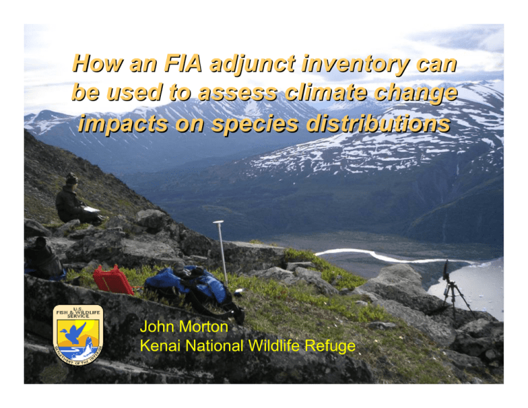
How an FIA adjunct inventory can impacts on species distributions John Morton
advertisement

How an FIA adjunct inventory can be used to assess climate change impacts on species distributions John Morton Kenai National Wildlife Refuge "Not everything that can be counted counts, and not everything that counts can be counted." - Albert Einstein (18791955) “… resource managers do not have sufficient site-specific information to plan for and manage the effects of climate change on the federal resources they oversee. [They] generally lack detailed inventories and monitoring systems to provide them with an adequate baseline understanding of the plant and animal species that currently exist on the resources they manage. For example, at the Chugach National Forest, managers told us that without accurate baseline inventory data of the plants and animals in the forest, it is difficult to determine whether changes to species populations are within the normal range of variability.” GAO Aug 2007 Climate Change: Agencies Should Develop Guidance for Addressing the Effects on Federal Land and Water Resources “Few DOI land management units have complete biological inventories of species. Additionally, DOI has no cohesive, systematic program for monitoring change over time in the distribution of species and communities. Inventories will be critical to assessing climate change impacts and to developing management responses to those impacts…” DOI Climate Change Task Force Feb 2008 Pre-decisional draft “The USFWS has an extensive inventory and monitoring program…However, inventory and monitoring plans often have little programmatic or geographic integration. The effects of climate change on Alaska flora and fauna are predicted to be far-reaching, and the Service’s ability to modify its management objectives and strategies in response to these changes may require a reconsideration of current inventory and monitoring efforts… “ USFWS R7 Climate Change Forum Inventory & Monitoring Breakout Group, Feb 2007 SOLUTION? Long Term Ecological Monitoring Program on Kenai National Wildlife Refuge Assessing biodiversity at the landscape level in cooperation with the Forest Inventory and Analysis (FIA) program ENLIGHTENED MANDATE! To conserve fish & wildlife populations and habitats in their natural diversity….” fish and wildlife = any member of the animal kingdom including without limitation any mammal, fish, bird, amphibian, reptile, mollusk, crustacean, arthropod or other invertebrate… (ANILCA) ¾ Determine the occurrence and distribution of selected terrestrial flora & fauna (inventory) ¾ Assess trends in occurrence and distribution of selected terrestrial flora & fauna (monitoring) ¾ Develop explanatory statistical models to assess effects of physical, biological, and anthropogenic factors on distributions 175 FIA points in forests at 5-km intervals Another 80 points in nonforested habitats LTEMP 255 permanent points systematically arrayed at 5-km intervals sampled cooperatively with FIA 2004 MOU designated LTEMP as FIA adjunct inventory Data collected in 2004 and 2006 ¾ Vascular & nonvascular flora on nonforested points (modified line intercept) ¾ Breeding bird densities (VCP) ¾ Insect relative abundance (sweep nets) ¾ Sound meter readings ¾ Rose galls as disturbance index LTEMP site 3088 Birds Arthropods Nonvascular flora GIS derived data Vascular flora Black spruce (IA2F), 40 years old Elevation = 20 m Patch size = 57 ha Nearest stream = 105m Nearest road = 2725 m Nearest border = 1119 m Leq = 46.4 dBa Rose galls = 0 LTEMP site 3088 Birds 26 species of vascular plants Arthropods Nonvascular flora Vascular flora Alanus incana Athyruium filiz-femina Betula nana Calamagrostis candadensis Chamerion angustifolium Cornus canadensis Dryopteris expansa Empetrum nigrum Equisetum sylvaticum Equisetum arvense Gymnocarpium dryopteris Linnaea borealis Mertensia paniculata Picea mariana Pyrola minor Ribes glandulosum Ribes hudsonianum Ribes triste Rosa acicularis Rubus arcticus Saliz pulchra Sanguisorba candadensis Spiraea stevenii Trientalis europaea Vaccinium uliginosum Vaccinium vitis-idaea LTEMP site 3088 Birds Arthropods Nonvascular flora Vascular flora 9 species of nonvascular plants and counting Ptilidium ciliare Drepanocladus uncinnatus Stereocaulon alpinum Aulacomnium palustre Cladonia umbricola Parmelia sulcata Pleurozium schreberi Rhizomnium nudum Brachythecium sp. LTEMP site 3088 7 bird species Birds Arthropods Nonvascular flora Vascular flora Alder flycatcher Cliff swallow Orange crowned warbler Ruby-crowned kinglet Swainson’s thrush White-winged crossbill Wilson’s snipe LTEMP site 3088 Birds Arthropods Nonvascular flora Vascular flora Aphidius sp. Ephedrus lacertosus Phaenoglyphis sp. Podabrini Aphididae Araneae Braconidae Hemerobiidae Cicadellidae Culicidae Diptera Empididae Ichneumonidae Javesella pellucida Lepidoptera Melanostoma mellinum Muscidae Mycetophilidae Pseudocalliope sp. Psyllidae Simuliidae Sminthurus A. 22 arthropod taxa and counting Alder flycatcher Cliff swallow Orange crowned warbler Aphidius sp. Ephedrus lacertosus Ruby-crowned kinglet Swainson’s thrush Phaenoglyphis sp. Alanus incana White-winged crossbill Podabrini Athyruium filiz-femina Wilson’s snipe Aphididae Betula nana Araneae Calamagrostis candadensis Braconidae Ptilidium ciliare Chamerion angustifolium Hemerobiidae Drepanocladus uncinnatus Cornus canadensis Cicadellidae Stereocaulon alpinum Dryopteris expansa Culicidae Aulacomnium palustre Empetrum nigrum Diptera Cladonia umbricola Equisetum sylvaticum Empididae Parmelia sulcata Equisetum arvense Ichneumonidae Pleurozium schreberi Gymnocarpium dryopteris Javesella pellucida Rhizomnium nudum Linnaea borealis Lepidoptera Brachythecium sp. Mertensia paniculata Melanostoma mellinum Picea mariana Muscidae Pyrola minor Mycetophilidae Ribes glandulosum Pseudocalliope sp. Ribes hudsonianum Psyllidae Ribes triste Simuliidae Black spruce (IA2F), 40 years old Rosa acicularis Sminthurus Elevation A. = 20 m Rubus arcticus Patch size = 57 ha Saliz pulchra Nearest stream = 105m Sanguisorba candadensis Nearest road = 2725 m Spiraea stevenii Nearest border = 1119 m Trientalis europaea Leq = 46.4 dBa Vaccinium uliginosum Rose galls = 0 Vaccinium vitis-idaea LTEMP site 3088 Birds Arthropods Nonvascular flora Vascular flora 647 species to date! 86 birds 333 vascular plants 78 nonvascular plants 44 lichen/fungi 106 arthropods species assemblages spatial distribution temporal change explanatory models What makes LTEMP work? ¾ Permanent sampling sites to measure change ¾ Statistically robust sampling frame (systematic) to survive planned and unplanned habitat changes ¾ Data are representative of the refuge unit ¾ Co-location of biotic & abiotic sampling (modeling) ¾ All sampling methods are passive, nondestructive (to habitat) and inexpensive ¾ Multi-taxa sampling and interagency cost-share Multiple approaches to monitoring spatial and temporal changes in species occurrences OCCUPANY MODELING INVENTORY DATA MINING GENERAL LINEAR MODELING Occupancy as a monitoring metric Pr (site being occupied) ¾ λ, extinction, colonization rates ¾ Program PRESENCE ¾ detection estimation problematic ¾ Matt Bowser Modeling and monitoring terrestrial arthropod diversity on the Kenai National Wildlife Refuge MS thesis, UAF Spatially-explicit modeling using GLM approach focus on explanatory modeling ¾ 60-80% accuracy ¾ computationally intensive ¾ incorporate climate variables ¾ management application ¾ Dawn Magness Managing the NWRS with climate change: The interaction of policy perceptions and ecological knowledge PhD dissertation, UAF Data mining using Random Forests focus on predictive modeling ¾ >90% accuracy ¾ computationally easy ¾ pixel-by-pixel change analysis ¾ Magness, Huettmann & Morton (In press) Using Random Forests to provide predicted species distribution maps as a metric for ecological inventory & monitoring programs In Applications of Computational Intelligence in Biology (Springer-Verlag) OCCUPANY MODELING INVENTORY DATA MINING GENERAL LINEAR MODELING We strongly recommend developing a national program to inventory and monitor changes in the biological integrity, diversity, and environmental health of the NWRS consistent with the 1997 Refuge Improvement Act. Objectives …would be scaled to detect changes in flora, fauna, and other metrics at the regional and/or national level. This program would consist of permanent sampling sites, ideally integrated and cost-shared with existing national monitoring programs such as the USDA Forest Inventory & Analysis program… Data resulting from this proposed I&M program can be used to model spatially-explicit distributions of biota now and into the future as a result of climate change.” Four Key Ideas to Guide the U.S. Fish and Wildlife Service’s Response to Climate Change Feb 2008 10,000 FIA plots on Federal lands in Alaska!? Forested acres Total acres % forested BLM 23,950,501 82,101,472 29 NPS 8,037,548 53,354,672 15 USFWS 27,968,227 83,529,052 33 ∑ 59,956,276 218,985,197


