Rapid Assessment Reference Condition Model
advertisement
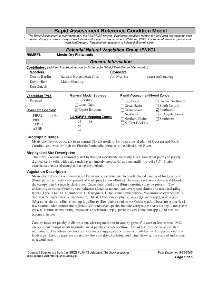
Rapid Assessment Reference Condition Model The Rapid Assessment is a component of the LANDFIRE project. Reference condition models for the Rapid Assessment were created through a series of expert workshops and a peer-review process in 2004 and 2005. For more information, please visit www.landfire.gov. Please direct questions to helpdesk@landfire.gov. Potential Natural Vegetation Group (PNVG) R9MEFL Mesic-Dry Flatwoods General Information Contributors (additional contributors may be listed under "Model Evolution and Comments") Modelers Reviewers Dennis Hardin Kevin Hiers Ken Outcalt Vegetation Type Forested Dominant Species* PIPA2 PIEL SERE2 ARBE ILGL hardind@doacs.state.fl.us khiers@tnc.org Jim Murrian General Model Sources Literature Local Data Expert Estimate LANDFIRE Mapping Zones 55 58 56 46 jmurrian@tnc.org Rapid AssessmentModel Zones California Great Basin Great Lakes Northeast Northern Plains N-Cent.Rockies Pacific Northwest South Central Southeast S. Appalachians Southwest Geographic Range Mesic-dry flatwoods occurs from central Florida north to the outer coastal plain of Georgia and South Carolina, and west through the Florida Panhandle perhaps to the Mississippi River. Biophysical Site Description This PNVG occurs in seasonally wet to flooded woodlands on nearly level, somewhat poorly to poorly drained sandy soils with dark sandy layers (mostly spodosols) and generally low pH (3-5). It also experiences seasonal droughts during dry periods. Vegetation Description Mesic-dry flatwoods is characterized by an open, savanna-like to nearly closed canopy of longleaf pine (Pinus palustris), with a component of slash pine (Pinus elliottii). In areas, such as south-central Florida, the canopy may be mostly slash pine. Occasional pond pine (Pinus serotina) may be present. The understory consists of mostly saw palmetto (Serenoa repens), and evergreen shrubs and trees including: lyonia (Lyonia lucida, L. fruiticosa, L. ferruginea, L. ligustrina), blueberries (Vaccinium corymbosum, V. darrowii, V. myrsinites, V. stamenium), titi (Cliftonia monophylla), oaks (Quercus spp.), wax myrtle (Myrica cerifera), hollies (Ilex spp.), gallberry (Ilex glabra) and bays (Persea spp.). These are typically of low stature under natural fire regimes. Ground cover species include wiregrasses (Aristida spp.), toothache grass (Ctenium aromaticum), dropseeds (Sporobolus spp.), panic grasses (Panicum spp.), and various perennial herbs. Canopy trees are patchy in distribution, with regeneration in canopy gaps of ¼ acre or less in size. Midsuccessional clumps occur in similar sized patches as regeneration. The oldest trees occur as isolated individuals. The reference condition classes are aggregates of numerous patches well dispersed over the landscape. Canopy gaps are created by fire mortality, lightning, and wind-throw at the scale of individual to several trees. *Dominant Species are from the NRCS PLANTS database. To check a species code, please visit http://plants.usda.gov. Final Document 9-30-2005 Page 1 of 5 Disturbance Description Frequent surface fires, often occurring every 1-3 years but ranging up to 5 year intervals, generally burn most of the vegetation. The mean fire return interval is skewed towards the more frequent end of this range. Fires are usually moderate in intensity overall, generally resulting in topkill of the lower and middle layers, but periodically will kill young regeneration patches and occasionally individual older trees. Although fire can occur in any season, in pre-European settlement times many lightning fires probably occurred during the dry summer season, although Native Americans were common in these areas and represented a significant ignition source. In this landscape, frequency is more important than seasonality, as long as the season of burn is varied periodically. This community is subjected to hurricanes which may cause thinning of stands, localized blowdown or uprooting of stands, or perhaps rarely blowdowns or larger areas. Flooding may cause vegetation changes at ecotones with wetland types. Adjacency or Identification Concerns Mesic-dry flatwoods exists as matrix in which many other types occur, often due to slight elevation changes, fire shadows, or strips parallel to extended elevation gradients between uplands and wetlands. In dry locations, it may be considered scrubby flatwoods. The wetter end may grade into wet flatwoods or savannas. Mesic-dry flatwoods may grade into dry or wet prairie as the tree canopy thins. Local Data Expert Estimate Literature Sources of Scale Data Scale Description Low intensity fires may have ranged in size from very small to thousands of acres pre-fragmentation. Replacement fires may have been localized to less than an acre, or as large as hundreds of acres. Hurricane and wind damage may have ranged from single trees, to a few tens of acres scattered in the landscape. Flooding disturbance probably was limited to a few acres. Patch size of this type may range from 10 acres to thousands of acres, forming the matrix within which other types are imbedded, especially in Florida Issues/Problems This community has very few reference examples from which to test the model outputs. The relative patchiness and presence of a high percentage of seral class C, represents a hypothesis for how fire and other disturbances maintained this community. The distribution of seral stages in this model should be managed with wide confidence intervals, recognizing the variation of structure in this community on the model landscape and the few glimpses of it in its pre-Columbian condition. Uncharacteristic vegetation types include even-aged canopy stands in which age structure has been homogenized by logging or clearing, often coupled with drainage. Examples include where loblolly or additional slash pine have replaced some or all of the longleaf pine. The effects of bedding, even when establishment of planted pine plantation has failed, persist often for many decades. Bedding may not completely drain a site; however, the alteration of micro-topography may affect the spread of fire. Disturbance caused by insects and other pathogens are very rare, except where conversions to dense stands of loblolly have occurred. I really think percents in this and the other longleaf dominated models should look more like the mesic uplands model. Model Evolution and Comments Wayne Taylor, Keith Fisher, Sharon Hermann *Dominant Species are from the NRCS PLANTS database. To check a species code, please visit http://plants.usda.gov. Final Document 9-30-2005 Page 2 of 5 Succession Classes** Succession classes are the equivalent of "Vegetation Fuel Classes" as defined in the Interagency FRCC Guidebook (www.frcc.gov). Class A 20 % Early1 All Struct Description Class A is a post replacement stage with canopy gaps, mostly single tree to quarter acre in size, of pine regeneration up to 15 years old. The native ground cover is dominated by wiregrass and other grasses, small statured shrubs, and forbs. Class B 4% Dominant Species* and Canopy Position PIPA2 Upper PIEL Upper ARBE7 Lower Upper Layer Lifeform Herbaceous Shrub Tree Fuel Model Description Dominant Species* and Canopy Position Class B is characterized as a midseral closed stage with patches, Upper Layer Lifeform mostly quarter acre or less in size, of canopy pines 15-75 years old Herbaceous and a substantial component of Shrub hardwoods (e.g., oaks, titi, bays) or Tree other pine species encroaching in Fuel Model 7 the absence of fire. The hardwood and encroaching pine cover is greater than 50%. The canopy pine cover ranges from 50-75%. Class C 44 % Mid1 Open Description Class C is characterized by a midseral open condition with patches, most ¼ acre or less in size, of canopy pines 15-75 years old and a minimal hardwood component due to frequent fire. The ground cover is grass-dominated, generally by wiregrass. The canopy pine cover ranges from 50-75%. Dominant Species* and Canopy Position PIPA2 PIEL SERE2 ARBE7 Upper Upper Low-Mid Lower Upper Layer Lifeform Herbaceous Shrub Tree Fuel Model Cover Height Min 0% Max 50 % Tree Regen <5m Tree Size Class Tree Short 5-9m Sapling >4.5ft; <5"DBH Upper layer lifeform differs from dominant lifeform. Height and cover of dominant lifeform are: 2 PIPA2 Upper PIEL Upper QUERC Upper Mid1 Closed Structure Data (for upper layer lifeform) Structure Data (for upper layer lifeform) Min 25 % Cover Height Max 75 % Tree Regen <5m Pole 5-9" DBH Tree Short 5-9m Tree Size Class Upper layer lifeform differs from dominant lifeform. Height and cover of dominant lifeform are: Structure Data (for upper layer lifeform) Min 0% Cover Height Max 25 % Tree Short 5-9m Tree Medium 10-24m Medium 9-21"DBH Tree Size Class Upper layer lifeform differs from dominant lifeform. Height and cover of dominant lifeform are: 2 *Dominant Species are from the NRCS PLANTS database. To check a species code, please visit http://plants.usda.gov. Final Document 9-30-2005 Page 3 of 5 Class D 29 % Dominant Species* and Canopy Position PIPA2 PIEL SERE2 ARBE7 Late1 Open Description Upper Upper Low-Mid Lower Class D is classified as a late-seral open stage with patches, most ¼ acre or less in size, of canopy pines Upper Layer Lifeform 75 or more years old and a minimal Herbaceous component of hardwoods. The Shrub ground cover is grass-dominated, Tree generally by wiregrass. The Fuel Model 2 canopy pine cover ranges from 2575%. Class E 3% Late1 Closed Description Class E is characterized by a lateseral closed stage with patches of canopy pines 75 or more years old, and a substantial component of hardwoods or pines other than longleaf in either the overstory or understory. The ground cover is shrubby or sparse. The hardwood and encroaching pine cover is greater than 50%. Dominant Species* and Canopy Position QUERC Upper PIPA2 Upper Structure Data (for upper layer lifeform) Min 0% Cover Height Tree Medium 10-24m Tree Size Class Tree Tall 25-49m Medium 9-21"DBH Upper layer lifeform differs from dominant lifeform. Height and cover of dominant lifeform are: Structure Data (for upper layer lifeform) Cover Height Min 25 % Upper Layer Lifeform Max 100 % Tree Medium 10-24m Tree Size Class Tree Tall 25-49m Medium 9-21"DBH Upper layer lifeform differs from dominant lifeform. Height and cover of dominant lifeform are: Herbaceous Shrub Tree Fuel Model Max 25 % 4 Disturbances Disturbances Modeled Fire Insects/Disease Wind/Weather/Stress Native Grazing Competition Other: Other Historical Fire Size (acres) Avg: 1000 Min: 1 Max: 100000 Sources of Fire Regime Data Literature Local Data Expert Estimate Fire Regime Group: 1 I: 0-35 year frequency, low and mixed severity II: 0-35 year frequency, replacement severity III: 35-200 year frequency, low and mixed severity IV: 35-200 year frequency, replacement severity V: 200+ year frequency, replacement severity Fire Intervals (FI) Fire interval is expressed in years for each fire severity class and for all types of fire combined (All Fires). Average FI is central tendency modeled. Minimum and maximum show the relative range of fire intervals, if known. Probability is the inverse of fire interval in years and is used in reference condition modeling. Percent of all fires is the percent of all fires in that severity class. All values are estimates and not precise. Avg FI Replacement Mixed Surface All Fires Min FI 65 550 2 2 Max FI Probability 5 150 1 8 0.01538 0.00182 0.5 0.51720 Percent of All Fires 3 0 97 References Brown, James K. and Smith, Jane Kapler, eds. 2000. Wildland fire in ecosystems: effects of fire on flora. *Dominant Species are from the NRCS PLANTS database. To check a species code, please visit http://plants.usda.gov. Final Document 9-30-2005 Page 4 of 5 Gen. Tech. Rep. RMRS-GTR-42-vol. 2. Ogden, UT: U.S. Department of Agriculture, Forest Service, Rocky Mountain Research Station. 257 p. Myers, Ronald L. and Ewel, John J. 1990. Ecosystems of Florida. Orlando, FL: University of Central Florida Press. 765 pp. Schmidt, Kirsten M., Menakis, James P., Hardy, Colin C., Hann, Wendel J. and Bunnell, David L. 2002. Development of coarse-scale spatial data for wildland fire and fuel management. Gen. Tech. Rep. RMRSGTR-87. Fort Collins, CO: U.S. Department of Agriculture, Forest Service, Rocky Mountain Research Station. 41 p. + CD. U.S. Department of Agriculture, Forest Service, Rocky Mountain Research Station, Fire Sciences Laboratory (2002, December). Fire Effects Information System, [Online]. Available: http://www.fs.fed.us/database/feis/. *Dominant Species are from the NRCS PLANTS database. To check a species code, please visit http://plants.usda.gov. Final Document 9-30-2005 Page 5 of 5
