GEG 150 GIS and Mapping Principles
advertisement
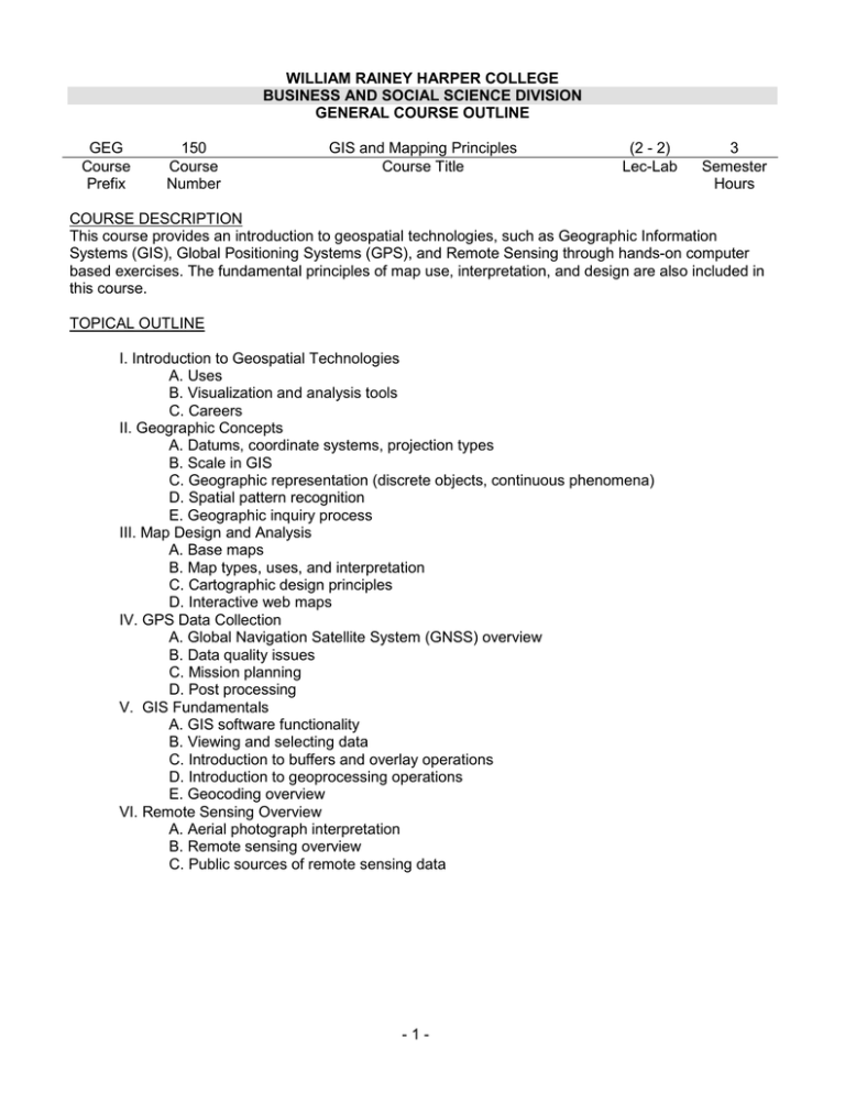
WILLIAM RAINEY HARPER COLLEGE BUSINESS AND SOCIAL SCIENCE DIVISION GENERAL COURSE OUTLINE GEG Course Prefix 150 Course Number GIS and Mapping Principles Course Title (2 - 2) Lec-Lab 3 Semester Hours COURSE DESCRIPTION This course provides an introduction to geospatial technologies, such as Geographic Information Systems (GIS), Global Positioning Systems (GPS), and Remote Sensing through hands-on computer based exercises. The fundamental principles of map use, interpretation, and design are also included in this course. TOPICAL OUTLINE I. Introduction to Geospatial Technologies A. Uses B. Visualization and analysis tools C. Careers II. Geographic Concepts A. Datums, coordinate systems, projection types B. Scale in GIS C. Geographic representation (discrete objects, continuous phenomena) D. Spatial pattern recognition E. Geographic inquiry process III. Map Design and Analysis A. Base maps B. Map types, uses, and interpretation C. Cartographic design principles D. Interactive web maps IV. GPS Data Collection A. Global Navigation Satellite System (GNSS) overview B. Data quality issues C. Mission planning D. Post processing V. GIS Fundamentals A. GIS software functionality B. Viewing and selecting data C. Introduction to buffers and overlay operations D. Introduction to geoprocessing operations E. Geocoding overview VI. Remote Sensing Overview A. Aerial photograph interpretation B. Remote sensing overview C. Public sources of remote sensing data -1- METHODS OF PRESENTATION 1. Lecture 2. Cooperative learning 3. Discussion 4. Hands-on lab exercises STUDENT OUTCOMES: (The student should…) 1. differentiate between and describe GIS, GPS, and remote sensing technologies. 2. understand the purpose of map projections, map scale, and coordinate systems. 3. differentiate between the representation of discrete and non-discrete phenomena in GIS systems 4. demonstrate proficiency in the basic functions of geospatial software and hardware. 5. apply cartographic principles in designing and constructing maps for different purposes and audiences 6. demonstrate proficiency in the creation and acquisition of spatial data with a GPS receiver. 7. understand the basic concepts of geocoding, building data queries, and using geoprocessing tools. 8. demonstrate awareness of fundamental remote sensing concepts. 9. identify problems and standards with accuracy of data. METHODS OF EVALUATION Grades are based on demonstrated proficiency in subject matter. Proficiency is determined from: 1. Completion of laboratory exercises 2. Passing exams 3. Completion of various homework assignments TEXTBOOK & INSTRUCTIONAL MATERIALS Shellito, Introduction to Geospatial Technologies, 2nd ed., W H. Freeman, 2014 Prepared by: Mukila Maitha Fall, 2014 -2-
