TRANSFER OF RECENT WOLF CREEK HYDROMETEOROLOGICAL PROCESS FINDINGS TO YUKON MINE RECLAMINATION PROJECTS
advertisement
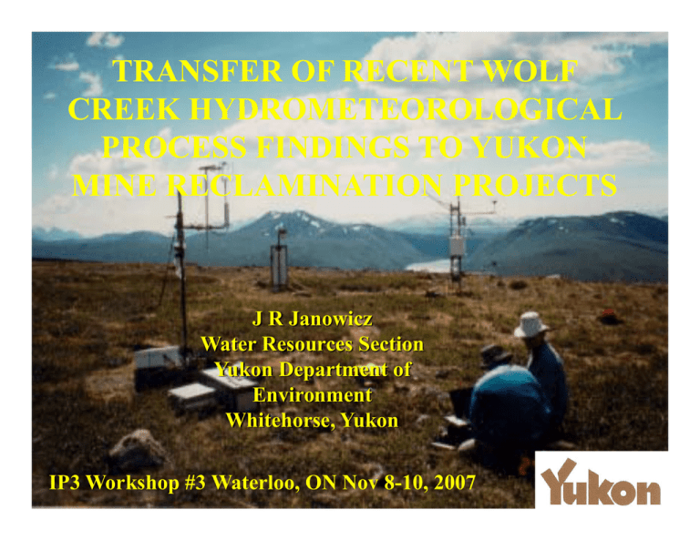
TRANSFER OF RECENT WOLF CREEK HYDROMETEOROLOGICAL PROCESS FINDINGS TO YUKON MINE RECLAMINATION PROJECTS J R Janowicz Water Resources Section Yukon Department of Environment Whitehorse, Yukon IP3 Workshop #3 Waterloo, ON Nov 8-10, 2007 WOLF CREEK - BACKGROUND •Established 1992 for Hydrologic Model Development / Calibration Purposes •Developed into an Integrated Study of Hydrometeorological Processes and Climate Research WOLF CREEK - LINKAGES •Strong GY Support •Climate Change Issues Priority •2007 Major Flooding •197 Yr “Perfect Storm” ANNUAL MAXIMUM DISCHARGE – ATLIN R •Linked to Climate Change 3 Discharge (m /s) 450 400 •Wolf Creek Research 350 300 250 •Linked to Climate Change 200 150 100 1950 1960 1970 1980 1990 2000 FLOOD FORECASTING (at its best!) WOLF CREEK UPDATE •IP3 / IPY Projects Underway •Yukon Water Resources Continues to Maintain Baseline Networks (14 Yrs) •Completed $60 K upgrade all met stn (Yukon funds) •Provide Logistical Support •Collaborate / Carry Out Research ANVIL RANGE MINING CORPORATION FARO MINE COMPLEX •SRK Consulting Ltd •Deloite & Touche •Could we Transfer Wolf Creek Finding to Faro Waste Rock Dumps to Develop a Water Balance? INVESTIGATION OF ANVIL RANGE MINING CORPORATION (FARO) WASTE DUMP WATER BALANCE Objective: Estimate Waste Rock Dump Recharge Determining Contaminant Seepage – Co-Investigators: Raoul Granger & Newell Hedstrom (NWRI) • 4 Year Study – Year 1: Develop Water Balance using Transposed Met Data – Year 2: Develop Water Balance using Site Meteorological Data – Year 3: Develop Estimates for Ave, Dry, Wet Scenario – Year 4: Apply Previous Work to Trial Covers ANVIL RANGE MINING CORP MINESITE •6 HRUs •Flat •Slopes (E.W.N.S) •Bubble Met Stations Snow Surveys Material Characterization Infiltration Studies COLD REGIONS HYDROLOGICAL MODEL CUMULATIVE SWE CUMULATIVE EVAPORATION Cumulative Infiltration Cumulative Runoff TRIAL COVERS TRIAL COVERS PROPERTIES Standard Proctor Thickness Dry Density Moisture* Compaction (m) (kg/m3) (%) (%) Uncompacted Till 1.8 2005 6.3 94.1 CT#2A Uncompacted Till 1.11 2096 5.5 98.4 CT#2B Uncompacted Till 0.75 1968 5 CT#3A Glaciofluvial - L1 0.45 1981 2.8 93 1963 2.9 92.1 2095 4.9 98.4 CT#1 CT#3B CT#4 Uncompacted Till - L2 1.05 Glaciofluvial - L1 0.5 Uncompacted Till - L2 0.6 Uncompacted Till - L1 1.79 Compacted Till - L2 0.5 92.4 2007 RESULTS SUMMARY • Simulated evaporation greater for horizontal covers as compared to the sloped covers • Simulated snowmelt infiltration greater from horizontal covers • Rainfall Infiltration is greater to sloped covers • Snowmelt runoff is low from all covers, while rainfall runoff is more significant • Simulated Annual recharge: – horizontal till – 117 mm – sloped till – 178 mm – sloped glacio-fluvial – 196 mm 2008 STUDY PLAN Compare Simulated Values to Measured Thank You
