Document 12009882
advertisement
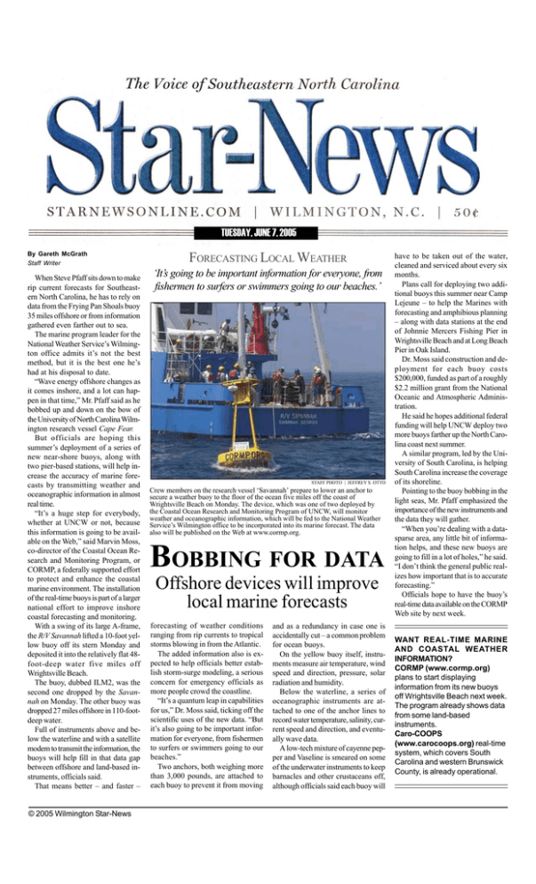
TUESDAY, JUNE 7, 2005 By Gareth McGrath Staff Writer When Steve Pfaff sits down to make rip current forecasts for Southeastern North Carolina, he has to rely on data from the Frying Pan Shoals buoy 35 miles offshore or from information gathered even farther out to sea. The marine program leader for the National Weather Service’s Wilmington office admits it’s not the best method, but it is the best one he’s had at his disposal to date. “Wave energy offshore changes as it comes inshore, and a lot can happen in that time,” Mr. Pfaff said as he bobbed up and down on the bow of the University of North Carolina Wilmington research vessel Cape Fear. But officials are hoping this summer’s deployment of a series of new near-shore buoys, along with two pier-based stations, will help increase the accuracy of marine forecasts by transmitting weather and oceanographic information in almost real time. “It’s a huge step for everybody, whether at UNCW or not, because this information is going to be available on the Web,” said Marvin Moss, co-director of the Coastal Ocean Research and Monitoring Program, or CORMP, a federally supported effort to protect and enhance the coastal marine environment. The installation of the real-time buoys is part of a larger national effort to improve inshore coastal forecasting and monitoring. With a swing of its large A-frame, the R/V Savannah lifted a 10-foot yellow buoy off its stern Monday and deposited it into the relatively flat 48foot-deep water five miles off Wrightsville Beach. The buoy, dubbed ILM2, was the second one dropped by the Savannah on Monday. The other buoy was dropped 27 miles offshore in 110-footdeep water. Full of instruments above and below the waterline and with a satellite modem to transmit the information, the buoys will help fill in that data gap between offshore and land-based instruments, officials said. That means better – and faster – © 2005 Wilmington Star-News FORECASTING LOCAL WEATHER ‘It’s going to be important information for everyone, from fishermen to surfers or swimmers going to our beaches.’ STAFF PHOTO | JEFFREY S. OTTO Crew members on the research vessel ‘Savannah’ prepare to lower an anchor to secure a weather buoy to the floor of the ocean five miles off the coast of Wrightsville Beach on Monday. The device, which was one of two deployed by the Coastal Ocean Research and Monitoring Program of UNCW, will monitor weather and oceanographic information, which will be fed to the National Weather Service’s Wilmington office to be incorporated into its marine forecast. The data also will be published on the Web at www.cormp.org. BOBBING FOR DATA Offshore devices will improve local marine forecasts forecasting of weather conditions ranging from rip currents to tropical storms blowing in from the Atlantic. The added information also is expected to help officials better establish storm-surge modeling, a serious concern for emergency officials as more people crowd the coastline. “It’s a quantum leap in capabilities for us,” Dr. Moss said, ticking off the scientific uses of the new data. “But it’s also going to be important information for everyone, from fishermen to surfers or swimmers going to our beaches.” Two anchors, both weighing more than 3,000 pounds, are attached to each buoy to prevent it from moving and as a redundancy in case one is accidentally cut – a common problem for ocean buoys. On the yellow buoy itself, instruments measure air temperature, wind speed and direction, pressure, solar radiation and humidity. Below the waterline, a series of oceanographic instruments are attached to one of the anchor lines to record water temperature, salinity, current speed and direction, and eventually wave data. A low-tech mixture of cayenne pepper and Vaseline is smeared on some of the underwater instruments to keep barnacles and other crustaceans off, although officials said each buoy will have to be taken out of the water, cleaned and serviced about every six months. Plans call for deploying two additional buoys this summer near Camp Lejeune – to help the Marines with forecasting and amphibious planning – along with data stations at the end of Johnnie Mercers Fishing Pier in Wrightsville Beach and at Long Beach Pier in Oak Island. Dr. Moss said construction and deployment for each buoy costs $200,000, funded as part of a roughly $2.2 million grant from the National Oceanic and Atmospheric Administration. He said he hopes additional federal funding will help UNCW deploy two more buoys farther up the North Carolina coast next summer. A similar program, led by the University of South Carolina, is helping South Carolina increase the coverage of its shoreline. Pointing to the buoy bobbing in the light seas, Mr. Pfaff emphasized the importance of the new instruments and the data they will gather. “When you’re dealing with a datasparse area, any little bit of information helps, and these new buoys are going to fill in a lot of holes,” he said. “I don’t think the general public realizes how important that is to accurate forecasting.” Officials hope to have the buoy’s real-time data available on the CORMP Web site by next week. WANT REAL-TIME MARINE AND COASTAL WEATHER INFORMATION? CORMP (www.cormp.org) plans to start displaying information from its new buoys off Wrightsville Beach next week. The program already shows data from some land-based instruments. Caro-COOPS (www.carocoops.org) real-time system, which covers South Carolina and western Brunswick County, is already operational.
