2010 RSAC BAER SUPPORT PROGRAM OVERVIEW
advertisement
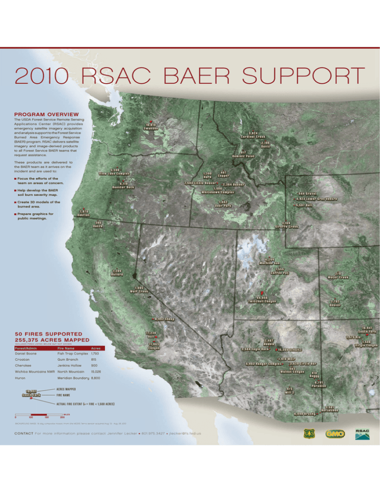
2010 RSAC BAER SUPPORT PROGRAM OVERVIEW The USDA Forest Service Remote Sensing Applications Center (RSAC) provides emergency satellite imagery acquisition and analysis support to the Forest Service Burned Area Emergency Response (BAER) program. RSAC delivers satellite imagery and image-derived products to all Forest Service BAER teams that request assistance. 16,8 10 S wakane 3,82 824 Car dinal Cr eek 2,186 Da v is 8 17 Dominic Point These products are delivered to the BAER team as it arrives on the incident and are used to: 5,308 V iew L ake Complex Focus the efforts of the team on areas of concern. 467 Copper 1,390 Hur d 7,50 4 Little Beaverr 6,119 Roo st er Rock 2,36 4 Banner 1,506 W hit eha w k Complex Help develop the BAER soil burn severity map. 5 4 4 Gr a vel 4 ,9 2 3 L ow e r G r o s Vent r e 1,00 4 2 Deer Par k Create 3D models of the burned area. 5,58 7 Bull 7,6 7 0 Oak F lat Prepare graphics for public meetings. 386 Dut ch 3,169 Gir Giraffe aff e Creek Cr eek 4,22 4 4 Machine Gun 1,555 Coffee Coff ee Pot 1,289 Bullardd Bullar 279 Wat er Cr eek 1,085 Wolf Cr eek 4 4 ,056 Tw it chell Canyon 2,702 Beaver Bea ver 8,992 Sheep 50 FIRES SUPPORTED 255,375 ACRES MAPPED I N C LU D ES FIR ES LI STED B ELOW B U T N OT S H OWN Forest/Admin Fire Name Daniel Boone Fish Trap Complex 1,793 Croatan Gum Branch 815 Cherokee Jenkins Hollow 900 Wichita Mountains NWR North Mountain Huron 16,9 41 Sout h Fork 17,2 38 Bull Acres 1,57 5 Rioo 2,467 2, Hobble 3,56 4 Eagle Rockk 15,360 S chult z 11,063 Canyon 11,9 14 Weir 33,639 Circle Bar 5,902 Ranger Complexx 563 56 6 Walnut Canyon 9 10 Boggy 15,026 Meridian Boundary 8,800 975 Mill 2 ACRES MAPPED 16,9 41 S outhh Fork Sout For k 11,506 V ir gin Canyon FIRE NAME 6,77 8 1 Paradise Par adis e ACTUAL FIRE EXTENT ( = FIRE < 1,500 ACRES) 3,56 1 Hor s e s hoe 6,098 Brushy MILES 0 100 150 200 BACKGROUND IMAGE: 16 day composite mosaic from the MODIS Terra sensor acquired Aug. 13 - Aug. 28, 2010 CONTACT For more information please contact Jennifer Lecker 801.975.3427 jlecker@ fs.fed.us
