APPLICATION ANALYZE OF GEOMETRIC RECTIFICATION BASED ON VECTOR DATA
advertisement

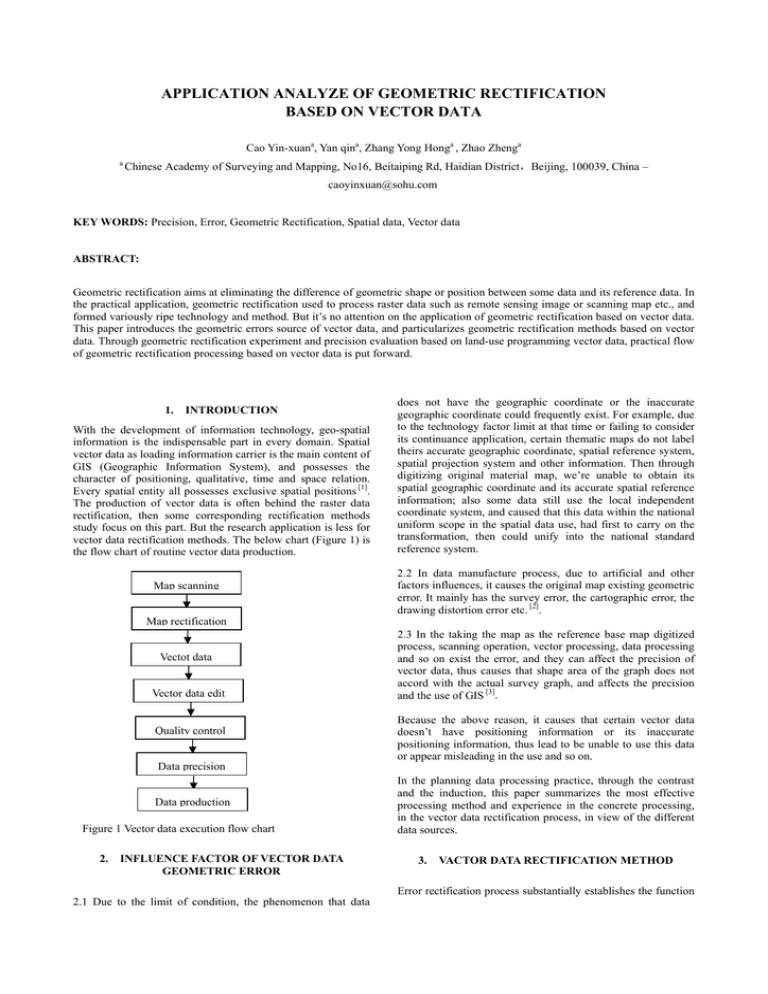
APPLICATION ANALYZE OF GEOMETRIC RECTIFICATION BASED ON VECTOR DATA Cao Yin-xuana, Yan qina, Zhang Yong Honga , Zhao Zhenga a Chinese Academy of Surveying and Mapping, No16, Beitaiping Rd, Haidian District,Beijing, 100039, China – caoyinxuan@sohu.com KEY WORDS: Precision, Error, Geometric Rectification, Spatial data, Vector data ABSTRACT: Geometric rectification aims at eliminating the difference of geometric shape or position between some data and its reference data. In the practical application, geometric rectification used to process raster data such as remote sensing image or scanning map etc., and formed variously ripe technology and method. But it’s no attention on the application of geometric rectification based on vector data. This paper introduces the geometric errors source of vector data, and particularizes geometric rectification methods based on vector data. Through geometric rectification experiment and precision evaluation based on land-use programming vector data, practical flow of geometric rectification processing based on vector data is put forward. 1. INTRODUCTION With the development of information technology, geo-spatial information is the indispensable part in every domain. Spatial vector data as loading information carrier is the main content of GIS (Geographic Information System), and possesses the character of positioning, qualitative, time and space relation. Every spatial entity all possesses exclusive spatial positions [1]. The production of vector data is often behind the raster data rectification, then some corresponding rectification methods study focus on this part. But the research application is less for vector data rectification methods. The below chart (Figure 1) is the flow chart of routine vector data production. Map scanning does not have the geographic coordinate or the inaccurate geographic coordinate could frequently exist. For example, due to the technology factor limit at that time or failing to consider its continuance application, certain thematic maps do not label theirs accurate geographic coordinate, spatial reference system, spatial projection system and other information. Then through digitizing original material map, we’re unable to obtain its spatial geographic coordinate and its accurate spatial reference information; also some data still use the local independent coordinate system, and caused that this data within the national uniform scope in the spatial data use, had first to carry on the transformation, then could unify into the national standard reference system. 2.2 In data manufacture process, due to artificial and other factors influences, it causes the original map existing geometric error. It mainly has the survey error, the cartographic error, the drawing distortion error etc. [2]. Map rectification Vectot data Vector data edit Quality control 2.3 In the taking the map as the reference base map digitized process, scanning operation, vector processing, data processing and so on exist the error, and they can affect the precision of vector data, thus causes that shape area of the graph does not accord with the actual survey graph, and affects the precision and the use of GIS [3]. Because the above reason, it causes that certain vector data doesn’t have positioning information or its inaccurate positioning information, thus lead to be unable to use this data or appear misleading in the use and so on. Data precision Data production Figure 1 Vector data execution flow chart 2. INFLUENCE FACTOR OF VECTOR DATA GEOMETRIC ERROR In the planning data processing practice, through the contrast and the induction, this paper summarizes the most effective processing method and experience in the concrete processing, in the vector data rectification process, in view of the different data sources. 3. VACTOR DATA RECTIFICATION METHOD Error rectification process substantially establishes the function 2.1 Due to the limit of condition, the phenomenon that data relation between graph position coordinate(X,Y)and theory coordinate (X′,Y′). According to this function relation, we could carry on rectification process for original graph, thus achieve theory coordinate requirement [4]. Figure2 Contrast graph between pre- and post-transformation There are many common rectification methods of vector data, such as linear transformation including affine, similitude, projection etc. transformation, and rubber sheet method, namely graph blocking partition rectification method. Fig 2 is the contrast graph between original map and rectification map. 3.1 Affine transformation: this transformation could carry on angle distortion, data zoom, distortion, rotation and translation, but transformed data still keep the parallel relation of primary linetype. Affine transformation needs three control points at least. Transformation formula is as follows: x’ = Ax + By + C y’ = Dx + Ey + F Figure3 is the pre-transformation and post-transformation sketch map of different data through zoom, distortion, rotation and translation. F is translation in y direction and: s is zoom scale coefficient t is rotation angle 3.3 RubberSheet: it could rectify geometric distortion locally in original data. Through a series of control points distributing in the graph, dividing the entire graph into multi-area, each area has respective transformation parameters. Compared with the traditional rectification methods, the difference is: in the traditional rectification method, a group of transformation parameter exists in entire transformation, locally rectifying entire mapsheet data distortion. And it meets the precision requirement; RubberSheet adopts subsection polynomial rectification, building irregular triangulation network through control points in entire area, and makes irregular triangulation network covering entire unrectified area, then acquires rectification coefficient through control points distributing in every triangle, and rectify other points within the triangle. The method needs relatively many control points about several decades’ points. And it could influence the rectified precision whether the distribution of control points is rational or not. Figure 4 is sketch map of rubber sheet. Reference layer Original data layer Figure 4 Sketch map of rubber sheet 3.4 Precision evaluation index: the precision of production data lies on the geometric precision of reference data, the accuracy of selecting control points in process, control points number, rectification methods and uptodate extent of original programming data and other factors. These errors cumulation necessarily influence the precision of programming data production. This paper adopts extracting sample points stochastically on production data, and then makes precision evaluation. Projecting rectified data onto corresponding reference base map, we could choose characteristic coordinate point, and measure coordinate errors of point, line and area, and then seek the maximum error, minimum error and mean error. Precision evaluation model adopts the following mean variance index: R= Figure 3 Sketch map between preand post-transformation 3.2 Similar transformation: this transformation could carry on data zoom, rotation and translation, but it must keep the shape of polygon, and couldn’t rectify data distortion. Similar transformation needs two control points at least. Transformation formula is as follows: x’ = Ax + By + C y’ = -Bx + Ay + F While: A = s · cos t B = s · sin t C is translation in x direction 1 n (Δxi2 + Δy i2 ) ∑ n i =1 n is the number of extracting check points stochastically, and Δy i2 Δxi2 are the errors respectively in X and Y direction. 4 EXPERIMENTATION ANALYSIS 4.1 Data analyze The data derives from digitizing original programming base map in this paper. Original programming base map is collectivity land-use programming map of national emphasis city in 1996-2010. It’s the first programming compilation map and used for illustration of programming text and index. So it lacked unified and strict execution standard in process; in addition, due to the technology limit, computer-aided cartography is no prevalence, and we couldn’t build thematic map database in time. As a result, it exists several errors in the above data, such as geometry shape, position, no geographic coordinate and no projection system etc. 4.2 Rectification methods In data process, considering data complexity and different errors, we choose the different rectification methods according to respective advantages. 4.2.1 Linearity transformation is the most common algorithm, could effectively settle mapsheet translation, scale and rotation deformation errors [5]. In the condition of equable mapsheet deformation, we could rectify through the same deformation coefficient for X and Y coordinate. For example, in the data, projection system is consistent, and it could meet the requirement through linearity transformation without geographic coordinate and mapsheet translation etc. In addition, due to other reason, deformation within the data is inconsistent, and it couldn’t meet the requirement through uniform transformation model. For this kind of data, firstly we could use linearity transformation, and the projection system and whole coordinate accord with reference base map. 4.2.2 RubberSheet In the above vector data rectification methods, it discusses rubber sheet method. Its characteristic is more accuracy deformation coefficient, and it could reflect more accuracy deformation of every point in data, and then improve the precision. The data rectification results lie on geometric position and point distribution of control points. For the data with large and irregular deformation, it keeps the number of control point more, and holds the distribution more equably. For satisfactory results, it needs multi-times rectification if necessary. In the data process, data contains geographic coordinate, and projection accords with reference data. But it exists large deformation between some data and reference data in geometric position and shape after linearity transformation. So it must carry on block partition rectification, then the position and shape of processed data accord with reference data. Figure 5 and Figure 6 display the different results after linearity transformation and block partition rectification. Figure6 RubberSheet 4.3 Precision analyze Precision calculation In the production data and reference data, we select 40 checkpoints stochastically. Compared X and Y coordinate of production data with reference data, we eliminate 4 gross error points. Finally, 36 checkpoints use for calculating precision error through the above mean variance formula. The following is a case of programming data in Tai’an. Scale is 1:20000. The results are in below table 1. Table 1 Programming production precision analyze statistics in Tai’an Programming Scale Tai’an 1:20000 Checkpoints RMSX RMSY RMS 35 7.03 7.2 10.06 From the above table, mean variance of rectification data is 10.06 m. The result meets the precision requirement according to corresponding scale. 5. CONCLUSIONS From the above, we could draw conclusions: 1 Through rectification methods, it may remedy the condition of vector data with no geographic coordinate and inaccurate geographic coordinate and shape; 2 In the rectification, it could select different rectification methods according to concrete condition of data; 3 Block partition rectification method meets precision requirement of different scale data; 4 For the data with large and irregular deformation in position and shape, making use of respective advantages, firstly it could carry on integrated transformation and location through linearity transformation, and then make precise rectification through block partition rectification method References: Zhengde, H., 1999, Error analysis and rectification of GIS data. Research progress of Qinhanwuji, 22(3), pp. 60-65. Qiyou, S., 1996, Error analysis and process of spatial data. Engineering of Surveying and Mapping, 5(1), pp. 48-52. Figure5 Linearity transformation Yunlan, G., 2001, Graph rectification in map scan-digitalizing, Transaction of academy of Surveying and Mapping. 8(4), pp. 242-245. Wenyou, F., 1998, Error rectification of GIS spatial data. Geoscience, 23(4), pp. 344-347. Yanhua, L., 2001, Geometric rectification algorithm research based on scanning topographic map. Mine Surveying and Mapping, 17(3), pp. 1-3. www.esriuk.com


