A LANDSLIDE HAZARD WARNING SYSTEM
advertisement
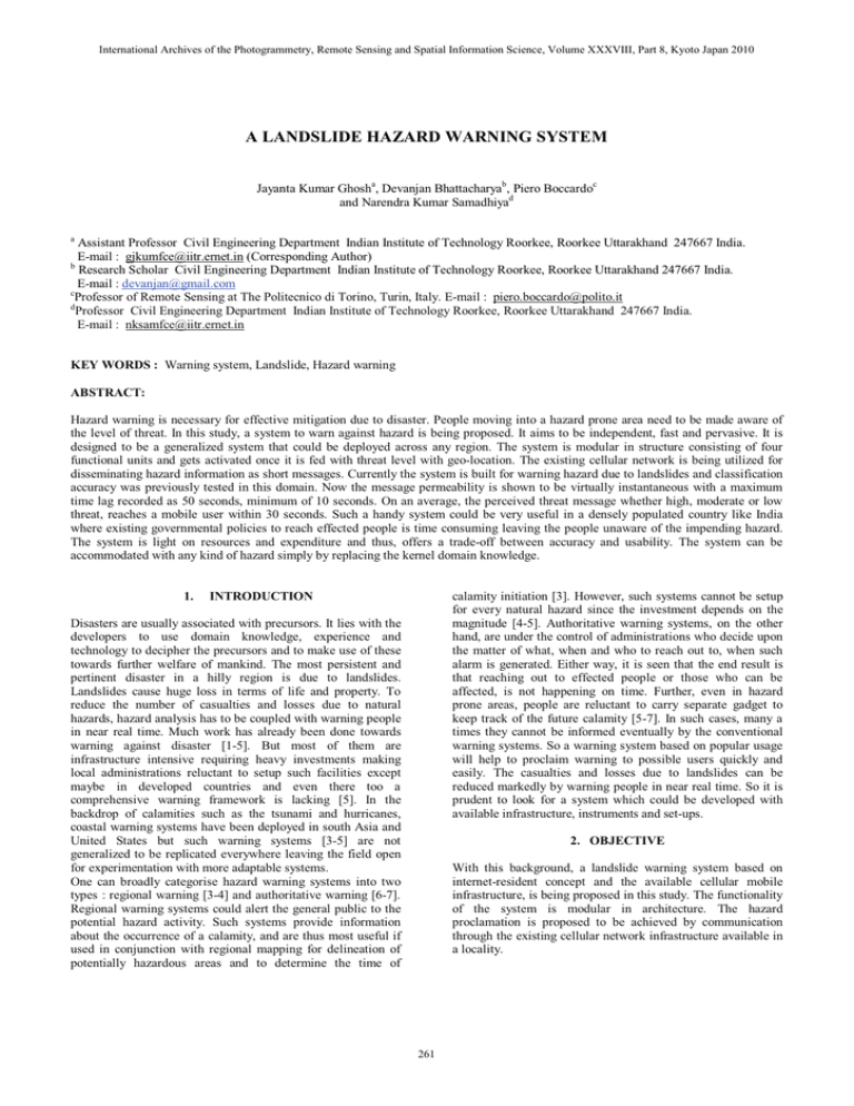
International Archives of the Photogrammetry, Remote Sensing and Spatial Information Science, Volume XXXVIII, Part 8, Kyoto Japan 2010 A LANDSLIDE HAZARD WARNING SYSTEM Jayanta Kumar Ghosha, Devanjan Bhattacharyab, Piero Boccardoc and Narendra Kumar Samadhiyad a Assistant Professor Civil Engineering Department Indian Institute of Technology Roorkee, Roorkee Uttarakhand 247667 India. E-mail : gjkumfce@iitr.ernet.in (Corresponding Author) b Research Scholar Civil Engineering Department Indian Institute of Technology Roorkee, Roorkee Uttarakhand 247667 India. E-mail : devanjan@gmail.com c Professor of Remote Sensing at The Politecnico di Torino, Turin, Italy. E-mail : piero.boccardo@polito.it d Professor Civil Engineering Department Indian Institute of Technology Roorkee, Roorkee Uttarakhand 247667 India. E-mail : nksamfce@iitr.ernet.in KEY WORDS : Warning system, Landslide, Hazard warning ABSTRACT: Hazard warning is necessary for effective mitigation due to disaster. People moving into a hazard prone area need to be made aware of the level of threat. In this study, a system to warn against hazard is being proposed. It aims to be independent, fast and pervasive. It is designed to be a generalized system that could be deployed across any region. The system is modular in structure consisting of four functional units and gets activated once it is fed with threat level with geo-location. The existing cellular network is being utilized for disseminating hazard information as short messages. Currently the system is built for warning hazard due to landslides and classification accuracy was previously tested in this domain. Now the message permeability is shown to be virtually instantaneous with a maximum time lag recorded as 50 seconds, minimum of 10 seconds. On an average, the perceived threat message whether high, moderate or low threat, reaches a mobile user within 30 seconds. Such a handy system could be very useful in a densely populated country like India where existing governmental policies to reach effected people is time consuming leaving the people unaware of the impending hazard. The system is light on resources and expenditure and thus, offers a trade-off between accuracy and usability. The system can be accommodated with any kind of hazard simply by replacing the kernel domain knowledge. 1. INTRODUCTION calamity initiation [3]. However, such systems cannot be setup for every natural hazard since the investment depends on the magnitude [4-5]. Authoritative warning systems, on the other hand, are under the control of administrations who decide upon the matter of what, when and who to reach out to, when such alarm is generated. Either way, it is seen that the end result is that reaching out to effected people or those who can be affected, is not happening on time. Further, even in hazard prone areas, people are reluctant to carry separate gadget to keep track of the future calamity [5-7]. In such cases, many a times they cannot be informed eventually by the conventional warning systems. So a warning system based on popular usage will help to proclaim warning to possible users quickly and easily. The casualties and losses due to landslides can be reduced markedly by warning people in near real time. So it is prudent to look for a system which could be developed with available infrastructure, instruments and set-ups. Disasters are usually associated with precursors. It lies with the developers to use domain knowledge, experience and technology to decipher the precursors and to make use of these towards further welfare of mankind. The most persistent and pertinent disaster in a hilly region is due to landslides. Landslides cause huge loss in terms of life and property. To reduce the number of casualties and losses due to natural hazards, hazard analysis has to be coupled with warning people in near real time. Much work has already been done towards warning against disaster [1-5]. But most of them are infrastructure intensive requiring heavy investments making local administrations reluctant to setup such facilities except maybe in developed countries and even there too a comprehensive warning framework is lacking [5]. In the backdrop of calamities such as the tsunami and hurricanes, coastal warning systems have been deployed in south Asia and United States but such warning systems [3-5] are not generalized to be replicated everywhere leaving the field open for experimentation with more adaptable systems. One can broadly categorise hazard warning systems into two types : regional warning [3-4] and authoritative warning [6-7]. Regional warning systems could alert the general public to the potential hazard activity. Such systems provide information about the occurrence of a calamity, and are thus most useful if used in conjunction with regional mapping for delineation of potentially hazardous areas and to determine the time of 2. OBJECTIVE With this background, a landslide warning system based on internet-resident concept and the available cellular mobile infrastructure, is being proposed in this study. The functionality of the system is modular in architecture. The hazard proclamation is proposed to be achieved by communication through the existing cellular network infrastructure available in a locality. 261 International Archives of the Photogrammetry, Remote Sensing and Spatial Information Science, Volume XXXVIII, Part 8, Kyoto Japan 2010 3. SYSTEM CONFIGURATION SMS [9-11] to the users’ mobiles registered under its network at the time of communication (Figure 2). The architecture of the system (Figure 1) consists of four functional units: the server database module, the web-content handler module, the trigger module and the communication module. The server database holds the network coverage details and the location of service towers / base stations in its tables. The web-content handler controls the display related configuration in the web (internet) application creating a graphical user interface (GUI) environment for the operator. This module utilizes the data from the database module as well as the triggering conditions from the trigger module. The trigger module has the logic of notifying the appropriate trigger. The level (at present there are three levels of hazards, such as low, moderate and high) of hazard determines the trigger to be generated. The trigger module initiates the trigger and calls the communication module. The communication module is responsible for directing the message to the proper network. The network communication broadcast facility will be used to freely send SMS (short messaging service) to all users of mobiles moving into an area affected by perceived threat prone. Figure 2. Schema for warning procedure 5. IMPLEMENTATION The open source development environment of JAVA has been used to code the landslide warning system. The system is encapsulated in different functional classes as shown in Figure 3. The initialization of the system occurs inside the Start Up Figure 1. Architecture of warning module 4. WORKING OF THE SYSTEM The geo-referenced hazard input activates the working of the warning module. To start with, the module gets fed with geolocation based intensity of landslide threat (defined by three levels: low, moderate or high) from the automated interpretation part, as explained in [8]. On activation of the warning module, web-content handler provides the desired environment to carry out further steps through the graphical user interface (GUI). It interacts with the server data base module to extract the list of users present in the area (i.e., to be informed) making use of the geo-location available in the input data. It further interacts with the trigger module to extract “appropriate warning message” in accordance with the “hazard level” of the input. The trigger module passes the warning message to the communication module. Communication module send the warning message to the appropriate network decided on the basis of the geo-location. Network communication disseminates the warning message through Figure 3 JAVA classes invoked for functioning of the system. 262 International Archives of the Photogrammetry, Remote Sensing and Spatial Information Science, Volume XXXVIII, Part 8, Kyoto Japan 2010 class which has functions for invoking all the other system classes in sequence as per the logic. The logic dictates that the input be processed, categorized, matched and evaluated so that decision can be made for each stored value. This sequence of events is taken care of in the subsequent classes. The Start Up class calls the Thematic Map class to handle the input which is the digital data for landslide causative factors pertaining to an area as 3-dimensional array images, the Thematic Map Processor class to digitally process the images, and Legend Classifier class to understand the images. The supporting classes used in this processing are image Main, image IO, and Utility.java classes. Next in the sequence, begins the traverse through the knowledge module where the matching, selecting and inferencing of the expert knowledge takes place. For this to happen there is a vast database of expert knowledge kept in file systems inside the knowledge-base. With the help of the knowledge-base the system arrives at a decision for each processing phase. And each processing phase constitutes of a single pixel representing the ground condition, as detailed in [8]. This is digitally stored in arrays which is traversed addresswise while processing. Corresponding to each pixel-address, a ground-location detail has been stored in a separate database. So the cycle of processing continues till all geo-locations get processed. Once a cycle gets completed, the system provides geo-location based hazard intensity level i.e., corresponding to each pixel, a geo-location (in terms of latitude and longitude) with a hazard level (low, medium or high) becomes available as shown in Figure 4a, the algorithm responsible for this landslide susceptibility zonation and its accuracy are mentioned in [8]. The database table maintained for the purpose of the threat message for each pixel according to the level of threat classified, is stored alongside the location details as shown in Figure 4b. Figure 4. (b) Snapshot of Warning module database table Next the main system class StartUp invokes the warning functions which are actually being monitored by iObserver.java class (Figure 3). This class has the trigger conditions for sending any SMS (Figure 1). The warning module uses the location database and accesses the threat message strings corresponding to each. In its own database, the warning module has the mobile numbers in a storage format shown in Figure 4b. Hence, as soon as the mobile numbers in the region are extracted from the table, the SMS Protocol program is called (Figure 5(a)) and the mobile numbers filled in the program (Figurer 5(b)) as command line parameters and the respective hazard messages are sent. The number of mobile numbers selected per region is fed in a loop and the SMS program (Figure 6) is called for each number for sending SMS (Figure 7). The SMS program connects to the SMS gateway via the internet and this gateway forwards the text message to the mobile environment [12]. 6. VALIDATION For the validation a landslide prone area of northern India between 30˚ 22΄ 15˝ to 30˚ 30΄ 5˝ Latitude and 78˚ 25΄ to 78˚ 30΄ Longitude was chosen [8]. The validation consisted of creating a database of pixel-wise listed hazard messages and registered mobile numbers in data tables. After this, the messages have been transmitted in a set of 20 short messages (SMSs) six times, to locally owned mobile numbers, resulting in a total number of 120. It has been found that 58 messages got delivered within 10 seconds, rest within 40 more seconds (Table 1). Progressively, it was noticed that, if one SMS is delayed, rest following it are cumulatively delayed too. But all messages generated were delivered and the time frame is acceptable for emergency purposes. For this study we registered for 120 SMSs to be sent for promotional purposes via the internet. It is possible to register for sending bulk SMSs in thousands via the internet requiring only very low payment. Figure 4(a). Snapshot of location database table 263 International Archives of the Photogrammetry, Remote Sensing and Spatial Information Science, Volume XXXVIII, Part 8, Kyoto Japan 2010 FIRST STEP: LOGIN SECOND STEP: SEND MESSAGES (REPEAT THIS TO SEND EACH SMS PACKAGE) To send 1 or more SMS via TCP/IP: DATA=04h + GSMNUMBER + 04h + SENDER + 04h + SMSTEXT + 04h + FLASH + 04h + FILENAME + 04h + GATEWAY + 04h + NETWORKCODE + 04h + 04h + DELIVERYCODE + 04h where Figure 6 Snapshot of pseudo-code to execute message sending event. Figure 5. SMS program (a) Calling the program (b) Filling parameters Figure 7 Flow of SMS controls . 264 International Archives of the Photogrammetry, Remote Sensing and Spatial Information Science, Volume XXXVIII, Part 8, Kyoto Japan 2010 Trial 1 2 3 4 5 6 Min duration Max duration Average delay 13 45 29 11 49 30 15 44 29.5 10 50 30 12 46 29 13 44 29 Table 1. SMS delay (in seconds) N. Waidyanatha, G. Gow and P. Anderson, “Hazard Warnings in Sri Lanka: Challenges of Internetworking with Common Alerting Protocol”, Procs. ISCRAM 2007, 1(1), pp. 281 – 293, 2007. R. Samarajiva, “Mobilizing information and communications technologies for effective disaster warning: lessons from the 2004 tsunami”, New Media and Society, 7 (6), pp. 731-747, 2005. 7. DISCUSSION J. H. Sorensen, “Hazard Warning Systems: Review Of 20 Years Of Progress”, Natural Hazards Review, Vol. 1, No. 2, pp. 119—125, 2000. It is seen that once hazard classification data is fed into the warning system (in the acceptable format [8], which could be best done by storing the information per pixel latitude and longitude and associating threat messages and mobile numbers in succeeding columns of the table (Figure 4a and 4b)) warning could be sent by mobile communication. The system functions by reading each pixel from the array of pixels and using the base address of the array to search the associated mobile information and message string to be transmitted. Once the table is accessed, the SMS program is initiated, and the mobile numbers filled in for the messages to be sent, the reliability of the system could be tested and the critical threat messages have all been delivered. So it could be summarized that a novel and stand-alone system for dynamic hazard warning is being implemented. Thus, cellular or mobile phones, a gadget used by common man, is expected to be the best proposition to effectively warn people individually and to propagate hazard messages to users in large regions ubiquitously. R. Pries, T. Hobfeld; and P. Tran-Gia, On the Suitability of the Short Message Service for Emergency Warning Systems, IEEE 63rd Vehicular Technology Conference, Volume 2, pp. 991 – 995, 2006. M. Cioca, L .Cioca, and S. Buraga, Spatial (Elements) Decision Support System Used in Disaster Management, Inaugural IEEE International Conference on Digital Ecosystems and Technologies, Cairns, Australia, IEEE Press, 1(1), pp. 607-612, 2007. Ghosh, J.K. and D. Bhattacharya, A Knowledge Based Landslide Susceptibility Zonation System, ASCE Journal of Computing in Civil Engineering, Vol.24, No.4, pp 1-10 (July/August), 2010. Federal Communications Commission FCC, “Enhanced 911”, http:// www.fcc.gov /911/enhanced/, 2009. 8. CONCLUSION The major outcome of the proposed system is a regional scale hazard warning system. The importance of such a system lies in efforts towards making people aware of hazard. It will help to provide a support system for disaster preparedness and mitigation activities. Such a user friendly system could be very useful where existing governmental policies reaching effected people is time consuming leaving the people unaware of the impending hazard. The system is light on resources and expenditure and therefore offers a trade-off between accuracy and easy usability. The system is commercially viable too. There has been a growing need of improvement in the existing disaster warning systems. So we propose such a system with a modular approach and up-gradable in future. The generalized nature of the warning comes from the modular approach of the system where the warning module can be integrated with a knowledge-based hazard classification system to work for a range of hazards. European Commission, “E l12 http://www.europa.eu.int/comm/environment/ civil/prote/112/112_en.htm, 2009. initiative”, 3GPP TS 03.40 version 7.5.0, “Digital cellular telecommunications system technical realization of the short message service (sms) point-to-point, Technical report”, ETSI 2001, ETSI TS 100 901 V7.5.0, Release 1998. G. Peersman, P. Griffiths, H. Spear, S. Cvetkovic, and C. Smythe, “A tutorial overview of the short message service within GSM”, IEEE Computing & Control Engineering Journal, 11(2), pp. 79-89, 2000. 9. REFERENCES M. Cioca, L.I. Cioca and S. C. Buraga, “SMS Disaster Alert System Programming”, Second IEEE International Conference on Digital Ecosystems and Technologies (IEEE DEST), Vol. 1, pp. 260-264, 2008. M. Montanari, S. Mehrotra and N. Venkatasubramanian, “Architecture for an Automatic Customized Warning System”, IEEE Conf. on Intelligence and Security Informatics, Vol. 1, pp. 32 – 39, 23-24 May 2007. 265
