POLYNOMIAL TEXTURE MAPPING AT ROUGHTING LINN ROCK ART SITE
advertisement

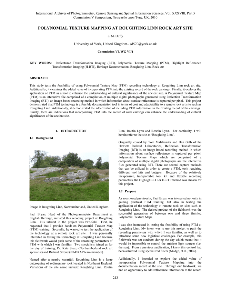
International Archives of Photogrammetry, Remote Sensing and Spatial Information Sciences, Vol. XXXVIII, Part 5 Commission V Symposium, Newcastle upon Tyne, UK. 2010 POLYNOMIAL TEXTURE MAPPING AT ROUGHTING LINN ROCK ART SITE S. M. Duffy University of York, United Kingdom– sd570@york.ac.uk Commission VI, WG VI/4 KEY WORDS: Reflectance Transformation Imaging (RTI), Polynomial Texture Mapping (PTM), Highlight Reflectance Transformation Imaging (H-RTI), Heritage Documentation, Roughting Linn, Rock Art ABSTRACT: This study tests the feasibility of using Polynomial Texture Map (PTM) recording technology at Roughting Linn rock art site. Additionally, it examines the added value of incorporating PTM into the existing record of the rock carvings. Finally, it explores the application of PTM as a tool to enhance the understanding of cultural significance of the ancient site. A Polynomial Texture Map (PTM) is an interactive file comprised of a compilation of multiple digital photographs generated using Reflection Transformation Imaging (RTI), an image-based recording method in which information about surface reflectance is captured per pixel. This project demonstrated that PTM technology is a feasible documentation tool in terms of cost and adaptability to a remote rock art site such as Roughting Linn. Additionally, it demonstrated the added value of including PTM information in the existing record of the carvings. Finally, there are indications that incorporating PTM into the record of rock carvings can enhance the understanding of cultural significance of the ancient site. Linn, Routin Lynn and Rowtin Lynn. For continuity, I will herein refer to the site as ‘Roughting Linn’. 1. INTRODUCTION 1.1 Background Originally coined by Tom Malzbender and Dan Gelb of the Hewlett Packard Laboratories, Reflection Transformation Imaging (RTI) is an image-based recording method in which information about surface reflectance is captured per pixel. Polynomial Texture Maps which are comprised of a compilation of multiple digital photographs are the interactive files generated using RTI. There are several capture methods that can be utilized in order to create a PTM, each requiring different tool kits and budgets. Because of the relatively inexpensive, transportable tool kit and flexible recording parameters, the Highlight-RTI or H-RTI method was chosen for this project. 1.2 Purpose As mentioned previously, Paul Bryan was interested not only in gaining practical PTM training, but also in testing the application of the technology at remote rock art sites such as Roughting Linn. The desired product of the fieldwork was the successful generation of between one and three finished Polynomial Texture Maps. Image 1: Roughting Linn, Northumberland, United Kingdom Paul Bryan, Head of the Photogrammetric Department at English Heritage, initiated this recoding project at Roughting Linn. His interest in the project was two-fold. First, he requested that I provide hands-on Polynomial Texture Map (PTM) training. Secondly, he wanted to test the application of the technology at a remote rock art site. I was personally interested in testing the technology at Roughting Linn because this fieldwork would push some of the recording parameters of PTM with which I was familiar. Two specialists joined us for the day of training, Dr. Kate Sharp (Northumberland rock art specialist) and Richard Stroud (NADRAP team member). I was also interested in testing the feasibility of using PTM at Roughting Linn. My intent was to use this project to push the recording parameters with which I was familiar, as well as to introduce some new logistical challenges. For example, this fieldwork was set outdoors during the day which meant that it would be impossible to control the ambient light sources (i.e. the sun). From a previous publication, I knew this control had been achieved using specialized filters (Mudge, et.al., 2006). Additionally, I intended to explore the added value of incorporating Polynomial Texture Mapping into the documentation record at the site. Through our fieldwork, we had an opportunity to add reflectance information to the record Named after a nearby waterfall, Roughting Linn is a large outcropping of sedimentary rock located in Northeast England. Variations of the site name include: Roughting Linn, Routin 213 International Archives of Photogrammetry, Remote Sensing and Spatial Information Sciences, Vol. XXXVIII, Part 5 Commission V Symposium, Newcastle upon Tyne, UK. 2010 as well as create a work product that captured the condition of the stone at a specific moment in time. I also became interested in exploring the possibility of using PTM to enhance understanding of the cultural significance of the ancient rock carvings. captures reflectance information of an object’s surface. The technique ‘creates a ’special’ image of the object which encodes a reflectance function per-pixel’ (Corsini 2006, 1). The ‘special’ image is referred to as a Polynomial Texture Map (PTM). 2. POLYNOMIAL TEXTURE MAPPING AT ROUGHITNG LINN A PTM is comprised of a compilation of multiple digital photographs. The photographs are all taken from one stationary position and the lighting is projected onto the object from different directions in each shot. Using a mathematical method, a computer program synthesizes the reflectance information in the photographs, compiling all of the information into one 2D file. The PTM viewer allows the audience to highlight various portions of the photographed object revealing texture and fine detail. PTM has been used in law enforcement, natural science (e.g. Palaeontology and Entomology) as well as cultural heritage projects. 2.1 The site: Roughting Linn Roughting Linn, a large elliptical outcropping of Fell Sandstone (See Image 1), is considered the largest decorated rock in Northern England (measuring approximately 20m x 15m). The site is located close to the Scottish boarder in Northumberland County near Doddington. It sits on private land and is accessed by Right of Way using a small footpath that leads directly from the road. Earliest accounts of Roughting Linn suggest that there was quarrying of the stone which ended before its modern discovery in the mid 19th century. Broken down, the name means ‘roaring pool’ (‘roughting’, roaring/bellowing noise and ‘linn’, pool). The stone, itself, is part of a larger cultural landscape, an ancient camp. There are several advantages of using PTM including ‘the simple, intuitive character of the [documentation] method’ (Mudge et. al. 2006, 7). A PTM is a 2D interactive file that reveals the surface detail such as texture, highlighting and shadowing of 3D objects sometimes not even obvious to the naked eye. It can be generated using a very inexpensive, transportable tool kit. Furthermore, because the viewing software is free and the information can be easily presented on the web, PTMs can be shared world-wide, fostering international research collaborations with professionals who may not be able to travel to remote sites. In a collaborative effort between the landowner and English Heritage, vegetation that obstructed access or visibility of the rock art has been removed along with dilapidated fencing and deteriorating interpretive signage. This action has made the site more accessible but also more vulnerable to both environmental and anthropogenic pressures. There are several capture methods that can be utilized to document different size objects on different monetary budgets using RTI technology. For example, a prefabricated frame can be manufactured to provide the light source. When using a prefabricated frame, not only is the object completely protected from inadvertent damage caused by handling, but also the position of each of the light sources is already established, cutting down the acquisition time and eliminating supplemental calculations during processing. However, prefabricating a frame also has its disadvantages. Namely, it can be quite expensive to produce and transporting such a frame can be cumbersome. Most important, the size of the frame dictates the size of the objects that can be recorded and is therefore a limiting feature of this method. The Scheduled Ancient Monument is decorated with prehistoric incised artwork, primarily cup and ring. Researchers speculate broadly that the Northumberland rock art originated in the ancient Neolithic and Early Bronze Age (Beckensall, 2007; Twohig, 1998; Mazel, 1997). Discovered by Rev. William Greenwell, Roughting Linn was first recorded in the 1850s using written description, tracing and rubbing techniques, drawings and lithographs. In the 1970s and 80s, the carvings were documented by rock art specialist, Dr. Stan Beckensall and later Elizabeth Twohig who used similar traditional recording techniques as well as incorporating photography. In the early 21st century as part of the Northumberland and Durham Rock Art Pilot Project (NADRAP), Roughting Linn was documented using more innovative techniques such as photogrammetry. The highlight RTI (HRTI) method, also referred to as the ‘Egyptian Method,’ is a ‘simpler, lower cost, and more flexible method of PTM acquisition’ (Zanyi Eva et. al. 2004, 22.4). This method of acquisition has many benefits. For example, the position of the light source is recovered from highlights on reflective black balls in each photograph, eliminating the necessity of knowing the light position in each photograph. Software used during the processing phase extracts the highlights in the black balls in order to determine the light position. The tool kit for this acquisition method is relatively affordable and transportable. The kit includes a digital camera, tripod, two billiard balls and a light source. Moreover, the objects that are documented are not limited by the size of the framing device and can range from ‘two square centimeters to multiple square meters’ (Zanyi Eva et. al. 2004, 22.4). There have been two main schools of thought regarding interpretation. The very early hypothesis was that the markings were similar to an ancient map, depicting camps and local geography, later referred to as ‘camp fancy’ (Tate, 1865). The alternate and contemporary explanation links the carvings with religious beliefs (Tate, 1865; Greenwell, 1867; Wilkerson, 1867; Beckensall, 1974; Bradly, 1997). While there have also been no definitive findings regarding instrumentation (stone versus metal), it is commonly held that the markings were created by pecking rather than rubbing (Tate, 1865; Beckensall, 1974; Beckensall, 2007). 2.2 The technology: Polynomial Texture Mapping (PTM) There were several reasons that I decided to use the H-RTI capture method at Roughting Linn. First, the ancient rock art site is remote, making the transportable tool kit attractive. Additionally, I did not have the funding or time to create an intricate framing device before our fieldwork. Finally, I did not Originally coined by Tom Malzbender and Dan Gelb of the Hewlett Packard Laboratories, Reflection Transformation Imaging (RTI) is an imaged-based recording method which 214 International Archives of Photogrammetry, Remote Sensing and Spatial Information Sciences, Vol. XXXVIII, Part 5 Commission V Symposium, Newcastle upon Tyne, UK. 2010 want the size of a prefabricated frame to dictate the size of area that could be documented. in other records, including photography, became clear through the use of Polynomial Texture Mapping. 2.3 The project: Discussion of process and outcomes While we successfully realized the preliminary research goals of this project (e.g. providing practical PTM training and testing the feasibility of using the technology at the site), I also became interested in exploring the feasibility of using PTM to enhance understanding of the cultural significance of the ancient rock carvings. We photographed two specific areas of carvings at Roughting Linn. During the capture sequence, the digital camera (which had been set to photograph in RAW) was positioned over a selected area of the rock. Specular black balls were placed next to the carvings in the frame but far enough away from the area so that they could later be cropped out during processing. The light source was moved Image 2: Camera set-up around the surface of the rock at Roughting Linn. as if to create a virtual dome. (Copyright: Sarah Duffy) Because the processing software compresses information in the photographs per pixel, it was essential that nothing but the light source moved during a photo sequence of at least 30 shots. (See Image 2) I have already used the PTMs generated already from the fieldwork at Roughting Linn to begin a preliminary investigation which focuses on what additional information can be ascertained about the ancient carving using the technology. The initial PTMs clearly establish differential carving depths. Many of the cups are considerably deeper than the rings. Furthermore, the cup marks, themselves, have varying depths. In the future, I hope to assemble a consensual panel of rock art specialists to help with a more specialized analysis focusing on some of the issues I outline below. At this time, ‘a key challenge facing rock-art researchers worldwide is the establishment of absolute and relative chronological frameworks’ (Mazel 2007, 236). Mazel (2007, 238) suggested future researchers ‘identify superimpositioning and different episodes of carvings through a thorough and systematic study’ using innovative tools. Dr. Kate Sharp noted that some of the cup marks at Roughting Linn were considerably deeper than the rings which introduces the possibility of differential phasing of the carvings. Using PTMs, I hope to inform a relative dating chronology at the site and address such questions as: Can we determine if the cups came before rings? There were a few logistical challenges encountered throughout the recording process at Roughting Linn. For example, because we were recoding during the day, it was impossible to eliminate all sources of ambient light (i.e. the sun). We, therefore, used specialized filters during the photo sequence. I also attached weights to the tripod in order to offset the wind and stabilize the camera during photography. Finally, we did not have access to electrical power so we needed to ensure that all equipment was self-powered (and properly charged). After a day of fieldwork and some processing in the lab, I was able to generate three separate PTMs of varying resolution from the images. It has been suggested that prehistoric people may have incorporated natural features into their carvings, sometimes enhancing them. For example, at Old Bewick (a nearby rock art site), there is evidence to suggest that natural features on stone attracted human additions (Beckensall, n.d.). There are multiple areas at Roughting Linn where it is difficult to determine natural features versus carvings; I would like to use PTM to further investigate these areas in question. In the processing stage, the RAW photographs were converted to DNG and then two sets of different JPEGs. A light position file was generated which logged the coordinates of the reflectance in the black ball. The final set of JPEGs and light position file were fed through software (specially developed by Hewlett Packard) and a PTM was generated which could be viewed using the appropriate viewing software. Figure 1 (viewed left to right) a) standard digital photograph, b) screenshot of PTM viewed with specular enhancement tool and c) normal map (Copyright: Sarah Duffy) Tate (1865) reported with some certainty that the ancient peoples most likely used bronze tools to inscribe the stones. However, no evidence has ever established this as fact, and later reports from researchers such as Beckensall (1974, 2007) shy away from making definitive decisions regarding this matter. I hope to test the usefulness of PTM in studying tooling. In other words, I want to answer the question: Can we use PTM to determine if the ancient sculptors used stone or metal tools? It will also be interesting to test how much detail PTM offers about the original engraving technique. Both Tate (1865) and Beckensall (1974) comment that the markings were made by a chipping or pecking technique (versus rubbing). I am curious to test how much information PTM would capture about tooling technique. Twohig (1988, 45) speculated that there are ‘clearly a number of hands were at work’ at Roughting Linn. After analyzing the PTMs in order to study tooling and instrumentation, I am interested to see if we could also use the technology in order to detect the work of different artists. Such information would offer insight into the carving program at the site. For example, do we see signs of the same artist engraving across the rock? Can we track that artist’s movements? After processing, I compared the PTMs to the more traditional documentation work products (e.g rubbings, drawing and static photographs). The qualitative value-added is clear. Information about surface reflectance, not available before, is now accessible through the interactive viewer and is illustrated by the figure above. (See Fig. 1) Surface features not apparent 215 International Archives of Photogrammetry, Remote Sensing and Spatial Information Sciences, Vol. XXXVIII, Part 5 Commission V Symposium, Newcastle upon Tyne, UK. 2010 feasibility of using PTM to enhance the understanding of cultural significance of the ancient cultural heritage. It would, furthermore, be interesting to explore the ways in which PTMs might be used as a tool to record the artifact condition. Having seen the detailed information gathered from the PTMs created at Roughting Linn, how can we enhance the value of the PTMs? Can we create a record to be used for future condition assessment? George Tate (1865, 44) summarized his work recording Northumberland rock art by saying ‘something…has been achieved–materials for aiding in the fuller solution of the problem have been placed on record - an advanced starting point made for future inquiries- and a description and representation preserved of marvellous sculptures which time and the elements will eventually obliterate.’ I hope that the Polynomial Texture Maps generated as a result of this project contribute to that record. As an additional output of this research, I plan to compile a comprehensive list using both Beckensall’s and Twohig’s detailed descriptions of Roughting Linn in which I will suggest motifs to target in future research. Included will be areas where they noted heavy erosion/ weathering (in order to track changes and create a record), motifs for which there is a question of human versus natural intervention, engravings with differential depths (in order to study phasing) and any areas where they needed to use raking light in order to view the motifs. Furthermore, I am hopeful that a panel of experts will be able to help me a) examine the issue of phasing, as well as establish if the different depths connote possible different artists b) give some insight into tooling practices and c) provide information on possible instrumentation. REFERENCES Bradley, R (1997) Rock art and the prehistory of Atlantic Europe: Signing the land, (103 - 126) New York : Routledge. Beckensall, S. (1974) The Prehistoric Carved Rocks of Northumberland. Frank Graham: Newcastle. Beckensall, S. ‘How the Study of Rock-Art Began and Developed’ in Mazel, A.D., Nash, G. and Waddington, C. (2007) Art as Metaphor: The Prehistoric Rock-Art of Britain, 231 – 256. Oxford: Archaeopress. CONCLUSIONS Today, by preserving heritage digitally, we can create an even more robust record. The growing utilization of digital recording has introduced many important issues into the field of heritage conservation. Established and emerging heritage documentation technologies can assist us in making informed decisions about cultural heritage in terms of conservation issues and significance. Reflection Transformation Imaging is an example of one such emerging recording technology Beckensall, S. n.d. ‘Roughting Linn’ http://rockart.ncl.ac.uk/ panel_detail.asp?pi=11. Page consulted 23 September 2009. Corsini, M., Dellepiane, M., Callieri, M., and Scopigno, R. “Reflection Transformation Imaging on Larger Objects: an Alternative Method for Virtual Representations.” Paper presented at the 2nd International Conference on Remote Sensing Archaeology, Rome, Italy, December 4-7 2006. Though quarrying of the stone at Roughitng Linn ended before its modern discovery, erosion and weathering are still at work. The recent improvements at Roughting Linn have allowed better physical access to the site, but clearing away vegetation on the surface of the stone may have negative consequences by introducing additional natural and anthropogenic pressures. Furthering the record of the site will allow future generations to continue studying the cultural resource even if the tangible evidence disappears. The importance of recording in advance of erosion is demonstrated by my research since it would have been impossible for me to conduct this work if it were not for the record left for me dating back to the 1850s. Greenwell, W. (1864) ‘President’s Address’ Transactions of the Tyneside Naturalists’ Field Club, Vol VI, 2 – 29. Greenwell, W. (1877) British Barrows: a Record of the Examination of Sepulchral Mounds in Various Parts of England. Oxford: Oxford University Press. Mazel, A. D. ‘On the fells and beyond: exploring aspects of Northumberlad rock-art’ in Mazel, A.D., Nash, G. and Waddington, C. (2007) Art as Metaphor: The Prehistoric RockArt of Britain, 231 – 256. Oxford: Archaeopress. Additionally, there are still many questions regarding this ancient stone (e.g. instrumentation, exact meaning and construction date). We may never find the Rosetta stone of rock art with which to unlock all of the hidden meanings behind these mysterious stone carving. However, using innovative technologies may allow us to see the cultural heritage in a new way and reveal things before unseen. Beckensall stated that a primary value of a model which had been created of the site was that it could be viewed with varying lighting conditions. (Beckensall, n.d.). PTMs offer this benefit digitally and often reveal information about an object’s surface not even visible to the naked eye. Malzbender, T., Gelb, D., and Wolters, H. “Polynomial Texture Maps.” Paper presented at the annual Special Interest Group on Graphics and Interactive Techniques (SIGGRAPH) conference, Los Angeles, USA, August 12-17, 2001. Mudge, M., Voutaz, J., Schroer, C. and Lum, M. “Reflection Transformation Imaging and Virtual Representations of Coins from the Hospice of the Grand St. Bernard.” Paper presented at The 6th International Symposium on Virtual Reality, Archaeology and Cultural Heritage (VAST), Cyprus, Italy, October, 30-November 4, 2005. By successfully generating multiple PTMs from the data gathered through the fieldwork, this research demonstrated the feasibility of using PTM at remote rock art sites such as Roughting Linn during the day. Additionally, this study allowed me to examine the added value of incorporating Polynomial Texture Mapping into the existing documentation record of the site. Furthermore, I was able to explore the Mudge, M., Malzbender, T., Schroer, C., and Lum, M. “New Reflection Transformation Imaging Methods for Rock Art and Multiple-Viewpoint Display.” Paper presented at The 7th International Symposium on Virtual Reality, Archaeology and Cultural Heritage (VAST) October 31 – November, 2006. 216 International Archives of Photogrammetry, Remote Sensing and Spatial Information Sciences, Vol. XXXVIII, Part 5 Commission V Symposium, Newcastle upon Tyne, UK. 2010 Padfield, J., Saunders, D., and Malzbender, T. “Polynomial Texture Mapping: a New Tool for Examining the Surface of Paintings.” Paper presented at the ICOM 14th Triennial Meeting, The Hague, The Netherlands, September 12-16, 2005. Sharpe, K., et. al. “The Prehistoric Rock Art of England: Recording, managing and enjoying our carved heritage.” London: English Heritage Publishing, 2008. Smith, C.D ‘Cartography in the Prehistoric Period in the Old World: Europe, Middle East, and North Africa’ in Harly, J.B., Woodward, D (1987) Cartography in the Prehistoric, Ancient and Medieval Europe and the Mediterranean, 54-102. The University of Chicago Press: Chicago. Tate, G. (1865) The Ancient British Sculptured Rocks of Northumberland and the Eastern Borders. Alnwick: Henry Hunter Blair. Twohig, S. E. 1988. The rock carvings at Roughting Linn, Northumberland. Archaeologia Aelian, 5th Series XVI: 37–46. Wilkinson, J. G. (1860) ‘On the Rock-Basins of Dartmoor, and Some British Remains in England’ Journal of the British Archaeological Association, VOL. XVI, 101 – 132. Zanyi, E., Schroer, C., Mudge, M., and Chambers, A. “Lighting and Byzantine Glass Tesserae.” (paper presented at EVA London Conference 11-13 July 2007). anon, 2004. ‘Northumberland Rock Art Web Access to the Beckensall Archive homepage’ http://rockart.ncl.ac.uk/. Page consulted 23 September 2009. anon. n.d. ‘England’s Rock Art homepage’ http://archaeolog ydataservice.ac.uk/era/. Page consulted 23 September 2009. AWKNOWLEDGEMENTS This research was completed in collaboration with Paul Bryan, Head of Photogrammetry, Imaging Graphics and Survey at English Heritage. Many thanks to Paul for his initiative and support. Thank you to Dr. Kate Sharpe for her input regarding interpretation of Northumberland rock art. 217


