PRELIMINARY RESEARCH ON POSITION ACCURACY OF CARTOSAT-1
advertisement
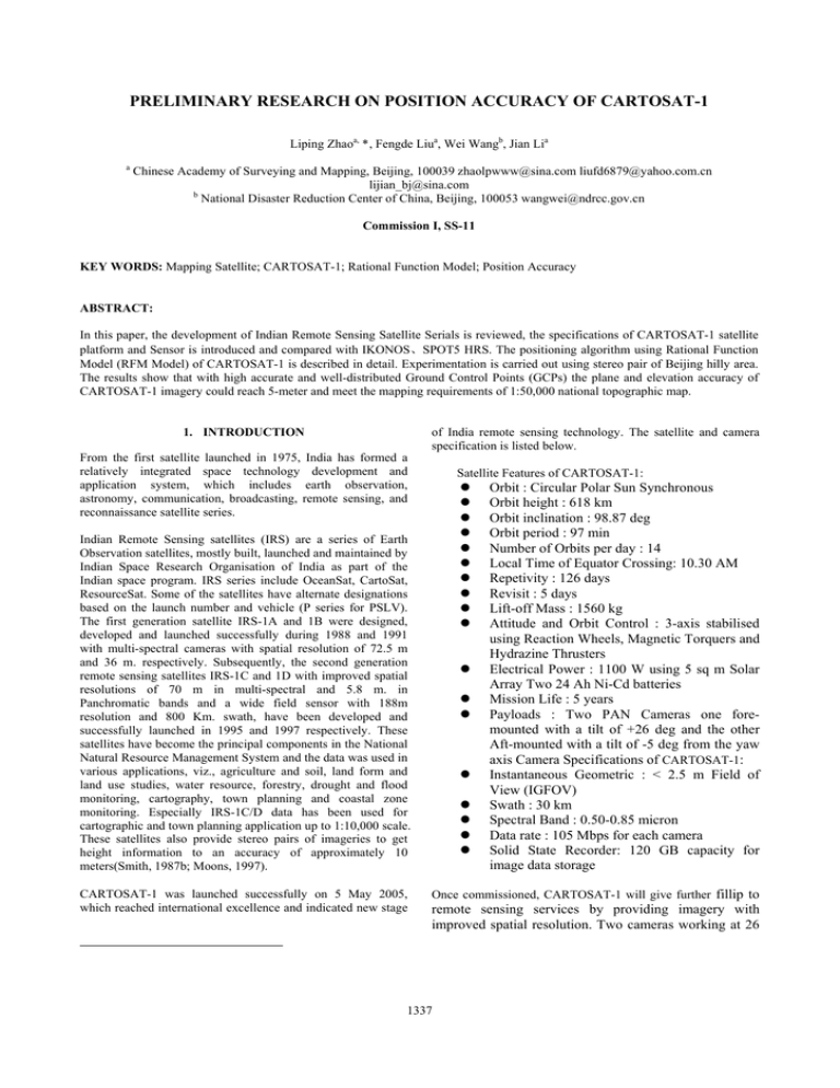
PRELIMINARY RESEARCH ON POSITION ACCURACY OF CARTOSAT-1 Liping Zhaoa, *, Fengde Liua, Wei Wangb, Jian Lia a Chinese Academy of Surveying and Mapping, Beijing, 100039 zhaolpwww@sina.com liufd6879@yahoo.com.cn lijian_bj@sina.com b National Disaster Reduction Center of China, Beijing, 100053 wangwei@ndrcc.gov.cn Commission I, SS-11 KEY WORDS: Mapping Satellite; CARTOSAT-1; Rational Function Model; Position Accuracy ABSTRACT: In this paper, the development of Indian Remote Sensing Satellite Serials is reviewed, the specifications of CARTOSAT-1 satellite platform and Sensor is introduced and compared with IKONOS、SPOT5 HRS. The positioning algorithm using Rational Function Model (RFM Model) of CARTOSAT-1 is described in detail. Experimentation is carried out using stereo pair of Beijing hilly area. The results show that with high accurate and well-distributed Ground Control Points (GCPs) the plane and elevation accuracy of CARTOSAT-1 imagery could reach 5-meter and meet the mapping requirements of 1:50,000 national topographic map. 1. INTRODUCTION From the first satellite launched in 1975, India has formed a relatively integrated space technology development and application system, which includes earth observation, astronomy, communication, broadcasting, remote sensing, and reconnaissance satellite series. of India remote sensing technology. The satellite and camera specification is listed below. Satellite Features of CARTOSAT-1: z z z z z z z z z z Indian Remote Sensing satellites (IRS) are a series of Earth Observation satellites, mostly built, launched and maintained by Indian Space Research Organisation of India as part of the Indian space program. IRS series include OceanSat, CartoSat, ResourceSat. Some of the satellites have alternate designations based on the launch number and vehicle (P series for PSLV). The first generation satellite IRS-1A and 1B were designed, developed and launched successfully during 1988 and 1991 with multi-spectral cameras with spatial resolution of 72.5 m and 36 m. respectively. Subsequently, the second generation remote sensing satellites IRS-1C and 1D with improved spatial resolutions of 70 m in multi-spectral and 5.8 m. in Panchromatic bands and a wide field sensor with 188m resolution and 800 Km. swath, have been developed and successfully launched in 1995 and 1997 respectively. These satellites have become the principal components in the National Natural Resource Management System and the data was used in various applications, viz., agriculture and soil, land form and land use studies, water resource, forestry, drought and flood monitoring, cartography, town planning and coastal zone monitoring. Especially IRS-1C/D data has been used for cartographic and town planning application up to 1:10,000 scale. These satellites also provide stereo pairs of imageries to get height information to an accuracy of approximately 10 meters(Smith, 1987b; Moons, 1997). CARTOSAT-1 was launched successfully on 5 May 2005, which reached international excellence and indicated new stage z z z z z z z z Orbit : Circular Polar Sun Synchronous Orbit height : 618 km Orbit inclination : 98.87 deg Orbit period : 97 min Number of Orbits per day : 14 Local Time of Equator Crossing: 10.30 AM Repetivity : 126 days Revisit : 5 days Lift-off Mass : 1560 kg Attitude and Orbit Control : 3-axis stabilised using Reaction Wheels, Magnetic Torquers and Hydrazine Thrusters Electrical Power : 1100 W using 5 sq m Solar Array Two 24 Ah Ni-Cd batteries Mission Life : 5 years Payloads : Two PAN Cameras one foremounted with a tilt of +26 deg and the other Aft-mounted with a tilt of -5 deg from the yaw axis Camera Specifications of CARTOSAT-1: Instantaneous Geometric : < 2.5 m Field of View (IGFOV) Swath : 30 km Spectral Band : 0.50-0.85 micron Data rate : 105 Mbps for each camera Solid State Recorder: 120 GB capacity for image data storage Once commissioned, CARTOSAT-1 will give further fillip to remote sensing services by providing imagery with improved spatial resolution. Two cameras working at 26 1337 The International Archives of the Photogrammetry, Remote Sensing and Spatial Information Sciences. Vol. XXXVII. Part B1. Beijing 2008 degree forward (GCD: 2.452 meter), 5 degree backward (GCD:2.187 meter), 0.62 base-height ratio, could greatly reduce the shading effect of high elevation difference area and the backward image is suitable to produce orthoimage. The acquisition time difference of two cameras is 52 seconds, the short interval of acquisition time is favorable for stereo observation and image matching. And the effective swath of CARTOSAT-1 stereo pair is 26 kilometers due to earth rotation. The two independent camera system of CARTOSAT-1 could work simultaneously and enables the acquisition of continuous swath up to 4000 kilometers which is only restricted by the storage and downlink capacity of the satellite. So, the characteristic of CARTOSAT-1 is designed for advanced and large scale mapping Data acquisition capability (large area) standard scene (square km) standard stereo pair (square km) Continuous swath length(km) There are many researches(Space Imaging 2002;, DigitalGlobe 2006; ORBIMAGE 2004; Fraser 2001; Fraser 2003; Li 2000; Tao 2000; Tao 2001; Jacek 2003; Toutin 2003 ) about the surveying and mapping application of IKONOS, QuickBird, OrbView, SPOT5 HRS and ASTER, but very few about CARTOSAT-1. In this paper, we tested a pair of CARTOSAT1 stereo pair of Beijing area and the results show that the planimetry and height accuracy of CARTOSAT-1 stereo pair is 70 meter without Ground Control Points(GCPs), and could reach 5-meter with high-accurate GCPs which meets the national 1:50,000 topographic maps survey specifications GSD(meter) base-height ratio Orbit Height(km) Quantization Data quality Multi spectral data Accuracy without ground control(meter) Accuracy with ground control(meter) Orbit orient accuracy Data acquisition capability (small area) CARTOSAT1 2.5X2.5 0.62 618 10 good No <80 IKONOS 1.0X1.0 0.54-0.87 680 11 excellent Yes <20 SPOT5 HRS 10.0X5.0 0.82 832 8 fair No* <50 1 10 fair good good good good good 30*30 11*11 120*60 About 26*26 About 11*11 About 120*60 <600 >4000 2. CARTOSAT-1 ORIENTATION PRINCIPLE AND METHODS Like IKONOS, QuickBird and OrbView, CARTOSAT-1 provides Rational Polynomial Coefficients(RPC) of Rational Function Model (RFM) for each scene, and it also provides rigor imaging parameters in LGSOWG format. And RFM is more popular in photogrametric processing. 2.1 RFM definition RFM is the initial of Rational Function Model,RFM is a common geometric model of the satellite imaging which mapping 3-dimension ground point to 2-dimension image point.( Tao 2000; Tao 2001; OGC 1999; Hartley 1997) Numr ( X n , Yn , Z n ) Den r ( X n , Yn , Z n ) Numc ( X n , Yn , Z n ) cn = Denc ( X n , Yn , Z n ) rn = X n , Yn coordinate, and (1) Z n are regularized 3-dimensional space rn and cn is corresponding regularized image and coordinate: Xn = rn = 5 good Table 1. Comparison of along-track stereo mapping satellites Where, specifications fair Notes: * SPOT5 HRS is panchromatic and HRG has multi-spectral data which is a different system from HRS from camera specification and control system. applications. IKONOS, QuickBird, OrbView, CARTOSAT-1, ALOS PRISM, SPOT5 HRS, ASTER are main along-track stereo cartographic applications satellites. And the resolution of IKONOS, QuickBird, OrbView is from 0.6 meter to 1.0meter, the resolution of CARTOSAT-1 and ALOS PRISM is 2.3meter, the resolution of SPOT5 HRS, ASTER is 10 to 15 meter. Compared with popular IKONOS and SPOT5 stereo data, CARTOSAT-1 stereo data has advantage in large-scale data acquisition and disadvantage in low geometric accuracy without ground control points and lacking multi-spectral data. And lacking internationally application cases of India remote sensing data blocks the marketing of IRS satellite data. good Where X − Xo Y − Yo Z − Zo , Yn = , Zn = Xs Ys Zs r − ro rs cn = (2) c − co cs ( X , Y , Z ) , ( X o , Yo , Z o ) (3) ( X s ,Ys , Z s ) and are the 3-dimensional coordinate, offset and scaling coefficients independently; and ( rs , cs ) ( r ,c ) ( ro , co ) and are the 2-dimensional coordinate, offset and scaling coefficients independently; 1338 , The International Archives of the Photogrammetry, Remote Sensing and Spatial Information Sciences. Vol. XXXVII. Part B1. Beijing 2008 The numerator and denominator in formula (1) are in third polynomial in general: p(X, Y, Z) = a0 + a1X + a2Y + a3Z + a4XY + a5XZ + a6YZ + a7X2 + a8Y2 + a9Z2+ a10XYZ + a11X3+ a12XY2 + a13XZ2+ a14X2Y + a15Y3+ a16YZ2 + a17X2Z + a18Y2Z + a19Z3 So there are 20 coefficients in formula (4) and 80 in formula (4) which are called RPCs (4) (6) (4) ( X , Y , Z ) is the model coordinate of RFM, ( X G , YG , Z G ) is the ground coordinate of origin point , ( X ′, Y ′, Z ′) is the corrected spatial coordinate, R is the Where 2.2 RFM Stereo Orientation RFM could express the transformation relation of image coordinate and corresponding 3-dimension space coordinates. So we could calculate the space coordinate of corresponding image points using the two RFMs of the left and right image, vice versa we could calculate image coordinate of stereo pair using RFMs and 3-dimension coordinate(Tao 2001). (Fig. 1) ⎡X ⎤ ⎡ X ′⎤ ⎡ X G ⎤ ⎢ Y ′ ⎥ = ⎢ Y ⎥ + λR ⎢ Y ⎥ ⎢ ⎥ ⎢ ⎥ ⎢ G⎥ ⎣⎢ Z ⎦⎥ ⎣⎢ Z ′ ⎦⎥ ⎣⎢ Z G ⎦⎥ rotarion matrix of Φ、Ω、Κ, and λis the scaling coefficient. Obviously the transformation has 7 independent coefficient, XG、YG、ZG, Φ、Ω、Κ andλ. So at least 2 planimetric and 3 height control points are needed in coefficient calculation. And 4 planimetric and height points in the corner of the model or more evenly distributed control points are used in coefficient calculation. 3. EXPERIMENT AND ANALYSIS 3.1 Experiment Data In this paper, a stereo pair of Beijing (city and hilly area) together with 16 control points were used to evaluate the geometric accuracy of the CARTOSAT-1 stereo mapping. The accuracy of ground coordinates of these control points measured from in-situ GPS is in centimeters, and the accuracy of image coordinates measured by JX4 DPS is sub-pixel. The distribution of the GCPs see figure 2. Figure 1. Stereo-model construction based on RFM model Generally the RPCs provided by CARTOSAT-1 is calculated using satellite ephemeris, attitude coefficient and rigid sensor model, but not using ground control point. The accuracy of RPCs is restricted by ephemeris, attitude data and is low. Ground control points is used to improve the accuracy of RPCs. For a single image, an affine transformation in image coordination system is used to correct the system error and improve the accuracy of RFM. L′ = a0 + a1·S + a2·L S′ = b0 + b1·S + b2·L (5) Where, (L, S) and (L′, S′) are image coordinate before and after correction independently; a0 , a1 ,a2 and b0,b1,b2 are the coefficients of affine transformation. At least 3 points are required in affine transformation. For stereo model using RFM, we could improve the accuracy of RFM both in image coordinate system and spatial coordinate system. Firstly, we calculate the model coordinate using RFM of the stereo pair; then transform the model coordinate to ground coordinate using linear 3-dimension transformation. Finally using ground control points to improve RFM stereo orientation accuracy. Figure 2. GCPs Distribution 3.2 Experiment Schemes With different numbers and distributions (different in planimetry and height) of control points we tested the accuracy of CARTOSAT-1 stereo mapping. And we produced topographic map(fig. 3), DEM(fig.4) and ortho-image(fig. 5) using JX4 DPS according to the survey specification of national 1:50,000 topographic maps. 1339 The International Archives of the Photogrammetry, Remote Sensing and Spatial Information Sciences. Vol. XXXVII. Part B1. Beijing 2008 No. Scheme Control Points No. 1 0C-16K No 2 16C-0K All 16points No 3 4C12K.1 01,07, 09,15 Other 12 points 4 4C12K.2 02,08, 10,16 Other 12 points 5 4C12K.3 03,06, 11,13 Other 12 points 6 12C4K.1 7 12C4K.2 8 12C4K.3 9 8C-8K.1 10 8C-8K.2 02,03,04, 05,06,08, 10,11,12, 13,14,16 01,03,04, 05,06,07, 09,11,12, 13,14,15 01,02,04, 05,07,08, 09,10,11, 12,14,16 01,07,09, 15,03,06, 11,13 02,04,05, 08,10,12, 14,16 Check Points All 16poi nts 01,07, 09,15 02,08, 10,16 03,06, 11,13 Other 8 points Other 8 points Description 16 checkpoints 16 Control points Four corner points as control points, and other 12 points as check points Four side points as control points, and other 12 points as check points Four center points as control points, and other 12 points as check points Four corner points as check points, and other 12 points as control points Four side points as check points, and other 12 points as control points Four center points as check points, and other 12 points as control points Four corner points and four center points as control points, and other 8 points as check points Four line points and four center points as control points, and other 8 points as check points Table 2. GCPs and Check points number and distribution schemes Figure 4. 12.5-meter DEM (partial) Figure 5. 2.5-meter Ortho-Image (partial) 3.3 Experiment Results The results of different number and distribution of control points( table 3) show that: without ground control (16 check points) the planimetry and height accuracy of CARTOSAT-1 stereo mapping is about 70-meter; using 16 control points the planimetry and height accuracy reach 5-meter; the accuracy of 4 corner GCPs and 4 side GCPs is slightly better than 4 center GCPs; the accuracy is becoming stable when using more GCPs; in general the planimetry and height accuracy of CARTOSAT-1 stereo mapping could reach 5-meter using high accurate ground control points. Figure 3. 1:50,000 topographic map (partial) No Scheme 1 2 3 4 5 6 7 8 9 10 0C-16K 16C-0K 4C-12K.1 4C-12K.2 4C-12K.3 12C-4K.1 12C-4K.2 12C-4K.3 8C-8K.1 8C-8K.2 Unit: meter 1340 Control Points Nor Hei East th ght 2.7 2.4 2.9 1.1 2.7 2.9 3.0 3.1 2.1 2.9 2.6 4.0 1.8 3.0 2.9 3.2 3.3 2.3 2.1 1.4 2.4 0.4 1.8 2.2 2.1 2 2.2 Check Points Nor Hei East th ght 72.6 44.8 74.6 3.2 2.2 2.2 2.4 2.3 2.1 2.4 3.4 3.0 2.0 4.5 3.6 3.2 1.3 2.6 3.5 3.3 1.7 3.8 3.2 2 2.4 2.3 2.1 The International Archives of the Photogrammetry, Remote Sensing and Spatial Information Sciences. Vol. XXXVII. Part B1. Beijing 2008 http://www.spaceimaging.com/whitepapers_pdfs/IKONOS_Pro duct_Guide.pdf (accessed 17 April, 2005). Table 3. RMS error of different GCPs and Check points number and distribution scheme 4. CONCLUSIONS Based on the experiment and analysis of CARTOSAT-1 stereo pair conducted in this paper, it is concluded that the planimetry and height accuracy of CARTOSAT-1 stereo pair could reach 5-meter, which meets the national 1:50,000 topographic maps survey specifications. The two camera of CARTOSAT-1 has two independent sets of imaging system, which could work on orbit synchronously and compose continuous stereo swath. And the swath could reach several thousands kilometers, which guarantee data acquisition in large-scale surveying projects. So further research on largescale triangulation and survey of CARTOSAT-1 will have great practical value. Tao, C.V., Hu, Y., Mercer, B., et al. Image Rectification Using A Generic Sensor Model - Rational Function Model [A], Int. Arch. Photogrammetry and Remote Sensing [C], 33 (Part B3), Amsterdam, The Netherlands, 2000, 874-881. Tao, C. V., Hu, Y. 3-D Reconstruction Algorithms with the Rational Function Model and their Applications for IKONOS Stereo Imagery [A], Proceedings of Joint ISPRS Workshop on High Resolution Mapping from Space [C], Hannover, Germany, 2001. Thierry Toutin. Error Tracking in Ikonos Geometric Processing Using a 3D Parametric Model [J] PE&RS 2003 Vol. 69, No. 1, 43-51 5. ACKNOWLEDGMENTS The experiment data in this paper is provided by Beijing East Dawn Information Technology Company Limited, who is the primary agency of CARTOSAT-1 satellite data in China. REFERENCES C. S. Fraser, H. Hanley & T. Yamakawa. Sub-Metre Geopositioning with Ikonos GEO Imagery [A], Proceedings of Joint ISPRS Workshop on High Resolution Mapping from Space [C], Hannover, Germany, 2001. C. S. Fraser and Harry B. Hanley. Bias Compensation in Rational Functions for Ikonos Satellite Imagery [J] PE&RS 2003 Vol. 69, No. 1, 53-57 DigitalGlobe, QuickBird Imagery Products - Product Guide (Revision 4.7), 3 February 2006. Li, R., G. Zhou, S. Yang, et al. A Study of the Potential Attainable Geometric Accuracy of IKONOS Satellite Imagery [A]. International Archives of Photogrammetry and Remote Sensing [C], Amsterdam, The Netherlands, 2000 Vol. 33, Part B4/2, 587-595. Jacek Grodecki and Gene Dial. Block Adjustment of HighResolution Satellite Images Described by Rational Functions [J] PE&RS 2003 Vol. 69, No. 1, 59-68 OGC. The OpenGISTM Abstract Specification: The Earth Imagery Case [S], 1999. ORBIMAGE, Geopositional Accuracy Evaluation of OrbView-3 BASIC Enhanced Mono, BASIC Enhanced Stereo Pair, and BASIC 1:50k Imagery Products, 14 December 2004. R. I. Hartley, T. Saxena, The Cubic Rational Polynomial Camera Model, Image Understanding Workshop, 1997, 649653 Space Imaging, IKONOS imagery products: Product Guide. 2002. 1341 The International Archives of the Photogrammetry, Remote Sensing and Spatial Information Sciences. Vol. XXXVII. Part B1. Beijing 2008 1342
