Mountain System Monitoring at Senator Beck Basin, San Juan Mountains
advertisement

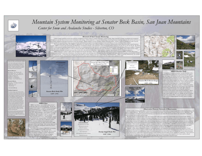
Mountain System Monitoring at Senator Beck Basin, San Juan Mountains Center for Snow and Avalanche Studies - Silverton, CO Mountain & Snow System Monitoring Climate change researchers around the world have recognized mountain systems as sensitive bellwethers of global change, where responses to change are perhaps more transparent and quicker to ‘present’ than in lower elevation urbanized or rural settings. As the complexities of regional climate change forecasting become increasingly apparent, the need for and value of place-based, 'designed' monitoring of mountain systems has emerged. Climate modelers, resource managers, industry and policymakers – all have a stake in evaluating how well, or poorly, climate predictions are performing. Long-term measurements and observations, based on an integrative protocol, may reveal what is, or is not, occurring in these systems? The Senator Beck Basin Study Area (SBBSA) is operated by the Center for Snow and Avalanche Studies as a catchment-scale mountain system observatory and a venue for process research. SBBSA is located in the western San Juan Mountains of Southwest Colorado, at the headwaters of the Uncompahgre River, centered at 37° 54’ 30” N x 107° 43’ 30” W. The 290 ha SBBSA exhibits physical and climatological attributes that reflect its continental position, high elevation, and comparatively southerly latitude within the Rocky Mountain cordillera. Elevations range from 13,510’ (4,118m), in tundra, to 11,000 (3,353m) in sub-alpine forest. The San Juan Mountains have been described as a “radiation snow climate”, where highly dynamic energy balance fluctuations dominate snowpack processes that, in turn, drive other processes in the Basin. Monsoonal rains contribute approximately 25-35% of annual precipitation. SBBSA land cover is typical of alpine basins throughout the San Juan Mountains. However, unlike adjoining basins, no active roads are present in SBBSA and early 20th Century mining activity resulted in only minor disturbances. Two micro-met stations with adjoining snow study plots have been developed in the basin, and a stream gauging station has been installed at the basin pour-point. A third micro-met station has been developed at a nearby summit to the east to obtain ‘free air’ wind measurements. SBBSA monitoring ‘infrastructure’ also includes a plant community baseline study performed in 2004 that documents current species distributions and conditions; the first repeat study is planned for 2009. Center for Snow and Avalanche Studies The Center for Snow and Avalanche Studies enhances the interdisciplinary investigation of the alpine snow system's behavior and role in human/environment relationships by offering resources – people, information, and facilities – for field-based research and education. SBSP Instrumentation: SBSG Instrumentation: Wind speed & direction Notched, broad-crested weir Staff gauge SW & LW radiation Stage transducer Air temperature & humidity SBSP Snow temperatures SASP Soil temperature & heat flux SBSG Board of Directors Don Bachman ~ Pres.; Bozeman, MT Boots Ferguson, Esq. ~ V.P., Aspen, CO Chris George ~ Sec./Treas.; Silverton, CO Art Mears ~ Gunnison, CO Keith Roush ~ Durango, CO Jeff Dozier ~ UC Santa Barbara Lee Dexter ~ Univ. Northern Arizona Snow depth Transect #11, above, looking west EC and water temp SBBSA Baseline Study Soil moisture Senator Beck Stream Gauge Executive Director Chris Landry ~ clandry@snowstudies.org PO Box 190 Silverton, CO 81433 (970) 387-5080 11,030’ - 3,362m Putney Study Plot www.snowstudies.org Funding & Supporters The Center for Snow and Avalanche Studies was founded in 2002 utilizing seed money from the American Avalanche Association, the Janss Family Foundation, contributions by Friends of the CSAS, Ballantine Family Charitable Fund, and in-kind donations of equipment and services. In 2003, US Forest Service Rural Development, Forestry and Communities Grant funds were requested and obtained on behalf of the CSAS by the Mountain Studies Institute, our sister organization in Silverton, Colorado. The National Science Foundation and several Colorado water conservation districts are supporting current research on the effects of desert dust on alpine snowpacks. “Friends of the CSAS” continue to provide significant operating funds. CSAS has also recently received grants from the Patagonia Environmental Program and the Mountain Hardwear Gives Back program in direct support of our SBBSA Mountain System Monitoring Program. Utah Arizona Colorado New Mexico 12,325’ - 3,757m Senator Beck Study Plot 12,200’ - 3,719m Red Mtn Pass Silverton A comprehensive plant community ‘baseline inventory’ of the Senator Beck Basin Study Area was performed for the CSAS in July and August 2004 by the Colorado Natural Heritage Program. Plant species distributions and soil surface characteristics were documented along three elevation bands – from 13,000’ in alpine tundra, to the current krumholz line, down to 11,050’ in subalpine forest – in twenty-three 100’ transects. Each of the 23 transects, shown as dots on the map above, consisted of ten 0.10 m2 Daubenmire frame micro-plots spaced at 10’ intervals, as seen in the photos above. The most diversity in species was found in the mid-elevation, krumholz line transect; the upper and lower transects exhibited statistically and ecologically significant differences in both species composition and abundance. Survey monuments were placed at each end-point of each transect to enable repeat studies on a five-year schedule, the first of which is planned for summer 2009. A complete species list is available online, and the complete Baseline Inventory report is available upon request. Wind speed & direction, air temp & RH SBBSA Data SBBSA ‘core’ datasets are available online as Excel workbooks, with associated metadata files. All sites are equipped with Campbell Scientific™ CR10-X dataloggers and measurements are executed on 5 second intervals. Dataloggers at the SASP and SBSP sites are supplemented with ‘slave’ CR10x dataloggers and Campbell Scientific™ multiplexers. Data are acquired from all sites via an RF network through a telephone-to-RF base station. Data are processed in 1-hour, 3-hour summary , and 24hour (calendar day) summary arrays. At SASP and SBSP an additional ‘solar noon’ array is collected to capture diffuse shortwave radiation measurements using a shadowed pyranometer (see right) and the Swiss ASRB program shadow-band design. Some ‘project data’ may be shown as temporarily embargoed; contact the CSAS to request those data. The CSAS is also hosting an AERONET sun tracking photometer (CIMEL™ ) at SASP, monitoring atmospheric particulates. Data from the “Red Mountain Pass” site #332 is available via NASA’s AERONET website. Red Mountain Pass is the second highest elevation AERONET site in the global network. PTSP Observation Protocol, Network of Observatories SASP Instrumentation: Precipitation & snow depth Wind speed & direction SW & LW radiation Air temperature & humidity Snow temperatures Soil temperature, heat flux, moisture Barometric pressure Swamp Angel Study Plot 11,050’ - 3,368m As both an index of climate, and a driver of processes, the mountain/snow system merits an integrated approach to understanding both its state and its complex behaviors. The snow/ice mantle is unusual among earth surface systems because it exists so near to or at its triple point. That inherent sensitivity to incremental environmental forcings is an important and observable trait closely linked to the vulnerability of mountain system resources and services to global change. Mountain systems are also described as the water towers of the world, and certainly this is demonstrably true of western North America. Uncertainties persist in current modeling of mountain climatology, vis-à-vis the effects of warming on cloud cover and precipitation quantity. To the extent that climate change in mountain/snow systems will impact human welfare, it could be beneficial to monitor the behavior of these systems using a sustained and integrative data collection design capturing crucial proxy indices, at multiple scales, and across elevation gradients. Significant steps toward sustained monitoring of mountain plant communities are underway, such as GLORIA, but don’t explicitly integrate the role of snow. Other networks are in place to monitor snowpack conditions, such as SNOTEL, or MODIS, but don’t yet integrate measurements of other mountain system conditions. Still other networks are being developed to investigate specific mountain processes, such as the Sierra Nevada Hydrologic Observatory, creating valuable new infrastructure and datasets. The SBBSA is yet another new observatory. Arguably, a widely adopted framework designed to holistically integrate and characterize the constitutive interactions and state of North American (or other) mountain systems would be broadly useful. Development of an integrative ‘mountain/snow system observation protocol’, collaboratively created by an interdisciplinary team of scientists and practitioners whose work spans the full spectrum of snow-driven mountain systems and resources, could result in improved mountain climate modeling and more timely resource management adaptations. Such a protocol could also form the foundation upon which the current North American mountain system observation network of sites could be refined, complementing existing infrastructure and observation platforms with strategic new facilities and technologies.


