Joint International Workshop of ISPRS WG VIII/1 and WG IV/1... Geospatial Data for Disaster and Risk Reduction
advertisement

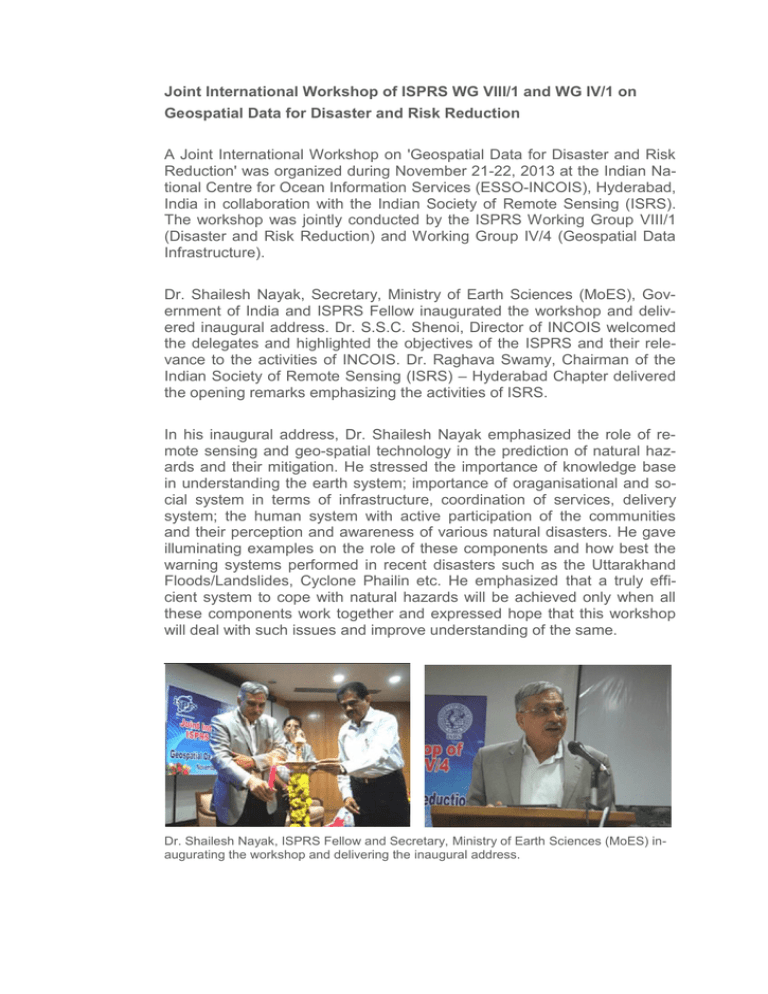
Joint International Workshop of ISPRS WG VIII/1 and WG IV/1 on Geospatial Data for Disaster and Risk Reduction A Joint International Workshop on 'Geospatial Data for Disaster and Risk Reduction' was organized during November 21-22, 2013 at the Indian National Centre for Ocean Information Services (ESSO-INCOIS), Hyderabad, India in collaboration with the Indian Society of Remote Sensing (ISRS). The workshop was jointly conducted by the ISPRS Working Group VIII/1 (Disaster and Risk Reduction) and Working Group IV/4 (Geospatial Data Infrastructure). Dr. Shailesh Nayak, Secretary, Ministry of Earth Sciences (MoES), Government of India and ISPRS Fellow inaugurated the workshop and delivered inaugural address. Dr. S.S.C. Shenoi, Director of INCOIS welcomed the delegates and highlighted the objectives of the ISPRS and their relevance to the activities of INCOIS. Dr. Raghava Swamy, Chairman of the Indian Society of Remote Sensing (ISRS) – Hyderabad Chapter delivered the opening remarks emphasizing the activities of ISRS. In his inaugural address, Dr. Shailesh Nayak emphasized the role of remote sensing and geo-spatial technology in the prediction of natural hazards and their mitigation. He stressed the importance of knowledge base in understanding the earth system; importance of oraganisational and social system in terms of infrastructure, coordination of services, delivery system; the human system with active participation of the communities and their perception and awareness of various natural disasters. He gave illuminating examples on the role of these components and how best the warning systems performed in recent disasters such as the Uttarakhand Floods/Landslides, Cyclone Phailin etc. He emphasized that a truly efficient system to cope with natural hazards will be achieved only when all these components work together and expressed hope that this workshop will deal with such issues and improve understanding of the same. Dr. Shailesh Nayak, ISPRS Fellow and Secretary, Ministry of Earth Sciences (MoES) inaugurating the workshop and delivering the inaugural address. Dr. V. K. Dadhwal, President, ISPRS TC VIII and President, ISRS addressing the delegates during the workshop. During the workshop inaugural ceremony, two important initiatives related to disaster risk reduction viz., Integrated Seismic & GNSS Network (ISGN) project and V-SAT aided emergency communication system were launched. The workshop was conducted by Dr. T. Srinivas Kumar, Chair, ISPRS WG VIII/1 and Mr. E. Pattabhi Rama Rao, Chair, ISPRS WG IV/4. Dr. Champathi Ray, Secretary, WG VIII/1 and Mr. Venkat Shesu Secretary, WG IV/4 conducted technical sessions successfully. Dr. N. Srinivasa Rao and Dr. Suprit Kumar from INCOIS were identified as rapporteurs of technical sessions. Dr. Srinivasa Kumar, Chair, ISPRS WGVIII/1 demonstrating the web-site of Integrated Seismic and GNSS Network (ISGN) during the inaugural Session Mr. E. Pattabhi Rama Rao, Chair, ISPRS WG IV/4 and Dr. Champathi Ray, Secretary WG VIII/1 interacting with delegates during the concluding session. The two day ISPRS Workshop was a highly successful blending of the focus areas of the two working groups of the event and provided delegates an in-depth look at the following themes: Geospatial Technology for Disaster Preparedness, Early Warning & Response Use of Geospatial data for Floods, Cyclones, Tsunamis, Earthquakes, Landslides, etc. Spatial Data Infrastructure for Disaster management Web-based and location-based Geospatial Services for Disaster management Recent Disasters - Research Findings The workshop was attended by about 150 participants from India and abroad representing research organizations, academia and industry. In all, 45 papers were presented during the workshop; 2 of them being lead talks, 27 of them in six Technical Sessions and the remaining 16 in two Short Interactive Sessions. Delegates attending the workshop The presentations and deliberations showed the importance of spatial data, particularly their reliance on enabling Web technologies, and real-time or near-real-time telecommunications, to make these data especially useful to society. A few examples of the many excellent technical presentations include high resolution satellite data for strom surges due to Cyclone Phailin, drought monitoring, flood hazard, and forest fire mapping in western parts of India. During the technical sessions several studies were presented on the use of LIDAR data in visualization and modelling of natural hazards. Authors presented very diverse information systems platforms which included mobile-based, web-based, radio-based and televisionbased systems. Emerging trends such as use of novel geo-computational techniques in spatial data infrastructure and web-based services with regard to the disaster management were also discussed. A special session 'Recent Disaster - Research findings' discussed about the new and emerging technologies and research findings from recent natural disasters such as Uttarakhand floods and landslides, Cyclone Phailin, and tsunami source identifications using modelling and geospatial techniques. Another session discussed on applications of geospatial technology and geospatial data infrastructure in very diverse areas, such as flood and river monitoring, prediction of harmful algal blooms, tsunami modelling using remote sensing and geo-spatial techniques. A unique aspect of this session was participation of industry. The workshop witnessed active participation of young students and their profound interest in pursuing their career in remote sensing and Geospatial technology and their applications for societal benefits. Further, the workshop discussed about the need to encourage outreach activities to tap more young talent in the field of remote sensing and geospatial technology. The workshop also discussed on the need for spreading proper awareness on natural hazards among the general public. Srinivasa Kumar Chair of ISPRS WG VIII/1 Indian National Centre for Ocean Information Services E. Pattabhi Rama Rao Chair of ISPRS WG IV/4 Indian National Centre for Ocean Information Services


