Fall 1996
L I
¯.
! .
. ’. p*..° ’
T E
¯
,*
i.
~
. °
New Mexico Bureau
.....
of "
Mines and Mineral
Resources
(NMBM&MR).,
EarthBriefs
A quarterlypdblication
for educators
andthe pul)li¢contemporary
geologicaltopics,issuesandeventi
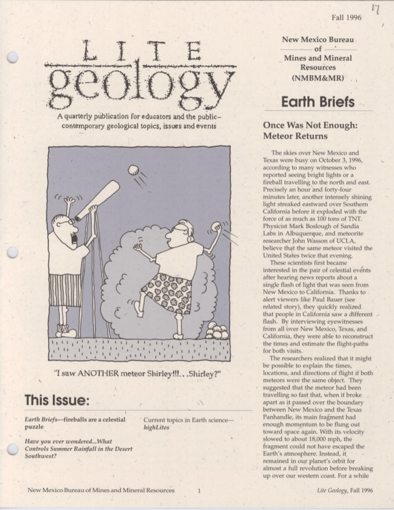
"I saw ANOTHER
meteorShirley!!L..Shide.y?"
k
This Issue: ’
Earth Briefsmfireballs are a celestial
puzzle
,,
Current topics in Earth science
highLites
Have you ever wondered... What
Controls SummerRainfall in the Desert
Southwest?
NewMexico Bureau of Mines and Mineral Resources
Once Was Not Enough!
Meteor Returns
The skies over NewMexico and
Texas were .busy on October 3, 1996,
according to many witnesses who
reported seeing bright lights or a
fireball travelling to the north and east.
Precisely an hour and forty-four
minutes later, another intensely shining
light streaked eastward over Southern
California before it exploded with the
force of as muchas 100 tons of TNT.
Physicist Mark Boslough of Sandia
Labs in Albuquerque, and meteorite
researcher John Wasson of UCLA,
believe that the same meteor visited the
United States twicethat evening.
Thesescientists first became
interested in the pair of celestial events
after hearing news reports about a
single flash of light that was seen from
NewMexico to California. Thanks to
alert viewers like Paul Bauer (see
related story), they quickly realized
that people in California saw a different .
flash. By interviewing eyewitnesses
from all bver New’Mexico, Texas, and
California, they were able to reconstruct
the times and estimate the flight-paths
for both visits.
The researchers realized that it might
be possible to explain the times,
locations, and directions of flight if both
meteors were the same object. They
suggested that the meteor had been
travelling so fast that, whenit broke
apart as it passed over the boundary
between NewMexico and the Texas
Panhandle, its main fra[~ment had
enough momentumto be flung out
toward space again. With its velocity
slowed to about 18,000 mph, the
fragment could not have escaped the
Earth’s atmosphere. Instead, it
remained in ouy planet’s’orbit for
almost a full revolution before breaking
up over our western coast. For a while
Lite Geology,Fall 1996
t
\
that October night, it seems we hhd a
second moon.
After reentering the atmosphere over
the Pacific Ocean, the meteor’s track
was visible and sonic booms were
heard as it streaked eastward over
California. Dozens of seismometers in
this earthquake-prone state recorded
the shock wave, and low frequency
sound (infrasound) wave~ were picked
up by an array of sensors that are
designed to makesure that nuclear test
ban treaties are not broken.
The fiery mass dropped some final
glowing embers as far east as Owens
Valley, CA.Scientists still have lots of
data to collect and study to confirm this
capture-and-reentry hypothesis. This
kind of event is of great interest to
scientists because it has never before
, been observed. They will make
d~tailed analyses of a video tape
recorded in El Paso, Texas, along with
the seismic and infrasound recordings,
and any photos, reports/,and meteorite
fragments that can be found.
This recent meteor appeared almost
fok~r years after a similar fireball
burned through the sky in Peekskill,
NYon October 9, 1992 (Lite Geology,
Summer1993). The New York meteor
was easy to verify. On its pathwayto
Earth, a large fragment punctured the
trunk of a 1980 Chevrolet Malibu that
was parked in the owner’s driveway.
The meteorite was found nearly intact
and still smoulderingunder the car.
Even if the capture idea is shownto
be correct, scientists mayhave a harder
time explaining other events that took
place that same night. Their research
has uncovered reports of manyother
bright meteors, fireballs and
atmospheric explosions that took place
all over the world within a few hours of
the ones in the skies of the western U.S.
One explanation is that Earth passed
through debris from an asteroid that
had recently broken UPfrom a collision.
Another suggestion is that an impact on
the moonmight have ejected some
rocks toward the Earth. Whatever
scientists ultimately conclude, there is
no doubt that something interesting.
happened on Oct. 3.
Sources
Fire ball seen’ over Southwest...:
Sandia Lab
News,Albuquerque,NewMexico, issue
for October25, 1996,vol. 48, no. 22, pp.
1-2.
Cosmicdebris makesdramatic entrance: Lite
Geology, NewMexicoBureau of Mines
and Mineral Resources, Summe¢
1993, pp.
1-2.
--story by S. Welch, NMBM&MR,
and M.
Boslough, Sandia National Laboratories
Haveyou ever wondered...
What Controls Summer
Rainfall in the Desert
Southwest?
David S. Gutzler
University of NewMexico
Cloudbursts, Droughts, and
Monsoons
The American Southwest is an
exceptionally arid environment in
which the availability of fresh water
profoundly affects the distribution and
activities of all life. At high elevations,
precipitation from winter storms creates
an annual snowpack, feeding rivers that
flow through the desert. Snowpackand
rivers form a natural storage and
transportation system for fresh water,
augmented by dams and canals built by
humans. Across much of the
Southwest, ’ however, ecosystems and
people depend on summerrainfall for
Fall 1996,Life Geology
Figure l--Percentage of the total annual precipitation falling in the.three
months o( July, August and September." Dots represent the stations used in
the analysis (modified from Douglas and ol~hers, 1993).
2
NewMexico Bureau of Mines and Mineral Resources
j0j
5000I
muchof their supply of fresh water. As
shownin Figure 1, most of Arizona and
NewMexico receive more than 40%of
the total annual precipitation in the three months of July, August, and ’
September. Climate researchers are
working to understand the large-scale
processes that promote precipitation
(or, as wasthe case in the first half of
1996, inhibit precipitation) in the desert
Southwest, with an emphasis on
summerrainfall. The ultimate goal of
this research is to predict climate
variations on seasonal to interannual"
time scales.
To understand why precipitation
varies from year to year, we first need
to consider the physical processes by
which clouds and rain are formed. Air
masses near the surface of the earth
always contain at least a small quantity
of water vapor, which evaporates from
oceans, lakes, plants, and moist soils
and is carried along by the wind.
Clouds form when water vapor in the
air condenses from a gas phase into
liquid droplets or solid particles of ice.
Precipitation (rain, snow, or hail) occurs
when these droplets or crystals grow so
large and weighty that they fall out of
the cloud.
What causes atmospheric water
vapor to condense?
The processes by which water
changes phase in the atmosphere are
extremely complicated and imperfectly
understood, but some key physical
principles are well-known. One such
, law of physics states that the saturation
vapor pressure Qf water is a strongly
increasing function of temperature.
This is a more precise wayof stating
the familiar (but physically imprecise)
phrase "warmair can hold more
moisture than cold air." Thus clouds
tend to form where a warm, moistureladen airmass is cooled below the
temperature at which the water vapor
k,., ( in the air reaches its saturation vapor
press’ure (then the relative humidity is,
° by definition, 100%).
At ground level, for example, moist
4000-
leadsto morecondensation,until
lifting
stopsor all the parcel’s vaporcondenses
/~ further
3000parcel’s relative humidity
reaches100%;vapor begins
condense,forming the
baseof a cloud
2000S
E
I000
,l,,a
°~
m
<
parcelis lifted from
the surface,whereits
is 30’C
p
parcel expandsand
as it rises; its saturation
vapor pressuredecreases
Q,)
Surface
I
0
-|1
Temperature (*C)
I
!0
t
20
30
I
40
=
Figure 2--Schematic depiction of cloud formation caused by lifting. A
parcel of rising air expands and cools, decreasing its saturation vapor
pressure. Whenits saturation vapor pressure decreases to its actual
water vapor pressure, (i.e. its relative humidlty is 100%),the water vapor
begins to condense, forming a cloud (modified from Moran and Morgan,
1994).
air can be cooled to the temperature at
which its water vapor starts to condense What causes air to rise?
(such as when moist air blows over
Lifting can be forced by several
snow- or ice-covered area) to fctrm
different causes. Orographiclifting ~
ground-hugging clouds that we call fog.
results whenair is forced up over a
Aloft, moist air can be cooled by lifting
mountam. range by the wind; thus the
the air, because, as depicted in Figure 2,
upwir~d side of a mountain range
rising air expands and cools in response receives haore rain than the downwind
to the decrease in air pressure with
side. Frontal lifting occurs along cold
increasing altitude.
fronts and warmfronts associated with
In general, then, the ONO
large cyclonic storm systems, when
requirements for forming clouds in the
airmasses w!th different temperatures
air abovethe surface are (1) rising air,
collide and the warmerair is forced up
and (2) sufficient water vapor in the air.
over the colder, denser air. This type of
To understand how summerrainfall is
lifting is mostprevalent in the winl:er,
modulated in the desert Southwest, we
when such storm systems are most
need to ask what would cause moist air.
active.
to rise, and identify the source of
In a previous edition of Lite Geology
moisture in the air, By considering
’(Winter 1995, pp. 4-9), Dr. Charles
these factors we maylearn someclues
Chapin explained that slowly-varying
that could lead to predicting the
tropical Pacific Oceansurface
climatic conditions that modulate
c!ouds and rain.
NewMexico Bureau of Mines and Mineral Resources
3
Lite Geology,Fall 1996
/
Low
o,s
15--
10--
rising
sinking
on.shore
High
I
20°S
oE.°
I
Equator
..~,
I
30°N
Latitude
Figure 3---Schematic latitude-height cross-section of a summermonsoon
circulation, modeled after the Southeast Asian summermonsoon. The land
surface (to the north) has heated up relative to the ocean (to the south).
warmair above the land rises and the cool air above the ocean sinks.
Rising motion over the continent is amplified by the heat released as
water vapor condenses in the clouds. Rising motion generates low (L) air
pressure near the ground and high (H) air pressure aloft; sinking motion
generates the opposite pressure conditions. Horizontal winds blow from
high pressure to low pressure, generating low-level onshore flow and
upper-level offshore flow, completing the circulation. (modified from
Webster, 1987).
the right environmental conditions,
temperatures (warm "El Nifio" and
cold "La Nifia" or/’El Viejo") affect the
which occur principally on hot summer
days, if a moist blob of air
winter and spring storm tracks over
(meteorologists refer to such
North America, changing the course of
hypothetical blobs as "air parcels") is
cyclonic storms and thereby providing
heated near the surface a~d rises
a potential means for long-range
enough to initiate condensation, the
prediction of cold-season precipitation.
additional heat added to the parcel by
The light snowpackand general deficit
condensation can be sufficient to make
of precipitation across the Southwest
the parcel warmer than the surrounding
during the winter and spring of 1995/
air. If this happens, then the parcel will
96 were consistent with the La Nifia
continue to rise (often rapidly and
conditions that prevailed then.
In the summer,the lifting necessary
explosively), creating a summer
to produce raindrops is mostly
¯ convective thunderstorm. Very large
droplets or (at altitudes higher than the
accomplished by yet another
freezinglevel) ice crystals can form in
mechanismfor lifting, called convective
forcing. This occurs because the process the intense updrafts of these storms,
yielding copious precipitation for a
of condensing water vapor releases
short time until the storm plays itself
heat to the surrounding air. The same
out.
process operates in reverse in a
Individual thunderstorms are by
familiar situation: you need to add
nature spotty and fairly randomrelative
heat to a pot of liquid water in order to
evaporate the water via boiling. Under to the rain produced by orographic or
Fall 1996, Lite Geology
4
frontal lifting. Givensufficient
moisture, thunderstorms can form from
cloud-scale hot spots on the ground,
which are very difficult to predict much
in advance. Over .the course of an
entire summer,however, large-scale
conditions that favor or inhibit
thunderstorm formation might persist,
or at least be potentially predictable.
Thus, we have no realistic hopes of
long-term prediction of individual
thunderstorms, but we may be able to
predict monthly or seasonal averages of
thunderstorm activity.
What is the source of summer
moisture?
Let us nowconsider the other
requirement for cloud and precipitation
formation: sufficient water vapor in the
air. If the moisture ’source for summer
thunderstorms is tied to an organized,
large-scale circulation system, then by
understanding the mechanisms
controlling the circulation we might
have some hope of characterizing and
predicting summerrainfall variability.
In the southwestern United States we
are located on the fringe of such a
circulation system: the Mexican
monsoon.
@
Whatis a monsoon?
A mons~onis a seasonal, large-scale
circulation system forced by differential
heating of continents and oceans,
illustrated schematically in Figure 3.
The ocean has a large thermal inertia
relative to land, which simply means
that the same amount of energy input
(in this case, fromsunlight) will raise
the temperature of a land surface more
than the ocean surface. Therefore, the
seasonal temperature variability of a
continent is larger than the ocean. In
the summer, the land heats up more
than the ocean, the warmcontinental air
tends to rise (forming clouds and
precipitation) while the cooler oceanic
air tends to sink, and onshore winds
develop near the’surface while offshore
winds develop aloft to complete the
NewMexico Bureau of Mines and Mineral Resources
t;
L
circulation. In the winter, the continentocean temperature difference reverses
and so does the associated circulation.
In someparts of the world, this fairly
straightforward seasonal reversal of the
large-scale circulation is strong enough’
to dominatethe local climate.
Monsoonalclimates generally occur
along continental margins in the tropics
and subtropics where winter frontaltype storms are not very prevalent and
ocean currents do not force a strong
separate seasonal cycle in ocean
temperatures. Another important factor
is the existence of a high plateau or
mountain range not too far from the
edge of the continent’, because a highelevation land mass serves as a very
efficient summertimeheat source for
the otherwise-cool air aloft, thereby
driving a strong monsoon. The
strongest and most famous such system
is the Southeast Asian summer
monsoon,the principal source of fresh
water for more than a billion people on
and around the lndian subcontinent.
Is there a true monsoon in the
Southwest?
As suggested by the fraction of
annual precipitation received in the
summermonths (Fig. 1), we certainly
see the characteristic monsoonal
summertime precipitation
maximum
here in the southwestern United States.
The existence of a clear seasonal wind
reversal is not so obvious, but recent
evidence shows that a true monsoon
system is anchored off northwestern
Mexico, where winds abruptly turn
northward up the Gulf of California in
July, forcing tremendous convective
activity along the western slopes of the
Sierra MadreOccidefftal. The
northward extent of this circulation
system is stili poorly resolved, but the
balance of evidence suggests that
rainfall during July and August
associated with this monsoon
circulation extends up at least as far as
the southern portions of Arizona and
NewMexico, and conceivably farther.
#
SpringSnowCoverandJuly him Precipitation
90A
E 80
E
to
,R
"~,
" ’
oo
u
~ I
I
-I/
,m
~
I%
15
,,~ /,,,
/
,° ’,,
t\
’,I ,
" ’ /
/I
I t
o
10 x
’
7,0==
’
F-015,,.
o0
vV
,01i
.m
t.
--O--
I
i
72
>
t o.o
’’
~50
I
40
°
o.s
=
’, ,,Ni
I i
75
i
I i
78
,
I
i _ i
81
I ’
84
HMPrecipitation
Snow Cover
i
I
i
87
i
I
-2.0
i i
90
2
" 93
Year
L
Figure 4--Year-to-year fluctuations of a dimensionlessindex of springtime
snowextent in the AmericanRockies(dashedline), and July rainfall in New
Mexico(solid line); units are in mm.
NewMexico Bureau of Mines and Mineral Resources
5
Predictability of monsoons
To the extent that our summer
rainfall is’associated with a large-scale
monsoon system instead of randomlyforced individual thunderstorms, we
stand a better chance of characterizing
(and perhaps predicting) year-to-year,
large-scale fluctuations of rainfall. An
intriguing result of research aimed at
forecasting the Southeast Asian summer
monsoonis that the springtime
snowpackacross the Tibetan Plateau
seems to modulate the amplitude of the
following summer monsoon rains, such
that heavy snowpackleads to a weak
monsoon, and light snowpack leads to a
strong monsoon.The reason for this is
intuitively clear: excessive spring snow
means cold continental temperatures
that tend to linger even after the snow
melts (because the land surface is still
moist and cool from above-normal
runoff), thus inhibiting the summertime
land surface heating that drives the
monsoon.
Jessica Preston, an undergraduate
student at the University of New
Mexico, and I have examinedthe
possibility that interannual fluctuations
in spring snowcover across the
American Rockies might modulate
summerrains in NewMexico, in
analogy with the Tibetan snowSoutheastAsian monsoon
relationship
described above. Weadopted an index
of spring snowextent across the
AmericanRockies derived by a
Canadianscier~tist, Mr. RossBrbwn,
basedon several decadesof satellite
observations. Wecomparedthe year-toyear fluctuations in the spring snow
index with a time series of July monthly
precipitation averagedover twenty-one,
stations distributed across NewMexico.
Thecomparisonindicates that there
has indeed beena tendencyfor abovenormal springtime snowextent to be
followed by below-normalrainfall in
July in NewMexicoover the past two
decades, and below-normalsnowextent
to be followed by above-normal
rainfall
(Fig. 4). As you can see, the snowindex
Life Geology,Fall 1996
is by no meansa perfect predictor of
July rainfall in NewMexico,but the
results satisfy a formalstatistical
significance test, and they are ~
suggestive enough to encourage us to
explore the relationship in more detail
using longer and more’ expansive data
sets.
To be sure, evett if the snowcoversummerrainfall relationship turns out
to be real, it is onlypart Of the larger
climatic picture. Long-term droughts
have occurred in the Southwest from
time to time, and the reasons for such
multi-year climate anomalies are very
poorly understood. The tendency for
20th-Century drought episodes to occur
about every other decade suggests that
variations of solar luminosity could be
an important forcing factor (solar
variations have a 22-year periodicity),
but a physical mechanismthat explains
howthese" rather modestsolar
fluctuations could result in large
climate anomalies has not been
demonstrated. Weare really just
beginning to .understand the climate
system well enough to consider the’
possibility of seasonal and interannual
forecasting. Formulating such forecasts
is a tremendously challenging and
fascinating ~problem.
Glossary
condensation--The process by which
water changes phase .from vapor (gas)
into liquid. Condensationreleases heat.
evaporation--The process by which
water changes phase from liquid into
gas (the opposite process from
condensation ). Evaporation consumes
heat.,
precipitation--In meteorological usage,
liquid water droplets or solid ice
crystals that are weighty enoughto fall
out of a cloud/toward the ground. Not
all jprecipitation reaches the ground;
some evaporates on the way down.
vapor pressure--The pressure onto
a surface (which can be an imaginary
surface in mid-air) exerted by a single
gaseous species, e.g. water vapor. If the
atmospheric w~ater vapor pressure onto
a liquid water surface is high enough,
then the number of water molecules
~
condensing onto the liquid surface
equals the number of water molecules
evaporating off the surface, !At this
pressure we say that the ai~ is
saturated, and the pressure at which
this takes place is called the saturation
vapor pressure.
relative humidity--A measure of water
vapor in the air, expressed as the ratio:
actual water vapor pressure
x 100%
saturation vapor pressure
The saturation vapor pressure (~he
denominator) increases rapidly as the
temperature increases, so a relative
humidity of 80%on a hot day indicates
muchmore water vapor in the air than
the same relative humidity on a cold
day. Athletes at the Atlanta Olympics
felt the effects of this!
References
pouglas, M.,.Maddox,R., Howard,K., and
Reyes, S., 1993, TheMexicanmonsoon:
AmericanMeteprologicalSociety, Journal
of climate,v. 6, pp. 1665--1677.
Moran,J., and Morgan,M., 1994,
Meteorology--Theatmosphere and the
science of Weather,Macmillan,4th ed.,
517pp.
Webster, E, 1987, The Elementarymonsoon;
in Fein, J., andStephens,E, (eds.),
Monsoons:
Wiley-lnterscience, ~p 3-32.
, j
Fall 1996, Lite Geology
6
NewMexico Bureau of Mines and Mineral Resources
(- Celestial object reports
Because of the spontaneous nature of’manycelestial events, scientists sometimes
rely on eyewitness reports from casual onlookers. NewMexico Bureau of Mines
and Mineral Resources geologist Paul Bauer was one of the first persons to report
the fireball to MarkBoslough, the scientist featured in the,story onpage one. Here
is Paul’s account of what he saw’onOctober 3, 1996.
"MarkBosloughandI are friends, andknowinghis interest in the celestial, I cpntacted
himby e-mailthe dayafter I sawthe firebaU..’..
(.
Thenight of the fireball wasclear andcloudless.That eveningI wasseated in a Chairat
homelthatfaced an eastern window.As the fireball cameinto view, myattention was
immediatelydrawn,as it wasvery bright (muchbrighter than Venusat it’s brightest) and
trailed brilliant greensparklers(like the 4th of July type). It appeared
to moveslowerthan
any shootingstar that I hadever seen. ,
Myfirst impressionwas that the bright dbject wasa plane or somethingthat wasburning
up and crashing. I jumpedup anddashedout the door andonto the deck, expecting to hear
an explosionas it crashedacrossthe river. But, it haddisappearedfromviewbehind~he
cottonwoodbosque without makinga sound.
Marklater askedmeto recreatethe trajectory of the fireball. Myreport wasimportant
becauseI hadviewedthe object througha fixed frameof reference(the window
frame).I sat
the samechair andused the windowframeto markthe spots wherethe object had appeared
and disappeared,andthen measuredmy distance from the window,and the angles from the
horizontal,(using myhandybruntoncompass).Then! t~ok art orienta’tion (azimuth)on
directhmthat the windowfaces. Markthen calculated the approximateposition andpath of
the fireball.
Marklater devisedandtested a moreprecisemethodof calibratingmeteortracl~s that does
not involve compassesor transits. He has askedmeto makea time exposure,night sky
photograph
fromthe precise observationspot, andrecord the exact time of the photograph.
WhenI get the print, I amto drawthe trajectory withxerrorbars. Usingthe stars, alongwith
the time andlocation, both of whichI can get extremelyaccuratelywith a global positioning
system (GPS)unit, Markwill then use a computerto determinea trajectory.
According to MarkBoslough, good
reports on meteor sightings are
difficult to find. Here are a couple of
examples: ,
"After UCLA
put out a $5,000
reward for the first meteorite recovered
from this event, they received do~zens
of rocks in the mail. So far they are
calling themall meteor-wrongs."
"The NewMexico fireball passed
almost directly over Roswell. Whenl
was first trying to get namesof
eyewitnesses in that area I called the
local TVstation and sheriff’s
department with no luck. It occurred to
me that some people might report
what they saw to one of the two local
UFOmuseums, so I called them to find
out. They both told me the same thing:
Theygot a lot of calls, but it’was "just a
meteor" so they didn’t write down any
ir~formation."
Dr. Nelson realized
NewMexico Bureau of Mines and Mineral Resources
’ 7
this
was no ordinary meteor
Lite Geology,Fall 1996
Tremor Troop and Seismic Sleuths workshopseries
concluded for 1996-1997
,,
Two’lh’mor ’lh~o F and lwo Seismic
5h’,lh~ workshops were conducted by
Mall trtm~ NewMexico I:~urt’au of Mines
and Mineral I,~,esources (NMBM&MR),
New Mexico Tech (NMT), and I,os
AlamosNational I,ab (I,ANI,). The
workshop series wa~ sponsored by the
NewI(arthquake I’rogram of the New
Mexico l)epartment of l’ublic Safety
(NMI)I’S), with funding from Federal
I’:mergency M,magenwnt Agency
(FEMA).
Ninety-three k’achers from across the
Mate’ attended the three-day courses,
which were held in four different
hwation~: %ocorro (hosted by
NMISM&MR),],os Alarnos (hosted
I,ANI.), Albuquerque (hosted by New
Mexico Museumof Natural I listory),
and I,as Cruces (hosted by I.as Cruces
I’ublic Schools). Teachers gained
hands-on experience with the
earthquake curricula and learned about
the geology of NewMexico on field
trips.
I)r..lamie (;ardner (A. R. (.;. (. ;., (, ;eologist at I,ANI,) fields teachers’ questions
the lispafiola Basin of the Rio (,;rande rift and the hwal fault activity.
The primary instructors for the
workshopseries we’re’ I)ave I,ow.,, Nelia
I)unbar, Bill (.’havez, Jarnie (;ardner,
and I,eigh Ihmse. Several classroom
leachers who had expe’rierwe with the
curricula were’ invited to serve a~
facilitators at the workshops.’lL, acherfacilitators included Sue Ann
Barancl’fick, SueAbbott, (;ary I,ewis,
[,arry Rucker, l)iana I,awton, I)on
Yotulg, and I-rnest Cumrnir~gs. (,)thers
who ]wiped as either coordinators or
facilitators were’ I)ebra I’ritchard and
BobP, edde,n(NMI)IL~), Mike’ I’rice
(Santa I,:e l’acific (;old Corp.), Susan
Welch and I,ynn I teizler
(NMBM&MR),
and Alexis l,avine ([ ,ANI ,).
I)r. Bill Chaw.,z(Associate I’rofessor, Ne’w Mexico’lech) and I)ave I,ove (Senior
linvironmental (;eologist,
NMI~M&MR)
discuss the fault offset along the Rio
(;rande fault south of Albuquerque.
NewMexico Btireau of Mines and Mineral I,le,,~ources
l)r. Nelia Dunbar (NMBM&MR
(;eochemist)
explains
at the Isleta Volcano south west of Albuquerque.
the hydrovolcanic
sequence
Tremor Troop participants listen to l)r. Jamie Gardner at Guaje Mountain fault, the
site where LANI, scientists excavated the first paleoseismic trench in the Jemez
Mountains region. The trench revealed evidence for a Holocene (between 4,000 and
6,000 years ago) magnitude 7 earthquake.
/
New Mexico Bureauof Mines and Mineral Resot,
rces
9
Lite Geoh~,,y, Fall 1996
oopsi
to represent the topographic relief of an
In thesummer1996 issue of Lite
assigned portion of the state. These
Geology, we inadvertently reversed
tiles will then be used to makemolds,
some terms and symbols in the map
then concrete casts that will be placed
legend on page 4. Here is the correct
together with hundreds of similar
designation for the terms basin and
sections to form the final map
uplift. The contour line containing
hachure marks pointing inward from the
sculpture. To becomea partner in this
project, contact "lish Morris at (505) 841- line indicat(~s a basin, or depression.
contour line with hachures pointing
2822; or tish@darwin.nmmnhabq.mus.nm.us.
outside from the line indicates an uplift.
Remember,basins are "innies" and
uplifts are "outies." We’resorry for the
confusion! cd.
upll,ft
basin
Life ¢peology evolves:
Life Geolbgybegan as a small Earth-science publication designed and scaled for
NewMexico. Our subscription list now includes a large numberpf out-of-state ’
readers. In order to keep up with the demandfor this,publication from Outside of
NewMexico, we charge $4.00 per year for out-of-state readers, which covers the
cost of printing and mailing. The subscription year begins with the Fall issue, and
ends with the Summerissue to correspond with the academic year. If you reside
outside of NewMexicoand wish to keep your subscription active, please return
this form with a check fo~ $4.00. If you have questions, please call’Theresa Lopez
at (505) 835-5420.
k.
NewMexico Bureau of Mines and Mineral Resources
11
Life Geology,Fail 1996
Lite Geology is published quarterly by New
Mexico Bureau of Mines and Mineral Resources
(Dr. Charles E. Chapin, Director and State
Geologist), a division of NewMexicoTl.~.-h (Dr.
Daniel H. Lopez, President).
have you missed us?
You may have noticed that our production
of Lite Geology has slowed over the past
months. Funding cutbacks
have forced us to stop printing
(temporarily).
Because
we remain committed to the idea that Lite Geology should be free to New Mexico
readers,
especially
teachers,
we are looking for new funding sources to support
this project.
Please be patient;
we’re working hard to resolve the problem. If you
have some creative
funding ideas, or would like to become a financial
sponsor,
please contact Life Geology at (505) 835-5112 or 835-5420. Thanks! ----ed
Board of Regents
Ex Officio
Gary Johnson, Gow,rnor of New Mexia~
Alan Morgan,Superintendent of Public Instruction
Appointed
Ann MurphyDaily, President, 1997-1999,
Santa Fe
Sidney M. Gutierrez, Secretary~Treasurer 199720(]1, Albuquerque
William Gruner, Student Member,1997-1999,
Socorro
Randall E. Horn, 1997-2003,Placitas
Charles Zimmerly, 1997-1998,Socorro
~..i
Purpose:to build Earth Scienceawarenessby
presenting educatorsand the public with’
contemporarygeologic topics, issues, and events.
UseLite Geologyas a sourcefor ideas in the
classr¢~)mor for public education. Reproduction
is encouraged
with proper recognition of the
source. All rights reserved on copyrighted © material
reprinted with permisshmwithin this issue.
Lite Geology Staff Information
Editor: Susan J. Welch;
susie@mailhost.nmt.edu
GadogicalEditors: Dr. DaveLove, Dr. Charles
Chapin, Gretchen Hoffman, Dr. Nelia
Dunbar
Graphic Designer: Jan Thomas
Cartoonist: Jan Thomaswith inspiration
from Dr. Peter Mozley
Editorial Assistant: TobyClick
Creatiw, and Technical Support: NMBM&MR
Staff
Mailing Address
NewMexico Bureau of Mines and Mineral
Resources, Socorro, NM87801. Phone (505) 8355420. For subscription information, please call or
write. Life Geologyis printed on recycled paper.
Visit our Website at the URLaddress:
http’.//geoin fo.nmt.edu/
L I. T F.
U.S. POSTAGE
PAID
New Mexico Bureau of Mines
and Mineral Resources
New Mexico Tech
$OCORRO,NEW MEXICO
PERMITNO9
/
801’ Leroy
Socorro,
NM 87801
address correction requested
Fall 1996, Life Geology
12
New Mexico
Bureau
of Mines and Mineral
Resources
/
~j

