Aquifer Mapping in New Mexico A Status Report for Interim Committee on
advertisement

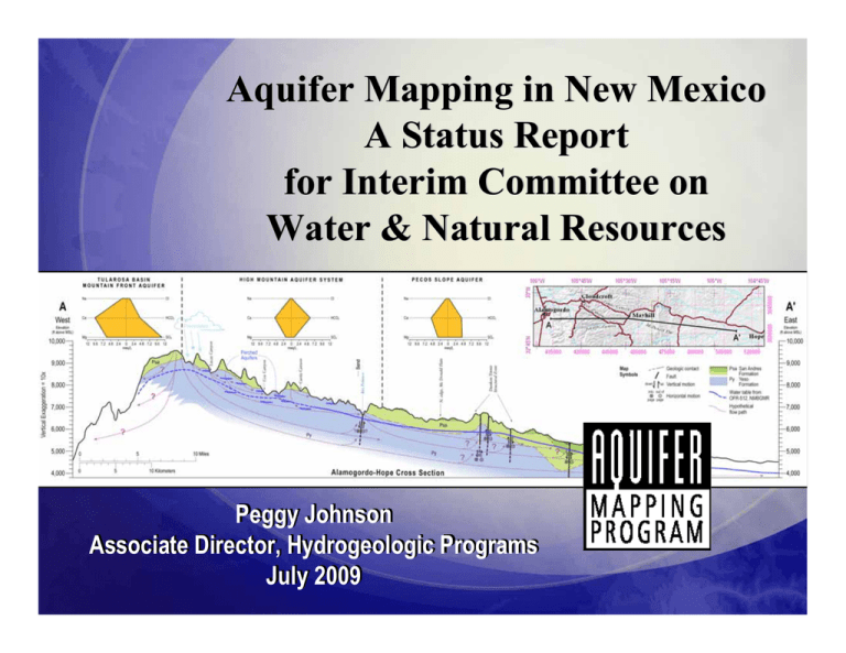
Aquifer Mapping in New Mexico A Status Report for Interim Committee on Water & Natural Resources Peggy Johnson Associate Director, Hydrogeologic Programs July 2009 Multi-Disciplinary Science WHAT IS IS AQUIFER AQUIFER MAPPING? MAPPING? –– AA scientific scientific process process WHAT wherein aa combination combination of of geologic, geologic, geophysical, geophysical, wherein hydrologic, and and chemical chemical field field and and laboratory laboratory analyses analyses hydrologic, are applied applied to to characterize characterize the the quantity, quantity, quality, quality, and and are distribution of of ground ground water water in in aquifers. aquifers. distribution • Geologic Mapping (STATEMAP) • Geophysical Surveys (NMBG&MR, USGS) • Drill Holes (NMBG&MR Subsurface Data Center) • 3-D Geologic Model • Hydrologic Data • Geochemical Data • Ground-Water Flow Models – conceptual, computer NEW MEXICO BUREAU OF GEOLOGY AND MINERAL RESOURCES Partners and Users Academic Institutions: NMT, UNM, NMSU, Highlands State Agencies: NMOSE/NMISC, NMEMNRD, NMED Federal Agencies & National Laboratories: US Geological Survey, Los Alamos NL, Sandia NL, US Bureau of Indian Affairs, US Fish & Wildlife Service, US Bureau of Land Management, US Forest Service, NASA Counties, Municipalities, Irrigation Districts, Water Utilities: Sandoval, Taos, Otero, Lincoln, Bernalillo, Albuquerque, Santa Fe, Town of Taos, PVACD Tribes: Taos, Picuris, Santo Domingo, Tesuque, Sandia, Isleta, Santa Ana, etc. Soil & Water Conservation Districts: Otero, Taos, Ciudad NEW MEXICO BUREAU OF GEOLOGY AND MINERAL RESOURCES Active and Completed Projects Each area area is is unique unique in in its its Each hydrogeologic setting setting and and the the hydrogeologic driving water water policy policy issues issues driving Albuquerque Basin – NMOSE, USGS, NMBGMR Placitas – Legislative funding to Sandoval County, NMBGMR Roswell Artesian Basin – PVACD, NMBGMR Santa Fe Area – NMOSE, NMBGMR, Santa Fe County Sacramento Mountains – Legislative funding to NMDA/NMSU, Otero SWCD Taos County – NMOSE/NMISC, NMBGMR, Taos County, Healy Foundation NEW MEXICO BUREAU OF GEOLOGY AND MINERAL RESOURCES The Santa Fe Area THE ISSUES: NMOSE administrative needs and the City/County water utilities’ search for sustainable, potable water sources. THE GOAL: Update hydrogeologic information on the basin aquifer and support development of tools for water rights administration and long-term sustainable development of aquifers. NEW MEXICO BUREAU OF GEOLOGY AND MINERAL RESOURCES The Santa Fe Area THE PRODUCTS: • Geologic framework – maps, cross sections and 3-D model of aquifers • Developed long-term regional water-level monitoring networks for NMOSE and City • Analyzed water quality and the chemical character of aquifers • Parameters for City/County ground-water model: aquifer layers, aquifer properties, and updated water levels for model calibration THE FUNDING: • NMBGMR AQUIFERMAP Program • NMBGMR STATEMAP Program – $300K Federal funding since 2000 • NMOSE Hydrology Bureau – $175K • Santa Fe County – $10K NEW MEXICO BUREAU OF GEOLOGY AND MINERAL RESOURCES Santa Fe Area Reports Influence of Basement Structure on Shallow Aquifer Geochemistry in the Santa Fe Embayment of the Española Basin, Northern Rio Grande Rift Peggy S. Johnson and Daniel J. Koning, NMBGMR; V.J.S. Grauch and A. Manning, USGS Geophysical Interpretations of the Southern Española Basin, New Mexico, That Contribute to Understanding Its Hydrogeologic Framework V.J.S. Grauch, J.D. Phillips, V. Bankey, USGS; D.J. Koning and P.S. Johnson, NMBGMR Geochemical Characterization of Ground Water In the Southern Española Basin, Santa Fe County, New Mexico Peggy S. Johnson, Daniel J. Koning, Stacy W. Timmons, and Brigitte Felix, NMBGMR Report of Findings from 2003 and 2004 Hydrogeologic Studies, Española Basin, New Mexico, Technical Completion Report for NMOSE Peggy S. Johnson, Daniel J. Koning, and Adam S. Read NEW MEXICO BUREAU OF GEOLOGY AND MINERAL RESOURCES Southern Sacramento Mountains THE ISSUES: What are the effects of tree thinning and climate variability on the local hydrologic balance; the hydrogeology of the mountain block and its connection with adjacent aquifers (Pecos Slope and Salt Basin). THE GOAL: Support scientifically sound decisions regarding vegetation and watershed management, and ground water development in mountain and adjacent aquifers. NEW MEXICO BUREAU OF GEOLOGY AND MINERAL RESOURCES Southern Sacramento Mountains THE PRODUCTS: • Geologic framework – maps, cross sections and 3-D model of aquifers • Developed long-term regional water-level monitoring network • Analyzed water quality and the chemical character of aquifers • Conceptual model of ground-water flow, recharge to adjacent aquifers • Watershed study – effects of tree thinning on local water balance THE FUNDING: • NM Legislature (NMDA/NMSU and Otero SWCD) – $2.362M • NMBGMR STATEMAP Program – $297K Federal funding since 2004 • NMISC – $150K to watershed study NEW MEXICO BUREAU OF GEOLOGY AND MINERAL RESOURCES Sacramento Mountains Reports 2009, Sacramento Mountains hydrogeology study, Update of Open-File Report 512 2009, Sacramento Mountains hydrogeology study, T. Newton, G. Rawling, S. Timmons, F. Partey, and B. Felix, NMGMR June 2009 Progress Report 2008, Sacramento Mountains hydrogeology study, G. Rawling, S. Timmons, T. Newton, P. Walsh, L. Land, T. Kludt, M. Timmons, P. Johnson, and B. Felix, NMBGMR Open-File Report 512 2007, Water level responses and preliminary spring chemistry results: Progress report on the hydrogeologic study in the southern Sacramento Mountains, S. Timmons, G. Rawling, P. Johnson, L Land, and J. Morse (abs.), New Mexico Geological Society, 2007 Spring Conference, New Mexico Geology Journal NEW MEXICO BUREAU OF GEOLOGY AND MINERAL RESOURCES Taos County THE ISSUES: • • • NMISC administration of Rio Grande compact Taos County land use planning and rural development relying on shallow aquifers Taos SWCD programs to protect watersheds and recharge areas. THE GOAL: Support scientifically sound policy decisions regarding regional ground water development, Rio Grande compact administration, and protection of recharge areas and watersheds. NEW MEXICO BUREAU OF GEOLOGY AND MINERAL RESOURCES Taos County THE PRODUCTS: • • • • Geologic framework – maps, cross sections and 3-D model of aquifers Regional and local water-level maps Age dating of Rio Grande springs and regional ground water Conceptual model of ground-water flow, stream/aquifer interconnection, and recharge/discharge THE FUNDING: • • • • • • NMBGMR AQUIFERMAP Program NMBGMR STATEMAP Program – $260K Federal funding since 1995 NMISC – $55K Taos County – $75K Healy Foundation – $75K US BOR - $61K NEW MEXICO BUREAU OF GEOLOGY AND MINERAL RESOURCES Taos County Reports 2009, Hydrogeologic Investigation of the Arroyo Hondo Area, Taos County, New Mexico, Final Technical Report Prepared for Taos County, P. Johnson, P.W. Bauer, and B. Felix, NMBGMR Open-File Report 505 2007, Springs of the Rio Grande Gorge, Taos County, New Mexico: Inventory, data report, and preliminary geochemistry, P.W. Bauer, P.S. Johnson, and S. Timmons, NMBGMR Open-File Report 506 2005, Geology and Hydrogeology of the Arroyo Seco Area, Taos County, New Mexico, G. Rawling, NMBGMR Open-File Report 492, CD-Rom NEW MEXICO BUREAU OF GEOLOGY AND MINERAL RESOURCES Benefits and Products of AQUIFERMAP Program • Baseline geologic and hydrologic information • Long-term water-level monitoring networks • Databases of existing hydrogeologic information • Interpretive reports and maps publicly available • Scientifically defensible decision making NEW MEXICO BUREAU OF GEOLOGY AND MINERAL RESOURCES Possible Future Projects • Continue local- to regional-scale hydrogeologic assessments to meet State, County, Municipal, and Rural water needs – Alamosa Creek and Plains of San Agustin (NMISC, NMED, NMEMNRD) – Miranda Canyon, southern Taos County (Taos County) – White Sands National Monument, Tularosa Basin (National Park Service) • Deep aquifer characterization – NMBGMR’s Subsurface Data Center (NMISC) • Uranium and mining legacy issues – impacts to ground water (NMED) • Carbon sequestration NEW MEXICO BUREAU OF GEOLOGY AND MINERAL RESOURCES NEW MEXICO BUREAU OF GEOLOGY AND MINERAL RESOURCES NEW MEXICO BUREAU OF GEOLOGY AND MINERAL RESOURCES NMBGMR and AQUIFERMAP Web Links • www.geoinfo.nmt.edu • www.geoinfo.nmt.edu/resources/water NEW MEXICO BUREAU OF GEOLOGY AND MINERAL RESOURCES


