This woodcut, based on a photograph of
advertisement
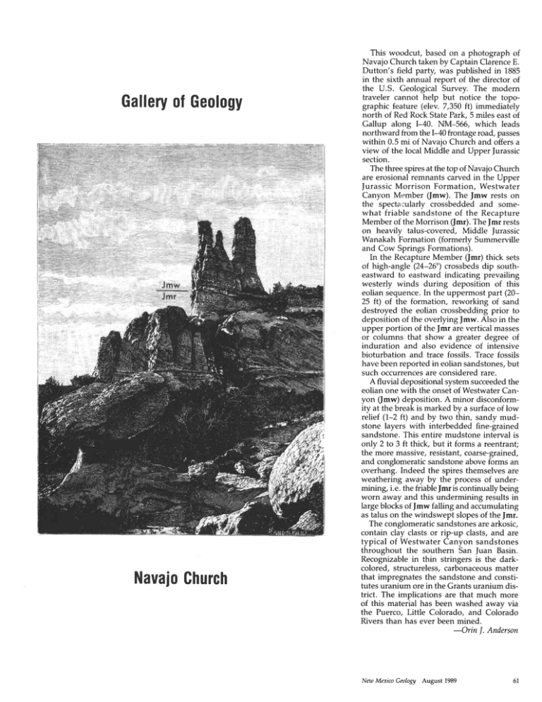
Galleryof Geology t4, f.,|t, 'Pr't 'fs NavajoChurch This woodcut, based on a photograph of Navajo Church taken by Captain ClarenceE. Dutton's field party, was published in 1885 in the sixth annual report of the director of the U.S. Geological Survey. The modern traveler cannot help but notice the topographic feature (elev. 7,350 ft) immediately north of Red Rock State Park, 5 miles east of Gallup along I-40. NM-566, which leads northward from the I-4Ofrontageroad, passes within 0.5 mi of Navaio Church and offers a view of the local Middle and Upper furassic section. The three spiresat the top of Navajo Church are erosional remnants carved in the Upper furassic Morrison Formation, Westwater Canyon Member flmw). The Jmw rests on the spectacularly crossbedded and somewhat friable sandstone of the Recapture Member of the Morrison (fmr). The fmr rests on heavily talus-covered, Middle furassic Wanakah Formation (formerly Summerville and Cow Springs Formations). In the RecaptureMember (fmr) thick sets of high-angle (24-26") crossbedsdip southeastward to eastward indicating prevailing westerly winds during deposition of this eolian sequence.In the uppermost part (2025 ft) of the formation, reworking of sand destroyed the eolian crossbedding prior to deposition of the overlying Jmw. Also in the upper portion of the fmr are vertical masses or columns that show a greater degree of induration and also evidence of intensive bioturbation and trace fossils. Trace fossils have been reported in eolian sandstones,but such occurrencesare considered rare. A fluvial depositionalsystemsucceededthe eolian one with the onset of Westwater Canyon flmw) deposition. A minor disconformity at the break is marked by a surfaceof low relief (1-2 ft) and by two thin, sandy mudstone layers with interbedded fine-grained sandstone. This entire mudstone interval is only 2 to 3 ft thick, but it forms a reentrant; the more massive, resistant, coarse-grained, and conglomeraticsandstoneaboveforms an overhang. Indeed the spires themselvesare weathering away by the process of undermining, i.e. the friablefmr is continuallybeing worn away and this undermining results in large blocks of Jmw falling and accumulating as talus on the windswept slopesof the Jmr. The conglomeraticsandstonesare arkosic, contain clay clastsor rip-up clasts,and are typical of Westwater Canyon sandstones throughout the southem San ]uan Basin. Recognizable in thin stringers is the darkcolored, structureless, carbonaceousmatter that impregnates the sandstone and constitutes uranium ore in the Grants uranium district. The implications are that much more of this material has been washed away via the Puerco, Little Colorado, and Colorado Rivers than has ever been mined. -Orin I. Anderson New Mexico Geolo3y August 1989
