New Mexico Grant County,
advertisement
NewMexico
of Gityof Rocks,GrantCounty,
development
Geomorphic
Australia
Adelaide,
South
ol Adelaide,
University
andC.B.Twidale,
NewMexico,
LasCruces,
NewMexico
StateUniversity,
byJ.E.Muetter,
Introduction
City of Rocks is one of several intricately sculptured groups of
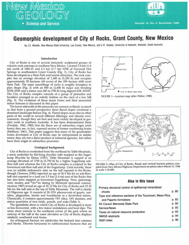
volcanicrock outcropsin southernNew Mexico.Located2.6km (1.6
mi) north of NM-61 and 4.3 km (2.7 mi) NNE of Faywood Hot
Springs in southeasternGrant County (Fig. 1), City of Rocks has
been developed as a StatePark and tourist attraction. The rock complex has an averageelevation of 1,600m (5,250ft) and occupies
approximately 20 hectares (49 acres) of the 2S9-hectare(640-acre)
State Park. The main assemblageof rocks is roughly hourglass in
plan shape (Fig. 2) with an 800-m (2,600ft) major axis trending
NNE-SSW and a minor axis 240 m (790ft) long aligned ESE-WNW.
The City of Rocks complex consists of a group of pinnacles and
boulders arranged in an orderly fashion on the crest of a low hill
(Fig. 3). The evolution of these major forms and their associated
minor features is discussedin this paper.
The lower sidewallsof the pinnaclesare concaveor flared, so much
so that from a ground perspective these flared slopes constitute a
dominant landscapefeature(Fig.a). Flaredslopesoccuralsoin other
parts of the world in several different lithologic and climatic environments, though they are best and most widely developedin granitic rocks in southern Australia. It has been demonstrated there
(Twidale, 1962, 1982)that the flares are of subsurfaceorigin (etch
form); they are, in fact, exposedsectorsof former weathering fronts
(Mabbutt, 1951).This paper suggeststhat many of the geomorphic
forms developed at City of Rocks may be interpretated in similar
terms: they are not a direct product of subaerialagencies,but rather
have their origin in subsurfaceprocesses.
Geological background
City of Rocksis overlooked from the northeast by TableMountain,
a meia underlain by flat-lying rhyolitic tuffs mapfed as the Sugarlump Rhyolite by Elston (1957). Table Mountain is capped at an
average elevation of 1750m (5,750ft) by a higher Sugarlump ashflow-tuff unit whereas the City of Rocks complex is sculpted in the
lowermost ash-flow-tuff unit of the Sugarlump. Until recently, there
was no reliable radiometric date on the tuff exposed in the Rocks,
though Clemons(1982)reported an age of 36.9Ma for an ash-flowtuff unit exposedin a road cut 5.5 km (3.4mi) eastof the Rocksthat
has also been mapped as lowermost Sugarlump. Now, paleomagnetic studies and *Ar/t'Ar dating by Mclntosh (personal communication 1987)revealan age of 35.12Ma for City of Rocksand 33.32
Ma for the tuff unit at the top of Table Mountain. The tuff is clearly
of Oligocene age. It consistsof 20-257ophenocrysts of quartz, sanidine, plagioclase, biotite and hornblende in a devitrified matrix.
Chemically, it contains approximately 74Vosilica, 147oalumina, and
minor quantities of iron oxide, potash, and soda (Table1).
The ignimbrite sheet in which City of Rocksis developed is more
or lesshorizontal,with a few minor undulationsand localdips. The
same sheet extends to the southeastcorner of the park where an
outcrop of the tuff at the same elevation as City of Rocks displays
similarly weathered rock forms.
An orthogonal fracture set subdivides the bedrock into columns
and blocks. Discrete horizontal to subhorizontal fractures that are
t,,,
r__f-l+
lDcmingo
i
Ciry ot Rnks SrarePark
FIGURE l-Location
map (after Weber, 1980)
FIGURE 2-Plan of City of Rocks. Roads and vertical fracture Pattern compiled from New MexicoHighway Department air photo taken March 15, 1968
at scale1:10,600.
Alsoin thisissue
mineralized
controlof epithermal
Primarystructural
shoots
P.80
MesaRica,
Typeand referencesectionsof the Tucumcari,
and Paiaritoformations
P.82
p. 90
Kit CarsonMemorialStatePark
Service/News
P.92
p' 93
Taxeson naturalresourceproduction
NMGSabstracts
P' 94
Staffnotes
P. 96
FIGURE 3-A
portion of City of Rocks as seen from park observation point. Vehicles provide scale
New AAexnc@
GEOLOGV
o Science
andService
1988
1O, No. 4, November
Editor: CaroI A Hjellming
Draf ting assistance:Michael Wooldridge
Publishedquarterly by
New Mexico Bureau of Mines and Mineral Resources
a division of New Mqi@ lnstihrte of Mining & lctnology
Volume
BOARD OF REGENTS
Ex Officio
Garry Camthers, Gwmor of Nru Merico
Alan Morgan, Supoinlendentol Publiclnslruction
Appointed
[f,nton Malry, Pre ,1985-7997,Albuquerque
Robert O Andenon, SeclTreas,1987-1993, Roswell
Gilbert L Cano, 1985-1989,Albuquqque
Donald W Mo(is, 1983-1989,Its Alamu
Steve Tones, 1967 1991, Seono
New Mexico lnstitute of Minint & Technology
Lrurence H Lattman
Plsidnt
New Mexico Bureau of Mines & Mineral Rercurces
Frank E Kottlowski
Dir(tor
Deputy Diectol
JamesM Robertson
Subrnptions:
November;
lssued quarterly, February, May, August,
price $6 0O/calendar year
subsription
Editorial mttq: Articles submitted for publication should
be in the editor's hands a minimum of five (5) months
before date oI publication (February, May, August, or
November) and should be no longer than 20 tyPewritten, double-spaced pages All rcientific PaPeG will be
reviewed by at least two people in the appropriate field
of study Address inquiries to CarolA Hiellmint, Editor
of Nru Mei@ G@logy, New Mexico Bureau of Mines &
Mineral Resources, Saono, NM 87801
Published as public domm, ther4orc rcPrMrctble utthout W'
mission Source credit rcqrcted
Circulation: 1,6fi
FIGURE 4-Large, bulbous-shaped pinnacle with flared sidewall. Note color
contrast between upper and lower surfaces. Camera bag for scale.
74
November
1988
New Mexico Geology
Priater: University
of New Mexico Printing
Plant
TABLE 1-Chemical analysis of Sugarlump ash-flow tuff at City of Rocks
State Park; analysis by Michael O. McCurry, New Mexico State University.
Element
sio,
TiO,
Alro.
Fe2O.
MnO
Mgo
CaO
Na,O
K'O
Weight (%)
736
0.28
74.7
1.89
003
032
134
3.8
4.8
Precision(t)
07
001
0.1
0.02
0.002
001
001
005
0.05
morphology of the pinnaclesand Platforms.
Landforms
Between the main rock complex and the southeast corner of the
FIGURE S-Pinnacle with discrete horizontal fracture Camera bag to left oI
fracture provides scale
m
30
FIGURE 6-Diagrammatic
ation is 6.2 times.
section through City of Rocks. Vertical exagger-
either related to sheeting fractures or are flat-lying members of the
orthogonal set can be seen within many, though not all, pinnacles
(Fig. 5). The orothogonal set also consists of vertical or nearly vertical
fractures that subdivide the ignimbrite into rhomboidal, quadrangular, or triangular blocks. The major vertical fractures trend NNESSW ENE-WSW and NW-SE (Fig. 2).
The origin and age of the fractures is unknown. Some fractures
might be cooling cracks associated with thermal contraction of the
ignimbrite sheet. Others could be associated with release of the
gravitational load as overlying upper and middle units of the Sugarlump, as well as younger volcanics, were denuded. Another possibility is that certain fractures developed in response to reduction
of lateral support in the rock complex that resulted from downcutting
by adjacent drainage lines. That the fractures may have more than
one origin might account for the fact that two adjacent vertical fractures, in some cases no more than a meter or so apart, have conspicuously different weathering and erosional histories: one is deeply
and exposure of former weathering fronts within the rock complex.
Two major types of rock platform are recognized within the park.
True rock pediments, with a thin veneer of gravel and an average
slope of 3", extend outwardly from the base of the main rock complex
to adjacent arroyo systems. These pediments may have their origin
in primarily surficial processes, or they might represent exposed
sectors of a gently inclined weathering front (Twidale, 1981). Whatever their origin, the pediments on their upper margins give way
rather abruptly to steeply sided (5"-10') rock platforms within the
rock complex. These upper rock platforms, unlike the pediments,
may have a structural origin, because, in places, they appear to be
developed along convex-upward sheeting fractures in the tuff. This
interpretation is supported by the fact that the plane of the inclined
platform, in some instances, continues as a basal fracture through
the large rock columns. In addition, steep rock platforms associated
with sheeting fractures are clearly evident at nearby Giant of the
Mimbres, an area of isolated, tall rock columns also developed in
the lowermost unit of the Sugarlump ash-flow tuff.
Maior vertical fractures have been weathered, eroded, and thus
enlarged to produce clefts or slots as large as 5 m (16 ft) wide. The
long continuous rock corridors are the "streets" of the City referred
to by Weber (1980). These corridors are best developed near thc
southeast and southwest margins of the rock complex. A few of the
widest corridors are the result of complete evacuation of regolith
between, as well as along, two adjacent and parallel fractures. In
places, all that remains between adjacent fractures is a low rock
mound or "traffic island" located just before a "street intersection."
Some of the shorter corridors also link with others at an obtuse angle
to form throughways. Others, however, terminate or "deadend"
against rock walls.
Weathering and widening of fracture zones has caused the fracture-defined blocks to be reduced in area and to become rounded
to a greater or lesser degree. The lower sidewalls of the rocks are
markedly flared. In some instances there is a single flared zone, but
commonly two or three such elongated and subhorizontal concavities can be distinguished on the sidewalls (Fig. 7). This marked
basal weathering has produced pinnacles that are bulbous. Where
maximum weathering occurs on midslope, the rocks resemble a dog
bone or a dumbbell.
The upper surface and sidewalls of the rocks are dark gray, but
the lower zones of flare development are cream colored with irregular patches of reddish brown. Although all the rock surfaces are
scaly and rough, the lower flared zones are especially so, and many
of the scales exposed in the basal areas are truncated. Finally, though
small hollows ranging in diameter and depth between I and 25 cm
are developed on the upper sidewalls, at several sites hollows are
developed in zones coincident with the upper part of the basal concavity (Fig. 8).
Some of the vertical rock columns are cut by horZontal fractures
that have been exploited by weathering to produce boulders resting
on pedestals. The pinnacles and pedestals merge basally with gently
Nan Mexico Geolog3r November
1988
sloping rock platforms that are narrow within the clefts(Fig. 7), but
which are commonly severalmeters acrosswhere all remnants of
the upper sheet structurehave been eliminated(Fig. 9). The traces
of vertical fracture sets are clearlyvisible in theseplatforms. Some
have been deeply eroded to produce narrow gorge-likeslots (Fig.
10). Remnants of the soil cover occur both within the clefts and on
the broader platforms, though the soil is in the process of being
stripped.
FIGURE9-Rock platform partially coveredwith thin regolith' Hammer provides scale
tl:'
l.'{
i. t',
''
,::!l
:T1
:
FIGURE 7-Cleft
with flares on sidewalls and fracture trace in bedrock floor.
FIGURE 8-Markedly
flared lower slopes and associated tafoni or rock hollows aligned along major fracture.
November
7988
Neu Mexico Ceology
narrow cleft developed on vertical fracture. Hammer
FIGURE lO-Deep,
faintly visible on left sidewall.
Rock basins are found on the broader platforms, on pedestals,
and also on the crestsof severalpinnacles.Many basinsare the flatfloored "pan" variety (Fig. 11a)in the terminology of Wentworth
(l9M), but some, locatedwithin pans, are conicalor hemispherical
in shape ("pits"). Of the latter, fifteen are bedrock mortars (Indian
grinding pits) locatedwithin 45 m (150ft) of a rock shelter on the
west side of the Rocks(Fig. 11b).The shelterformed when a large
pinnacle toppled upslope and againsttwo adjacentupright pinnacles.Three of the bedrock mortars, which probably date back at least
to the Mogollon culture (pre-1400A.D.) (S. Upham, personalcommunication 1987),retain their smoothly ground upper sidewalls.In
others, however, deeply etched and roughened sidewallsindicate
weathering by standing water.
clefts (Twidale, 1962, 1982).The crucial evidence, however, is revealed in artificial excavations in which markedly concave weathering fronts are exposedat the baseof the regolith. Perhapsthe bestknown site of this type occursat Yarwondutta Rock, (Fig. 12a),near
Minnipa, on northwestem Eyre Peninsula,SouthAustralia, but others
are known, and additionalexamplescometo light from time to time
(Fig. 12b). In a generalway the upper extremity of the concavity
marks the former hill-plain junction, the former upper limit of the
regolith, the former stand of the land surface(Fig. 13).
Fracture-controlledclefts are especiallyProne to weathering and
to the development of flared forms becauserun-off is concentrated
there. Also, the fracture(s) allow infiltration of waters charged with
chemicalsand biota that reactwith the mineralsof the bedrock.Once
Interpretation and conclusions
The developmentof flared slopeson the lower sidewallsof pinnaclesstrongly suggeststhat thosezoneswere weatheredby moisture beneaththe land surface.Many lines of evidenceand argument
have been noted to demonstratethat flared slopesare a particular
Each flare records a period of relative standstill during which
form of the weathering front developedin the piedmont zone of
subsurfaceweathering took place, followed by the stripping of the
inselbergs,around the basesof boulders,and in fracture-controlled weathered mantle and exposureof the concaveweathering front.
Pan is 9l cm long,
FIGURE 11-b. Indian bedrock mortar developed in rock platform. Pit is 25
cm wide, 31 cm deep
FIGURE 12-a. Yarwondutta Reservoir, near Minnipa, Eyre Peninsula, South
Australia showing flared basal slope of inselberg and weathering front exposed in excavation. The row of posts to the right marks the upper limit oI
the former soil cover. Between the rows of posts and within 2 m of the former
land surface is a freshly exposed, concave weathering front.
FIGURE 12-b. Small flare exposed in 1987at Calca Quarry, west coast of
Eyre Peninsula, South Australia.
FIGURE 11-a. Solution pan developed in rock platform
66 cm wide, 10 cm deep.
Nao Mexico Geology November
1988
The occurrence of multiple flares implies several alternations of
weathering and erosion (Fig. 1a). Such subsurface moisture attack
could account for the contrasted characteristics of lower and upper
sidewalls. Upper sidewalls have a distinctive gray color that develops from the accumulation of algae, lichens, and dark-colored oxides. The cream to reddish-brown color of the exposed weathering
front, on the other hand, is due to bleaching of the feldspars and
accumulation of iron oxides. The greater degree of roughness at the
weathering front results from differential weathering of the rock at
crystal scale to produce a pitted surface (Twidale and Bourne, 1976).
The truncation of scales, which is probably related to proximity to
the weathering front (Hutton etal.,1977; Twidale, 1986),is the result
of especially intense attack by soil moisture.
The development of hollows or tafoni also is comprehensible in
these terms, for here, as elsewhere, they are initiated in a zone of
intense weathering just below the ground surface (Twidale, 1982).
They are undoubtedly developed on weak zones or "softer spots"
(Webea 1980), the nature of which cannot be ascertained because
the evidence has been evacuated. Like the flares, the associated
tafoni have been developed primarily by subsurface moisture attack,
though once exposed, the forms continue to evolve. At City of Rocks
the coincidence of tafoni with the sloping zones of concavity provides
especially persuasive evidence that tafoni are initiated at the weathering front (Twidale and Bourne, 7975; Twidale, 7978a, 7982).
The platforms, large and small, are also of etch type, as suggested
by their continuity with flares, and by the fact that they are manifestly being exposed as the regolith is stripped (Twidale 1978b).
Moreover, their surfaces are rough, scaly or platy, and stained with
the same reddish-brown patina that characterizes the basal flares of
the pinnacles. The uppei limit of the stain on the pinnacles can be
used to reconstruct the former land surface that once extended across
the now-exposed platforms. Also of probable etch origin are the
numerous rock basins located on top of rock platforms. These basins
develop where points of weakness are exploited along the weathering front. Once exposed, the basins hold both detritus and water
and continue to evolve (Twidale and Corbin, 1963;Twidale and Boume,
1975). Thus, the lower flared sidewalls of pinnacles and the development of platforms can reasonably be interpreted in terms of subsurface moisture attack guided by and concentrated in the vertical
fractures that subdivide the rock mass. The rounded crests of the
pinnacles, however, can as readily be explained in terms of subaerial
weathering. Assuming that the fracture-defined blocks were originally angular, the corners and edges of such blocks are, as many
writers from MacCulloch (1814) onwards have pointed out, more
rapidly attacked than the plane faces, so that blocks are eventually
converted to boulders: nature mutat quadratarotundis.
Two features suggest that the upper zones of the clefts, like the
lower, have been exploited by water percolating along fractures and
that they are the result of subsurface moisture attack. First, the
general ionfiguration of the complex of Pinnacles is suggestive of a
former thick sheet of ash-flow tuff that has been broken into its
constituent blocks. That the City of Rocks complex is preserved on
the crest of a hill can be exPlained by the disintegration of rock
downslope by the increased volume of waters that run and infiltrate
there. Similarly, platforms within the complex presumably reflect
weak zones of, perhaps, greater fracture density. If surface runoff
alone were responsible for the preferential lowering of the lower
slopes, this would surely have produced alternating valleys and
divides. Subsurface flow and weathering, however, could Produce
destruction of the entire mass.
Second, many pinnacles have deep pits or basins on their crests
(Fig. 15). It is unlikely that such forms would develop initially at
such sites, for water would tend to run off the crests of convex rocks.
On the other hand, rock domes are noted for the development of
basins and gutters (Rillen), and the City of Rocks' forms can be
interpreted as basins formed on a topographic dome, possibly under
a weathered mantle, and now fortuitously preserved on especially
large and resistant blocks or pinnacles. Similar remnant blocks with
gutters and a basin are found near Mannum in South Australia
(Centeno and Twidale, 1988). If this interpretation is correct, two
major phases of weathering and erosion are implied (Fig. 1a). During
the first, the upper sectors of clefts were formed and exposed. The
second phase involved one, two, or possibly three minor alternations
of subsurface weathering and erosion during which one, two, or
three basal concavities were developed, exposed, and preserved.
The latest and continuing phase of soil erosion and exposure of
the weathering front probably relates to recent entrenchment of the
two nearby arroyos that serve as a base level for the numerous,
though generally poorly defined, drainage lines that encroach upon
the Rocks from the southeast and northwest. Because the stripping
of the regolith is so nearly complete, even at the highest levels of
the rock platforms along the major drainage divide, a long period
of erosion is implied. Corroborative evidence for a long interval of
erosion is provided by the bedrock mortars that apparently have a
minimum age of 600 years. Therefore, the impact of settlement of
the region in the last century and the use and abuse of the Rocks
by tourists and vehicles may have accelerated the rate of stripping
of the regolith, but certainly did not initiate it.
The major and minor landforms so beautifully developed and
displayed at City of Rocks originated not at the surface after the
exposure of the tuff, but in the shallow subsurface as a result of
structurally controlled moisture attack.
Flare*
FIGURE 13-Progressive lowering of the weathering front and the development of flared sidewalls
November
1988
New Mexico Geology
FIGURE 14-Episodic developmentof regolith and flared slopes along a
deeply weathered vertical fracture (dotted line).
FIGURE 15-Oblique air view of rock complex with basins developed on top of several pinnacles in
foreground The vertical fractures and their expression as clefts and corridors are apparent.
AcrNowleucMENrs-The
authors appreciate the helpful reviews
of Russ Clemons, Rick Giardino, Dave Love, Mike McCurry, and
Bob Weber. Russ Clemons and Mike McCurry visited the field area
and helped with the geological interpretation. Wayland Mueller served
as field assistant and offered many helpful insights to the identification and interpretation of the forms discussed in this paper. Rowena Gilstrap typed the manuscript. Research support for Dr. Mueller
was provided by Minigrant 1-3-43848 of the College of Arts and
Sciences at New Mexico State Universitv.
References
Centeno, J D, and Twidale, C R, 1988, Rocas fungiformas, pedestales v formas
a s o c i a d a se n A n v i l H i l l , M a n n u m , A u s f r a l i a d e l S u r : C u a r d e r n o s d o L a b o r a t o r i oX e o logica de Laxe, in press.
Clemons, R E , 1982, Geology of Massacre Peak quadrangle, Luna County, New Mexico:
New Mexico Bureau of Mines and Mineral Resources, Geologic Map 51, scale 1:24,000
Elston, W E., 1957, Geology and mineral resources of Dwyer quadrangle, Grant, Luna,
and Sierra Counties, New Mexico: New Mexico Bureau of Mines and Mineral Resources, Bulletin 38, 86 pp
H u t t o n , J T , L i n d s a y ,D S , a n d T w i d a l e , C R , 7 9 7 7 , T h e w e a t h e r i n g o f n o r i t e a t
Black Hill, South Australia: Journal of the Geological Society of Australia, v 24, pp
37-50
Mabbutt,f A.,196l,"Basalsurface"or"weatheringfront":ProceedingsoftheGeological
Association of London, v 72, pp 357-358
MacCulloch f., 1814, On the granite tors of Cornwall: Transactionsof the Geological
Society of London, v 2, pp 66-78
Twidale, C. R , 1962,Steepenedmargins of inselbergsfrom northwestern Eyre Peninsula, South Australia: Zeitschrift frlr Geomorphologie, v 6, pp 5^l-69
Twidale, C R , 1978a,On the origin of Ayers Rock, Cenhal Australia: Zeitschrift fiir
GeomorphologieSupplementBand, v 31, pp 777-206
Twidale, C R , 1978b,Granite platforms and the pediment problem; in Davies, J L ,
and Williams,M A J (eds.),Landformevolutionin Australasia:AustralianNational
University Press,Canberra, pp 288-304
Twidale, C R , 1981,Origins and environments of pediments:Journal of the Geological
Society ofAustralia, v 28, pp 423-434
Twidale, C. R , 1982,Granite landforms: Elsevier,Amsterdam, 372 p
Twidale,C R., 1986,Granitelandformevolution:factorsand implications:Geologische
Rundschau, v 75, (3), pp 769-779
Twidale, C R and Bourne, J A , 1975,The subsurfaceinitiation of some minor granite
landforms: Journal of the GeologicalSocietyof Ausrraha, v 22, pp 477-484
Twidale, C. R. and Bourne,J A ,1976, Origin and significanceof pitting on granitic
rocks: Zeitschrift frir Geomorphologie,v. 20, pp. 405-416.
Twidale, C. R. and Corbin, E. M.,7963, Gnammas:Revuede G6omorphologieDynamique, v 14, pp 1.20
Weber, R H , 1980,City of Rocks:New Mexico Geology, v 2, pp 10-71.
Wentworth, C K, 1944, Potholes, pits and pans: subaerial and marine: Journal of
Geology, v 52, pp 177-730
Continue to read New MexicoGeology. . .
All subscriptionsexpirewith this issue.Renewyour subscriptionby sending $6.00
in the renewal envelopethat has been inserted in this issue.
New Mexico Geolo1gy November
1988
79
