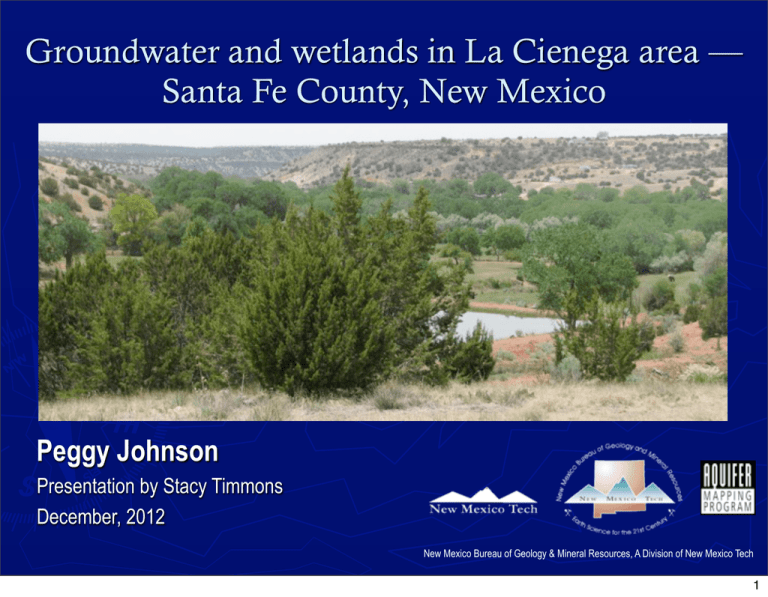
Groundwater and wetlands in La Cienega area — Peggy Johnson
advertisement

Groundwater and wetlands in La Cienega area — Santa Fe County, New Mexico Peggy Johnson Presentation by Stacy Timmons December, 2012 New Mexico Bureau of Geology & Mineral Resources, A Division of New Mexico Tech 1 Project team ▶ NM Bureau of Geology/NM Tech: Peggy Johnson (P.I., hydrogeology, geochemistry, conceptual model for springs) Dan Koning (geologic mapping, geologic model), Stacy Timmons (field team leader), Kitty Pokorny (field support, database), Brigitte Felix (GIS/graphics) ▶ NM Office of State Engineer: Laura Petronis (stream gaging, regional hydrology) ▶ NM Environment Dept: Maryann McGraw (wetlands) ▶ Ecotone /J.W. Jansens: Community outreach, technical oversight ▶ Funding: NM Bureau of Geology Aquifer Mapping Program, Healy Foundation, US Environmental Protection Agency New Mexico Bureau of Geology & Mineral Resources 2 Wetland hydrology ▶ Water Budget: Wetlands and uplands continually receive or lose water through exchange with the atmosphere, streams and groundwater ▶ How water budget components interact are unique to each wetland La Cienega wetlands: Groundwater in, surface water out Evapotranspiration Favorable geologic setting Adequate and persistent water supply Project covers surface water outflow, ET, geology, and source/age of inflow ▶ ▶ “The formation, persistence, size and function of wetlands are controlled by hydrologic processes. Distribution and differences in wetlands … are caused primarily by geology, topography, and climate.” V. Carter, 1996, in USGS Water-Supply Paper 2425 New Mexico Bureau of Geology & Mineral Resources 3 Geologic setting of southern Española Basin 22-14 MY ▶ ▶ ▶ ▶ Erosion of highlands form Tesuque Formation – Santa Fe Group aquifer Older volcanic-derived sediments line the bottom of the basin – Espinaso Fm 14-3 MY erosion forms unconformity 2.8 MY deposition of Ancha gravels begins New Mexico Bureau of Geology & Mineral Resources 4 Geology & hydrology New Mexico Bureau of Geology & Mineral Resources 5 Subsurface geology New Mexico Bureau of Geology & Mineral Resources 6 Base of the Ancha ▶ ▶ ▶ Valleys, ridges, topography on pre-Ancha land surface Paleo drainages El Dorado Ancestral Santa Fe River High Tesuque surface Between Cieneguilla and Arroyo Hondo Floodplain and lake deposits, low K Significant feature 150 ft above adjacent ancestral Santa Fe River paleovalley New Mexico Bureau of Geology & Mineral Resources 7 Saturation in the Ancha Formation ▶ ▶ ▶ Thick zones east of La Cienega correlate to areas of paleo-valley fill Springs discharge from Ancha Fm Contact with underlying strata (north slope of Guicu Creek, Las Lagunitas) Incised drainage (Cienega Creek, Arroyo Hondo) Paleo-valleys control elevation of discharge and location of wetlands New Mexico Bureau of Geology & Mineral Resources 8 Springs and wetlands discharge from Ancha New Mexico Bureau of Geology & Mineral Resources 9 Paleo-valleys and paleo-topography ▶ ▶ ▶ Existence of paleo-valleys first recognized by Z. Spiegel (1963) El Dorado and Ancestral Santa Fe River paleo-valleys Springs and wetlands associated with Ancha paleo-valleys New Mexico Bureau of Geology & Mineral Resources 10 Local watertable surface ▶ 2012 groundwater conditions for Santa Fe Group aquifer ▶ 22 spring elevations and 45 wells measured winter 2012 ▶ Used existing data from 29 wells measured between 1997 and 2007 to fill data gaps ▶ Hydraulic gradient east (6180) to west (5860) ▶ Water table mound beneath Santa Fe River New Mexico Bureau of Geology & Mineral Resources 11 Groundwater flow directions ▶ Horizontal flow direction perpendicular to contours ▶ Regional flow from east to west toward Rio Grande and Santa Fe River ▶ Local flow direction varies – recharge from or discharge to streams or arroyos New Mexico Bureau of Geology & Mineral Resources 12 Recharge, discharge, losing and gaining streams ▶ ▶ ▶ Recharge: downstream deflection of contours Losing stream reach Santa Fe River and upper Arroyo Hondo Discharge: upstream deflection of contours Gaining stream reach Cienega Creek, Arroyo Hondo, Guicu Creek, Canorita de las Bacas Wetlands are groundwater discharge zones L. Petronis & J.Veenhuis, 2012 New Mexico Bureau of Geology & Mineral Resources 13 Wetlands and seasonal water-table fluctuations Winter Seasonal water-table fluctuations controlled by precipitation and evapotranspiration (ET) ▶ Fall-Winter rise = ET decrease ▶ Spring-summer drop = ET increase ▶ Spring Summer 4/24/2012 LC-025 Leonora Curtin kiosk well Fall New Mexico Bureau of Geology & Mineral Resources V. Carter, 1996 14 Seasonal water-level changes – summer/fall 2011 to winter 2012 ▶ ▶ ▶ Two measurements in 38 wells Winter increase (0.04 to 6.60 ft) in 84% (32 of 38) of wells Average WL rise 0.77 ft Wells in or adjacent to wetlands or in drainages upstream of wetlands Consistent with drop in ET Winter decline (-0.13 to -0.50 ft) in 6 wells Wells located in dry uplands with depth to water > 100 ft Change independent of ET New Mexico Bureau of Geology & Mineral Resources 15 Hydrographs -0.25 feet/year -0.11 feet/year ▶ ▶ ▶ -0.32 feet/year -0.14 feet/year -0.29 feet/year Persistent trend of declining water levels EB-220, 10 feet in 40 yrs (0.25 ft/yr) EB-338 and EB-607, high frequency shows seasonal changes superimposed on long-term decline New Mexico Bureau of Geology & Mineral Resources 16 Piper diagram Indicates cation exchange and groundwater evolution ▶ Deeper wells with higher Na ▶ Shallow wells, near streams have lower Na, higher Ca ▶ Wells and springs with mixture of deep and shallow sources Upper La Cienega Creek and Guicu Creek Arroyo Hondo Las Golondrinas ▶ New Mexico Bureau of Geology & Mineral Resources 17 Isotopic data ▶ ▶ ▶ ▶ Deep wells – less than -95 ‰ deuterium Shallow wells and springs -86.5 to -74.7 ‰ deuterium Springs have undergone evaporation Isotopic differences in wetland zones are similar to ion chemistry More depleted in Arroyo Hondo and Las Golondrinas New Mexico Bureau of Geology & Mineral Resources 18 Contoured apparent 14C ages and tritium concentrations ▶ ▶ ▶ ▶ ▶ Apparent 14C ages range from 10,780 to 1,550 years before present Tritium ranges from <0.1 to 1.73 tritium units Oldest groundwater is away from streams and arroyos Recharge from streams is indicated in Cienega Creek and downstream of WWTP West slopes of lower Cienega Creek have slightly older mixtures of groundwater New Mexico Bureau of Geology & Mineral Resources 19 Mixing groundwater from different flowpaths ▶ ▶ Older deeper waters with high Na, depleted isotopic signature, older apparent 14C age and no detectable tritium Shallow waters along drainages have higher Ca, lower Na, more enriched isotopic signature, younger apparent 14C , and higher tritium levels V. Carter, 1996 New Mexico Bureau of Geology & Mineral Resources 20 Geologic controls on La Cienega ▶ ▶ ▶ Springs discharge from Ancha Formation Paleo-valleys control discharge locations Ancecstral Santa Fe River El Dorado paleovalley Edge of basin and thinning of Ancha Formation New Mexico Bureau of Geology & Mineral Resources 21 Summary ▶ ▶ ▶ ▶ ▶ Locations of springs and wetlands are controlled by geology Seasonal water-level changes in vicinity of wetlands show typical pattern of winter rise and summer decline associated with evapotranspiration Progressive long-term water-level declines are consistent with regional groundwater pumping and development Ion chemistry, isotopic data and age dating methods indicate a mix of shallow and deep sources of groundwater to La Cienega region Findings can help direct future restoration plans New Mexico Bureau of Geology & Mineral Resources 22


