Document 10907287
advertisement
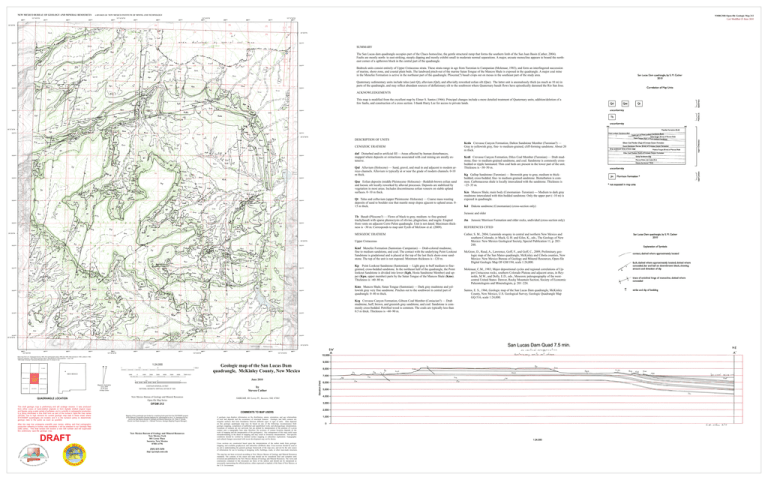
NEW MEXICO BUREAU OF GEOLOGY AND MINERAL RESOURCES 250000 107°45'0"W 251000 252000 A DIVISION OF NEW MEXICO INSTITUTE OF MINING AND TECHNOLOGY 253000 254000 107°42'30"W 255000 256000 107°40'0"W 257000 258000 259000 260000 NMBGMR Open-file Geologic Map 212 Last Modified 21 June 2010 107°37'30"W 261000 262000 35°30'0"N 35°30'0"N 3931000 3931000 SUMMARY The San Lucas dam quadrangle occupies part of the Chaco homocline, the gentle structural ramp that forms the southern limb of the San Juan Basin (Cather, 2004). Faults are mostly north- to east-striking, steeply dipping and mostly exhibit small to moderate normal separations. A major, arcuate monocline appears to bound the northeast corner of a upthrown block in the central part of the quadrangle. 3930000 3930000 3929000 3929000 Bedrock units consist entirely of Upper Cretaceous strata. These strata range in age from Turonian to Campanian (Molenaar, 1983), and form an interfingered succession of marine, shore-zone, and coastal plain beds. The landward pinch-out of the marine Satan Tongue of the Mancos Shale is exposed in the quadrangle. A major coal mine in the Menefee Formation is active in the northeast part of the quadrangle. Pliocene(?) basalt crops out on mesas in the southeast part of the study area. Quaternary sedimentary units include talus (unit Qt), alluvium (Qal), and alluvially reworked eolian silt (Qae). The latter unit is anomalously thick (as much as 10 m) in parts of the quadrangle, and may reflect abundant sources of deflationary silt to the southwest where Quaternary basalt flows have episodically dammed the Rio San Jose. ACKNOWLEDGEMENTS This map is modified from the excellent map by Elmer S. Santos (1966). Principal changes include a more detailed treatment of Quaternary units, addition/deletion of a few faults, and construction of a cross section. I thank Harry Lee for access to private lands. 3928000 3928000 35°27'30"N 3927000 3927000 35°27'30"N DESCRIPTION OF UNITS CENOZOIC ERATHEM 3926000 3926000 daf Disturbed and/or artificial fill —Areas affected by human disturbances, mapped where deposits or extractions associated with coal mining are areally extensive. Qal Alluvium (Holocene) — Sand, gravel, and mud in and adjacent to modern arroyo channels. Alluvium is typically at or near the grade of modern channels. 0-10 m thick. 3925000 3925000 Qae Eolian deposits (middle Pleistocene–Holocene)—Reddish-brown eolian sand and loessic silt locally reworked by alluvial processes. Deposits are stabilized by vegetation in most areas. Includes discontinuous eolian veneers on stable upland surfaces. 0–10 m thick. 3924000 3924000 3923000 3923000 Qt Talus and colluvium (upper Pleistocene–Holocene) — Coarse mass-wasting deposits of sand to boulder size that mantle steep slopes ajjacent to upland areas. 0– 15 m thick. Tb Basalt (Pliocene?) — Flows of black to gray, medium- to fine-grained trachybasalt with sparse phenocrysts of olivine, plagioclase, and augite. Erupted from vents on adjacent Cerro Pelon quadrangle. Unit is not dated. Maximum thickness is ~30 m. Corresponds to map unit Tyxtb of McGraw et al. (2009). MESOZOIC ERATHEM 35°25'0"N 35°25'0"N 3922000 3922000 3921000 3921000 3920000 3920000 3919000 3919000 3918000 3918000 35°22'30"N 35°22'30"N 250000 251000 107°45'0"W 252000 253000 254000 255000 107°42'30"W 256000 257000 258000 107°40'0"W 259000 260000 261000 107°37'30"W 262000 Base map from U.S. Geological Survey 1963, from photographs taken 1956 and 1958, field checked in 1963, edited in 1980. Polyconic projection. 1927 North American datum. Reprojected to UTM projection -- zone 13N 1000-meter Universal Transverse Mercator grid, zone 13, shown in red 1:24,000 1 EL DADO AMBROSIA LAKE DOS LOMAS San SAN LUCAS DAM Lucas Dam SAN MATEO NEW MEXICO 0.5 1000 0 0 1000 2000 3000 1 MILE 4000 5000 6000 7000 FEET CERRO ALESNA 1 CERRO PELON QUADRANGLE LOCATION This draft geologic map is preliminary and will undergo revision. It was produced from either scans of hand-drafted originals or from digitally drafted original maps and figures using a wide variety of software, and is currently in cartographic production. It is being distributed in this draft form as part of the bureau's Open-file map series (OFGM), due to high demand for current geologic map data in these areas where STATEMAP quadrangles are located, and it is the bureau's policy to disseminate geologic data to the public as soon as possible. After this map has undergone scientific peer review, editing, and final cartographic production adhering to bureau map standards, it will be released in our Geologic Map (GM) series. This final version will receive a new GM number and will supercede this preliminary open-file geologic map. DRAFT Magnetic Declination June, 2009 9º 55' East At Map Center 0.5 0 1 Kilometers Geologic map of the San Lucas Dam quadrangle, McKinley County, New Mexico June 2010 NATIONAL GEODETIC VERTICAL DATUM OF 1929 by Steven Cather New Mexico Bureau of Geology and Mineral Resources Open-file Map Series NMBGMR, 801 Leroy Pl., Socorro, NM, 87801 CONTOUR INTERVAL 20 FEET OFGM 212 COMMENTS TO MAP USERS Mapping of this quadrangle was funded by a matching-funds grant from the STATEMAP program of the National Cooperative Geologic Mapping Act, administered by the U. S. Geological Survey, and by the New Mexico Bureau of Geology and Mineral Resources, (Dr. Peter A. Scholle, Director and State Geologist, Dr. J. Michael Timmons, Geologic Mapping Program Manager). New Mexico Bureau of Geology and Mineral Resources New Mexico Tech 801 Leroy Place Socorro, New Mexico 87801-4796 [505] 835-5490 http://geoinfo.nmt.edu A geologic map displays information on the distribution, nature, orientation, and age relationships of rock and deposits and the occurrence of structural features. Geologic and fault contacts are irregular surfaces that form boundaries between different types or ages of units. Data depicted on this geologic quadrangle map may be based on any of the following: reconnaissance field geologic mapping, compilation of published and unpublished work, and photogeologic interpretation. Locations of contacts are not surveyed, but are plotted by interpretation of the position of a given contact onto a topographic base map; therefore, the accuracy of contact locations depends on the scale of mapping and the interpretation of the geologist(s). Any enlargement of this map could cause misunderstanding in the detail of mapping and may result in erroneous interpretations. Site-specific conditions should be verified by detailed surface mapping or subsurface exploration. Topographic and cultural changes associated with recent development may not be shown. Cross sections are constructed based upon the interpretations of the author made from geologic mapping, and available geophysical, and subsurface (drillhole) data. Cross-sections should be used as an aid to understanding the general geologic framework of the map area, and not be the sole source of information for use in locating or designing wells, buildings, roads, or other man-made structures. The map has not been reviewed according to New Mexico Bureau of Geology and Mineral Resources standards. The contents of the report and map should not be considered final and complete until reviewed and published by the New Mexico Bureau of Geology and Mineral Resources. The views and conclusions contained in this document are those of the authors and should not be interpreted as necessarily representing the official policies, either expressed or implied, of the State of New Mexico, or the U.S. Government. Upper Cretaceous Kmf Menefee Formation (Santonian–Campanian) — Drab-colored mudstone, fine to medium sandstone, and coal. The contact with the underlying Point Lookout Sandstone is gradational and is placed at the top of the last thick shore-zone sandstone. The top of the unit is not exposed. Minimum thickness is ~120 m. Kp Point Lookout Sandstone (Santonian) — Light gray to buff medium to finegrained, cross-bedded sandstone. In the northeast half of the quadrangle, the Point lookout Sandstone is divided into lower (Kph, Hosta Sandstone Member) and upper (Kpu, upper member) parts by the Satan Tongue of the Mancos Shale (Kms). Thickness is ~60–80 m. Kms Mancos Shale, Satan Tongue (Santonian) — Dark gray mudstone and yellowish gray very fine sandstone. Pinches out to the southwest in central part of quadrangle. 0–40 m thick. Kcg Crevasse Canyon Formation, Gibson Coal Member (Coniacian?) — Drab mudstone, buff, brown, and greenish gray sandstone, and coal. Sandstone is commonly cross-bedded. Petrified wood is common. The coals are typically less than 0.5 m thick. Thickness is ~60–90 m. Kcda Crevasse Canyon Formation, Dalton Sandstone Member (Turonian?) — Gray to yellowish gray, fine- to medium-grained, cliff-forming sandstone. About 20 m thick. Kcdi Crevasse Canyon Formation, Dilco Coal Member (Turonian) — Drab mudstone, fine- to medium-grained sandstone, and coal. Sandstone is commonly crossbedded or ripple laminated. Thin coal beds are present in the lower part of the unit. Thickness is ~30–50 m. Kg Gallup Sandstone (Turonian) — Brownish gray to gray, medium to thickbedded, cross-bedded, fine- to medium-grained sandstone. Bioturbation is common. Carbonaceous shale is locally intercalated with the sandstone. Thickness is ~25–35 m. Km Mancos Shale, main body (Cenomanian–Turonian) — Medium to dark gray mudstone intercalated with thin-bedded sandstone. Only the upper part (~10 m) is exposed in quadrangle. Kd Dakota sandstone (Cenomanian) (cross-section only) Jurassic and older Jm Jurassic Morrison Formation and older rocks, undivided (cross-section only) REFERENCES CITED Cather, S. M., 2004, Laramide orogeny in central and northern New Mexico and southern Colorado, in Mack, G. H. and Giles, K., eds., The Geology of New Mexico: New Mexico Geological Society, Special Publication 11, p. 203– 248. McGraw, D., Read, A., Lawrence, Goff, F., and Goff, C., 2009, Preliminary geologic map of the San Mateo quadrangle, McKinley and Cibola counties, New Mexico: New Mexico Bureau of Geology and Mineral Resources, Open-file Digital Geologic Map OF-GM 194, scale 1:24,000. Molenaar, C.M., 1983, Major depositional cycles and regional correlations of Upper Cretaceous rocks, southern Colorado Plateau and adjacent areas, in Reynolds, M.W., and Dolly, E.D., eds., Mesozoic paleogeography of the westcentral United States: Denver, Rocky Mountain Section, Society of Economic Paleontologists and Mineralogists, p. 201–224. Santos, E. S., 1966, Geologic map of the San Lucas Dam quadrangle, McKinley County, New Mexico, U.S. Geological Survey, Geologic Quadrangle Map GQ-516, scale 1:24,000.
