Geography - Lasswade High School Centre
advertisement
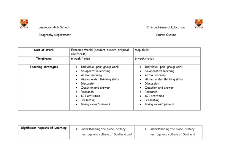
Lasswade High School S1 Broad General Education Geography Department Course Outline Unit of Work Timeframe Teaching strategies Significant Aspects of Learning Extreme World (dessert, tundra, tropical rainforest) Map skills 6 week (rota) 6 week (rota) Individual, pair, group work Co-operative learning Active learning Higher order thinking skills Discussion Question and answer Research ICT activities Presenting Giving views/opinions 1. understanding the place, history, heritage and culture of Scotland and Individual, pair, group work Co-operative learning Active learning Higher order thinking skills Discussion Question and answer Research ICT activities Presenting Giving views/opinions 1. understanding the place, history, heritage and culture of Scotland appreciating local and national and appreciating local and national heritage within the world; heritage within the world; 2. developing an understanding of the 2. developing an understanding of the world by learning about how people world by learning about how people live live today and in the past; today and in the past; 3. understanding economic, social and environmental issues; 3. understanding economic, social and environmental issues; 4. becoming aware of cause and effect, 4. understanding the principles of change, sequence and chronology; representative democracy, 5. understanding the principles of participation, citizenship by representative democracy, practising democracy through participation, citizenship by electoral participation and active practising democracy through citizenship in the school and local electoral participation and active community; citizenship in the school and local community; 6. developing useful skills for learning, life and work 5. locating, exploring and linking periods, people, events and features in time and place; 6. developing useful skills for learning, life and work. Homework Assessment Summative and formative Design you own animal: Pupils should use their knowledge of the conditions which animals need to adapt to in order to survive in harsh environments and design their own animal. The animal should be designed to live in either the desert, tundra or rainforest and pupils should annotate their animal to highlight the adaptations. Deforestation investigation: Pupils should investigate the meaning of deforestation and research strategies used by the UN and other organisations to combat it. Summative Pupils should write a diary extract of someone living in one of the biomes studied (either tundra, desert or rainforest). Pupils are provided in advance with the marking rubric so they are aware of the standard of work which is expected and what they should include in order to achieve a gold, silver or bronze award. Geoduko Treasure island map task: Pupils must use the map work skills they have developed such as using grid references, scale and direction to complete the task. European country research: Pupils research a country of their choice and present their research in poster or leaflet format. Pupils are issued with a rubric to highlight the success criteria and demonstrate what should be included to achieve a gold, silver or bronze award. Summative European country homework research task is used as an assessed piece. A rubric is used for marking to ensure consistency and standardisation. Pupils should use their map skills to design their own island. Success criteria for their own island are displayed on the board and include skills they have learned throughout the unit such as grid referencing, map symbols, scale and direction. Pupils will also be shown examples of good work so that they are aware of the standard expected. Success Criteria (differentiated): Formative Formative AIFL strategies used include: The use of learning logs based on learning intentions and success criteria; no hands up for questioning; traffic lights; think, pair, share; exit passes; carrousels and peer assessment etc. AIFL strategies used include: The use of learning logs based on learning intentions and success criteria; no hands up for questioning; traffic lights; think, pair, share; exit passes; carrousels and peer assessment etc. Section 1(humans and the environment): Acknowledge there is a link between humans and the biosphere Discuss the relationship humans have with the biosphere Explain the impact humans can have on the biosphere Section 2(location of biomes): Name three biomes and show where they are located on a map Use an atlas to find a map which shows biomes Explain why certain biomes are located in certain areas Sections 3 (rainforests): Name the different layers of vegetation in the rainforest Annotate a diagram Explain convectional rainfall Section 1 (Atlas skills): Explain what the contents and index pages are used for Find specific places using the contents and index pages Locate specific places in an atlas using coordinates Label the continents and oceans on a map Identify the continents and oceans without the aid of an atlas Use an atlas to locate European countries Name at least one line of latitude Locate the five main lines of latitude on a map Sections 2 (OS map skills): Locate the key on an OS map Name at least one rainforest Describe the threats the rainforest faces Explain the consequences of these threats Justify an opinion about rainforest destruction Section 4 (deserts): Locate deserts on a map Explain what affects the deserts climate Explain how the climate affects people living there Develop research skills Describe what desertification is Explain what causes desertification Explain how desertification affects people Justify solutions to desertification Sections 5 (tundra): Locate the tundra on a map Describe the climate of the tundra Explain what affects the climate Draw a climate graph Name at least three tundra animals Describe how these animals have adapted to the climate in order to survive Discuss the link between climate and fauna Give at least three facts about Inuit Use the key to find specific symbols Use four figure grid references to locate a place on a map Use six figure gird references to locate a place on a map Draw and identify the points on a eight point compass Identify where the scale is on a map Use scale to calculate distance Describe what contour lines on a map show Use contour lines to describe the relief of the land Calculate the height of the land using contour lines Social skills success criteria: Listen to the ideas of others Contribute their own ideas Work to a deadline Encourage and help people in their group Manage resources Social How Parents/Carers can support the coursework people Describe how they survive living in the tundra skills success criteria: Listen to the ideas of others Contribute their own ideas Work to a deadline Encourage and help people in their group Manage resources Provide a quiet place to work. Provide lots of healthy food and water. Support regular sleep (8 hours a night) Give lots of encouragement and praise. Support time management. Prompt learners to do the following to increase their learning: Check knowledge of facts using questioning based on jotter work which has been completed in class Go to websites for extra learning. Provide a quiet place to work. Provide lots of healthy food and water. Support regular sleep (8 hours a night) Give lots of encouragement and praise. Support time management. Prompt learners to do the following to increase their learning: Check knowledge of facts using questioning based on jotter work which has been completed in class Go to websites for extra learning. Websites to support extra learning in S1 http://www.nationalgeographic.com/ http://kids.mongabay.com/ http://www.rainforest-alliance.org/kids http://www.bbc.co.uk/nature/wildlife http://www.sciencekids.co.nz/sciencefacts/eart h/desert.html http://kids.nceas.ucsb.edu/biomes/desert.html http://www.kidsgeo.com/geography-forkids/0166-tundra.php http://www.bbc.co.uk/scotland/education/sys m/landscapes/highlands_islands/mapskills/ind ex_intro.shtml http://education.nationalgeographic.co.uk/edu cation/map-skills-elementarystudents/?ar_a=1 http://www.ordnancesurvey.co.uk/mapzone/
