Day 10
advertisement
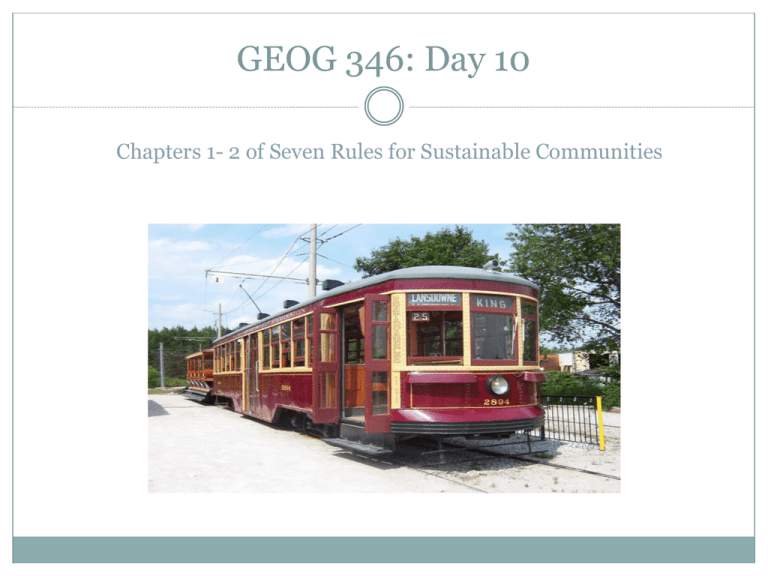
GEOG 346: Day 10 Chapters 1- 2 of Seven Rules for Sustainable Communities Housekeeping Items IT says that, on Friday, between 10:00 and 11:30 p.m., they expect erratic or no access to the following: VIU websites , VPN, D2L Web sites, shared drives, and other resources. I will circulate information about the Campus Food movement’s jobs, if I haven’t already. I will have the outlines back to Tuesday; have been too swamped this week. I need to know the destinations for the next two field trips so I can prep the driver – next Tuesday meet downstairs between this building and the Chemistry building just before 10 o’clock. Significant Point from Chapter 1 “Normally, GHG production is described by sector. We often read that buildings account for about half of all GHG production; transportation, for about 25 percent; and industry, for most of the rest. But this division obscures a fundamental point: cities are responsible for 80 percent of all GHG—caused by the way we build and arrange our buildings, by all the stuff we put in them, and by how we move from one building to the next. Since the problem is caused by cities, the solution should be there too” (Condon). SEVEN RULES FOR SUSTAINABLE, LOW-CARBON COMMUNITIES 1. Restore the streetcar city. 2. Design an interconnected street system. 3. Locate commercial services, frequent transit, and schools within a five-minute walk. 4. Locate good jobs close to affordable homes. 5. Provide a diversity of housing types. 6. Create a linked system of natural areas and parks. 7. Invest in lighter, greener, cheaper, and smarter infrastructure. [PLEASE READ THESE CHAPTERs CAREFULLY!] The Streetcar City Do you agree with Condon’s claim that “U.S. and Canadian cities built between 1880 and 1945 were streetcar cities”? He argues that this applies to virtually all cities of more than 10,000 people. You can find stats on the history of North American and Latin American streetcars at http://www.absoluteastronomy.com/topics/List_of_town_tramway_s ystems_in_Canada. He argues that the street car city is the “fundamental architecture” of North American cities. Do you think this is true? He sees it as combining four key principles: an interconnected street system, a diversity of housing types, a 5-minute walking distance to services and transit, and good jobs close to affordable homes. Has Nanaimo ever had streetcars? As to the 10,000 threshold, I was unable to find any historical population figures for Nanaimo. Was Vancouver Island ever divided into the square mile tracts as occurred elsewhere in North America? The Streetcar City Condon cites numerous studies that show that people drive less in a streetcar city. Is a streetcar city (grid pattern) always the only way to go? While not antithetical to streetcars, downtown Nanaimo has a radial pattern from the original 1864 plan by George Deverill: http://maps.nanaimo.ca/nanaimomap/. Other urban typologies include: resource towns designed in a utopian spirit (Kitimat). Source: GEOG 350, UBC. Urban Form: Street Patterns Source: Canada Mortgage and Housing Corporation Urban Form: Street Patterns Source: Canada Mortgage and Housing Corporation Urban Form: Variant of Fused Grid Source: Canada Mortgage and Housing Corporation Urban Form: Pedestrian-Friendly Non-Grid (South False Creek) The Vancouver neighbourhood – South False Creek –was designed in the mid-70s to minimize intrusion by cars. [Drawing by Stanley King] http://www.placesonline.com/north_america/canada/british_columbia/vancouver/map.asp European and Early American Cities vs. Streetcar Cities In contrast with the nodes, intersections, and squares of European and early North American cities, streetcar cities have “civic life” along the length of the main arterials – what are known in Great Britain as the “high streets.” European and Early American Cities vs. Streetcar Cities Condon argues that linear cities can be just as rich as nodal cities. What kind of city is Nanaimo? With the advent of the streetcar, which replaced the original walking cities, commute times did not change that much, but people were now occupying an area sixteen times larger at much lower densities. The automobile has facilitated even more spread, and increasingly longer commute times [see statistics]. The global population of cars – which has grown from somewhere between 48000 in 1900 to 800,000,000 cars and light trucks today to a projected 1,200,000,000 in 2030 – has radically transformed our cities. European and Early American Cities vs. Streetcar Cities As is well-known, General Motors, Firestone, and Phillips Petroleum conspired to destroy streetcar systems throughout the U.S. Los Angeles once had the largest system of streetcars and interurban tram lines in the world. Hard to believe!! While he has strong views on the subject of transportation/ transit generally, he favours a reduction in kms. travelled regardless of the mode. What do you think about his arguments for modern streetcar technology, as is being deployed in Portland and much of Europe – in contrast with so-called LRT systems (for instance, Skytrain), which are often grade-separated? In Vancouver there is a big debate regarding Broadway. Currently, there are frequent stop buses combined with express buses (the B-line). Some have argued for at grade light rail, Skytrain, or more likely a subway to connect existing systems to UBC. Condon argues for three principles: ● shorter trips ● low carbon ● what is most affordable. For metrics for each of these, see pp. 36-38. What transit system would best serve Nanaimo given its layout? Role Play/ Design Exercise The role play will work like this: you will be in one of four or five groups. Your task will be to determine how – over a ten year period – to radically improve Nanaimo’s transit with limited resources. The five groups will be: transit users; car drivers and other taxpayers who don’t want to pay for transit infrastructure; transit officials who sincerely want to improve transit, but who have limited resources at their disposal; urban planners who have to coordinate land use decisions with creating better conditions for transit, and the VIUSA wich, historically, has been opposed to a U-Pass system for VIU students. Role Play/ Design Exercise You will have a certain amount of time for brainstorming, then you will have put your ideas down visually on the acetate and write a point summary for sharing with the class (3 minutes maximum each group). This is one of the two mini-assignments mentioned in the course outline and is worth 10%. It will be evaluated based on the originality of the ideas your group comes up with, how eloquent your spokesperson is in putting across your ideas and arguments, and how much each of you participates in the process of your group.
