Hurricane Development
advertisement
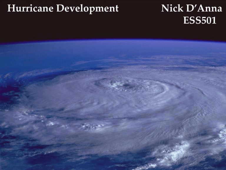
Hurricane Development Nick D’Anna ESS501 What is a Hurricane? • A tropical cyclone • Counter-clockwise circulation around a Low-Pressure System. • Sustained winds exceeding 64 knots (74 mph) • Usually about 500km in diameter Structure of Hurricane Jeanne September 26, 2004 http://svs.gsfc.nasa.gov/vis/a000000/a003000/a003024/index.html Eyewall Eye Spiral Rain Bands Yellow illustrates 1 “/hr of rainfall http://svs.gsfc.nasa.gov/vis/a000000/a003000/a003024/jeanne_09_26.0185.tif Formation: • Hurricanes do not just appear. • There is a sequence of steps to their formation. • Certain conditions must be met for the sequence to progress. Thunderstorms Tropical wave Tropical depression Tropical storm HURRICANE First Thunderstorms: Tropical regions (23½°N - 23½°S) have the right ingredients for frequent thunderstorm activity. There is little seasonal temperature variation. The daily heating and high humidity encourage the formation of cumulus / thunderstorm clouds In addition to Thunderstorms, hurricanes require warm water (28°C). Water with the appropriate temperature will only be found in tropical regions A series of sea surface temperature (SST) images will depict the location of the warm water. JANUARY -10.0 0.8 11.6 22.4 33.2 ( oC ) FEBRUARY MARCH APRIL MAY JUNE JULY AUGUST SEPTEMBER OCTOBER NOVEMBER DECEMBER JANUARY Air will rise over the warm water. Air moves in to replace the air that rose up. The converging air will further rise. As it rises, it cools and water vapor will condense. This will release latent heat, and further heat the column of air. The ITCZ shows up as a band of clouds near the equator The ITCZ may be the birth of some hurricanes, but it is uncommon. Hurricanes more frequently start off as Easterly Waves. An Easterly Wave also called a Tropical Wave Often the seed of a hurricane A group of thunderstorms that has organized The lines on the illustration are streamlines Tropical Wave • originate near the African coast as a shear instability in the flow (spin off from the African easterly jet – seasonal jet) • have wavelengths of about 2500 km • position is found in a trough of streamline pattern • convergence/upward motion on east side • divergence/downward motion on west side • travel from east to west at 10-20 knots This is a scheme of a series of tropical waves coming off the coast of Africa toward the Caribbean Sea. As the waves travel across the Atlantic, they may organize and grow into tropical depressions. How could a wave become a hurricane? 1. It has to stay over the warm water (28°C) 2. It must be far enough from the equator in order to start to spiral. #1. Warm water • Water vapor turning into liquid water is the real “fuel” of a hurricane. • The initial cause for rising air is the intense solar heating, but as this air rises, it cools adiabatically, and water vapor condenses into cloud droplets. • The condensation process releases large amounts of latent heat (540 cal/gram). • This in turn heats the column of air, further causing it to rise, creating a pressure gradient force. Tropical Depression • Winds near the center are constantly between 20 and 34 knots (23 - 39 mph). • Designated at the first appearance of a lowered pressure and organized circulation in the center of the thunderstorm complex. • At least one closed isobar. Tropical Depression Tropical Storm • Maximum sustained winds are between 35-64 knots (39-73 mph). • Assigned a name. • The storm becomes more organized and begins to become more circular in shape -- resembling a hurricane. • Tropical storms can cause a lot of problems even without becoming a hurricane. However, most of the problems a tropical storm causes stem from heavy rainfall. Tropical Storm Hurricane: eye & spiral bands develop as a result of rotation Satellite images of the various stages in a hurricanes development #2. Must be some distance from the equator • At the equator the Coriolis force is zero. • In order for the storm to start to spiral it must be large and about 10 degrees from the equator. 300 mb 300 mb Two columns of air (blue blocks). The wax paper represents the pressure gradient. 300 mb 300 mb Heat one column with intense solar radiation (shown here with a flashlight). 300 mb 100 mb ??? 300 mb The air molecules expand when heated. They become less dense and rise (remember warmer air is thicker air). This creates a pressure gradient. Outward upper air flow is clockwise Air flows down the pressure gradient. The direction of flow is deflected to the right due to the Coriolis force. Stacked on air 300 mb 300 mb Stacked on air 300 mb The air essentially leaves the center column and stacks on the outer columns. Creating differences in surface pressure 300 mb 300 mb The air at the surface will rush toward the L. When the air collides it will be forced to rise, creating a positive feedback loop to drive the system. 300 mb Counter-clockwise surface flow In addition to (#1)warm water and being (#2)far enough from the equator the storm needs: 3. Weak winds aloft, high wind shear will spread out the energy 4. Upper air outflow must be greater than the surface convergence. #3. Weak winds aloft • The rising column of air needs stability. • Wind shear will disrupt that and the rising column’s energy will disperse. How wind sheer lessons the chance of a hurricane developing: No or little shear, good vertical development Good for hurricanes High amount of shear, less vertical development Not good for hurricanes Hurricane in Therapy #4. Upper-level outflow of air must be greater than the surface inflow This is not so obvious. A commonly used analogy is that of a vacuum. As long as the air is exiting the vortex from the top more air will be “sucked” up into it from the bottom. As air leaves the upper High, air is “sucked” in toward the surface low. This is what creates the intense winds. H L In well developed hurricanes, there is a downward flow of air inside the eye. This is caused by the eyewall being heated more than the air inside the eye, creating a temperature/pressure gradient. Eye Not heated by release of latent energy. Eyewall super heated by latent energy Creates pressure gradient and downward flow. Eyewall super heated by latent energy The air flowing down the eye is heated by compression and water droplets evaporate. This allows clear skies to be seen from the eye of the storm. H L Composite image of Charley, Jeanne, Ivan, & Frances 2004 Hurricane Tracks The 2004 Hurricane Season SUMMARY • Form only at lower latitudes because they require deep layer of warm water. • Hurricane season is summer and fall since that is when ocean is warmest • Rotation of storm needs some Coriolis force so they cannot form at the Equator SUMMARY (con’t) •May form at point of surface convergence - possibilities include easterly waves, ITCZ, organized mass of thunderstorms, old front from middle latitudes •Certain conditions aloft hinder development - sinking air suppresses convection and strong winds aloft shear apart storms SUMMARY (con’t) • Still debate about exact mechanism that drives storm - but certain is that warm ocean surface is source of energy SUMMARY Hurricane development • Stages that are somewhat arbitrarily defined • Tropical disturbance/tropical wave is just a mass of thunderstorms with evidence of weak circulation • Tropical depression when winds are 23-39mph and central pressure a few millibars lower than surrounding pressure References • http://www.usatoday.com/weather/hurricane/hurrican e-resources.htm • http://www.usatoday.com/weather/graphics/hurricane /hurricane_explainer/flash.htm • http://ww2010.atmos.uiuc.edu/(Gh)/guides/mtr/hurr/s tages/home.rxml • http://apollo.lsc.vsc.edu/classes/met130/notes/chapter1 6/east_waves.html • http://brookscole.com • Ahrens, Donald C. Meteorology Today, 7th ed. Thomson Brookscole. 2003. • Ahrens, Donald C. Essentials of Meteorology, 3rd ed. Thomson Brookscole. 2001. References (con’t) • http://www.atmos.washington.edu/2003Q3/101/notes/ Hurricanes.html • http://www.palmbeachpost.com/storm/content/weathe r/special/storm/ • http://www.sullivanet.com/misc/hurricanes/hurrfear.g if • http://cagle.slate.msn.com/news/Hurricanes/1.asp • http://svs.gsfc.nasa.gov/index.html • Inquiring Minds: Weather Phenomena. Hurricanes. TV Ontario © 1998. http://www.unitedstreaming.com • http://www.physicalgeography.net/fundamentals/7u.html
