The-Power-of-InterActive-Maps-IAM-Final ANKARA
advertisement
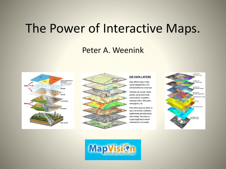
The Power of Interactive Maps. Peter A. Weenink This presentation….. • • • The old map The new map The InterActive Maps ( IAM) on the Internet (online, wifi) In October 2014, I visited the InterGeo event in Berlin. While walking through the exhibitionhalls, I suddenly had a frightening split second about all the available software, uav’s, measuring-instruments, camera’s and GIS-systems, and I directly asked myself; Where is my privacy, who is using my own not released “free” generated data and where will this end ? Peter Weenink My BIG passion for maps; • I travelled around the world from my childhood till now, • My love for maps and their backgrounds made me a Cartographer and a data-miner, • Informative character of map and atlases, • Collection of physical maps/atlases and an enormous digital DATA-base, • Hoping for the biggest world atlas, Earth Platinum (EP), into de “Low Countries”. • Teaching the knowledge of the map to individuals & groups through Mapvision Maps, from History till Today. Topographical ===> thematical (subjects) nowadays using DATA visualization. 1. Static ----> paper (platform), drawn/printed format 2. Dynamic ----> <---- screen (platform), software format; zooming (less detailing) 3. InterActive (IA) <---> <---> screen (platform), software format; zooming, Q & A, Definitions are “widely usable”; gradations and ranges are within a "sliding scale”. Static Map, Dynamic Map, InterActive Map ===> StatM, DM, IAM (Semi IAM). • • • • Old (topo)situation The then current situation Old situation The current situation • • • • • The current situation Real-time situation 2D Map 3D Map 4D Map on an old (ancient, antiquarian) clay or paper map, on an old (antiquarian) paper map, on a nowadays paper/digital/app map, on a nowadays paper/cloth map, digital maps using infographics, texts/storytelling, stats, (sat)pics, on a nowadays digital/app map, (incl. time-delays), digital maps using navigation & distances, digital depth-maps (on earth surface), using time (sliders), sounds/noise, movement or else. InterActive Maps need….. DATA, lots and lots of Data, BIG Data! • Free data: static + mobile + realtime • Your data: private • Bought data: government/institutions/organizations • Local, regional, international data By all means !!! The Map. Many of us do have a “Hate – Love” relationship to the map; Difficult visualizations bring incomprehensible information. Sender (Cartographer/GIS-technician) <==> Receiver (user) http://www.theguardian.com/world/datablog/interactive/2010/oct/23/wikileaks-iraq-deaths-map Satellite Map ( esri ) Fra Mauro Worldmap from 1435 (static) http://maps.esri.com/rc/sat/index.html Our World, mapping the static map and keeping the map simply colorful, or making sophisticated InterActive Maps. The Internetmap (Connections/Communication). Dynamic: only zooming. http://internet-map.net http://the-internet-map.blogspot.nl/2012/09/map-layout-process-video.html Early interactive map ? Distoguide ® from Hallwag (CH) E-Distoguide® by QR-Code. From Geneva to Poschiavo is 553 km. Who Provides the modern InterActive Map (IAM) ? Google, esri or else? Individuals & Tech start-ups ! What brings the InterActive Map? Safe Society, Your Safety; Quality of Life! At home, on the street, your geographic area influences you day by day, so knowledge is “ lifesaving ”! • Education, shopping, food, • Crime, vandalism, services • Personal health, childcare, demography, • Flooding, drought, weather, • Environment, pollution, • Leisure, free time, sports, transport, • communication, politics, • Your PC use and data storage. Do we need highly technical, detailed or simple ? Shop till you drop! The NY shopping map. The website has gone (ERROR 404), but the App is there! Search by www.archive.org Techniques & calculations behind the IAM map. http://www.jasondavies.com/maps/voronoi/airports/ http://bl.ocks.org/mbostock/raw/3711652/ http://www.mapvision.eu/node/map-projections/ Voronoi Projections Baby names; this interactive map shows the top 100 of names per US state per year. The Java technology might be obsolete, a new version seems to be on its way. If we work internationally, we should speak many languages! Where do they speak Popoloca or popoluca ? http://www.verbix.com/maps/where-do-they-speak/ (6545 languages, Dynamic) Flooding or drought? http://globalfloodmap.org http://www.floodmap.net Weather mapping. https://www.windyty.com/?surface,rh,now,52.367,4.900,4 Ireland February 2014 http://www.meteoearth.com/#/,19.74,59.10,2.12,6,1,1,0,1,0,time=1431940860 Je Suis Charlie, twittermap. http://srogers.cartodb.com/viz/123be814-96bb-11e4-aec1-0e9d821ea90d/embed_map Bundestagswahl 2013 in Berlin. All votes from all 1709 polling stations. http://berlinwahlkarte2013.morgenpost.de/#partei=13 Transport Different (realtime) IAM models for a big global audience ! http://planefinder.net Semi IAM New York Transport www.marinetraffic.com Kaspersky & DDoS attack map. https://cybermap.kaspersky.com/ http://www.digitalattackmap.com/#anim=1&color=0&country=PH&list=0&time=16235&view=map Music maps. (Audio & time) http://andywoodruff.com/blog/the-music-of-geography-ohio-is-a-piano/ http://austinmusicmap.com Ohio Pianomap, Austin Musicmap And, New York by night….. http://uk.businessinsider.com/aerial-photographs-of-new-york-city-2015-1?r=US At the end…… Interactive Maps (IAM) are: • Informative, providing more and more global subjects, • Useful to create to get a better, safer & healthier society, • Necessary in a fast growing (digital & physical) world, • Educational for scolars, students and professionals, • Easy accessible (mostly) and attractive for the eye. • Sometimes a “once in a lifetime map”. But • Allways check your information for Source, Provider and the “Truth” before official use, • Allways use a second “opinion”, the more sources/data, the better ! Thanks for listening! http://ukdataexplorer.com/european-translator/?word=to+translate


