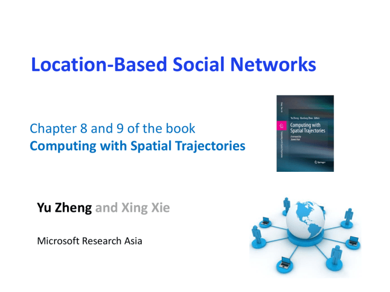
Location-Based Social Networks
advertisement

Location-Based Social Networks
Chapter 8 and 9 of the book
Computing with Spatial Trajectories
Yu Zheng and Xing Xie
Microsoft Research Asia
Outline
• Chapter 8 (Location-based social networks: Users)
–
–
–
–
Concepts, definition, and research philosophy
Modeling user location history
Computing user similarity based on location history
Friend recommendation and community discovery
• Chapter 9 (Location-based social networks: Locations)
– Generic travel recommendations
• Mining interesting locations and travel sequences
• Trip planning and itinerary recommendation
• Location-activity recommendation
– Personalized travel recommendation
• User-based collaborative filtering
• Item-based collaborative filtering
• Open challenges
Social Networks
“A social network is a social structure made up of
individuals connected by one or more specific types of
interdependency, such as friendship, common interests, and
shared knowledge.”
3
Social Networking Services
A social networking service
builds on and reflects the real-life
social networks among people
through online platforms such as
a website, providing ways for
users to share ideas, activities,
events, and interests over the
Internet.
4
Locations
Location-acquisition technologies
Outdoor: GPS, GSM, CDMA, …
Indoor: Wi-Fi, RFID, supersonic, …
Representation of locations
Absolute (latitude-longitude coordinates)
Relative (100 meters north of the Space Needle)
Symbolic (home, office, or shopping mall)
Forms of locations
Point locations
Regions
Trajectories
5
Locations + Social Networks
Add a new dimension to social networks
Geo-tagged user-generated media: texts, photos, and videos, etc.
Recording location history of users
Location is a new object in the network
Bridging the gap between the virtual and physical worlds
Sharing real-world experiences online
Consume online information in the physical world
6
Examples
Virtual world
Interactions
Sharing &
Understanding
Generating &
Consuming
Physical world
7
Location-Based Social Networks
Locations
Sharing
Geo-tagged media
Virtual Physical worlds
Understanding
User interests/preferences
Location property
User-user, location-location,
user-location correlations
An new dimension: Geo-tag
An new object
Social networks
Expanding social structures
Recommendations
Users
Locations
media
Sharing
Locations
Understanding
Social networks
8
Scenarios - Sharing
Data +
Intelligence
Microsoft
Services
Third Party
Services
Scenarios - Understanding
Data Information Knowledge Intelligence
Data +
Intelligence
Microsoft
Services
Third Party
Services
Location-Based Social Networks (LBSN)
not only mean adding a location to an existing social network so that people
in the social structure can share location-embedded information,
but also consists of the new social structure made up of individuals
connected by the interdependency derived from their locations in the
physical world as well as their location-tagged media content
Here, the physical location consists of the instant location of an individual at a given
timestamp and the location history that an individual has accumulated in a certain
period.
The interdependency includes not only that two persons co-occur in the same
physical location or share similar location histories
but also the knowledge, e.g., common interests, behavior, and activities, inferred
from an individual’s location (history) and location-tagged data.
From Book “Computing With Spatial Trajectories”
11
Categories of LBSN Services
Geo-tagged-media-based
Geo-
Point-location-driven
Trajectory-centric
LBSN Services
Focus
Real-time
Information
Geo-tagged-media-based
Media
Normal
Poor
Point location
Instant
Normal
Trajectory
Relatively Slow
Rich
Point-location-driven
Trajectory-centric
12
Research Philosophy
User Graph
Users
User-Location Graph
User
Correlation
Trajectories
Locations
Location
Correlation
Location-tagged user-generated content
Location Graph
13
Research Philosophy
Sharing
Making sense of the data
Effective and efficient information retrieval
……
14
Repla
y
Shar
e
Replay travel experiences on a map with a GPS trajectory
15
16
Research Philosophy
User Graph
Understanding
Understanding users
Understanding locations
Understanding events
Location Graph
17
Understanding Users (Chapter 8)
User similarity/
link prediction
Experts/Influencers
detection
Community Discovery
18
Understanding Locations (Chapter 9)
Generic recommendation
Most interesting locations and travel routes/sequences
Itinerary planning
Location-activity recommenders
Personalized recommendation
Location recommendations
User-based collaborative filtering model
Item-based collaborative filtering model
Open challenges
19
Understanding Events
Anomaly
Crowd Behavioral Patterns
20
Mining User Similarity Based on
Location History
21
GIS ‘08/Trans. On the Web
Grouping users in terms of the similarity between their location histories,
and conduct personalized location recommendations.
22
Mining User Similarity Based on Location History
Model user location history
Geographic spaces
Semantic spaces
User similarity
Museum 1
Cinema 2
Semantic Location history
Coffee 3
Geo-Location history
GPS trajectories
23
Mining User Similarity Based on Location History
Computing user similarity
Hierarchical properties
Sequential properties
Popularity of a location
c10
1
High
{C }
c20
c21
S1 A
c30
Low
c31
c32 c33
2
2
3
4
5
2
0.5
1
1
B
4
1
c34
S2
A
2
B
C
0.5
0.5
4
D
D
5
2
0.5
C
E
6
2
3.5
2
E
7
F
1
2
F
2
G
𝐴 → 𝐵 → 𝐶, 𝐴 → 𝐵 → 𝐷 → 𝐸 → 𝐹
Stands for a stay point S
Stands for a stay point cluster cij
24
GPS Logs of
User 1
GPS Logs of
User i
GPS Logs of
User 2
GPS Logs of
User i+1
GPS Logs of
User n-1
GPS Logs of
User n
1. Stay point detection
2. Hierarchical clustering
GPS Logs of
User 1
GPS Logs of
User 2
Layer 1
Layer 1
c10
G1
Layer 2
G2
High
G1
{C }
c20
c21
A
A
B
Low
c
c30
c31
c32 c33
B
c34
Layer 3
G3
3. Individual graph building
Layer 3
Low
e
a
Layer 2
G2
High
Stands for a stay point S
Stands for a stay point cluster cij
Shared Hierarchical Framework
e
a
d
b
G3
Friend and Location Recommendation
Similar Users Retrieval
Ranking Locations
Location Candidates Discovering
User taste inferring
u1
u2
.
.
un
L1, L2, …., Ln
x1, x2, …, xn
y1, y2, …, yn
.
.
z1, z2, …, zn
26
Mining interesting locations and travel
sequences from GPS trajectories
27
Mining interesting locations, travel sequences, and travel
experts from user-generated travel routes
28
Users:
Hub nodes
The HITS-based
inference model
Locations:
Authority nodes
29
Location-Activity Recommendation
Goal: To Answer 2 Typical Questions
Q1: what can I do there if I
visit some place?
(Activity recommendation given
location query)
Location query
Recommended
activity list
A recommended
location
Activity query
Q2: where should I go if I
want to do something?
(Location recommendation
given activity query)
Recommended
location list
31
Problem
Data sparseness (<0.6% entries are filled)
Exhibition
Shopping
Forbidden City
5
?
?
Bird’s Nest
?
1
?
Zhongguancun
1
?
6
Activities
Locations
Tourism
?
32
Solution
• Collaborative filtering with collective matrix factorization
U
Y=
UWT
Activities
V
X = UVT
Activities
Activities
Locations
Locations
Features
Z = VVT
– Low rank approximation, by minimizing
where U, V and W are the low-dimensional representations for the locations,
activities and location features, respectively. I is an indicatory matrix.
33
Research Philosophy
User Graph
Users
User-Location Graph
User
Correlation
Trajectories
Locations
Location
Correlation
Location-tagged user-generated content
Location Graph
34
New Challenges in LBSNs
Papers
Heterogeneous networks
Locations and users
Geo-tagged media and trajectories
Authors
Conferences
Special properties
Hierarchy / granularity
Sequential property
Fast evolving
Easy to access a new location
User experience/knowledge changes
Media
Users
Locations
35
GeoLife Trajectory Dataset (1.1)
Transportation
mode
Distance
(km)
Duration
(hour)
Walk
11,457
5,126
Bike
6,335
2,304
Bus
21,931
1,430
Car & taxi
34,127
2,349
Train
74,449
459
Airplane
28,493
37
Other
10,886
335
Total
187,679
12,041
Version 1.0
Version 1.1
Incremental
Time span of the collection
04/2007 – 08/2009
04/2007 – 12/2010
+16 months
Number of users
155
167
+12
Number of trajectories
15,854
17,355
+1,501
Number of points
19,304,153
22,294,264
2,990,111
Total distance
600,917 km
1,070,406 km
+469,489 km
Total duration
44,776 hour
48,349 hour
+3,573 hour
Effective days
8,977
9,694
+717
Link to the data
Conferences
ACM SIGSPATIAL Workshop on Location-Based Social Networks
LBSN 2011: Nov. 1, 2011, in Chicago (3rd year)
Over 40 attendees this year
26 submissions. 10 full papers and 4 short papers
38
Summary
Locations and social networks
Sharing and understanding
New challenges and new opportunities
39
Thanks!
Yu Zheng
yuzheng@microsoft.com
40


