Watershed PowerPoint Presentation
advertisement
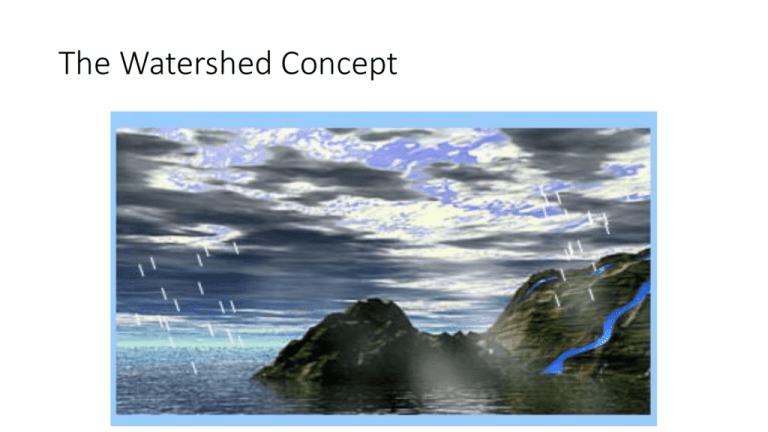
The Watershed Concept The Watershed Concept • Water reaches the earth’s surface as rain and snow. A portion of the water falling on land seeps into the soil or flows over the surface before entering streams and lakes. The land area that supplies water to a particular river or lake is called a watershed. We manage watersheds and the water they produce to provide for agriculture, human consumption, industry, flood control and recreation. In this exercise, you will learn more about what makes up a watershed, track the movement of water through thehydrologic cycle and explore ways in which scientists and engineers work to manage water resources. • What is watershed? • The hydrologic cycle • Managing water • Emerging issues What is a watershed? • Just as a city, county or state has boundaries, so does a watershed. We define a watershed as the land that contributes water to a given site. Think of this as a line that connects all of the highest points in an area – as illustrated in the animation at right. Precipitation falling inside this line is delivered to small streams or tributaries which join to form rivers. A watershed with its small tributary streams and larger river can be compared to a leaf with its sub-veins and main vein. Michigan’s Watersheds Michigan’s Watersheds • Each of us is a resident of a county or town in the State of Michigan. We are also residents of a watershed. For example, people living in Midland, Michigan reside in the Tittabawassee watershed because water falling on this city is delivered to the Tittabawassee River. Watersheds can be part of other, larger watersheds: • Tittabawassee River > Saginaw River > Saginaw Bay > Lake Huron > Great Lakes > St. Lawrence River > Atlantic Ocean • You can find out what watershed you live in by going to the U.S. EPA Surf Your Watershed web site. The Hydrologic Cycle The Hydrologic Cycle • The total quantity of water on the earth remains essentially constant. Water moves about, changing form (vapor, liquid, solid) and location as part of the hydrologic cycle. Water is delivered to the earth as precipitation (rain or snow) and then seeps into the ground (infiltration) or travels over the ground (runoff). Some of the water moving over land or in streams and lakes is lost to the atmosphere through evaporation. In addition, plants extract water from the ground and release it to the atmosphere as water vapor (transpiration). Losses to evaporation and transpiration are referred to collectively as evapotranspiration. Water that has seeped into the soil moves along asgroundwater flow and water which runs off to streams moves as stream flow. • Components of the hydrologic cycle • Precipitation • Infiltration • Runoff • Evaporation • Transpiration • Groundwater Flow • Stream Flow Precipitaion Precipitation • Water vapor in the atmosphere condenses and is delivered to the earth as dew, rain and snow. Condensed water droplets or ice particles in the atmosphere are visible to us as clouds. The movement of water from the atmosphere to the earth is called precipitation. • Many of our problems with water supply are due to the fact that precipitation is not evenly distributed over the earth’s surface: some areas are very wet (Miami, Florida gets 120 cm of precipitation each year) and others are very dry (Reno, Nevada gets 18 cm of precipitation each year). In addition, precipitation is not evenly distributed in time. This leads to wet periods (flooding) and dry periods (droughts). Infiltration Infiltration • Some of the precipitation that falls on land seeps into the ground where it is stored in aquifers and is transported to streams and lakes by subsurface flow. The amount of infiltration is influenced by the permeability and moisture content of the soil, the presence of vegetation and the volume and intensity of precipitation. • The amount of water in an aquifer is indicated by the height of the water table (the upper boundary of aquifer). This animation illustrates the effect of soil permeability (large particles have large spaces between them and let more water in) and precipitation volume (large rain events can lead to more infiltration) on the amount of water stored in the aquifer. Groundwater Flow Groundwater Flow • Water which seeps into the ground passes through a zone of aeration where the open spaces between soil particles are filled with both air and water. We cannot pump water from this zone. Below the zone of aeration lies the zone of saturation where all of the spaces between soil particles are filled with water. The water in this zone is called groundwater and is available for pumping. An aquifer is made up of all the soil, rock and water in the zone of saturation. The dividing line between the two zones is called the water table. Groundwater moves through the subsurface supplying streams and lakes. Runoff Runoff • Water that does not infiltrate the soil runs off across the surface of the watershed. Runoff begins as a sheet of water and then turns into small trickles and then streams. Runoff may contribute water directly to lakes or it may flow first to steams (streamflow) and then to lakes or the ocean. • Runoff can erode the land surface, leading to pollution of lakes and rivers. If precipitation is intense and/or the soil is saturated, flooding can occur. Watershed managers try to reduce erosion and flooding by using good land use practices and by building control structures. Evaporation Evaporation • Evaporation is the process by which water is converted from its liquid form to its vapor form and thus transferred from land and water masses to the atmosphere. Evaporation from the oceans accounts for 80% of the water delivered as precipitation, with the balance occurring on land, inland waters and plant surfaces. • As shown in the accompanying interactive animation, the rate of evaporation depends upon: Wind speed: the higher the wind speed, the more evaporation Temperature: the higher the temperature, the more evaporation Humidity: the lower the humidity, the more evaporation Transpiration Transpiration • Transpiration is the process where water contained in liquid form in plants is converted to vapor and released to the atmosphere. Much of the water taken up by plants is released through transpiration. It is difficult to separate the processes of evaporation and transpiration, so this transfer of water is sometimes simply called evapotranspiration. The U.S. EPA estimates that an acre of corn transpires 4000 gallons of water each day. Stream Flow Stream Flow • Runoff that is not extracted from the land surface by evaporation and transpiration is delivered to streams, lakes and oceans. Changes in stream flow over time can be illustrated using a hydrograph (= water picture). The flat portion of the hydrograph is called baseflow and represents inputs to the stream from groundwater. The portion of the hydrograph above baseflow is called direct runoff and indicates the presence of a rain or snow melt event. Land Use and the Hydrograph Land Use and the Hydrograph • The amount of urbanization of a watershed has a dramatic effect on the amount of precipitation which is delivered to streams or lakes (runoff) and that which enters the soil (infiltration) or returns to the atmosphere (evapotranspiration). Urban watersheds typically have fewer plants (less transpiration) and more impervious surfaces (less infiltration). This leads to increased runoff and higher streamflow (and perhaps flooding) during rain events. The accompanying interactive animation illustrates this. Urban Versus Rural Runoff Rouge River Sturgeon River Urban Versus Rural Runoff • Differences in the permeability of urban and rural land surfaces lead to differences in their hydrographs. Urban streams have ‘spikey’ hydrographs, that is stream flow goes up quickly during a rain storm event and then down quickly when the rain stops. Rural streams have much more ‘gentle’ hydrographs, with stream flow going up slowly during a rain storm and falling over a long period after the rain event is over. • In the next page, the accompanying animation and sound files illustrate the difference between urban and rural hydrographs. Here, we have converted streamflow data to sound files. High-pitched tones of long duration indicate high stream flow and low-pitched tones of short duration indicate low stream flow. Compare the sound files (as tones or musical instruments) for an urban stream (the Rouge River in Detroit) and a rural stream (the Sturgeon River in the Upper Peninsula). Can you ‘hear’ the rain storms? Hydrograph Sound • Watch the playback marker move across the graph. If it doesn't seem to match with the sound, wait for the entire (550 Kb) animation to download and try again. Water Management Control Structures Dam Reservoir Dam showing Fish Ladders and Spillway Water Management Control Structures • One of the problems with water is that we never seem to get the right amount in the right place at the right time. Engineers use water management control structures to protect against flooding, reduce erosion and store water for later use. • There are many different kinds of control structures. One of the most common systems includes a dam, reservoir and spillway. The dam permits river flow to be controlled, with water stored for later use in the reservoir. The spillway allows high flows to be released without damaging the dam. A properly designed dam system ‘smoothes out’ the hydrograph and keeps river flow at a constant and safe level. Dams can be constructed with ‘ladders’ to help migrating fish pass the barrier. Great Lakes Water Levels Great Lakes Water Levels • Most of us in State of Michigan are residents of watersheds that discharge to the Great Lakes. Coastal communities in the Great Lakes are sensitive to changes in water levels which occur due to extremes in the balance of precipitation and evaporation. High water levels lead to shoreline erosion and the loss of houses constructed too close to the lakes. Low water levels reduce beach access, the use of docks and can make navigation hazardous. Emerging Issue: Water Availability Emerging Issue: Water Availability • Water is not distributed evenly on the earth. This NASA image of plant growth in North America highlights water-rich regions in dark green and water poor areas in light tan. It is estimated that by the year 2010, southern Nevada will have committed 100% of its available water: there will be none to support new population growth or agricultural and industrial applications. The U.S. Geological Survey has concluded that we can no longer count on dams and aqueducts to increase water supply, but must look to conservation, recycling, and reuse to meet the nation’s ever increasing water demands. Today, western states have begun to look to the east, particularly to the Great Lakes, for help in meeting future needs. Emerging Issue: Inter-Basin Water Transfer Water pipelines in India where inter-basin transfer is a major topic of discussion. Emerging Issue: Inter-Basin Water Transfer • The movement of water from one basin (or watershed) to another, as a way to reduce the scarcity of water, is called inter-basin water transfer. The Great Lakes, holding 90% of the country’s supply of fresh water (~ 6,000,000,000,000,000 gallons) is a target for such strategies. While such programs may provide an economic boost to water-rich regions, there are concerns that inter-basin transfer could change the climate and hydrology of the watersheds contributing water and endanger plants and animals. Everyone Lives Downstream! Everyone Lives Downstream! • In a watershed, we all live downstream. This means that the quality of water available to us is determined by our upstream neighbors. In the Grand River watershed, over 100 million gallons of water are withdrawn from lakes and rivers to provide drinking water for the public. At the same time, almost 200 million gallons of treated wastewater are discharged to the lakes and rivers of the watershed by public wastewater treatment plants. Thus it is vital that we serve as environmental stewards of our watersheds, protecting the quality of that water for those who live downstream. And remember, everyone lives downstream.
