January 2015 Newsletter - Connecticut Association of Land Surveyors
advertisement
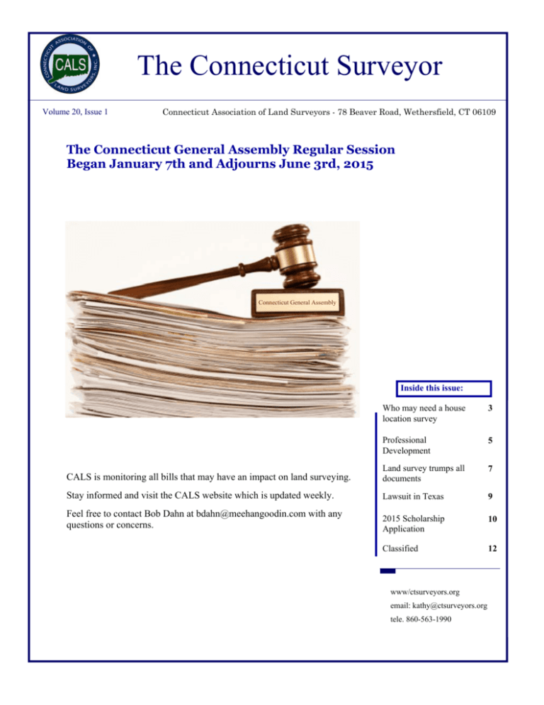
The Connecticut Surveyor Volume 20, Issue 1 Connecticut Association of Land Surveyors - 78 Beaver Road, Wethersfield, CT 06109 The Connecticut General Assembly Regular Session Began January 7th and Adjourns June 3rd, 2015 Connecticut General Assembly Inside this issue: Who may need a house location survey 3 Professional Development 5 CALS is monitoring all bills that may have an impact on land surveying. Land survey trumps all documents 7 Stay informed and visit the CALS website which is updated weekly. Lawsuit in Texas 9 Feel free to contact Bob Dahn at bdahn@meehangoodin.com with any questions or concerns. 2015 Scholarship Application 10 Classified 12 www/ctsurveyors.org email: kathy@ctsurveyors.org tele. 860-563-1990 EASTERN TOPOGRAPHICS Providing high quality digital topographic mapping - est.1977 www.e-topo.com/map/ ASPRS CALS MSLS MALSCE Completed Mapping Projects: 383 NHLSA NYSAPLS One icon represents 325 photo centers - click icon nearest to area of interest. Continue to select until low resolution aerial image appears. Fast alternative (Top Left) - enter address– hit Go! All images can be panned, zoomed, and downloaded for free. LOW ALTITUDE IMAGERY ONLINE RISPLS Over 200,000 images - Low resolution scans represent high quality aerial photos captured with a USGS calibrated cartographic camera suitable for detailed engineering level mapping (1”=40’/2’DTM). Download free imagery or submit a topographic mapping request for proposal (RFP) www.e-topo.com/map/ VSLS TIGHT BUDGET? Every proposal includes our LOW PRICE GUARANTEE. See website for complete details. SPEC FLIGHTS - NO UPFRONT COST (15MAR-20APR) F20140224-CT Vol. 20, Issue 1 The Connecticut Surveyor Page 3 Why you may need a house location survey before you buy By Myrna Keplinger Taken with permission from the Washington Post March, 2014 A (Matthew Staver/Bloomberg) couple recently bought their dream home in Alexandria. It had everything on their wish list, including a back yard large enough for a swimming pool they always wanted. All was well until the city denied their application to build the swimming pool because only half of that big back yard was actually theirs. How could this happen? The more appropriate question is: How could this have been avoided? The simple answer is the couple could have obtained a house location survey when they bought the property. A survey at settlement would cost on average $275 to $450. So, why is a house location survey so important? Here are a few reasons: • It shows the location and existence of the property. • It shows the relationship of the property to adjoining properties. • It establishes discrepancies between actual occupation or use and the description of record. • It indicates the location of physical improvements in relation to the property lines. • A house location survey is the only reliable way of obtaining and confirming basic information about a property. Be so good they can’t ignore you! Vol. 20, Issue 1 The Connecticut Surveyor Page 4 Why you may need a house location survey before you buy continued... Many home buyers get a copy of an old plat and figure that it’s good enough. But have things changed on the property since the old survey was made? Have local laws changed that might affect your property rights? The perceived boundaries of a property, such as tree lines or that beautiful new fence in the back yard often differ from the actual recorded boundaries. Obtaining a survey prior to closing brings such discrepancies to light before it is too late. It is critical to note that the house location survey must be read with the title report. Discrepancies encountered should be resolved before moving to settlement. Together, the house location survey and the title report form the basis for the issuance of insurance. Why accept a blanket exception on your title insurance when you can know about issues with a proper house location survey? There are four elements of the survey process: research, fieldwork, computations and map making. A surveyor will research land records and other public files for information about the property and the adjoiners. They then perform onsite field work, including measuring physical improvements and locating all appropriate evidence of corner monumentation. The surveyor will then compare findings in the field with the description of record and finally draft a plat that shows property limits and the location of manmade features, such as power poles, manholes, drainage ditches, telephone and cable TV boxes. The surveyor shall note any discrepancies found on the plat. House location surveys are so important that they are regulated by the District, Maryland and Virginia. You should get a house location survey prior to planning new construction. Do not depend on a building contractor to determine your building location in relation to your lot lines. Building contractors are not land surveyors. Be sure that the home is in compliance with the zoning restrictions mandated by the local government and homeowners association. In another case, a couple seeking to buy a house in Fairfax County learned through a house location survey that a portion of the property was in violation of a building restriction line. In other words, the house was built too close to the property line. The buyers got the seller to address the issue before it became their problem. If they had not discovered this prior to the purchase, the buyers later on could have been subject to penalty from the homeowners association or a notice of violation from the zoning administrator. They could have been forced to remove the offending structure at any time or jeopardize future permits until the issue was resolved. Sellers who want to make their properties more attractive to buyers should have a house location survey done before they put their property up for sale. This gives potential buyers confidence that property boundaries are clear before they commit to buying. When you buy, build, or modify your property, you don’t want surprises that can cost you major time and/or money. Get a house location survey done up front. Your home is one of the most important investments of your lifetime and is worth the comfort and security of knowing that what you see is what you’ll get. Myrna Keplinger is principal of The Settlement Group in Burke, Va. Be so good they can’t ignore you! Vol. 20, Issue 1 The Connecticut Surveyor Page 5 Professional Development Connecticut Land Surveying Certificate Courses for Spring 2015 The Land Surveying Certificate program for academic achievement in land surveying is offered by Charter Oak State College, www.charteroak.edu. Isn’t it time for you to start working on your land surveying certififcate now? The following courses of interest are offered for Spring, 2015. Charter Oak State College Online Courses: All courses have a registration deadline of January 14, 2015 courses start January 20, 2015. These courses are offered online. Course cost with book about $1,000 plus book cost. EGR 410, Boundary Law, 15 weeks. Boundary law, history of surveying, public land system, legal foundations, evidence, original surveys, water boundaries, title search, evidence, professional issues. 25% of the FS and 50% of the PS examination consists of boundary law questions. PLG 210, Legal Research & Writing, 8 weeks. Students will learn the essential skills of legal research, writing and analysis in this course. They will learn to use the traditional book-based methods of legal research as well as electronic research systems such as Westlaw and/or LexisNexis. Surveyors are expected to know the law. This paralegal course will teach you how to find the law and how to evaluate and weigh legislative laws against court decisions. You will also learn how to organize your material to frame your legal research. Central Connecticut State University, Civil Engineering Department Course starts January 18, 2015. Cost is $1,333 plus book cost. CE 458 Introduction to GPS & GIS Mapping, 13 weeks Saturdays, 8am-10:40am This course explores in detail the elements of GPS operations and systems, coordinate systems and hands on experience using GPS to collect data and compute results. The class project will utilize AutoCAD Map 3D to process GPS data collected in the field. (3 openings) For more detailed information on how to register for these courses, please contact Jay Doody at jjdoody@snet.net. Three Rivers Community College, located in Norwich, offers an accredited A.S. program in both civil and environmental engineering technologies as well as a 27.5-credit Survey Technician Certificate. Three Rivers has a full range of conventional survey equipment, survey-grade GPS receivers, GIS and AutoCAD software. Formerly Thames Valley Tech, the college has recently been fully renovated and the survey lab in particular has state of the art technology and projectors. The plan of study for the program is attached for reference. Survey II is being offered this spring, and there are still seats available for both the lecture and lab sessions. Students do not necessarily have to take Survey I prior to taking Survey II. For more information contact Kevin Franklin at kfranklin@trcc.commnet.edu. Be so good they can’t ignore you! Vol. 20, Issue 1 The Connecticut Surveyor Page 6 Professional Development UPCOMING SEMINARS FOR 2015 " The Creation, Discontinuance and Abandonment of Roads" Presented by James Sakonchick, PE&LS, President Kratzert, Jones & Associates, Milldale, CT Wednesday, February 18, 2015, 8:30am-noon ITBD CCSU, New Britain, CT Cost $100 "Connecticut Town Boundaries" Moderated by John Doody, PS&PE The history, research resources and case studies of town boundaries. Thursday, March 19, 2015, 8:30am-3:30pm ITBD CCSU, New Britain, CT Cost $200 Transferred Records Only a professional land surveyor can appreciate the intrinsic value of old survey maps. CALS makes every effort to keep track of who is holding the records of surveyors who are no longer practicing. If you are holding any records please advise the CALS office so that we can better assist you and your fellow professionals. CALS 2015 Membership Dues are now due. Save CALS the postage and save Kathy the work … send in your payment today! Be so good they can’t ignore you! Vol. 20, Issue 1 The Connecticut Surveyor Page 7 Land survey trumps all documents in a purchase Reprinted with permission By: Bob Aaron Property law, Published on Thu Dec 19 2013 Encroachment issues are easier to work out before a property sale, and a land survey is needed for that. True or false? A land survey is unnecessary if the house purchaser buys title insurance. Answer: false. A court decision released last month by small claims court in Welland, Ont. illustrates the commonly held but incorrect belief that title insurance replaces the need for a land survey. In November, 2008, Jonathan Strutt wanted to buy a house on Stonehaven Rd., in Dunnville, Ont. Strutt is the pastor of the local Calvary Pentecostal Church. Strutt had never previously owned a rural house and was unfamiliar with septic systems. After some negotiation, the agreement of purchase and sale was amended to include the seller’s statement that, to the best of her belief, the septic system was installed according to all relevant regulations at the time, and continued to operate satisfactorily. Two years after closing, Strutt was informed by Chad Plath, his next-door neighbour, that part of Strutt’s septic system encroached onto the Plath property. Wisely, Plath had obtained a land survey prior to his own closing. That 2010 survey disclosed the encroachment, but Platt did not view the issue as a real-breaker when he bought his new house. Be so good they can’t ignore you! Vol. 20, Issue 1 The Connecticut Surveyor Page 8 Land survey trumps all documents in a purchase continued... Fortunately, Strutt’s lawyer had arranged a title insurance policy with Chicago Title. So that future sale would not be jeopardized, Chicago Title arranged to have the septic bed relocated back onto the Strutt property at a cost of several thousand dollars. In 2011, Strutt sued the prior owner of the house for negligent misrepresentation. The real plaintiff was Chicago Title, which sued Franko using Strutt’s name in what is known as a subrogated claim. At trial, Strutt conceded that on all prior home purchases he had obtained a survey first. He had wanted one for the Dunnville property, but his agent told him — wrongly as it turned out — it was unnecessary and to take title insurance instead. When I spoke to Strutt last week, he told me that he was happy that he had purchased title insurance, since Chicago Title took care of all the costs of moving the septic bed. Of course, had a proper land survey been obtained prior to closing, the issue of the encroaching bed could and would have been resolved years before. As well, there would have been no inconvenience or disruption when the septic bed and two holding tanks had to be moved. Title insurance does not compensate for that. In his written decision last month, deputy judge Terry Marshall acknowledged that it was his task to separate “the wheat from the chaff” and decide whether Franko’s written statement in the offer that the septic system “continues to operate satisfactorily” amounted to negligent misrepresentation. After a detailed analysis based on a misrepresentation case in the Supreme Court of Canada, Marshall wrote, “The septic system worked fine when Franko was the property owner. It continued to work fine after Strutt became the property owner.” Even though the case was a “hotly contested matter,” the judge ruled in favour of Franko and dismissed the claim. For both urban and rural homeowners, the Strutt case provides important lessons when buying houses: Title insurance is not a substitute for a land survey . It may pay to rectify a problem but not for the inconvenience involved, or the aggravation of a lawsuit. It’s far better to have a survey before closing so that encroachment issues can be resolved in advance than have to deal with them later — even if the title insurer pays for the costs. A land survey is the most important document in a real estate transaction. Don’t buy a house without one. Bob Aaron is a Toronto real estate lawyer and chair of the Tarion consumer advisory council. He can be reached at bob@aaron.ca . Visit his website at aaron.ca. Be so good they can’t ignore you! Vol. 20, Issue 1 The Connecticut Surveyor Page 9 Ranch owner seeks $1M in fire lawsuit By Jim McBride, Amarillo Globe-News July 22, 2014 A Dallas ranch owner is seeking more than $1 million in damages in a lawsuit filed against a Woodward, Okla., land surveying company that claims one of the company’s pickups sparked a wildfire that destroyed hundreds of acres of ranchland in Lipscomb and Hemphill counties. The federal suit, filed in Amarillo’s U.S. District Court, was filed by Nell Beth Sansing Steele, the owner of the Steele Ranch, against Jividen’s Land Survey Inc. The suit alleges that on July 21, 2012, Jimmy Good, a Jividen’s employee, drove through the Steele Ranch in a company pickup to perform some survey work to stake out an oil well. Good then allegedly drove the pickup off a ranch road into some tall, dry vegetation, and the vehicle undercarriage ignited it, sparking a blaze that forced numerous fire departments to respond. Good, who allegedly admitted that he started the fire, placed a call to emergency personnel and gave them GPS coordinates of the fire’s location, according to the suit. The fire damaged at least 278 acres on the Steele Ranch, including portions in Ellis County, Okla., and in Lipscomb and Hemphill counties. The blaze caused substantial damage to the ranch and destroyed numerous trees, including 22 acres of wild plum thickets, the suit said. According to the suit, the wildfire also destroyed fences and native grasses, causing extensive erosion to the property. The fire also rendered the ranch unfit for grazing and destroyed valuable hunting grounds. The suit said Good’s actions that day were negligent and “created a foreseeable risk of harm to the ranch property.” Jividen’s Land Survey Inc. declined to comment on the suit . Jim McBride can be reached at 806-345-3354 or jim.mcbride@amarillo.com. Follow Jim on Twitter @https://twitter.com/#!/jimi52. Be so good they can’t ignore you! The Connecticut Surveyor Vol. 20, Issue 1 Page 10 CALS 2015 Memorial Scholarship ESTABLISHED IN HONOR OF THE FOLLOWING MEMBERS: HARRY E. COLE – 1909-1984 OLIVER H. PAQUETTE – 1931-1992 WILLIAM G. BERGLUND – 1918-1989 WILLIAM W. SEYMOUR – 1947-1998 The Connecticut Association of Land Surveyors is pleased to offer annual scholarships to deserving students of surveying. To qualify an applicant must: 1) Be a resident of Connecticut. 2) Be enrolled in a program leading to a BS, AS or Certificate program in surveying, or a student in a BS or AS program who has a proven record of surveying employment, as evidenced by letters of recommendation from his or her employer. 3) Show an interest in being a part of the surveying profession. 4) Students must be in their BS program junior or senior year, or AS second year. Please submit a statement outlining qualifications, together with a transcript, resume, and other pertinent information to: CALS SCHOLARSHIP COMMITTEE C/O JAY DOODY 49 ARLINGTON STREET WEST HAVEN, CT 06516 The deadline for applications is June 1, 2015 Be so good they can’t ignore you! The Connecticut Surveyor Vol. 20, Issue 1 Page 11 February 2015 Sun Mon Tue Wed Thu Fri Sat 1 2 3 4 5 6 7 8 9 10 11 12 13 14 15 16 17 18 19 20 21 26 27 28 CALS Seminar The Creation, Discontinuance and Abandonment of Roads 22 23 24 25 Board of Directors Meeting Be so good they can’t ignore you! Vol. 20, Issue 1 The Connecticut Surveyor Page 12 Classified Fairfield County Pereira Engineering, LLC is an established Civil/Environmental/Land Surveying firm located in Shelton, CT and we are looking to fill the following positions as of January 2015: Instrument Man / Survey Technician: We are seeking an experienced Instrument Man / Survey Technician with a minimum of five (5) years experience in all facets of land surveying from boundary surveying to construction layout. The qualified candidate must be highly-motivated and detail-oriented and must be familiar with Trimble Instruments, Trimble Data Collectors, and GNSS systems. AutoCAD Civil 3D experience a real plus! Duties include field surveying, downloading/uploading survey data, land record research, and AutoCAD drafting. Civil Engineer:We are seeking a Civil/Site Engineer experienced in various types of site development projects including residential, commercial, and municipal projects. Responsibilities include the design of site layouts, subdivisions, septic systems, storm and sanitary sewers, stormwater management systems, grading, roads, and hydrologic/hydraulic studies. Duties will include preparation of plans, specifications, and calculations as well as coordination with other design professionals and public officials. Qualified candidate must have a B.S. in Civil Engineering from an accredited engineering program and must be proficient with AutoCAD Civil 3D and other commonly used design and drainage analysis software. Candidate must also be organized, highly-motivated, and detail-oriented. Pereira Engineering offers a very competitive salary and benefits package including Major Medical Insurance, Retirement Plan, Life Insurance including Short-Term Disability and AD&D coverage, paid Vacation, Holidays, Sick Days, and Direct Deposit for payroll. Please email resume and salary requirements to: joe.pereira@pereiraeng.com or fax to: (203) 944-9945. New Haven County Civil Engineer, Project Manager - Small multi-discipline firm looking for self-motivated, energetic engineer to fill this full-time permanent position. Duties to include, residential & commercial site planning, subdivision design, storm water management and septic system design. Experience with AutoCAD, HydroCAD Carlson and the public approval process required. Career oriented individual. This position offers exposure to a diverse workload that provides for excellent professional development with a future. All inquiries will be kept completely confidential. Respond to ahoffman@godfreyhoffman.com Be so good they can’t ignore you! The Connecticut Surveyor Vol. 20, Issue 1 Page 13 Classified Survey Field Technician - Milone & MacBroom, Inc. is a growing multidisciplinary engineering, planning, landscape architecture, and environmental science consulting firm. Our corporate office is located in Cheshire, Connecticut with satellite office locations in Maine; New York; South Carolina; Massachusetts; and Vermont. We are looking for talented Survey Field Technicians (Rod Person) to join our Survey team and perform field boundary, topographic and construction surveys for various projects in the New England area. The candidates should have zero to two years experience in land survey field work, knowledge of field instruments and proficient computer skills required. College degree and CAD experience preferred. Excellent oral and written communicative skills required. All candidates should have a strong work ethic, enjoy working outdoors in a technical capacity, working individually or in a team, willing and eager to learn, and looking to take on more responsibility. We offer a competitive salary, opportunity for advancement, a comprehensive benefits package, and a flexible and positive work environment. Our success depends on attracting the best talent and continuously striving to improve what we do and how we do it. There are no barriers to where your talent can lead you. Interested applicants may submit their resume to: Pamela Harris, Human Resources Manager Milone & MacBroom, Inc. 99 Realty Drive, Cheshire, CT 06410 pamh@miloneandmacbroom.com (203) 271-1773 Milone & MacBroom, Inc. is an Affirmative Action/Equal Opportunity Employer M/F/D/V Looking for Position - CALS member with BS degree from Southern CT State College. Extensive experience as a Senior Survey Technician. Located in New Haven County. Willing to travel. References upon request. Call the CALS office for more information. Refer to #2014-10 Available this summer Jay Doody is teaching Introduction to GPS in the Civil Engineering Department at CCSU. He has 9 seniors, 8 juniors and 8 sophomores, many of whom will be looking for jobs after graduation or summer positions. All the students have taken a surveying course and are now taking GPS. If you are looking to hire new engineers or surveyors permanently or for the summer please contact, Jay Doody jjdoody@snet.net, 203-933-3850. Be so good they can’t ignore you! PLEASE SUPPORT YOUR SUSTAINING MEMBERS BEARINGSTAR INSURANCE GROUP Home, Auto & Other Personal Insurance Needs Avon, CT Evan Cooper - 800-300-4180 EASTERN TOPOGRAPHICS MW FINANCIAL GROUP Aerial Photogrammetry Services Wolfeboro, NH Wayne Kelloway - 603-569-2400 Long Term Care & Disability Farmington, CT John Carbone - 860-677-2600 x129 wkelloway@e-topo.com john_carbone@mwfinancial.com evan.cooper@bearingstar.com FENNER & ESLER AGENCY BERNTSEN INTERNATIONAL Professional Liability for Engineers & Surveyors Oradell, NJ Timothy P. Esler - 201-262-1200 Survey Markers & Monuments Madison, WI Tim Klaben-800-356-7388 tklaben@berntsen.com BUNCE INDUSTRIES, LLC Surveying Instruments & Supplies Newington, CT Paul Morin – 860-388-9008 pmorin@bunce.com CAMILLERI & CLARKE An Affiliate of SMITH BROTHERS INSURANCE tpesler@gmail.com kreynolds@rsgllc.com SUPERIOR INSTRUMENT Aerial Photogrammetry Services Bethpage, NY William Crawbuck - 516-827-9100 Surveying Instruments & Supplies Milldale, CT Mike Jiantonio - 888-852-7377 billc@geomapsintl.com mjiantonio@superiornetwork.com GOLDEN AERIAL SURVEYS Glastonbury, CT Robert D. Camilleri - 860-430-3306 rcamilleri@camillericlarke.com lgjohnson@goldenaerialsurveys.com CARLSON SOFTWARE KEYSTONE PRECISION INSTRUMENTS DESIGN PRODUCTS, CO. Engineering Equipment & Supplies Newington, CT Tim Lagosh - 860-666-8573 tim@dpcct.com Counselors at Law West Hartford, CT Kevin Reynolds - 860-308-2388 GEOMAPS INTERNATIONAL Aerial Photogrammetry Services Newtown, CT Lenny Johnson - 203-426-3322 Surveying Software Agawam, MA John O’Brien - 800-283-0023 www.carlsonsw.com jobrien@carlsonsw.com REYNOLDS STRATEGY GROUP Surveying Instruments & Supplies Eric Beiler, CT Sales Rep. 860-558-5700 ebieler@keypre.com Paul Carver, Manager - 888-443-9840 MAINE TECHNICAL SOURCE Surveying Instruments & Supplies Woburn, MA Mike Gage - 800-322-5003 mgage@maintechnical.com TRIMBLE Surveying Equipment Westminster, CO Susan Hall - 303-635-8419 www.trimble.com susan_hall@trimble.com WADDELL & REED Financial Services Manchester, CT Matt Peak - 860-432-8111 peak@wradvisors.com WSP GROUP Mulit-disciplinary Engineering Services Ted Covill - 508-248-1970 www.wspgroup.com ted.covill@wspgroup.com
