Historical Geographies of Local Water Forms
advertisement
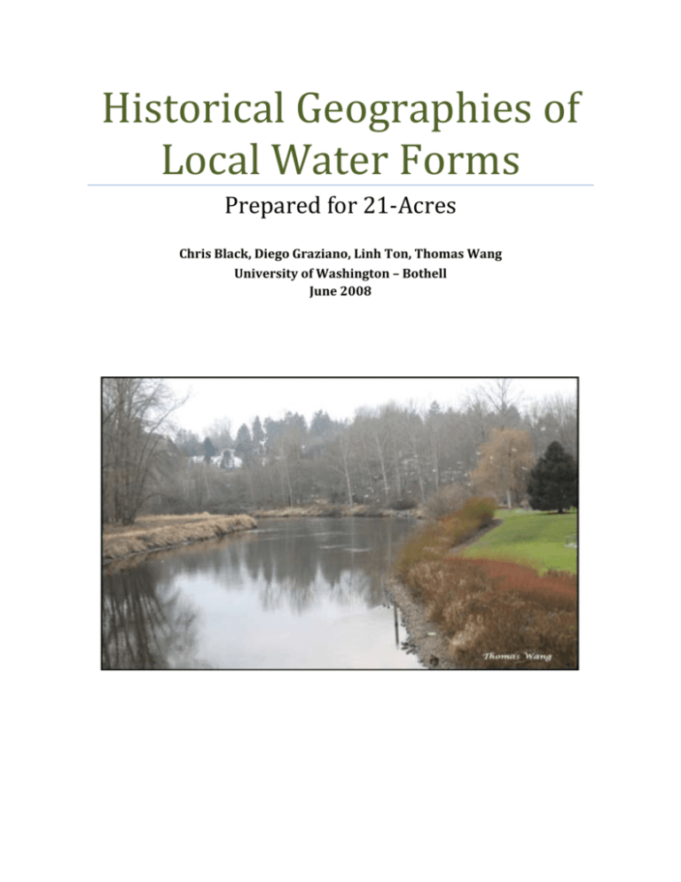
Historical Geographies of Local Water Forms Prepared for 21-Acres Chris Black, Diego Graziano, Linh Ton, Thomas Wang University of Washington – Bothell June 2008 Historical Geography of Local Water Forms Table of Contents Table of Figures ....................................................................................................................................... 2 Executive Summary ............................................................................................................................... 3 Introduction .............................................................................................................................................. 4 Major Hydrological Modifications .................................................................................................... 5 Sammamish River .............................................................................................................................. 5 Bear Creek .......................................................................................................................................... 10 North Creek ....................................................................................................................................... 11 Stream Alterations on the 21 Acres Site ..................................................................................... 11 Conclusion .............................................................................................................................................. 14 Appendix A: Research Methodology............................................................................................. 15 Historical Maps & Aerial Photographs .................................................................................... 15 Sammamish River Modifications .............................................................................................. 15 Water Quality .................................................................................................................................... 15 Works Cited ............................................................................................................................................ 17 Table of Figures Figure 1: 1895 Maps of 21 Acres Site .......................................................................... 3 Figure 2: 1895 Map of Sammamish River .................................................................... 7 Figure 3: 1895 Map of the region .................................................................................. 8 Figure 4: Bear Creek-1965 ........................................................................................... 10 Figure 5: Bear Creek-1895 ........................................................................................... 10 Figure 6: North Creek .................................................................................................... 11 Figure 7: Site of 21-Acres-1895 ................................................................................... 12 Figure 8: Plat Map of 21-Acres .................................................................................... 13 2 Historical Geography of Local Water Forms Executive Summary The historical geography of local water forms contains several sections. The first section covers the methods that were used to research and collect data. The next section contains the findings of the report. The Sammamish River has been altered by the Army Corps of Engineers (ACOE) and King County from its original form for purposes of logging transportation, flood control and boating from the late 1800’s until about 1964 which brought the river to its current depth and form. Originally, the river was 30 plus miles long and 5-10 feet shallower. The impact of these changes over the years has adversely impacted the vegetation, wild life including their habitat, and overall health of the river. Figure 1: 1895 Maps of 21 Acres Site The historical maps and photos show the Sammamish River flooded into the current 21 Acre property or was part of the wetlands in that part of the basin. An early map from the year 1895 shows runoff, possibly a seasonal creek, from the adjacent eastern ridge flowing down through the 21 Acre property and into the Sammamish River. Photos and maps from around the 1920’s do not show this same creek from the eastern ridge of the valley. 3 Historical Geography of Local Water Forms Introduction The naturally meandering creeks and rivers that once flowed through our cities have been systematically altered, and sometimes re-routed entirely, in order to suit the needs of our society. Hydrological reformation such as this is typically spearheaded by the ACOE, as well as local and county governments, in order to provide the people with benefits such as farm irrigation, flood prevention, and easement for highway expansion and human sprawl. Rivers that once meandered slowly throughout our valleys have since been straightened, widened, and deepened, to accommodate the surrounding civilization. Hydrological reformation has its benefits, but it also comes at a price. The surrounding wetlands, which play an integral role in environmental stability, are almost entirely eradicated from the straightening of rivers. The loss of these wetlands, which serve as a habitat for important local wildlife, has a detrimental impact on the local environment. The river ecosystem is also disturbed from the loss of the protective wetlands as we often see river temperatures rise dramatically, an increase in water pollutants, and a struggle for marine wildlife to thrive as it once did. Unfortunately rivers don’t exist in a vacuum. They flow through many counties and directly impact the wellbeing of many cities, making hydrological reformation a concern for all citizens. 21 Acres, a non-profit farming community located in Woodinville Washington, is an organization that has taken an interest in the stream alterations in their area. As a result, they have consulted us to survey the hydrological patterns of the region and determine what they looked like before they were altered by human intervention and answer the question of whether the Sammamish River ever ran through their property. The scope of our research is geographically bound to the Sammamish River as it flows out of Lake Sammamish and into Lake Washington, also surveying the major creeks that flow into the Sammamish River. Along with presenting the stream alterations that have occurred, an assessment of the impact of these hydrological changes to the local ecosystem is presented. 4 Historical Geography of Local Water Forms Major Hydrological Modifications Sammamish River The Sammamish River went through two major modifications documented by the ACOE. The first modification was during the Lake Washington Ship Canal and Locks Project in 1917 and the river, which was originally at least 30 miles long, was straightened to a length of about 14 miles long (ACOE & KC, 2002). The first river modification in 1917 lowered these two lakes connected to the Sammamish River. The second modification in 1964 was called The Flood Damage Reduction Project and it deepened the Sammamish River approximately 5 to 10 feet (ACOE & KC, 2002). The Sammamish River flowed through several cities including Redmond, Woodinville, Bothell, and Kenmore. The Sammamish River starts at Lake Sammamish flows north until it reaches Woodinville and then it flows west into Lake Washington. Historically, the Sammamish River was a meandering river with tributaries such as Bear Creek, Little Bear Creek, North Creek and Swamp Creek flowing into it. This meandering and shallow river flooded yearly, which resulted in the two major river alterations. Characteristics of the Sammamish River before the alterations consist of a wide floodplain which ranges from 1,000 plus feet, heavy vegetation, and shrub wetlands (ACOE & KC, 2002). The floodplain near the river was filled plant species such as cranberry, wild crabapple, hazelnut, alder, fir, hemlock, willow, cedar, cottonwood, sphagnum bog, spirea, vine maple, red-osier, dogwood, red alder, salmonberry, twinberry, Labrador tea, bog laurel, Oregon ash, snowberry (ACOE & KC, 2002). The river’s abundance of wildlife and natural resources made it a main source of food for Native Americans who inhabited along the river. The river’s current name came from a Native American tribe called the Squak people. In the 1800’s European settlers used the Sammamish River for the transportation of logs from Kenmore to Lake Washington (ACOE & KC, 2002). The river was also used by “…shallow-draft steamers and was used to float logs and coal barges from Lake Sammamish to Lake Washington” 5 Historical Geography of Local Water Forms (Wikipedia – Sammamish River). As the logging and farming industry boomed, more settlers moved in the area. Since the Sammamish River was a main source for logging and farm produce transportation, the meandering and shallow river made it hard for the massive transportation of goods. From 1880’s to the 1900’s, logging was the most concentrated industry in the area. Farming was also a popular industry during that time and many farmers transported produce Seattle using the Sammamish River. Since the river was shallow farmers needed to wait for the water levels to raise high enough to “…travel by steamboat, rowboat, or barge from Issaquah to Seattle (Bothell Thumbnail History).” The characteristics of the Sammamish were good for natural habitat but not for commercial usage. Due to the shallowness of the river yearly flooding occurred and made it undesirable for people to live near this particular area. The flooding of the Sammamish River ruined crops and made the main river channel difficult for boaters to navigate due to the other channels that ran into it. Navigating was especially hard during foggy weather and winter seasons. The logging industry and farmers in the area were familiar with conditions of the Sammamish River in its original state. In 1865 the Sammamish River meandered as it flowed out from Lake Sammamish until it reached Lake Washington. The surrounding river banks throughout this valley were predominately marsh lands and had many small creeks flowing into it from the foothills that surround the river on both sides. The 1895 topographical map below shows the Sammamish River in its original state as it meandered along with a few of the creeks that once flowed into it from the surrounding foothills. 6 Historical Geography of Local Water Forms Figure 2: 1895 Map of Sammamish River 7 Historical Geography of Local Water Forms Figure 3: 1895 Map of the region The need to eliminate the flooding conditions of the Sammamish River was evident to many residents. To address the Sammamish River flooding issue, King County implemented a project to lower Lake Washington and Lake Sammamish during the ACOE Lake Washington Ship Canal and Locks project in 1917 (ACOE & KC, 2002). Originally, King County had a $25,000 plan to deepen the Sammamish River to coincide with the deepening of the two lakes, but the plan did not go through. Lake Washington was lowered 9 feet and Lake Sammamish was lowered 6 feet in 1917 (ACOE & KC, 2002). After the lake lowering, the Sammamish River had a stronger current. In 1911 the Drainage District was formed and over the years it continued to straighten and deepen the river to prevent flooding. They also removed debris jams and gravel bars to improve river navigation. Although the Sammamish River continued to be altered by either the Drainage District or King County, by the 1950’s flooding was still too frequent. King County requested the ACOE to resolve the flooding. The 8 Historical Geography of Local Water Forms ACOE decided to lower the river and straighten the channels. The Flood Damage Reduction Project deepened the Sammamish River from 5 to 10 feet and straightened it near North Creek and Woodinville. This project was finished in 1964 and cost a total of $3,279,459 of which $2,583,536 came from federal funds and $695,923 from donations. This project was the last major alteration done to the Sammamish River. From the first time the Sammamish River was modified, land, water, vegetation, shrubs, and wildlife quality have diminished. In an effort to restore some of the diminished quality, restoration projects have been created. However, due to commercial, residential and public works surrounding the area, it is difficult to fully restore the Sammamish River to something close to its original form. The deteriorated water quality in the Sammamish River has put it “on the Federal Clean Water Act 303(d) (FCWA) list of impaired water due to the high temperatures” (NW Hydrology Consultants, 2004). The reason the Sammamish River is on the FCWA 303(d) impaired list is due, not only to these high temperatures, but also from fecal coliform, dissolved oxygen, and elevated pH levels (ACOE & KC, 2002). The high temperatures are possibly caused by two main factors. First, the out flowing water from Lake Sammamish is the warmest water in the Sammamish River’s system in the warmer months of the year possibly from the shallowness and the time the water spends within the lake. These warmer temperatures continue down river to the mouth of the Bear Creek tributary (ACOE & KC, 2002). Second, the Sammamish River as described previously, was straightened and deepened which caused the river to have less cooler water inflows from “an associated network of wetlands, tributaries and side channels” (ACOE & KC, 2002). By straightening the river and removing the vegetation on its banks it also left less shade for the water to remain at sustainable temperatures for the aquatic wildlife (ACOE & KC, 2002). Daily high temperatures often exceed 68 degrees Fahrenheit and the water temperature in some parts of the river can reach up to 80 degrees Fahrenheit in the summer which is extremely high for fish species such as salmon. The ideal temperatures for salmon should be 50-57 degrees Fahrenheit and anything above this can cause “adverse physiological and behavioral effects” (ACOE & KC, 2002). These temperatures can also affect the migration and habitat 9 Historical Geography of Local Water Forms suitability for the young salmon that are being reared. However, the tributaries give some cooling for the river and results in a slightly lower temperature further downstream (ACOE & KC, 2002). Bear Creek Figure 4: Bear Creek-1965 Figure 5: Bear Creek-1895 When comparing the maps from 1895 to the data available today Bear Creek was also slightly re-routed at one point. The imagery above shows the natural bends in Bear Creek as it flowed into the Sammamish River have been straightened, yielding the creek’s current shape. It is unclear when this alteration took place or why, but it is believed to have taken place when the Sammamish River was re-routed. 10 Historical Geography of Local Water Forms The alterations to the Sammamish River, which include the lake lowering, deepening, stocking of non-fish species, urban, industrial, agricultural development, and channel realignment, have eliminated most of the floodplain and the wetland habitat in the corridor, as well as vegetation and the in-stream habitat for fish and wildlife. This degradation caused a decline in fish and wildlife populations and the aquatic life has been reduced by more than half (ACOE & KC, 2002). North Creek Originally, North Creek did not flow into the Sammamish River as it does today. The 1895 topographical map in Figure 2 shows that North Creek actually ended at the swampy marshes just north of the Sammamish River. The 1965 map below clearly shows that North Creek now flows into the Sammamish River, likely a result of the highway expansion and development in the North Creek area. Figure 6: North Creek Stream Alterations on the 21 Acres Site 11 Historical Geography of Local Water Forms The 1895 topographical map below shows the portion of land that is located at the SW corner of Unit 10, Township-26, Range-05 (Coordinates of the Public Land Survey System). This is the location of the present-day home of 21 Acres. Figure 7: Site of 21-Acres-1895 The 1895 topographical map above displays many characteristics of the native land that is now home to 21 Acres. Currently, this particular area is very different from its undisturbed native state which was predominately marshy wetlands. However, from this same map above we have been able to identify an un-named creek that flows from the ridge just east of the 21 Acres property and directly through as it makes its way down into the Sammamish River. This creek does not show up in 12 Historical Geography of Local Water Forms any recent photographs or maps, so it is believed that it has either been converted into an industrialized drainage system or no longer exists at all. Shown below is a plat map of the current 21 Acres site, and the parcels of land belonging to 21 Acres have been highlighted in yellow. In order to answer the question of whether the Sammamish River ever ran through the 21 Acres site, we performed a side-by-side comparison of the 1895 topographical above to the present-day plat maps maintained by King County. Figure 8: Plat Map of 21-Acres 13 Historical Geography of Local Water Forms The plat map above shows the Sammamish River running through the lower left hand corner of the map. This is the exact same location of the river shown in the 1895 topographical map. In other words, the location of the Sammamish River near 21 Acres is almost in the same identical location today as it was originally in 1895. Therefore, based on this side-by-side comparison, we can conclusively state that the Sammamish River never ran through the 21 Acres site. Conclusion The Sammamish River had been altered several times from the late 1800’s up until 1964. The river’s original form was meandering with many braided channels. It was a main source of transporting logs (and agricultural products) during the logging boom in 1880’s to 1990’s and had yearly floods and vast wetlands surrounding the river. The river’s usage and characteristics made it a high candidate for modifications. Residents wanted to put a control on the river’s frequent flooding and advocated for river alterations. Once these alterations were done the negative impacts affected the habitat and wildlife to a point that is very difficult to restore. With the increasing urbanization of land in the Seattle area there needs to be planning, not only for the population and for businesses, but for the environmental factors in order to preserve the beauty and sustainability of the natural resources that we have instead of causing extensive damage and later trying to restore it. 14 Historical Geography of Local Water Forms 15 Historical Geography of Local Water Forms Appendix A: Research Methodology This project required that we pursue multiple resources in researching the various components of the project. The following sections discusses the research process & resources that were utilized for this project, namely the acquisition of historical maps & aerial photographs, researching the Sammamish River modification and also assessing the subsequent impacts to local water quality. Historical Maps & Aerial Photographs This process of historical researching maps and photos was done by initiating preliminary research to survey what sort of aerial photographs and maps were available, either in digital or hard copy format. The primary source of aerial photographs was the United States Geological Survey (USGS) website. The USGS conducted regular photographic land surveys of Washington State on a regular basis, dating back to the turn of the century. Their photographs, which are available in digital format on their website, are very clear and highly accurate images that were ideal for this project. Historical maps were a bit more difficult to obtain, primarily because most maps are coiled up and stored away in a box inside a library somewhere. The primary source for the historical maps was the University of Washington libraries which has full-color digital copies available on their website from maps they’ve scanned over the years and made available to the public. Sammamish River Modifications Resources for this portion of the topic came from online sources. The ACOE and King County were also contacted and they suggested a few different websites and links. A majority of the findings section contained in this report came from a PDF file from the ACOE’s website titled Sammamish Corridor Action Plan. This ACOE report was useful in providing the history of the Sammamish and its involvement with the Sammamish River. 16 Historical Geography of Local Water Forms Water Quality The methods used to research the Sammamish River’s water quality were the King County and ACOE web site. These sites include many visuals as well as official documents researching the Sammamish River which include information on alterations, wildlife, and water quality. The ACOE ended up having the best possible source for information about the Sammamish River. The ACOE information was also cross referenced with the King County web site to ensure accuracy. 17 Historical Geography of Local Water Forms Works Cited Hartley, David & Stuart, Derek. (2004, December 23). Sammamish River Case Study Memo to WSDOT. Retrieved April 14, 2008, from www.wsdot.wa.gov/NR/rdonlyres/E8854985-BC82-4C43-BF15CB5AE20C8D18/0/SammamishRiverCaseStudy.PDF Rivard, Katie. (2000) The Sammamish Slough What Were We Thinking? Retrieved May 14, 2008, from http://cafeademain.tripod.com/enviro/slough.html. U.S. Army Corps of Engineers. (2007, August 01). Drought Preparedness Study. Retrieved May 15, 2008, from http:// www.nws.usace.army.mil/ PublicMenu/Menu.cfm?sitename=waterres&pagename=cedargreenriver. U.S. Army Corps of Engineers & King County. (2002, September). Sammamish River Corridor Action Plan Final Report. Retrieved May 15, 2008, from http:// www.nws.usace.army.mil/ERS/reposit/Sammamish_River_Corridor_Action_ Plan.pdf Wikipedia, Various Authors. (2008, May 10). Sammamish River. Retieved May 15,2008, from http://en.wikipedia.org/wiki/Sammamish_River. Wilma, David. (2003, June 12) Bothell-Thumbnail History. Retrieved May 15, 2008, from http:// www.historylink.org/essays/output.cfm?file_id=4190 18
