Depositional and Deformational History of Sheep Mountain, Wyoming
advertisement
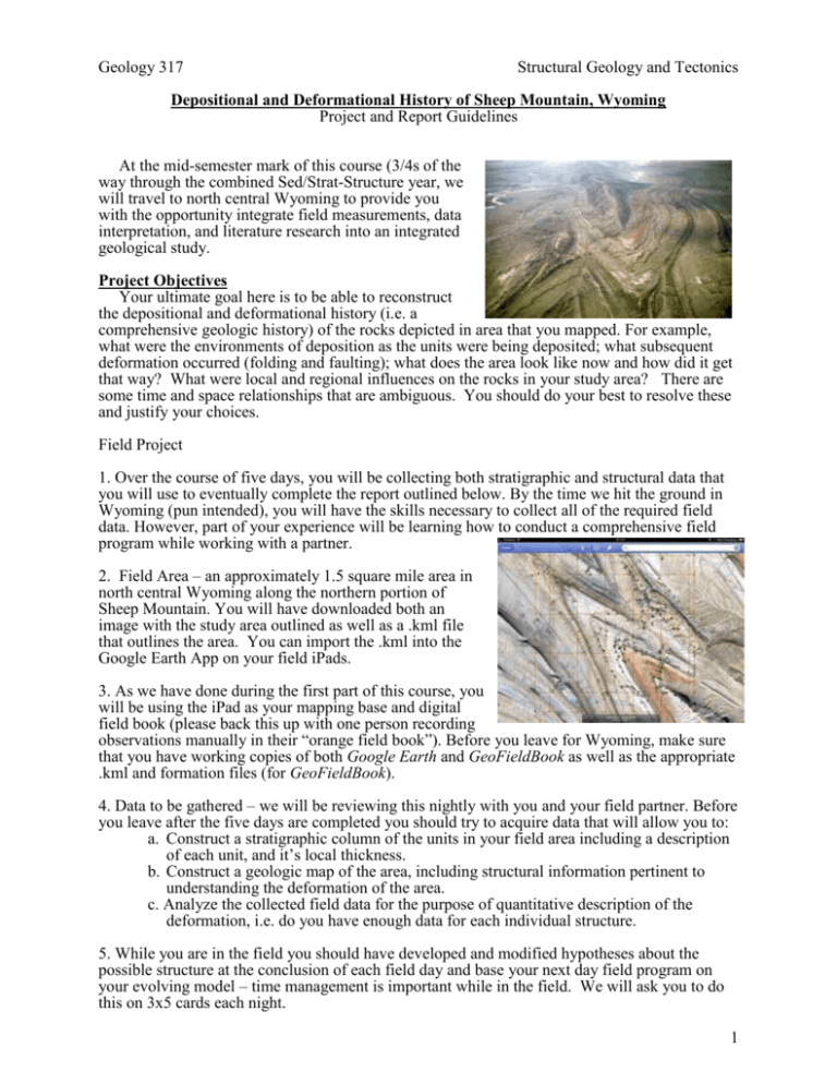
Geology 317 Structural Geology and Tectonics Depositional and Deformational History of Sheep Mountain, Wyoming Project and Report Guidelines At the mid-semester mark of this course (3/4s of the way through the combined Sed/Strat-Structure year, we will travel to north central Wyoming to provide you with the opportunity integrate field measurements, data interpretation, and literature research into an integrated geological study. Project Objectives Your ultimate goal here is to be able to reconstruct the depositional and deformational history (i.e. a comprehensive geologic history) of the rocks depicted in area that you mapped. For example, what were the environments of deposition as the units were being deposited; what subsequent deformation occurred (folding and faulting); what does the area look like now and how did it get that way? What were local and regional influences on the rocks in your study area? There are some time and space relationships that are ambiguous. You should do your best to resolve these and justify your choices. Field Project 1. Over the course of five days, you will be collecting both stratigraphic and structural data that you will use to eventually complete the report outlined below. By the time we hit the ground in Wyoming (pun intended), you will have the skills necessary to collect all of the required field data. However, part of your experience will be learning how to conduct a comprehensive field program while working with a partner. 2. Field Area – an approximately 1.5 square mile area in north central Wyoming along the northern portion of Sheep Mountain. You will have downloaded both an image with the study area outlined as well as a .kml file that outlines the area. You can import the .kml into the Google Earth App on your field iPads. 3. As we have done during the first part of this course, you will be using the iPad as your mapping base and digital field book (please back this up with one person recording observations manually in their “orange field book”). Before you leave for Wyoming, make sure that you have working copies of both Google Earth and GeoFieldBook as well as the appropriate .kml and formation files (for GeoFieldBook). 4. Data to be gathered – we will be reviewing this nightly with you and your field partner. Before you leave after the five days are completed you should try to acquire data that will allow you to: a. Construct a stratigraphic column of the units in your field area including a description of each unit, and it’s local thickness. b. Construct a geologic map of the area, including structural information pertinent to understanding the deformation of the area. c. Analyze the collected field data for the purpose of quantitative description of the deformation, i.e. do you have enough data for each individual structure. 5. While you are in the field you should have developed and modified hypotheses about the possible structure at the conclusion of each field day and base your next day field program on your evolving model – time management is important while in the field. We will ask you to do this on 3x5 cards each night. 1 Much of the above will seem a bit alien to you right now (as will parts of Wyoming!). However, one of the objectives of this project is to get you to begin to feel comfortable in the field completing a comprehensive project and there is no better way than to jump right in. We will ask you at the end of the report production to provide an evaluation of how you might change what you actually did in order to be better prepared for the report production. This self-analysis (or evaluation) of your field team’s production is an extremely important part of the learning process. 2 Report Preparation 1. The following is a suggested format for your report. You can obviously modify the format as you think best fits your needs, but at the very least, we will be looking for you to include the information requested below. 2. Over the last several weeks, you have been asked to complete analyses of various aspects of the geology and structure in the Sheep Mountain Area. This includes the stratigraphic and structural datasets you gathered from the field. You should use these various pieces to complete your report. 3. We will be preparing all stratigraphic, geologic and structural material in Adobe Illustrator! You will be asked to create two different files: 1. A composite stratigraphic column file 2. A map file with many “layers” of data representation. These include: a. Strike and dip and/or trend and plunge measurements b. Map - line drawings of formation boundaries (solid for known, dashed for inferred) c. Colored polygons that represent each formation d. Structural information like: fold axes or hinge lines and plunge direction, faults and motion e. Line-drawn structural cross-sections along the three different traverses indicated on the map file (make sure you use apparent dip), f. Colored polygons that can “fill-in” the cross-sections. g. A layer with your data observation location – can be colored keyed for formations if you would like h. Your base image will be a separate layer. i. If you are really good, you might be able to capture images of your stereoplots that you can place in appropriate places on the “map”. We will provide you with some auxillary information required to complete this portion of the project and will ask you to submit these files in stages. When the files are complete you will appreciate how the ability to turn layers on and off will improve your ability to visualize the structure and geology of the area. It also provides an easy way for the production of numerous figures that you will include in your report. 4. As you prepare the geologic history, you will undoubtedly be doing some research into things like the source of stress that caused the deformation (Sevier and Laramide Orogenies for example). This will be the part of the report for which you will have to do the most literature research. There are a dozen articles available to you on the course course website which may help you understand the regional tectonics. You will want to develop an understanding of how the local deformation relates to the development of the Bighorn Basin and how this relates to regional tectonics. This should include a discussion of the orientation of the three stress directions (see chapter 10 in your lab book). Make sure that you properly cite any information and work that is not original. 5. As you prepare the final cross-sections make sure that you use the thicknesses that we sent you and summarized here: Kf 600 Js 300 Km 150 Jss 300 Ksc 80 Tch 600 Kt 600 Td 100 Ksm 130 Pp 200 Jm 575 3 6. Figures are going to be very valuable in this report. If you can, embed them within the text. If you are not able to do this, included the figures in a section at the end of the text, but make sure that they are sequentially numbered and referred to as such within the text. 7. Writing – the report should be aimed at a geologist who has never seen the area before. You do not have to describe basic geologic concepts (for example, what is a geologic map or an anticline), but you do need to be complete enough for them to be able to understand the geology (example: the hinge line plunges 47 and trends 125). Pages 96 – 98 in your lab book do a good job of discussing report format as well as some common errors. 8. As usual, make your submission look professional… You should be proud of the product that you submit. This may mean having to redo (again!) maps and cross-sections. The report needs to be put into a cover that is bound…and use manila envelopes as pages to hold large attachments that are not easily bound, etc. Pictures from your field area are necessary, but they should be used only for illustrative purposes, not as filler. Reference List Amrouch, Khalid, Olivier Lacombe,1 Nicolas Bellahsen,1 Jean-Marc Daniel, and Jean-Paul Callot; 2010, Stress and strain patterns, kinematics and deformation mechanisms in a basement-cored anticline: Sheep Mountain Anticline, Wyoming; Tectonics, Vol. 29. Bird, P, 1984, Laramide Crustal Thickening in thye Rocky Mountain Foreland and Great Plains; Tectonics, Vol 3, no. 7, pp.741-758. Dickinson, W.R., et al. 1988, Paleogeographic and Paleotectonic Setting of Laramide Sedimentary Basins in the Central Rocky Mountain Region, Geological Society of America Bulletin, v. 100, p. 1023-1039. English, J.M. and Stephen T. Johnson, 2004, The Laramide Orogeny: What Were The Driving Forces; International Geology Review, vol 46. Erslev, Eric A and Nicole V. Koenig, 2009, Three-dimensional kinematics of Laramide, basementinvolved Rocky Mountain deformation, USA: Insights from minor faults and GIS-enhanced structure maps; The Geological Society of America, Memoir 204 Erslev, Eric A. , 2005, 2D Laramide Geometries and Kinematics of the Rocky Mountains, Western U.S.A.; in Karlstrom, K.E. and Keller, G.R., editors, 2005, The Rocky Mountain Region -- An Evolving Lithosphere: Tectonics, Geochemistry, and Geophysics: American Geophysical Union Geophysical Monograph 154, p. 7-20. Humphreys, Eugene, 2009, Relation of Flat Subduction to magmatism and deformation in the Western United States; Geological Society of America, Memoir 204. Mills, N.K., 1956, Subsurface Strigraphy of the Pre-Niobrara Formations in the Bighorn Basin, Wyoming, Wyoming Geological Association. Moberly, R., 1960, Morrison, Cloverly, and Sykes Mountains Formations, Northern Bighorn Basin, Wyoming and Montana, Bulletin of the Geological Society of America, v. 71, p. 1137-1176. Moberly, R., 1962, Lower Cretaceous History of the Bighorn Basin, Wyoming. Wyoming Geological Association Guidebook, 17th Annual Field Conference. p. 94-101. Perry, Jr., William J. and R.M. Flores, 1997, Sequential Laramide Deformation and Paleocene Depositional Patterns in Deep Gas-Prone Basins of the Rocky Mountain Region; U.S. Geological Survey Bulletin 2146-E 4 Neeley, Thomas G. and Eric A. Erslev, 2009, The interplay of fold mechanisms and basement weakness at the transition between Laramide Basement-involved arches, north-central Wyoming, USA, Journal of Structural Geology, vol.31, issue 9. Saleeby, Jason, 2003, Segmentation of the Laramide Slab—evidence from the southern Sierra Nevada region; GSA Bulletin, v. 115, no 6. Stanton, Heather I. and Eric A. Erslev, 2004, Sheep Mountain: Backlimb Tightening and Sequential Deformation in the Bighorn Basin, Wyoming; Wyoming Geological Association Guidebook, Fifty Third Field Conference. Thomas, L.E., 1965, Sedimentation and Structural Development of Big Horn Basin. Bulletin of the American Association of Petroleum Geologists. v. 49, p. 1867-1877. Zoback, Mary Lou, 1992, First- and Second-Order Patterns of Stress in the Lithospher: The World Stress Map Project; JGR, vol 97, no B8. Possible Report Organization (* indicates a new page, within larger sections, use sub-headings) Abstract Table of Contents * Introduction* Stratigraphy and Depositional History* Background (Regional Tectonics)* Sevier and Laramide orogenies Models for stress generation Regional stress patterns – maps and discussion Deformation (your work)* Geologic and Structure maps Cross-sections Description of deformation Folds, all Faults Discussion of your observed deformation Relationship of different wavelength folds to each other or to faulting Timing of deformation of the units just within your mapped area. Comparison with other work on deformation of Sheep Mountain area - this would be where you could put discussion of blind thrusts and drape folding Deformational history (local) summarized (from your work) Geologic History (deposition and deformation) Summarized* Citations* Appendices* Complete data table Additional figures from your work that you want to peripherally mention but not emphasize as much 5 Evalution Draft Effort Organization Completeness 30 _____________ Final Report Organization 1. Report bound, any large inclusions in folded and bound or put into sleeves in the back 2. Table of Contents 3. Nicely organized into sections 4. Data in appendices 10 _____________ 1) Stratigraphic Column a) details of vertical facies variability within each unit b) fossils/sedimentary structures/contacts noted within 10 ______________ 10 ______________ 2) Geologic Map – evaluation of your map a) known and inferred contacts in correct place b) nicely presented – include a border c) units labeled and colored correctly d) fold axes shown correctly e) fault w/ indication of offset f) short-wavelength fold axes 15 _____________ 5 _____________ 5 _____________ 5 _____________ 5 _____________ 5 _____________ 3) Structure Sections – evaluation of your cross-sections - professionally presented, label SW and NE 44.65 (symmetry?) 44.655 44.6625 5 _____________ 8 _____________ 8 _____________ 9 _____________ 4) Text (this will probably be at least 15 - 20 pages (not including any figures) a) abstract 5 _____________ - should tell people what you found and how it compared to other people’s research b) table of contents; include sub-sections 5 _____________ c) introduction 1) purpose 5 _____________ 2) location 5 _____________ – big to small maps, include a map with observation locations 3) methods; both field and lab 5 _____________ d) stratigraphy 1) detailed formation descriptions 10 _____________ 2) interpretations of your data and comparisons with literature 15 _____________ e) Introduction to section on deformation - transition from sed/strat 5 _____________ f) Tectonics and regional stresses (this is primarily a literature review) 1) tectonic history 10 _____________ - please put the deposition and deformation into the framework of regional tectonic events – the Sevier, but primarily the Laramide Orogeny. 6 - what are the possible and preferred models for stress generation in the Laramide? - what is the timing between the Sevier and Laramide 2) discuss the stresses (directions) related to deformation - (1, 2, & 3) - include map(s) with inferred stresses shown g) Your Geologic Map - description 1) give a brief description of the general structure of the map area h) Your Structure sections discussed 1) A figure and general description of each cross-section on separate pages i) Folds 1) describe the folds – only from what you have observed - use terminology that you have learned from your book. - internal angle, word description of fold “tightness” - symmetry - fold axes description - justify your description using data presented in Pi-diagrams - reference to your cross-sections is imperative here - compare data from cross-sections and Pi-diagrams 2) field pictures of folds included, especially short-wavelength 3) Pi-diagram(s) 4) Small folds - discussion - axes maps necessary 5) drag folds versus parasitic fold - use figures from your texts to show comparison with your observations j) faults – only what you have observed 1) describe the fault, discuss the nature of the faulting, sense of motion - how you know or infer this. 2) what is the throw on the fault 3) speculate as to the attitude of the fault – how do you know? 4) reference to your cross-sections is necessary here 5) cartoon showing evolution of the fault/outcrop pattern would be useful k) fold – fault relationships (blind thrusts) 1) what do other geologists think about the relationship between folding and faulting in the Big Horn Basin l) inferred stresses from your work 1) three stress directions shown on one of your maps 2) how does this compare with other workers results m) local deformational history - detailed 1) this should be a concise summary of how stresses sequentially transformed the units discussed in the stratigraphic section into the deformed state that you observed including the timing of the events (should be just from your mapped area). 2) sequential cartoon diagrams will be very useful n) geologic history of the area 1) generalized summary of both depositional environments/basin fill history and subsequent deformation 5 _____________ 5 _____________ 5 _____________ 15 _____________ 5 _____________ 5 _____________ 5 _____________ 15 _____________ 5 _____________ 5 _____________ 15 _____________ 15 _____________ 7 2) this can easily be accomplished by simply creating a bulleted list of events on sequential order from earliest to the present o) summary of your work with comparison to published work 1) brief comparison of your fold description with that published for all of Sheep Mountain 2) compare your ???? o) references listed and cited correctly p) data tabulated in an appendix 5 _____________ 10 _____________ 5 _____________ 5) Late (1 day: -15, 2 days -30, 3 days: not accepted) _____________ Total (doesn’t include the draft value): 290 _____________ Total: % _____________ 8 Issues Common to most Papers Text Stay away from long wordy paragraphs. Break up text with references to figures Use lots of figures to illustrate the points you are trying to make in the text You can also use bullets for emphasis of important ideas or to summarize information about features (for example the fold descriptions) You can start different major sections on new pages, but you should also be breaking up some sections using sub-headers For the methods/data section: o Include a figure showing data locations w/strike and dips shown o Refer to data tabled in appendix Locations Maps: Regional w/ mapped area indicated Local w/ lat/long indicated and can include data location points Geologic Maps Plunge directions and amounts In addition to color, each formation needs the letter symbology (Jgs, Kt for example) For your colored formation polygons, make the border have no color so the layer with the contacts drawn is more evident. Remember that not all contacts are known, so bring your contact layer – which has some solid and some dashed lines above your colored polygon layer. Use different lines or colors to differentiate fold axes from the fault Maps need a scale (the lat/long indicators are usually sufficient, but a bar scale is also nice) Stratigraphy and depositional history No need to include a table showing the results of your Jacob Staff work compared to the published thicknesses (which we gave you – you can reference this as Sunderlin, personal communication, 2011) Could include one or two maps from Ron Blakey showing depositional environments regionally with your area indicated on each map o http://www2.nau.edu/rcb7/garmgeolhist.html Important As you begin the discussion of the deformation, you should start with a section describing and discussing in general the geologic map that you created. And this should immediately be followed by figures and brief discussion of your cross-sections You can then refer to these as you work through each successive section. It is an important part of your report and should not be relegated to an afterthought…as in oh, by the way we also made a geologic map. Fold Descriptions: - Use stereoplots, maps (with old axes shown), strikes and dips taken on hinge lines and cross-sections to describe and compare the different results Please make the stereoplots a half page in size. Only need two – one each for big anticline and syncline For description consider Symmetry 9 Plunge, Trend of fold axes Internal angle, word description of fold “tightness” Each fold could get a separate paragraph with short description and bullets summarizing the description of the fold Need to add descriptions for shorter wavelength folds Will also need to eventually discuss how the shorter wavelength folds were formed o Drag folds, parasitic folds? Faulting You might consider a figure that is a close-up of the faulted area. How did you identify where the fault was? What is the nature of the faulting? Calculate a rough estimate of throw along the fault – you can presume dip-slip motion What is the timing relative to folding? A sequential diagram showing how the region got to what is observed in the northernmost crosssection might be appropriate Stress Discussion Almost everyone neglected a discussion of stress directions as interpreted from your mapping. These can be shown on your map (in a separate figure) and cross-sections They should be related to what other writers suggest for both regional and local stresses. Regional Tectonics – possibly call this Background and put it before the discussion of your field data Sevier Orogeny? How does this play into the geologic history of this region? What was the source of terrestrial sedimentation into the basin prior to deformation? Might be good to start with a regional map showing the locations of various orogens (see the Saleeby article) Need figures and brief discussion showing possible theories (3 or 4) – see Bird articles o then focus in on one that is most probable Need figures and discussions documenting stress orientations through time across the western US resulting from Laramide events. Need discussion of how thrusting creates mountains and how back-thrusts can be related to folding of sedimentary rocks in the adjacent basins – see Erslev articles Need to consider the source for clastic sedimentation that accumulated in the Bighorn Basin – which orogenic event created highlands, where were they? Cross-sections Be careful locating fold axis on cross-section relative to where you indicate it on the map. Show asymmetry if it exists Use fill-in color only for formation below the surface – use dotted lines to show connection above the surface Need to now include many figures from your AI plots When you make figures, please reduce the background Google Earth image to 50% opacity – enough to see it, but not bright enough that it distracts from your maps and cross-sections Each cross-section should get a separate figure (page sized) o When you do the cross-sections please reduce the opacity of the geologic map as well Consider a structural map which doesn’t have formation layer showing – just strikes and dips and axes, faults, and contacts 10 o You could also have small versions of your stereoplot superimposed on this figure Data point location map – should be in methods section Geologic Map (should look like a published geologic map – make a border); need location information (usually lat/long) Map showing location where o Data traverses were completed o Cross-sections were made o Jacob Staff measurements were made Cartoon showing development of long, short-wavelength folds and faulting – could be included in your local deformation history section Some figures that I would minimally include besides those from your work: Regional location maps showing where your mapping area is Location with traverse and cross-section lines shown Why not include some pictures that you took in the field to show structure o Some might be appropriate for inclusion into your stratigraphy section o You could discuss the axis of a fold locate it on a map and then show a picture from the field Tectonics o Four models o Preferred model o Areas affected by Sevier and Laramide orogenies o Resulting stresses assumed by other researchers o On any maps, show where your mapping area is located. Appendices Data table with all your field observations tabled. Needs to include: o Lat/long o Strikes and dips o Contacts o Field description if you had them Additional figures not emphasized in text, but still referred to Citations This is not a bibliography. Every article in your list should be cited somewhere in the text and vice-versa. Each figure needs a citation Make sure that your text is well cited and that you rewrite – don’t pull text from the articles. We will help you print out 11 x 17 pages if you want to have fold-outs of important figures Geologic map Strat section 11
