Cluster Maker Manual
advertisement
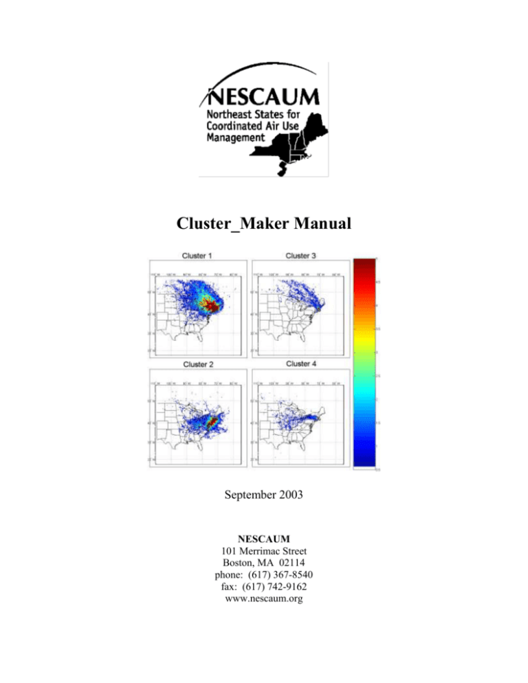
Cluster_Maker Manual September 2003 NESCAUM 101 Merrimac Street Boston, MA 02114 phone: (617) 367-8540 fax: (617) 742-9162 www.nescaum.org 1. Features - Clusters calculation : o Choice of the height (Level 1, 2 or 3) o Choice of the third parameter (Altitude or Pressure) o Radius (of proximity) o Number of hours (end points) to use for the calculation o Choice of the input directory (Browse) o Choice of the output directory (Browse) o Sort by site o Sort by time (number of trajectories per day) - Density o Choice the limits of the grid (Manual or Automatic) o Number of cell per degree for the grid - Progress Bar for each step of the calculation (reading …) - Output File o ClusterX_LevelY.txt All the coordinates of the central trajectory All the coordinates of the trajectories in the neighborhood o ClusterX_LevelY_FileName.txt Name of the file corresponding to the central trajectory Names of the files corresponding to the trajectories in the neighborhood o Report File Contents all the parameters of the application Number of File to read Number of valid trajectories Number of invalid Files Standard Deviation for the 3 coordinates Means of the 3 coordinates For each cluster : Name of the generated files Number of used trajectories Number of unused trajectories The means (using the coordinate used for the calculation) Density : Latitude and Longitude Min and Max Range (Automatic or Manual) Cell per degree o Invalid Files.txt Names of the invalid File o Density_ClusterX_LevelY.txt Contents the Density grid values 1 2. Setup window This window allows you to setup the calculation. Cluster Height : Starting level of the back trajectory 3rd Paramter : The third geographic coordinate Radius : Radius of proximity Number of Hours : Number of hours to used per back trajectory Trajectories : Directory where are the input files Clusters : Directory where will be write the output files WARNING : All the files and Folder in that directory will be erase File Information Site : Sort by site Starting Hour and 4/day or 8/day : Sort by hour If you choose Starting Hour = 02 and 4/day, only the files corresponding to the hours 02, 08, 14 and 20 will be read. If you choose Starting Hour = 01and 8day, only the files corresponding to the hours 01, 04, 07, 10, 13, 16, 19 and 22 will be read. Density 2 Number of cells per degree : each cell can be divided in several equal parts Auto Range : This feature will define the grid limits (Latitude Min and Max, Longitude Min and Max) automatically by reading the input files.. 3. Output Files a. ClusterX_LevelY.txt X represents the Cluster Number Y represents the stating level used for the back trajectories This file contains three columns of coordinates representing the back trajectories included in the cluster: ----Coordinates of the Central trajectory --------------------- Coordinates of the trajectories in the neighborhood of the central trajectory ------------First Column: Latitude Second Column: Longitude Third Column: Pressure or Altitude (3rd Parameter) b. ClusterX_LevelY_FileName.txt X represents the Cluster Number Y represents the stating level used for the back trajectories This file contains the File’s names corresponding to the trajectories included in the cluster: 3 brig02 07 06 10.dat brig02 12 26 11.dat brig02 12 16 20.dat brig02 12 15 11.dat brig02 12 01 08.dat brig02 11 28 11.dat brig02 11 23 17.dat brig02 11 23 14.dat brig02 11 23 08.dat brig02 11 17 05.dat brig02 10 29 20.dat brig02 09 12 22.dat brig02 09 12 19.dat … c. Name of the file corresponding to the central trajectory Name of the file corresponding to the trajectories in the neighborhood of the central trajectory Density_ClusterX_LevelY.txt X represents the Cluster Number Y represents the stating level used for the back trajectories This file contains the value related to each cell of the density grid. The first value of the file corresponds to the cell with the minimum longitude and latitude d. Invalid Files The file Invalid Files.txt contents the name of the files that can not be used for the calculation because there is not enough end points available. 4 e. Cluster_Maker_Report.txt Parameters : Input Output Level Third parameter Radius Number of hours Site Starting Hour Files Per Day C:\Data\bost C:\ProgramsC\Copy of Graphs\Altitude 2 Altitude 9.00 48 bost 00 All Reading : Number of files to read : 2780 Number of trajectories : 2329 Number of invalid files : 451 Treatment : Standard Deviation : ---------------------Latitude : 3.548404 ---------------------Longitude : 6.788110 ---------------------Altitude : 798.647195 Means : ---------------------Latitude : 43.068444 ---------------------Longitude : -75.711028 ---------------------Altitude : 916.283976 Cluster 1 : ---------------------Cluster1.txt ---------------------Cluster1_FileName.txt ---------------------891 trajectories in the neighborhood ---------------------1438 unsed trajectories ---------------------Means : 990.239697 Cluster 2 : ---------------------Cluster2.txt ---------------------Cluster2_FileName.txt ---------------------359 trajectories in the neighborhood ---------------------1079 unsed trajectories ---------------------Means : 935.211612 Cluster 3 : ---------------------Cluster3.txt ---------------------Cluster3_FileName.txt ---------------------335 trajectories in the neighborhood ---------------------744 unsed trajectories ---------------------Means : 1600.594563 Density : Latitude Min 17 Max 56 Longitude Min -133 Max -55 Range Auto Cell/Degree 4 Density Array : 156 x 312 This file contents the parameters and results of the calculation and is also use by the MATLAB Script. 5 4. MATLAB script Start Reading the report file Reading Cluster File X Plot cluster X Next Cluster (X+1) End At the beginning of the script, there are several parameters to set : Path = 'C:\ProgramsC\Copy of Graphs\Altitude'; Number_of_Cluster = 19; Range_Min = 0.5; Range_Max = 5; Map_Type = jet; 6
