16 Module 12 - Erosion and Sedimentation Controls
advertisement
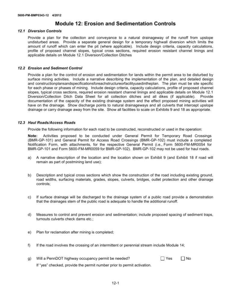
5600-PM-BMP0343-12 4/2012 Module 12: Erosion and Sedimentation Controls 12.1 Diversion Controls Provide a plan for the collection and conveyance to a natural drainageway of the runoff from upslope undisturbed areas. Provide a separate general design for a temporary highwall diversion which limits the amount of runoff which can enter the pit (where applicable). Include design criteria, capacity calculations, profile of proposed channel slopes, typical cross sections, required erosion resistant channel linings and applicable details on Module 12.1 Diversion/Collection Ditches 12.2 Erosion and Sediment Control Provide a plan for the control of erosion and sedimentation for lands within the permit area to be disturbed by surface mining activities. Include a narrative describing the implementation of the plan, and detailed design and constructionplansandspecificationsforeachstructureorfacilityusedintheplan. The plan must be site specific for each phase or phases of mining. Include design criteria, capacity calculations, profile of proposed channel slopes, typical cross sections, required erosion resistant channel linings and applicable details on Module 12.1 Diversion/Collection Ditch Data Sheet for all collection ditches and all dikes (if applicable). Provide documentation of the capacity of the existing drainage system and the effect proposed mining activities will have on the drainage. Show discharge points to natural drainageways and all culverts that intercept upslope drainage or carry drainage away from the site. Show all facilities to scale on Exhibits 9 and 18 as appropriate. 12.3 Haul Roads/Access Roads Provide the following information for each road to be constructed, reconstructed or used in the operation: Note: Activities proposed to be conducted under General Permit for Temporary Road Crossings (BMR-GP-101) and General Permit for Access Road Crossings (BMR-GP-102) must include a completed Notification Form, with attachments, for the respective General Permit (i.e., Form 5600-FM-MR0054 for BMR-GP-101 and Form 5600-FM-MR0059 for BMR-GP-102). BMR-GP-102 may not be used for haul roads. a) A narrative description of the location and the location shown on Exhibit 9 (and Exhibit 18 if road will remain as part of postmining land use); b) Description and typical cross sections which show the construction of the road including existing ground, road widths, surfacing materials, grades, slopes, culverts, bridges, outlet protection and other drainage controls; c) If surface drainage will be discharged to the drainage system of a public road provide a demonstration that the drainages stem of the public road is adequate to handle the additional runoff. d) Measures to control and prevent erosion and sedimentation; include proposed spacing of sediment traps, turnouts culverts check dams etc.; e) Plan for reclamation after mining is completed; f) If the road involves the crossing of an intermittent or perennial stream include Module 14; g) Will a PennDOT highway occupancy permit be needed? If “yes” checked, provide the permit number prior to permit activation. 12-1 Yes No 5600-PM-BMP0343-12 4/2012 MODULE 12.1 DIVERSION/COLLECTION DITCH DATA SHEET Type Ditch: Mine Operation Name: Company: Surface Mine Permit Number: Prepared by: Telephone Number: Date: Sheet of Channel Cross-Section Type: Station Start End Elevation Drainage Area Design Storm Average Watershed Slope acres (yrs.) (%) Curve Number Channel Lining Peak Discharge Q Channel Bed Slope Freeboard cfs (%) (ft) (specify average rock size) Manning’s Coefficient Channel Bottom Width Channel Side Slopes Flow Area Flow Depth (n) (ft.) L/R (sq.ft.) (ft.) Top Flow Width (ft) Flow Velocity Q Available (ft/sec.) cfs With Freeboard Top Channel Channel Q Depth Width Available (ft.) (ft.) Elevation Stations PROFILE 12-2 Vertical Scale 1” = ____ Horizontal Scale 1” = ____ Cfs
