Heron cruise report - Ocean Mapping Group
advertisement
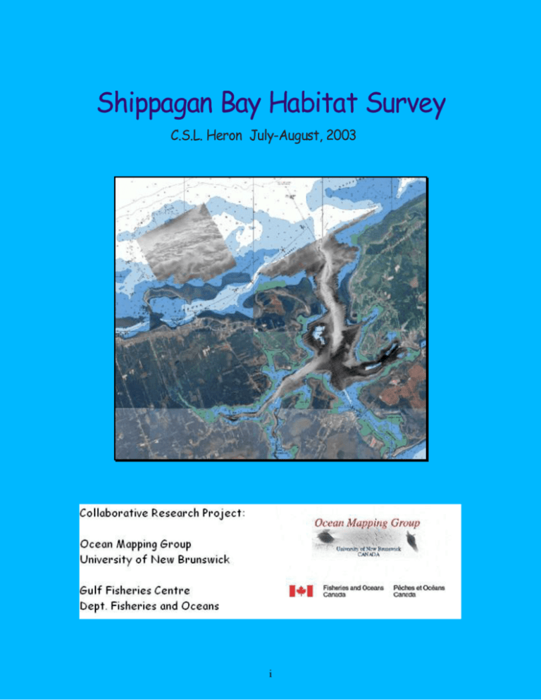
Shippagan Bay Habitat Survey C.S.L. Heron July-August, 2003 i Table of Contents Page 1 Survey Overview 1 1.1 Equipment 2 1.1.1 Echo-Sounders 2 1.1.2 Positioning Systems 3 1.1.3 Orientation Systems 5 1.1.4 Oceanographic Systems 6 1.2 Aims of Survey 8 1.3 Survey Extent 10 2 Data Acquisition 15 3 Data Processing 18 4 Final Products 20 ii List of Figures Page Fig. 1 The CSL Heron 1 Fig. 2 Keel Mounted Acoustic Survey Systems 2 Fig. 3 Airmar 0.5º x 50º 200 kHz Sidescan Staves 3 Fig. 4 C-Nav Positioning System 4 Fig. 5 Thalimedes Shaft Encoder with Integral Data Logger 4 Fig. 6 Coda Octopus F-180 GPS Antennas 5 Fig. 7 Seatex MRU-6 5 Fig. 8 AML SVP-16 6 Fig. 9 MVP-30 Winch and Probe installed on the Stern of the CSL Heron 7 Fig. 10 The ADCP Installed Using a Pole Mount 7 Fig. 11 CHS Chart of Area Surveyed 10 Fig. 12 CHS Chart of the Area Surveyed with the Sidescan Data collected 11 Fig. 13 CHS Chart of Shippagan Channel with the Sidescan Data Collected 12 Fig. 14 CHS Chart of Shippagan Channel with the Sidescan Data Collected 12 Fig. 15 CHS Chart of Saint-Simon Inlet, Saint Simon Bay North, and Saint Simon Bay South, with Sidescan Data Collected. 13 Fig. 16 Chart of Lameque Bay with Sidescan Data Collected 13 Fig. 17 Swathed Refraction Tool. 19 iii 1. Survey Overview The Ocean Mapping Group, University of New Brunswick, undertook a survey sponsored by the Gulf Fisheries Centre (GFC) , Department of Fisheries and Oceans (DFO) Moncton in the area of Shippagan New Brunswick. The survey ran from July 2nd to August 11th 2003 using the Ocean Mapping Group survey launch, CSL Heron. The CSL Heron is a 34 foot long, hydrographic survey launch. It is owned by the Canadian Hydrographic Service and is on loan to the Ocean Mapping Group for a period of ten years. Fig. 1. The CSL Heron The project was headed by John Hughes Clarke who also acted as a scientific advisor along with Marc Comeau of the Department of Fisheries and Oceans. The surveyors were Anya Duxfield and Beth-Anne Martin, with skippers Théophile Gionet, Serge Lemay and Alcide Degrace. 1 1.1 Equipment 1.1.1 Echo-Sounders Simrad EM3000S 300 kHz multibeam echo-sounder. The EM3000 has a swath of 65 degrees on either side of the vessel and can get depth information to an accuracy of approximately 10 centimetres. Knudsen 320 BP - 28 kHz CW and 3.5 kHz chirp single beam echo-sounders. These sonars acquire depth data directly underneath the vessel and are used to collect information on the subbottom Fig. 2. Keel Mounted Acoustic Survey Systems on the CSL Heron 2 Knudsen 320M sidescans –Two, 200 kHz keel-mounted staves mounted at 50 degrees on the keel of the CSL Heron. The sidescans collect data about the intensity of the signal that is reflected off the sea-floor. For the duration of the survey, these sidescans were each set to a range of 50 metres. Fig. 3. Airmar 0.5º x 50º 200 kHz Sidescan Staves Mounted on the Keel of the CSL Heron 1.1.2 Positioning Systems -C&C Technologies, C-Nav GPS positioning system. This uses a Real Time Gypsy (RTG) signal to provide a positioning accuracy of approximately 10 centimetres. 3 Fig. 4. C-Nav Positioning System http://www.cctechnol.com -Ott Hydrometry, Thalimedes Shaft Encoder with integral Data Logger, Tide Gauge. This tide gauge is installed inserting the device into a stilling well and allowing the float to rest on the surface of the water. The float is attached to a cord, which travels around the wheel at the top of the stilling well. The other end of the cord is fastened to a weight and hangs on the opposite side of the wheel. The motion of the wheel is recorded as the water level changes. The tides are derived from this motion. The data can be downloaded to a laptop using an infrared cable. Fig. 5. Thalimedes Shaft Encoder with Integral Data Logger http://www.ott-hydrometry.de 4 1.1.3 Orientation Systems - Coda Octopus F-180 roll, pitch, heave, and heading sensor. The F-180 uses two GPS antennas which are mounted on top of the boat, to measure roll, pitch, heave, heading and position. Fig. 6. Coda Octopus F-180 GPS Antennas, Installed on the CSL Heron. Seatex MRU-6 roll, pitch and heave sensor. This system uses solid-state sensors to measure the motion of the vessel. It also has a magnetic heading sensor. Fig. 7. Seatex MRU-6 http://www.seatex.no/pdf/mru6.pdf 5 1.1.4 Oceanographic Systems: Applied Microsystems Sound Velocity Profiler, AML SVP-16. The SVP-16 gathers values for the temperature and sound velocity of the water column, as it is manually lowered to the bottom. A profile of the water column can then be generated and sent to the EM3000 operator interface to correct for refraction in the multibeam data. Fig. 8. AML SVP-16 http://www.ashtead-technology.com Brooke Ocean Technology freefall Moving Vessel Profiler (MVP-30) with an AML 25 Hz sensor. The MVP measures the pressure, temperature and salinity of the water column. It is deployed using a freefall winch system which is programmed to recover the sensor when it reaches a specified height above the bottom. This system has been installed on the stern of the CSL Heron. 6 Fig. 9. MVP-30 Winch and Probe Installed on the Stern of the CSL Heron. RDI Monitor 600 kHz Acoustic Doppler Current Profiler (ADCP). The ADCP is used to measure the velocity of the water using four sensors which are located on the face of the instrument. It is installed by a pole mount on the port side of the CSL Heron. Fig. 10. ADCP Installed Using a Pole Mount on the Port Side of the CSL Heron 7 1.2 Aims of Survey The survey was conducted as part of a collaborative research project between the Gulf Fisheries Centre (GFC) , DFO Moncton and The Ocean Mapping Group at UNB. The GFC has a broad mandate to map fisheries habitat in the southern gulf region as part of DFO’s Oceans Act. This requires the delineation of seabed and water column habitats that are important for the fisheries and other marine species. To date GFC habitat mapping had been based primarily on regional historic bottom sampling surveys and reconnaissance oceanographic sections. The Ocean Mapping Group has been developing high-resolution acoustic mapping techniques for agencies such as the U.S. Geological Survey and the Canadian Hydrographic Service. Prior work has included Marine Protected Area mapping in support of DFO programs. The Shippagan Bay survey was designed as a test bed to assess the feasibility of these acoustic mapping techniques for habitat mapping. Shippagan Bay was chosen as it is the focus of a number of issues involving aquaculture, fish processing plant waste and an active inshore fishery (lobseter, crab, herring etc.). The methods employed here had a number of unique aspects that were tested: These acoustic swath mapping systems had not previously been deployed in such shallow and mesotidal conditions. Simultaneous ADCP measurements had not previously been attempted during swath mapping operations. The effectiveness of the swath mapping systems in the vicinity of shellfish aquaculture sites had not previously been assessed. 8 The main priority for this survey was to collect complete sidescan coverage of the entire Shippagan Bay. Once this was achieved the next priority was the area north of Caraquet Island to enable a comparison with DFO 's single beam sediment classification (QTCview) sidescan and video-tow data which was collected previously. Once the sidescan coverage was complete, the next task was to acquire as complete a multibeam coverage as was possible, given the time available and the water depths. The last priority, and an option when weather was bad, was to attempt 100% multibeam coverage in Saint-Simon Inlet. In parallel with this acoustic seabed mapping program simultaneous ADCP current information was collected to try and look at the circulation of the bay over the semidiurnal and diurnal tidal cycles. At the conclusion of the main mapping survey, based on the ADCP results, two 12.42 hour ADCP and MVP-30 (continuous underway CTD) sections were performed. Whilst not a primary requirement of this survey, continuos 3.5 kHz subbottom information was obtained for all regions of the bay allowing an assessment of the shallow geological structure. The final goal was to process all the data collected and produce images that could be distributed to all parties involved. This report discusses only the sidescan and multibeam data collection and processing. The ADCP, MVP-30 and subbottom data will be reported separately. 9 1.3 Survey Extent Fig.11. CHS Chart of Area Surveyed The survey consisted of an area of approximately 60 square kilometres and included Shippagan Bay, Lameque Bay, Saint-Simon Inlet, Shippagan Channel, Fisherman Channel and Caraquet Shoal. This region was surveyed utilising all of the on board sensors (sidescan, multibeam and single beam sonars and the ADCP). The survey lines for the majority of the survey area were at an 80 metre line spacing. 10 Fig. 12. CHS Chart of the Area Surveyed with the Sidescan Data Collected. Shippagan Channel and Shippagan Bay survey areas were completed with a 40 meter line spacing, for the EM3000 multibeam and the ADCP. This gave complete seafloor coverage in the deeper portion of Shippagan Channel. 11 Fig. 13. CHS Chart of Shippagan Channel with the Sidescan Data Collected. Fig. 14. CHS Chart of Shippagan Bay with the Sidescan Data Collected. Survey operations were extended from Saint-Simon Inlet into Saint-Simon Bay North and Saint-Simon Bay South using the multibeam and sidescan. In Saint-Simon Inlet and the dredged channel in Lameque Bay, complete (100%) seafloor coverage was achieved with the multibeam and sidescan. 12 Fig. 15. CHS Chart of Saint-Simon Inlet, Saint Simon Bay North, and Saint Simon Bay South, with Sidescan Data Collected. Fig. 16. CHS Chart of Lameque Bay with Sidescan Data Collected. 13 Transit data, which was collected on most days, extends from the coast guard base in Shippagan, to the mouth of Shippagan Channel. Two 12 to 13 hour oceanographic surveys were completed to gather data (water column velocity, salinity and temperature, and currents) over the diurnal tidal cycle in Shippagan Channel and in Lameque Bay. This data was collected using the MVP and the ADCP. 14 2 Data Acquisition During the 39 days of data acquisition, a detailed log sheet was kept with information about who was on board each day, what lines were surveyed, weather conditions, and any incidents which may have occurred. This log can be found in Appendix I. The following is a summary of some of the issues which may have affected the data quality or caused a delay in the survey. The stilling well and tide gauge were installed on July 2nd and 3rd. Sometime on July 4th, the float inside the stilling well became stuck. This was discovered on July 5th and fixed immediately, however no valid data was logged for most of July 4th and 5th. Profiles of each day's tide values can be found in Appendix II. All times are in GMT plus one hour. On Saturday, July 5th, the MVP was deployed to acquire a velocity profile to be applied to the multibeam bathymetry data. The probe was deployed in 10 metres of water and due to problems with the winch 50 to 100 metres of cable needed to be fed back in before the first acquisition deployment. The probe snagged on something and out and reeled was dragged to the bottom. It was fully recovered but the temperature pin was bent and had flooded the instrumentation. The probe was sent to AML in British Columbia for repairs and recalibration. On its return two weeks later, the probe was reinstalled, however it was established that there was damage or an internal break in the cable and therefore no communication with the probe. Technicians from Brooke Ocean Technology were sent from Halifax to repair the cable. They located the damaged area and removed 15 metres of cable. As they were reinstalling it, they knocked over the fish and the probe pin was 15 bent again. The probe had to be sent away for repairs. For most of the survey, the AML SVP-16 was used to acquire a velocity profile instead of the MVP. Due to limited disk space on board, some time was spent on July 12th and 15th zipping files. It wasn't until later that it was realized that while the computer is zipping a file, the sidescan data file becomes corrupted. On July 21st, five corrupted lines were resurveyed. On the morning of July 11th, after acquiring an SVP profile, the EM3000 operator interface stopped responding. The Simrad company was contacted and it was discovered that a corruption in the SVP profile caused the program to turn the echo-sounder off. Another profile was chosen from a previous day and the program returned to normal. On July 11th and 12th, the sidescan was mistakenly set on a 10 metre range instead of 50 metres. The evening of the 12th and early morning on the 13th were required to resurvey all of these lines at the proper range. On the evening of the 12th, the pins that keep the pole mount for the ADCP in place while it is in the water, were broken as the launch went over a patch of seaweed. A local metal shop was able to repair the damage and return the poles within a couple days. On July 14th, Alcide Degrace, the skipper at that time, called in sick. Later that day, it was discovered that he would be unable to work for the duration of the survey. Théo Gionet stepped in for the rest of that week, however due to commitments with the Coast Guard, he could not be there on July 17th, 18th, or 20th. No surveying was done on those days. Serge Lemay joined the team as the replacement skipper for Alcide the next week. 16 On July 27th the F180 orientation system began giving erroneous values for roll and position. The MRU-6 was used in the F180's stead for orientation and the C-Nav for position. A VTG and ZDA string from the C-Nav were fed to the MRU-6 to improve the heading accuracy. By July 30th, the F180 was functioning normally. It again became the primary orientation and positioning system for the survey. The ADCP's hydrodynamic casing came loose July 27th. The vibration of the casing caused invalid ADCP data for a few lines. Upon inspection, it was found that half the casing had been bent away from the instrument. The entire casing was removed and the ADCP functioned properly after that. The AML SVP-16 stopped working on August 2nd. It was thought that the batteries were probably dead. On August 3rd, while the batteries were being changed, the inner part of the probe slipped and the power connector wires were pulled away from their soldering points. For the last few days of the survey, profiles were selected from the previous days based on similar weather conditions and by checking visually the EM3000 Merlin acquisition systems across track beam and swath displays to ensure minimal refraction. The last four days of the project were surveyed by John Hughes Clarke, who was able to do two, 12 hour tidal cycles using the MVP and the ADCP. Some extra transit lines were also surveyed. While doing this in Lameque Bay, a mooring line was caught in the propeller. It was removed by diving under the water and cutting the rope. No lasting damage was done to the propellor or shaft. 17 3 Data Processing Processing of the data was done on a daily basis while in Shippagan. Ordinarily, the data from one day would be processed the next day by the person who had collected it. The cleaning and compiling of the data was done in Fredericton, after the survey was completed. The processing manual can be found in Appendix III and the log of the cleaning and compiling can be found in Appendix IV. The following is a summary of some of the issues arising in the processing of the data. The tide data was successfully downloaded from the tide gauge. The tide gauge data was gathered with time values in GMT plus one hour. The multibeam survey data is gathered in GMT, the tide data was modified to be in GMT time and applied to the multibeam data. The problem with the F180 orientation system from July 27th to 30th, caused some issues in processing. The unravel program was not coded, so as to enable a reapplication of the second orientation file (the MRU-6 system) to the bathymetric data. The F180 is the first orientation file and in the code was hard wired as the selected orientation file. Jonathan Beaudoin (OMG/UNB) was able to modify the unravel code to allow the second orientation file to be included and applied in the unravelling. In gridding the data, it was found that there were several large circles on the map sheet that were a result of stray beams from the EM3000. The circles tended to be quite far away from where the sonar actually was when the signal was transmitted. To get rid of the circles, a filter was run to eliminate soundings that were deeper than 25 metres, 18 shallower than 0.5 metres, and had a larger range than 60 metres. This successfully eliminated all of the circles on the map sheets. A velocity profile was collected and applied daily to the bathymetric data, thereby eliminating most refraction issues. However, on July 27th, no valid profile was able to be collected using the SVP-16. These lines had a significant amount of refraction associated with them. The swathed program used to edit the data, has a refraction tool which enabled the refracted data to be modified so that the refraction did not show on the map sheet. Fig. 17. Swathed Refraction Tool. 19 4 Final Products The Shippagan survey concluded with the production of large maps which were distributed to all those involved in the project. Bathymetric and sidescan maps were compiled for the entire area as well as the smaller areas of Saint-Simon inlet, Lameque Bay, Shippagan Bay, Shippagan Channel, and the region of Carquet Shoal and Fisherman Channel. Each map contains a CHS chart, Service New Brunswick stencilled aerial photographs, and the data collected during the survey. Contours are superimposed on each map and are set to an interval of 5 metres. A grid can be located on the outer edge of the image and has an interval of one minute. The sidescan maps are plots of the intensity of the signal reflected off the seafloor and received by the sidescan. The more intense signals are represented by lighter greyscale colours while the weaker signals are represented by dark greyscale colours. The sea-floor area where the image is lighter may be composed of rocks or other dense materials. A darker region could be a substance such as mud. A variety of greyscale colours tend to be in the shallow areas. This is thought to be eel grass at close range to the sidescans. A feature on the sea-floor is shown as a lighter colour with a dark “shadow” behind it with respect to the direction the vessel was travelling. A depression is shown as a dark colour with a lighter region behind it. The bathymetric maps display a color coded image showing the depth below the chart datum. The colour bar can be used to identify what depth value is associated with each range of colour. 20 As well as the bathymetric and sidescan maps, other aspects of the survey were presented. Subbottom fence diagrams, ADCP time series plots and MVP profiles were compiled and distributed. 21 References C&C Technologies. Copyright 1993-2003. Available : http://www.cctechnol.com [August 21, 2003] OTT-Hydrometrie. Copyright 2003. Available: http://www.ott-hydrometry.de [August 26, 2003] Seatex. Copyright 2002. Available http://www.seatex.no/pdf/mru6.pdf [August 21, 2003] Ashtead Technology. Copyright 2003 Available http://www.ashtead-technology.com [August 22, 2003] 22


