DYNAMIC EARTH STATION PACKET Braille Pages 1
advertisement
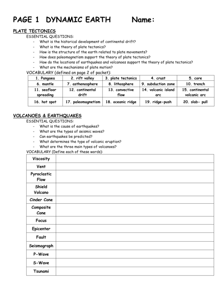
PAGE 1 DYNAMIC EARTH Name: PLATE TECTONICS ESSENTIAL QUESTIONS: - What is the historical development of continental drift? - What is the theory of plate tectonics? - How is the structure of the earth related to plate movements? - How does paleomagnetism support the theory of plate tectonics? - How do the locations of earthquakes and volcanoes support the theory of plate tectonics? - What are the mechanisms of plate motion? VOCABULARY (defined on page 2 of packet): 1. Pangaea 2. rift valley 3. plate tectonics 4. crust 5. core 6. mantle 7. asthenosphere 8. lithosphere 9. subduction zone 10. trench 11. seafloor spreading 12. continental drift 13. convective flow 14. volcanic island arc 15. continental volcanic arc 16. hot spot 17. paleomagnetism 18. oceanic ridge 19. ridge-push 20. slab- pull VOLCANOES & EARTHQUAKES ESSENTIAL QUESTIONS: - What is the cause of earthquakes? - What are the types of seismic waves? - Can earthquakes be predicted? - What determines the type of volcanic eruption? - What are the three main types of volcanoes? VOCABULARY (Define each of these words): Viscosity Vent Pyroclastic Flow Shield Volcano Cinder Cone Composite Cone Focus Epicenter Fault Seismograph P-Wave S-Wave Tsunami PAGE 2 “PLATE TECTONICS” VOCABULARY Inner core Outer core Mantle Crust Lithosphere Asthenosphere Tectonic plate Continental drift Pangaea Mid-ocean ridge Convection Convection current Theory of plate tectonics Divergent boundary Rift valley Magnetic reversal Hot spot Convergent boundary Subduction Continental-continental collision Oceanic-oceanic subduction Oceanic-continental subduction Transform boundary WHO AM I? Write the vocabulary word on the line that best matches each clue. 1. I’m an area of volcanic activity that develops above rising plumes of magma. 2. I’m the huge underwater mountain ranges that are present in every ocean and circle Earth. 3. I’m one plate sinking beneath another. 4. I occur where two plates move past each other in opposite directions. 5. I state that Earth’s lithosphere is broken into huge, moving slabs of rock driven by motions in the mantle. 6. I’m the name that Alfred Wegener gave to the huge supercontinent that he proposed had once existed. 7. I’m the place where older crust is destroyed because two plates converge, or push together. 8. I’m the hypothesis that proposed that Earth’s continents were once joined in a single landmass and then gradually moved apart. 9. I’m the layer of hotter, softer rock in the upper mantle. 10. I’m a plate with oceanic crust sinking under a plate with continental crust. 11. I’m the layer of liquid metals that surrounds the inner core. 12. I’m the motion created when heated material continually rises, cools, and sinks. 13. I’m the thin layer of rock that surrounds Earth. 14. I’m the gap that forms as tectonic plates move apart. 15. I occur where plates with continental crust push together. 16. I’m a ball of hot, solid metals at Earth’s center. 17. I’m the transfer of heat within a material. 18. I’m the large and small slabs of rock that make up pieces of the lithosphere. 19. I’m Earth’s crust and the very top of the mantle combined. 20. I’m a plate with oceanic crust sinking under another plate with oceanic crust. 21. I’m the switch in direction of Earth’s magnetic north and south poles. 22. I’m Earth’s thickest layer, measuring nearly 2900 kilometers. 23. I occur where tectonic plates move apart. PAGE 3 STRUCTURE OF THE EARTH Outline the layers of the earth, including details/characteristics of each. One characteristic MUST be its physical state: solid / liquid / semi-solid / semi-liquid. EXPLAIN THE CORRELATION BETWEEN OOBLECK AND THE EARTH’S ASTHENOSPHERE WRITE A CREATIVE STORY ABOUT YOUR “TRIP” TO THE CENTER OF THE EARTH. CREATIVELY INCLUDE AT LEAST 2 CHARACTERISTICS OF EACH LAYER. PAGE 4 BRAIN POP - Earth’s Structure Quiz http://brainpop.com 1. What are Earth’s three basic layers? a. Core, mantle, and surface b. Core, mantle, and crust c. Center, middle, and top 2. What is the main component of the earth’s inner core? a. granite b. nickel c. iron 3. How have scientists learned about the composition of the Earth? a. by digging very deep holes b. by studying earthquakes c. by taking samples of the surface 4. Where is the earth’s crust the thickest? a. in the oceans b. on the continents c. at the North Pole 5. What is the earth’s crust made of? a. rock b. water c. molten metal 6. Which of the following statements is true? a. the upper layer of the mantle is partially molten b. the lower layer of the mantle is partially molten c. the Earth’s mantle extends 2,000 meters deep 7. How deep would you have to drill to reach the center of the earth? a. about 80,000 kilometers b. about 600 kilometers c. about 6,000 kilometers 8. Which layer of the earth is liquid metal? a. the crust b. the outer core c. the inner core 9. Which layer of the earth allows the tectonic plates to move around above it? a. the mantle b. the outer core c. the crust 10. What effect does the spinning of the earth’s core have? a. it creates gravity b. it creates the earth’s magnetic field c. it allows spaceships to navigate Page 4 Continued BRAIN POP - Plate Tectonics Quiz http://brainpop.com 1. What is Pangaea? a. one of the earth’s tectonic plates b. a super-continent that existed 300 million years ago c. another name of Antarctica. 6. Which type of plate boundary involves two plates moving apart? a. divergent boundary b. transform boundary c. subversive boundary 2. What is plate tectonics? a. theory about the movement of the continents b. a theory about the origin of the earth c. a new way to wash dishes 7. Which type of plate boundary involves two plates sliding alongside one another? a. convergent boundary b. subsiding boundary c. transform boundary 3. What kind of plates are involved in the plate tectonics theory? a. thick slabs of snow that accumulate on mountains b. thick, shifting slabs of the earth’s crust c. thick slabs of water that cover the entire earth 4. How much does the average continent move each year? a. several hundred kilometers b. a few hundred meters c. several centimeters 5. Which type of plate boundary involves two plates moving toward one another? a. convergent boundary b. divergent boundary c. transform boundary 8. What process can explain why we see fossils of the same prehistoric animals on different continents? a. hotspot formation b. continental evolution c. continental drift 9. What is another major piece of evidence that supports the theory of plate tectonics? a. South America and Africa appear to fit together, like puzzle b. you can feel the continents move under your feet c. there is no evidence; plate tectonics is “just a theory” 10. What can be found directly under the plates of the earth’s crust? a. mostly water b. a soft mantle c. mostly granite PAGE 5 PANGAEA AND CONTINENTAL DRIFT Continental Drift = What scientist came up with this theory? Did most people believe him? His Evidence for Continental Drift: List 1 2 3 4 Why was his hypothesis rejected? Describe PAGE 6 NAME ______________________________________ Types of Plate Boundaries In the main boxes, describe what happens at each region, and include the landforms that occur at each (and why they form). In the smaller boxes, answer the questions. Earth’s Three Layers Significance: Two types of Crust Significance: Convergent Oceanic-Oceanic Example(s) on Earth: Convergent Boundary What’s happening? Divergent Boundary What’s happening? Convergent Oceanic-Continental Example(s) on Earth: Transform Boundary What’s happening? Convergent Continental-Continental Example(s) on Earth: How does energy/convection impact this boundary? Divergent Oceanic-Oceanic Example(s) on Earth: How does energy/convection impact this boundary? Divergent Continental-Continental Example(s) on Earth: Transform Example(s) on Earth: How does energy/convection impact this boundary? PAGE 7 ANSWER QUESTIONS 1-5 ON PAGE 255 OF YOUR TEXTBOOK. 1. 2. 3. 4. 5. SKIP THIS DIAGRAM. Label the plates in the boxes. Eurasian (2 places) Australian-Indian (2 places) North American South American Arabian Nazca DESCRIPTION OF CANDY BAR ACTIVITY African Philippine Antarctic Pacific Juan DeFuca The candy bar’s ____ is like the Earth’s ____ because _______________. PAGE 8 PLATE TECTONICS THIS PAGE IS NOTES. Plates move _______________ when the convection below them circulates apart. This is called a _______________ boundary. Plates move _______________ when the convection below them circulates together. This is called a _______________ boundary. ________________ is the cycling of heat. Does this happen in the lithosphere or asthenosphere? ________________________ Are plates made of lithosphere or asthenosphere? ________________________ What is the lithosphere made of? _______________________________________ COMPARE & CONTRAST Continental drift When was the theory created? Who created it? What does it say? Overall… Plate tectonics PAGE 9 EVIDENCE FOR PLATE TECTONICS – THIS IS NOTES PALEOMAGNETISM & CRUST AGE RING OF FIRE: EARTHQUAKES & VOLCANOES HOT SPOTS SLAB PULL RIDGE PUSH MANTLE CONVECTION THE CAUSE OF THE PLATE MOTION ABOVE IS: PAGE 10 Convection Lab Background Information: The term rheoscopic is the combination of two Greek words - rheo meaning to flow, and scope meaning to watch or see. Rheoscopic, therefore, means to be able to watch or see something flowing. Rheoscopic fluid is a unique and dynamic substance with the ability to produce striking visual images of currents taking place within a liquid. PreLab Questions: 1. Define convection: 2. What is under Earth's crust? 3. What is the inside of Earth like? Objective: to demonstrate convective flow within the mantle using rheoscopic fluid. Materials: Beaker (400mL) Rheoscopic Fluid Hot Plate Goggles Procedure: 1. 2. 3. 4. Obtain rheoscopic fluid and pour approximately 200 mL of the fluid into the beaker. Place beaker on a hot plate and heat slowly on low heat. Do not overheat! Make observations (wearing goggles) of the rheoscopic fluid as it is being heated. Using hot pads, remove the beaker from the hot plate. Observations: Draw a picture of your observations of the fluid Hot Pads PAGE 10 CONTINUED Analysis Questions: 1. In comparison to Earth’s structure, what do the following represent? a. Hot plate: ____________________ b. Rheoscopic fluid: _____________________ 2. What could you have added to the model to represent lithospheric plates? 3. Describe convection as it relates to the rheoscopic fluid. 4. Explain in your own words how this model demonstrates convective flow of the mantle. 5. Label the layers of Earth on the picture below. Draw arrows in the mantle to represent how convection causes plate movement. Volcano Explorer http://dsc.discovery.com/convergence/pompeii/interactive/interactive.html Global Perspective The Ring of Fire is one of the Earth’s most __________________________________. Volcanoes, as well as many _____________________ occur here. It runs around the __________________ Ocean. VOLCANO TYPES: describe each type of volcano and give examples on earth. SHIELD VOLCANO CINDER CONE VOLCANO STRATOVOLCANO Inside a Volcano Define the following parts of a volcano. Magma Chamber Central Vent Crater Fissure Build your own volcano Two factors affect the size of the volcano and strength of the eruption: (1) ________________ = resistance to flow, or “_________________” of the magma. (2) ___________________________ (3) ___________________________ (the more silica, the higher the viscosity!!) **Generally, stronger eruptions are caused by _____ viscosity, _____ gas, & _____ silica. For each setup, tell what is created: ( V = viscosity G = gas ) Setup Volcano Type V low G low V low G high V med-lo G low V med-lo G high V med-hi G low V med-hi G high V high V high G low G high Description of Eruption LITHOSPHERIC PLATE ACTIVITY EARTH-ENVIRONMENTAL NAME_______________________________ DATE_________________ PERIOD______ Follow all instructions from beginning to end. Then, answer the questions. BE NEAT! If I can’t read it, I can’t grade it, and you get a ZERO! Latitude 50°N 45°N 20°N 10°N 20°N 40°N 15°N 45°N 5°S 55°N Longitude 170°W 120°W 100°W 85°W 155°W 15°E 120°E 145°E 120°E 165°E Earthquakes (use a BLUE dot) Volcanoes (use a RED dot) 1. Use a RED dot to represent Volcanoes and BLUE dot to represent Earthquakes. Plot the data below on your labeled map of the lithospheric plates. Latitude 60°N 60°N 20°N 35°S 25°S 20°S 35°N 50°N 35°N 20°S Longitude 150°W 135°W 70°W 70°W 75°W 45°E 15°E 160°E 142°E 45°E 2. Mountain Ranges: a. Symbol: use a series of ^^^^^^^ symbols & label it with the name. b. Where to look: Book p.744-745 & Class Maps Andes Himalayas Rocky Alps Appalachian Sierra Madre 3. Ocean Ridges & Trenches: a. Symbol: use a highlighter & label it with the name. b. Where to look: Book p.396-397 & Class Maps Aleutian Trench Mid-Atlantic Ridge Mariana Trench Peru-Chile Trench 4. Tectonic Plates: a. Symbol: use the name only. b. Where to look: Book p.256-257 Pacific (2 plates) South American Eurasian African North American Nazca Indo-Australian Antarctic 5. Color each of the plates VERY LIGHTLY using a different color. You need to color lightly so that you can still see your writing through the coloring. INSTRUCTIONS: *Answer the following questions IN FULL SENTENCES. *Use your Chapter 9 of your book for help. A) What relationship exists between the location of earthquakes and the location of volcanoes? B) What plate matches (almost perfectly) with the Ring of Fire, where most of the world’s earthquakes and volcanoes occur? C) What can be found near the point at (20°N, 133°W)? ________________________________________ D) From this information, what can you infer about some volcanoes?? E) Where do most earthquakes and volcanoes occur in relation to the plate boundaries? Explain why. F) Explain why the Himalaya Mountains formed (consider the location of these mountains, relative to the plate boundaries). G) Explain how the Peru-Chile Trench formed (consider the location of this trench, relative to the plate boundaries). H) On which plate is most of the United States? _______________________________________________ I) What part of the United States is NOT on this plate? _________________________________________ J) What plate is this part of the United States on? ______________________________________________ K) What geologic feature is found at this plate boundary? _______________________________________ Name_________________________________ Date _______ Period __ VOLCANO & POMPEII VIDEOS © Discovery Education & http://dsc.discovery.com/convergence/pompeii/pompeii.html As we view these short videos, answer the questions. Listen carefully!!! The answers go quickly!!! UNDERWATER VOLCANOES 1) 80% of volcanic activity is _______________________________________________. 2) Can we detect underwater volcanoes from the surface? Explain why/why not. PLATE TECTONICS 3) Why are volcanoes called “Earth’s cooling vents”?? 4) A Volcano REALLY is _____________________________________________. 5) Draw and label the Earth’s layers: 6) How do the plates move? 7) _____________________________________ is when one plate slides against another. 8) _____________________________________ is when one plate moves under another. KILAUEA – A VOLCANO LAB 9) Kilauea is the world’s ____________________________________________. 10) It has been erupting NONSTOP since _________ 11) What is the “bench”?? 12) What is tephra? MOUNT SAINT HELENS 13) Mount Saint Helens is ______________times more powerful than ___________________ 14) How many people died when it erupted? 15) What is the deadliest kind of eruption? PINATUBO 16) In what month & year did Mount Pinatubo erupt? 17) Where is Mount Pinatubo? 18) How many people died when it erupted? 19) Why is it good that Pinatubo erupted exactly when it was predicted to? ASH – A VOLCANO’S LEGACY 20) What is in volcanic ash? 21) What happens when a plane flies through ash? Pompeii – a Volcanic Mystery 22) Were the bodies damaged during the eruption? YES / NO Uncovering the site at Pompeii 23) When and how was the lost city of Pompeii discovered? 24) In what year did excavation begin? 25) Why was it so easy to dig in Pompeii? Pompeii – Examining the Skeletons 26) Describe how the bodies were able to be cast so easily. 27) Using MRIs, scientists found ________________________________in the skulls. 28) The MRIs proved that the people of Pompeii _____________________________. 29) Who was Pliny the Younger? 30) Where was Pliny when Vesuvius erupted? 31) Pliny described the volcanic cloud as being _____________ kilometers high. Vesuvius – AD 79 Eruption 32) Why couldn’t lava get out of Mount Vesuvius before AD 79? 33) Why was the explosion so big? 34) Why did they survive the initial ashy downpour? 35) To protect their heads, the people of Pompeii used _____________________. Pompeii’s Last Breath 36) By the end of the eruption, the pumice that covered Pompeii was __________ deep. 37) The deeper the body in the pumice, the ________________ that person died. 38) The people of Pompeii died by ______________________________. TYPE OF FAULT DIAGRAM STRESS WHAT HAPPENED? COMPRESSION TENSION SHEARING COMPRESSION TENSION SHEARING COMPRESSION TENSION SHEARING COMPRESSION TENSION SHEARING Please open up your textbook to section 8.2 and answer the following questions concerning earthquakes. 1. Describe the difference between P waves and S waves in terms of their rate of travel and how they move. 2. How many recording stations are needed to locate the epicenter of an earthquake? Explain why that many stations are needed. 3. Why is the Richter scale no longer used by scientists? Explain the advantages of using the Moment Magnitude scale. 4. Looking at table 1 on page 227, describe the relationship between the number of earthquakes per year and the magnitude of the earthquakes. QUICK LAB: MEASURING THE DISTANCE TO EPICENTERS INSTRUCTIONS: Use the figures to answer questions below. Make sure to USE ONLY THE BOTTOM SCALE ON THE X-AXIS (measured in kilometers). Figure 8 Analyze and Conclude 1. What is the difference in arrival times in minutes between the first P wave and first S wave for stations that are the following distances from an epicenter: 1000km, 2000km, 2400km, 3000km? 2. How does the difference in arrival times of the first P wave and fist S wave on a seismogram change? How does it change if the station is farther from the epicenter? 3. How do you think the vibrations recorded on a seismogram would change as the distance to the epicenter increases? Name__________________________ Date_______________ Period______ Laboratory Investigation: Locating an Epicenter © Prentice-Hall, Inc. 1995 Laboratory Manual BACKGROUND INFORMATION Whenever an earthquake occurs, shock waves spread out in all directions. Some of these waves cause rock particles to vibrate from side to side as they pass through the rock. Other types of waves cause rock particles to vibrate forward and backward. Different types of earthquake waves travel through rocky material at different speeds. The earthquake shock waves that travel fastest are known as P, or primary, waves. P waves are also sometimes called push-pull waves. Certain slower waves are referred to as S, or secondary, waves. S waves, also known as shear waves, are the types that cause rock particles to vibrate from side to side. S waves reach locations distant from the earthquake’s point of origin somewhat later than P waves. The underground point of origin is called the earthquake’s focus. The point on the land surface directly above the focus is known as the epicenter. To detect earthquake shock waves, geologists use a very sensitive instrument called a seismograph. It can detect even the weakest of shock waves. From the information recorded by a seismograph, scientists are able to determine the exact arrival times of both P and S waves. Since P waves travel faster than S waves, you have probably realized that you can determine how far away you are from the earthquake’s epicenter if you know the difference in the arrival time of the two types of waves. And that is exactly how seismologists determine the distance to an earthquake’s epicenter, even when it is thousands of kilometers away. When similar information from stations in different locations is compared, the precise location of the epicenter can be determined. PROBLEM: How can an earthquake’s epicenter be located? MATERIALS (per student) Drawing compass with pencil (be sure it has a sharp point!!) The accompanying graph The accompanying map of the United States PROCEDURE 1. Carefully observe Figure 1, which shows a comparison of the difference in arrival time between P and S waves and distance to the epicenter of an earthquake. Note that the two quantities are directly related; that is, the greater the difference in arrival time, the greater the distance to the epicenter. 2. Before going further in this investigation, you will need to become familiar with the graph. Use the graph to answer questions 1 through 4 in Observations. 3. Now that you know how to read the graph, see if you can put it to use. Assume that an earthquake has occurred and that the times of arrival of the P and S waves from it have been detected and recorded by seismographs located at the three cities listed in the Data Table. Note that the difference in P and S wave arrival times has been included in the table. NOTE: for steps 4-8, be as precise as possible – it will make this lab much easier!!! 4. 5. 6. 7. 8. Using Figure 1, determine each city’s distance from the epicenter. Enter your figures in the DataTable. Use the map scale to set your compass at a radius equal to the distance from Denver to the epicenter. On the map in Figure 2, draw a circle with the radius determined in step 5, using Denver as the center. Repeat steps 5 and 6 for Houston and Miami. If you have worked carefully, the three circles should intersect at one point. This point marks the epicenter of the earthquake. Draw a point at the epicenter, circle it, and label it epicenter. OBSERVATIONS 1. If the difference in arrival time for P and S waves at a certain location is 3 min, how far from that station is the epicenter? A. 430 km B. 1400 km C. 1800 km D. 2100 km 2. If a seismograph shows that a P wave arrives 7 min 20 sec before an S wave, how far is it to the earthquake’s epicenter? ____________________________________ 3. If a recording station is known to be 4600 km from an earthquake epicenter, what is the difference in arrival time between the P and S waves from that earthquake? __________________________ 4. If a seismograph is located 2200 km from an earthquake epicenter, how great will be the difference in arrival time between the P and S waves at this station? __________________________ Denver, Colorado DATA TABLE 1 Difference in P and S Wave Arrival Time 2 min 25 sec Houston, Texas 4 min 10 sec Miami, Florida 5 min 40 sec City Distance (km) ANALYSIS AND CONCLUSIONS 1. a. Which city on the map is closest to the earthquake epicenter? ______________________________ b. How far, in km, is this city from the epicenter? ____________________________ 2. Which of the three cities listed in the Data Table would feel the earthquake… First? _____________________ Second? _____________________ Third? ___________________ 3. Why was it necessary to know the distance from the epicenter for at least three recording stations to be able to locate the epicenter? _______________________________________________________ _________________________________________________________________________________ 4. If the epicenter of this earthquake were located in San Francisco, how much earlier than the S wave would the P wave arrive for an observer in New York City? ________________________________ 5. As the distance between an observer and an earthquake decreases, the difference in arrival times of P and S waves A. decreases, B. increases, C. remains the same. CRITICAL THINKING AND APPLICATION 1. What can happen to the Earth’s surface when the vibrations from an earthquake travel through the crust?____________________________________________________________________________ _________________________________________________________________________________ _________________________________________________________________________________ 2. What relationship do you think exists between the amount of energy an earthquake contains and the amount of damage it will do? ________________________________________________________ _________________________________________________________________________________ _________________________________________________________________________________ 3. Is it possible for seismologists to know for sure that an earthquake or volcanic eruption will not occur in a particular area? Explain your answer. ______________________________________________ _________________________________________________________________________________ _________________________________________________________________________________ Golden River Topographic Map 1. What is the contour interval of the map? _______________________________________________________ How did you determine this? _________________________________________________________________ _________________________________________________________________________________________ 2. Which side of the Golden River is steeper? Eastern or Western How do you know this? _____________________________________________________________________ 3. How many hilltops are on the map? _____________ How is a hilltop represented? ________________________________________________________________ 4. Give an estimate of the elevation at each point. Be as exact as possible. A ____________ C ____________ E ____________ G ____________ B ____________ D ____________ F ____________ H ____________ 5. Which direction do the following streams flow? Golden River: North or South Silver Creek: East or West Don’t Know Creek: East or West How do you know this? ___________________________________________________________ 6. What is the elevation of the swamp? _________________ 7. What is the elevation of the mine? ___________________ 8. What is the elevation of the school? __________________ 9. Compare the church and school in terms of their elevation _________________________________________ _________________________________________________________________________________________ 10. Where would you build an airport? Explain. _____________________________________________________ _________________________________________________________________________________________ Callister Quadrangle Topo Map Exercise Thanks to NY Earth Science Education Legend Jeff Callister http://geoscience.stevekluge.com/regentses/labs/callisterquad.pdf 1. What is the contour interval on this map? 2. What is the highest contour line on the map? 3. What is the highest possible elevation on the map? 4. What do the hatch marks on Vails Gate Mountain represent? 5. Give the approximate elevation of the following points: a. Abel Pond ______________________ b. Coren Swamp ______________________ c. Denman Orchard ______________________ d. Callister City Church ______________________ e. Highway 84 ______________________ 6. Towards what direction does Newburgh River flow? 7. What area is the steepest on the map? 8. What area is most similar to a plain? 9. How far is it from Callister School to the peak of Temple Hill, in miles? 10. What are the latitude and longitude coordinates of where Route 84 crosses Newburgh River? 11. What is the gradient along Newburgh River on this map? =========================================================================== Now do the following: 1. Neatly label the elevation of all contour lines (notice that some lines are already labeled). 2. LIGHTLY shade in all water areas blue. (Hint: rivers, creek, lake, pond, and stream) 3. LIGHTLY shade in all elevations as follows… less than 100ft = yellow 100ft – 200ft = orange 200ft – 300ft = red 300ft or more = brown =========================================================================== NAME: ___________________________________________ Earth-Environmental Science DYNAMIC EARTH REVIEW Chapters 8, 9, 10, 11 Key Terms Earthquake Focus Epicenter Fault Elastic rebound hypothesis Aftershock Foreshock Liquefaction Tsunami Concept Map Crust Mantle Lithosphere Asthenosphere Inner core Outer core Continental drift Pangaea Plate tectonics Divergent boundary Convergent boundary Transform boundary Ocean ridge Rift valley Subduction Trench Volcanic island arc Continental volcanic arc Paleomagnetism Convection currents Viscosity Vent Pyroclastic flow Volcano Shield volcano Cinder cone Stratovolcano Deformation Stress Normal fault Reverse fault Thrust fault Strike-slip fault Compressonal stress Tensional stress Shearing stress 1. What is continental drift AND who developed a scientific argument for continental drift? 2. What 4 scientific observations did Alfred Wegener use to support his continental drift hypothesis? 3. How do scientists explain the existence of fossils of the same plants and animals on continents thousands of kilometers away? 4. What is the theory of plate tectonics? How does it relate to continental drift? 5. Why were scientists able to locate the mid-ocean ridge by looking for areas with a lot of earthquakes? 6. The pattern of stripes on the ocean floor is identical on both side of a mid ocean ridge. How are these matching stripes evidence of ocean-floor spreading? What is this called? 7. Identify and describe the mechanism of plate motion. 8. What two layers of the Earth are considered to make up the lithosphere? What is an important characteristic of the lithosphere? 9. Identify and describe the 3 different types of plate boundaries PLATE BOUNDARY WHAT HAPPENS AT THIS BOUNDARY? Convergent 10. Identify and describe the 3 different kinds of plate collisions PLATE COLLISION WHAT HAPPENS (land forms, islands, Subduction, trench etc.)? Oceanic-Oceanic 11. Identify and describe the 4 types of faults and the stresses associated with each TYPE of FAULT STRESS WHAT HAPPENS? 12. What evidence supports the idea that the production and destruction of the lithosphere must be going on at about the same rate? 13. Earthquakes and volcanoes often occur at ____________________ boundaries. 14. What is an earthquake? And at what type of plate boundary do most earthquakes occur? 15. Which is a stronger, more dangerous earthquake: (circle your answer) 2.3 on the Richter scale -OR- 7.3 on the Richter scale How many times greater is the largest earthquake from the smallest? _______________ 16. What are some of the hazards of Earthquakes in the ocean and on land? What are some measures we can take to protect people from the destruction associated with an earthquake? 17. Identify and label the volcano’s parts: 18. What is the ring of fire? Where is it? 19. Name the 3 types of volcanoes: - Largest - usually rise from the ocean floor______________________________________ -Tall & steep - that are often very dangerous ____________________________________ -Short & cylindrical - grow slowly from cooling lava _____________________________ 20. What is a Pyroclastic flow? 21. How hot is a Pyroclastic flow? ________________ How fast does it move? ____________ 22. Explain why volcanoes are known as the Earth’s cooling vents. 23. Name the volcano… a. In Hawaii that has been erupting nonstop since 1983. ________________________________ b. In the Philippines that killed 900 people in 1991. ___________________________________ c. In Washington State that’s the biggest in the Continental USA. . ________________________ d. In Italy that destroyed the cities of Pompeii, Herculaneum, and Stabiae.___________________ 24. What type of volcano is… a. Vesuvius?________________________________ b. Kilauea? _________________________________ c. Mt. Saint Helens? __________________________ 25. What is the difference between a focus and an epicenter? 26. How can triangulation be used to find the focus of an earthquake? 27. What 3 factors determine the type of volcanic eruption? 1- 2- 3- 28. Large volcanic eruptions eject large amounts of gas, dust and ash into the atmosphere. This volcanic material can affect the world climate by blocking incoming solar radiation. An eruption from what type of volcano is most likely to cause global climate changes? EXPLAIN YOUR ANSWER! CONVECTION CURRENTS LAB/DEMO VOLCANO EXPLORER ACTIVITY VOLCANO & POMPEI VIDEO QUESTIONS LITHOSPHERIC PLATE PUZZLE LABORATORY FAULTS & EARTHQUAKE QUESTIONS EARTHQUAKE EPICENTER ACTIVITY BRAIN POP VIDEOS – EARTH’S STRUCTURE & PLATE TECTONICS TOPOGRAPHIC MAPS – GOLDEN RIVER TOPOGRAPHIC MAP TOPOGRAPHIC MAPS – CALLISTER QUADRANGLE Boundaries Practice BOUNDARIES: Convergent Divergent Transform oceanic-oceanic oceanic-continental continental-continental oceanic continental FEATURES/VOCABULARY: subduction mountains volcano trench fault line lithosphere asthenosphere convection

