Schedule of Events - Salem State University
advertisement
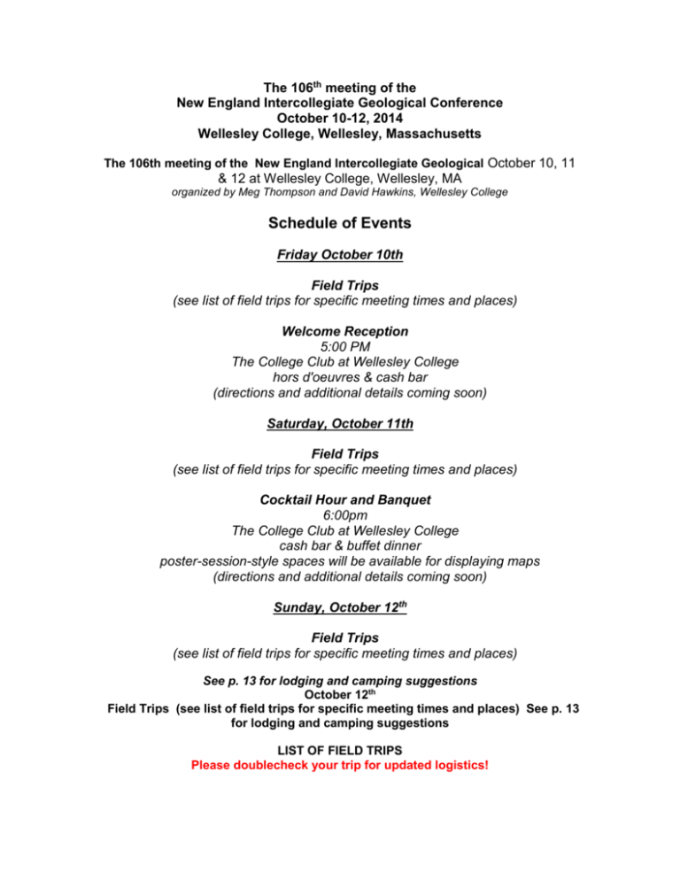
The 106th meeting of the New England Intercollegiate Geological Conference October 10-12, 2014 Wellesley College, Wellesley, Massachusetts The 106th meeting of the New England Intercollegiate Geological October 10, 11 & 12 at Wellesley College, Wellesley, MA organized by Meg Thompson and David Hawkins, Wellesley College Schedule of Events Friday October 10th Field Trips (see list of field trips for specific meeting times and places) Welcome Reception 5:00 PM The College Club at Wellesley College hors d'oeuvres & cash bar (directions and additional details coming soon) Saturday, October 11th Field Trips (see list of field trips for specific meeting times and places) Cocktail Hour and Banquet 6:00pm The College Club at Wellesley College cash bar & buffet dinner poster-session-style spaces will be available for displaying maps (directions and additional details coming soon) Sunday, October 12th Field Trips (see list of field trips for specific meeting times and places) See p. 13 for lodging and camping suggestions October 12th Field Trips (see list of field trips for specific meeting times and places) See p. 13 for lodging and camping suggestions LIST OF FIELD TRIPS Please doublecheck your trip for updated logistics! 2014 Trip List p. 2 Many trips in the following list have assembly points other than Wellesley College, and details for these can be found in the final section of each trip blurb. Trips leaving from the College will assemble in the parking lot east of the Science Center in down-loadable pdf map. The single exception is Trip B6 (see blurb below). Friday—October 10 Trip A1. BEDROCK QUARRIES OF EASTERN MASSACHUSETTS. Leaders: Carl A. Francis and Mark Van Baalen Description: This trip focuses on the mineralogy, petrology, and history of three very different bedrock quarries of Eastern Massachusetts. The first stop is the historic Quincy Railroad Quarry, one of several quarries in close proximity to each other. The peralkaline rock here is the Early Devonian Quincy Granite, containing sodic pyroxenes and amphiboles. The Quincy Granite has traditionally been associated with the Peabody Granite and the Cape Ann Granite (Zartman & Marvin, 1971), but these have now been dated as Upper Devonian and Middle Silurian, respectively (Thompson & Ramezani, 2008). See also Trip A-4, this guidebook. This rock is extremely hard and resistant to weathering, which has made it useful for building stone used at the Bunker Hill Monument and other historic structures. This quarry is also the site of the first railroad in the United States, opened in 1826 and used to transport granite from the quarry to Boston Harbor. A portion of the railroad remains. Today the quarry is also much favored by rock climbers. The second stop is the Fletcher granite quarry in Westford, in continuous operation for 150 years. The peraluminous rock here is the Devonian Chelmsford Granite, recently remapped by Walsh et al. (2013). At this locality we will see an operating granite quarry and its highly automated finishing mill. The minerals here include both muscovite and biotite, as well as aluminous accessory minerals such as garnet and tourmaline. Chelmsford Granite is also highly sought after for use as curbstones, fence posts, and the like. The final stop is the historic Bolton Quarry, used from the early 1700s for production of lime for plaster and mortar. A portion of the old lime kiln remains. Minerals here include scapolite, forsterite (“boltonite”), and diopside, all formed through contact metamorphism. The calc-silicate bedrock here, part of the Nashoba Block, is probably Cambrian but may be as young as mid-Ordovician. Contact metamorphism occurred as a result of an unnamed Devonian (?) intrusion (Kopera, 2005). Starting point and other logistics: Assembly will be at parking lot east of the Wellesley College Science Center, 8:30 a.m., and the trip will end at the same place. Van pooling is encouraged. Group size limited to 50. Participants should bring lunch and all-weather clothing. Trip A2. AGES IN THE RYE COMPLEX, COASTAL, NH: A DEFORMATIONAL HISTORY SLOWLY REVEALED. Leaders: Wally Bothner, Patrick Kane, Erin Stoesz, Kristin Sorota, Jo Laird, Art Hussey, Chris Hepburn, Mick Kunk, Mike Dorais and Bob Wintsch Description: The Rye Complex occupies coastal New Hampshire and a bit of southwestern Maine. It represents an enigmatic slice between 1) the well-documented Avalonian basement of northeastern Massachusetts and an offshore extension of the Nashoba block, and 2) the SiluroDevonian cover rocks of the Merrimack and Central Maine belts. New U/Pb ages of detrital zircons from the metasedimentary rocks, geochemistry and U/Pb zircon ages of intrusive bodies, and 40/39Ar cooling ages from variably strained phases of the Rye indicate multiple deformational, metamorphic and magmatic events spanning the entire Paleozoic and Mesozoic! 2014 Trip List p. 3 However, correlation with rocks of the Nashoba to the south, parts of the Casco Bay sequence to the north, and exposed basement to the west remain elusive. We look forward to discussing these results and possible regional ties on the outcrops! Starting point and other logistics: 9am at Hampton Park and Drive (19T 348295E 4757520N), I-95 to Hampton Exit from North or South, then to Exit 13 eastbound on Rt 101 towards the town of Hampton, NH follow Timber Swamp Rd to parking lot. https://www.google.com/maps/place/Hampton+Park+and+Ride/@42.955153,70.859469,17z/data=!3m1!4b1!4m2!3m1!1s0x89e2e8f8a8056f4d:0xaf7d3c5a34085693 Trip A3.THE EASTERN MERRIMACK TERRANE IN MASSACHUSETTS: REVISITING METAMORPHISM, DEFORMATION AND PLUTONISM Trip leaders: Joe Kopera and Greg Walsh Description: This trip will reexamine the Nashua and Rockingham sub-belts of the Merrimack Terrane in light of recent NCGMP-sponsored geologic mapping, structural analysis, metamorphic petrology, and geochronology. The first half of the day will focus on spectacular fold-fabric relationships and low-grade metamorphic assemblages in metaturbidites that typify the belts, including the famous chiastolite schist of the Worcester formation. The second half of the day will be spent examining phases of the Ayer-Chelmsford pluton and their intrusive relations to the Berwick formation. Starting point and other logistics: 8:30 AM at Walmart Plaza in Leominster, MA at Junction of Rts 117 and 190 (42.493185, -71.729052) - This is approximately a 50 minute drive from Wellesley College going against rush hour traffic, so please plan accordingly. We strongly encourage participants to carpool and consolidate into highclearance vehicles. The trip will involve driving on rutted woods-roads that require high clearance. The last stop will be in Tyngsborough, MA, approx. 45 minutes northeast of the starting point and 1 hour north of Wellesley with Boston's rush-hour traffic between. Vehicles will be returning to the starting point. Please bring a packed lunch, as we will be eating on the outcrop. Bathroom facilities will not be available for most of the trip. Abundant overnight accommodations and camping areas exist nearby. Trip A4. THE CAPE ANN PLUTONIC SUITE: CLASSIC STOPS FOR TEACHING PETROLOGY ALONG THE NORTH SHORE Leaders: John B. Brady, John T. Cheney, Jahandar Ramezani and Margaret D. Thompson Description: This trip will visit class-accessible localities from Marblehead to Rockport selected mostly from previous NEIGC trips led by Toulmin (1964), Dennin (1976), and Hon et al. (1993) where units have recently been constrained by reliable U-Pb isotopic dates. The goal of the trip is to view and discuss the rocks in the context of using them to teach concepts in igneous petrology. Come on this trip if you would like to see typical North Shore igneous rocks, if you would like to discuss their origin, and/or if you would like to discuss teaching petrology in the field. Starting Point and other logistics: The trip will assemble at 8:30 am in the parking lot of the Square One Mall, 1201 Broadway, Saugus, MA 01906. The Square One Mall is 2014 Trip List p. 4 on Route 1 (and Route 129), 4 miles south of I-95. Look for the outcrops in the mall parking lot NE of Macys. Bring your lunch. Trip A5. ICE, WATER, AND WIND: A SOURCE-TO-SINK VIEW OF THE GLACIAL, PARAGLACIAL AND COASTAL SEDIMENTS AND PROCESSES THAT HAVE SHAPED NORTHEAST MASSACHUSETTS Leaders: Chris Hein and Byron Stone Description: This trip will focus on the sedimentary deposits associated with the transgressive and regressive cycles following the retreat of the Laurentide Ice Sheet from northeastern Massachusetts. Sea level in this region reached a maximum of ca. 32 m above present as the ice sheet retreated. Glacial, fluvial and coastal processes resulted in the deposition of drumlins, glacial deltas, draping glaciomarine clay, and regressive shorelines and fluvial terraces which dominate the modern onshore landscape. Many of these deposits have been mapped continuously across the modern shoreline and into the subaqueous environment offshore of the barrier islands of the Merrimack Embayment and beyond the 13,000-year-old lowstand shoreline located 45 m below modern sea level. Reworking of these glacial and post-glacial deposits by coastal processes during the most recent (and, in some places, ongoing) marine transgression has allowed for the building of the barriers, beaches, marshes and dunes of the modern coastal zone. This trip will trace the shoreline from its highstand position up the Merrimack River Valley and down to Plum Island, tracking the various processes and deposits responsible for building the modern landscape, and discussing how glacial and marine geologists can come together to map continuous surficial geology across the modern shoreline. Starting Point and other logistics: This trip will leave trip will leave at 8:15 AM from an assembly point in front of the Market Basket in Haverhill Plaza Shopping Center, 285 Lincoln Ave, Haverhill, MA. Participants are encouraged to bring a bagged lunch since the trip will continue past the lunch hour. Excellent restaurants for a late lunch will be pointed out at the end of the trip for any who want to sample the local Newburyport cuisine before leaving! For those who may be driving from Wellesley, directions to Haverill Plaza can be found on p. A5-23 of the field trip guide. This drive will take 1hr 15 minutes. Saturday—October 11 Trip B1. QUATERNARY GEOLOGY OF THE BOSTON AREA: GLACIAL EVENTS FROM LAKE CHARLES TO LAKE ABERJONA Leader: Byron Stone Description: During this trip we will review the new detailed geologic maps of the Boston area and briefly discuss the revisions of the history of glacial Lake Charles. We travel through Needham to Newton and will visit historical sites in this lake, including eskers, the famous delta at Newtonville, and erosional features that were created during the emptying of the lake along the lower Charles River reach to the glaciomarine sea. After learning of low-frequency seismic methods to detect depth to bedrock beneath drumlins, we turn to the gravel at the top of Mt. Auburn Cemetery where we will discuss the fairly simple geology of the Boston basin, and pay our respects to Professor Agassiz there. At the Fresh Pond moraine we will see a core from the lake (?) clay to the north, which leads to discussion of the marine-lake-marine-lake history of the lower Aberjona valley. 2014 Trip List p. 5 Starting Point and other logistics: This trip will begin at 7:45 AM in the parking lot east of the Science Center at Wellesley College (link to campus map at beginning of this announcement). Bring lunch. Trip B2. Conglomerate in and around the Boston Basin, Massachusetts: U-Pb geochronology, stratigraphy and Avalonian tectonic setting. Leader: Meg Thompson Description: Conglomerate in Boston, Massachusetts was named more than a century ago for exposures in the Roxbury district of the city, and since then other conglomerates across the region have all been lumped under this heading. Systematic attention to clast assemblages and especially the availability of U-Pb zircon age constraints for units in and around the Boston Basin, however, reveal new distinctions within the Roxbury itself, as well as the presence of pre-Roxbury conglomerate. This trip will proceed stratigraphically from basement on the south side of the Boston Basin through Roxbury Conglomerate and associated Brighton igneous units within the Basin. Locations to be visited will highlight recently completed age constraints showing that conglomerate lying unconformably on 609.5 Ma Dedham Granite is part of the 597-593 Ma LynnMattapan Volcanic Complex and demonstrating a 595-585 Ma age range for the Roxbury proper. Discussion throughout the day will emphasize implications of the new age constraints for Avalonian tectonics both in and beyond southeastern New England. Starting point and other logistics: Trip will leave at 8AM from parking lot east of the Wellesley College Science Center. Car/van pooling strongly encouraged for better chance of keeping together en route though Boston & suburbs. Spare vehicles can stay at Wellesley where we will return at the end of the day. Limited to 50 people. Bring lunch. Trip B3. EVOLUTION OF THE NASHOBA TERRANE, AN EARLY PALEOZOIC GANDERIAN ARC REMNANT IN EASTERN MASSACHUSETTS Leaders: J. Christopher Hepburn, Yvette Kuiper, John Wesley Buchanan and Andrew Kay Description: The Nashoba terrane is a fault-bounded, tectonized and highly metamorphosed early Paleozoic arc/backarc complex that lies between lower grade Avalonian rocks to the east and Merrimack belt metasediments to the west. This terrane forms the trailing edge of Ganderia in SE New England. During the excursion we will include recent radiogenic dating, geochemistry and Sm/Nd isotopic analyses in our discussions as these have helped to identify the Ganderian nature of the rocks and allow them to be related to other Ganderian arcs in the northern Appalachians. The trip is designed to be a general introduction to the stratigraphy, metamorphism, structure and plutonic rocks of the terrane. We will include visits to the early Paleozoic metamorphosed rocks that make up the tectonostratigraphy of the terrane as well as younger plutonic rocks that intruded during the approach of Avalonia in the mid-Paleozoic. Starting point and other logistics: Meet in the parking lot east of the Wellesley College Science Center at 8am where we will carpool as much as possible. Please bring lunch; we will picnic at the outcrop. Trip B4. DIKE SWARMS OF CAPE ANN, MASSACHUSETTS Leader: Marty Ross 2014 Trip List p. 6 Description: This trip will emphasize the field characteristics of selected dikes within the swarms on Cape Ann. In addition to the usual fine-to-medium-grained aphyric dolerites, other types to be seen include coarsely plagioclase-phyric dolerites, a dike in which felsic and mafic magma have mingled, a thick aplite dike intruded along an older rhyolite dike, a pyroxene trachyte dike, diorite dikes intruded into mobile granite magma, and large dike segments containing large purple plagioclase xenocrysts and xenocryst clusters. Starting point and other logistics: 9:00 AM at Sunoco Station service area on Route 128 just north of Exit 19. First Stop will be Rafe’s Chasm Park, Magnolia, Gloucester. Trip B5. ALLEGHANIAN METAMORPHISM OF THE SOUTHERN NARRAGANSETT BASIN, RI: HINGED BURIAL AND EXHUMATION. Leaders: Daniel Fetherston, Daniel Murray, and Robert Wintsch Description: The Pennsylvanian Rhode Island Formation (RIF) preserves in detail the effects of the Alleghanian orogeny on southeastern New England. This trip will revisit classic locales along the southern RI coast, where new metamorphic and geochronologic data will be presented that tightly constrain models for the burial, deformation & regional metamorphism, and exhumation of the Narragansett Basin. Stops include chlorite to sillimanite grade metasedimentary rocks, as well as the contact of the RIF with the Narragansett Pier Granite. The start and end of this trip are the same as those for the Carter et al trip on Sunday. Moreover, both trips will lunch at the locale where the contact between the Pennsylvanian cover and the Pre-Alleghanian basement occur. Starting point and other logistics: 9AM at commuter parking lot at intersection of Route 1A and 138. Allow 1.5 hours, to go from Wellesley College to the starting point of the trip. We will consolidate vehicles at the start, and the trip will finish here at 4PM. The trip is suitable for all vehicles, and will entail less than ~40 miles of driving. The stops will be primarily on shoreline outcrops, and waterproof shoes with good grip are needed. Bring lunch, as there will be opportunities to purchase food only at the start in a convenience store. Group size limited to 50. Trip B6. GROUNDWATER CONTAMINATION IN WELLESLEY AND NORWELL, MASSACHUSETTS: LOCATION OF SOURCES AND PROTECTION OF PUBLIC WATER SUPPLIES. Leaders: Jim Besancon, Rudi Hon, Peter Dillon, David Beutel, and Bianca Bello Description: We will visit three contaminant sources on the Wellesley College campus: the Paintshop Pond lead and chromium paint pigment site (remediated), the Alumnae Valley coal tar site (being remediated), and the sodium chloride sources affecting campus drinking water, demonstrating some of the field sampling and analysis methods used to trace their origin. We will then proceed to Norwell, Massachusetts where a small (10 square miles) drainage basin supplies most of the town water supply. If current trends continue, drinking water chloride content will reach EPA Secondary Maximum Contaminant Drinking Water limits within the next decade. Eleven new Geoprobe wells and cores, piezometer nests, long duration high frequency logging of surface and groundwater levels and specific conductivity, and extensive chemical analysis all help distinguish between several potential salt contaminant sources. We will examine the main production well, and visit several field measurement sites along Third Herring Brook. We will tour 2014 Trip List p. 7 the Norwell water treatment plant which produces most of the town supply. This trip is especially appropriate for students. Starting point and other logistics: This is the one trip originating at Wellesley that will not assemble in the Science Center Parking lot. Instead head west on Route 135 past the West Entry to the College and turn left on drive immediately past the Keohane Sports Center shown in the campus map. Follow drive on left around to (unmarked) parking lot west of the Distribution Center. We will depart at 8:30 for walk to first stop (on campus) Group size limited to forty. Participants should bring lunch and all-weather clothing. Trip B7. THE SEISMIC, HISTORIC AND GEOLOGIC RECORD OF EARTHQUAKES IN NEW ENGLAND Leaders: Katrin Monecke, John E. Ebel, Iglika Atanassova (with contributions from Charlotte Benishek, Michaela Fendrock, Emma Howey, Diana Lee, Rosalie Sharp) Description: The USGS National Seismic Hazard Map indicates an increased seismic hazard for northeastern Massachusetts and southeastern New Hampshire, which is largely determined by the occurrence of two damaging historical earthquakes, the A.D. 1727 Newbury, MA, magnitude M=5.6 and the A.D. 1755 Cape Ann, MA, M=5.9 earthquakes. This trip will start at the Weston Observatory that operates the New England Seismic Network. Here we will discuss the recent seismicity in New England and how it relates to the historically reported earthquakes. Then we will visit the Bloody Bluff Fault Zone in Minute Man Park, Lexington, MA, as well as other major faults in the Newbury area to get an idea about the regional tectonic setting and possible sources of the 1727 earthquake. Numerous historical accounts of liquefaction exist for the epicentral region of the 1727 earthquake and were identified in trenches during paleoseismic studies in the Newbury area in the early 1990s. We will visit some of these locations (now largely obscured due to development) and analyze the liquefaction potential of exposed quaternary sediments in this area. In addition, we will present preliminary results from recent paleoseismic studies of lake sediments in northeastern Massachusetts. A number of historic houses built in the late 17 th century exist in the Newbury area and if time allows, we will evaluate the potential structural damage to these historic sites. Starting Point and other logistics: 8:00 am at Weston Observatory, 381 Concord Road, Weston, MA 02493-1340 (for directions see: http://www.bc.edu/content/bc/research/westonobservatory/about/directions.html). Please bring lunch and water and dress accordingly to the weather. Trip limit: 20 Sunday—October 12 Trip C1. Bedrock Geology of Boston Harbor: Cambridge Argillite and associated diabase sills and debris flows. Leaders: Peter J. Thompson, Joe Kopera, Marty Ross. Dick Bailey, Meg Thompson Description: The focus of this trip will be the Cambridge Argillite, including the latest thinking on internal stratigraphy and depositional setting, relations to the rest of the Boston Bay Group, new data on diabase sills and dikes, and structure beneath Boston Harbor, based on recent mapping of the Hull 7 ½′ Quadrangle and reports on the geology of sewage tunnels: the Inter-Island Tunnel and the Outflow Tunnel. The trip will start in the morning with a traverse in Squantum to view multiple debris flows within the Cambridge. (The cost of this early part of the trip is included in the conference registration). We will then go by boat to Calf Island, the largest of the Brewster 2014 Trip List p. 8 Islands north of Boston Light. The boat trip is limited to 24 people in addition to trip leaders, and the cost will be $45 per person. If weather conditions preclude landing on Calf, alternate stops will be arranged on the mainland and your money will be refunded. Starting Point and other logistics: Meet at 8:30AM at the American Legion parking lot, Squantum Head, Quincy, to the left before the bridge to Moon Island. (We must schedule this early in order to catch the low tide). Bring lunch. 2014 Trip List p. 9 Trip C2. BEDROCK GEOLOGY AND GEOMORPHOLOGY OF THE BREAKHEART AND LYNN WOODS RESERVATIONS: WHAT THEY REVEAL AND WHAT STILL NEEDS TO BE EXPLORED. Leaders: Lindley Hanson and Rory McFadden Description: This trip focuses on the geology of the Lynn Woods and Breakheart reservations, where we will use contact relationships viewed in outcrops and in glacial erratics, and new U-Pb age data to evaluate magmatic, stratigraphic and tectonic relationships of rocks within the Boston-Avalon Terrane north of the Northern Border Fault. New data indicate that at some locations, rocks previously mapped as Lynn Volcanics are most likely Middlesex Fells Volcanics. We will also investigate contact relationships between the Neoproterozoic Westboro Formation and the Middlesex Fells in the Breakheart Reservation, and investigate the nature of the Walden Pond Fault that delineates the northern portion of Burrill Hill structural block in Lynn Woods. Lunch will be at the Saugus Iron works where we will stop for a brief tour. Starting Point and other logistics: Meeting place is the Walden Pond entrance to Lynn Woods: Lat 42.493283° Long -70.977386°. Meeting Time 8:00. Bring comfortable walking Trip C3. CLIMATE CHANGE COMES TO THE SOUTH SHORE OF RHODE ISLAND: EROSION, INUNDATION, MIGRATION Leaders: Jon Boothroyd, Bryan Oakley, Scott Rasmussen, Janet Freedman, Stephen McCandless, Matthew Dowling, Robert Hollis Description: The trip will focus on coastal hazards and human response to same along the southern shore zone (barriers and headlands) of Rhode Island from Narragansett Pier to Westerly. Hazards include frontal erosion from storm waves, storm-surge inundation (now and future), and barrier migration under conditions of present, and accelerated, sea-level rise. We will examine some changes from Superstorm Sandy, including interesting coastal-zone management issues (beach and foredune replenishment for instance). Starting Point and other logistics: Remote start. We will assemble in the south parking lot at Narragansett Town Beach (Stop 1) at 8:30 am. Consolidate if you can at Wellesley (northbound people). We can also leave cars at Stop 1. Number of vehicles will indicate individual stop locations; we cannot fit a large number of vehicles at some locations. Bring lunch. 2014 Trip List p. 10 Trip C4. STRUCTURAL HISTORY OF THE NASHOBA TERRANE - MERRIMACK BELT BOUNDARY ZONE, EASTERN MASSACHUSETTS Leaders: Yvette D. Kuiper, J. Wesley Buchanan, Robert Charnock, J. Christopher Hepburn, Joseph P. Kopera Description: The Nashoba terrane is an early Paleozoic arc-backarc complex with Ganderian affinity, while the adjacent Merrimack belt to the northwest consists of Silurian metasedimentary rocks, likely derived from both Ganderian and Laurentian sources. The Nashoba terrane was metamorphosed under upper amphibolite conditions while the Merrimack terrane adjacent to the Nashoba terrane only reached greenschist facies conditions. Both are strongly deformed, but the deformation styles are different and the ages of deformation may not be the same. While deformation in the Nashoba terrane is predominantly consistent with Acadian and Neoacadian ages, deformation in the Merrimack belt may be predominantly Alleghanian. We will compare and contrast structures in the partially migmatized rocks of the northwestern Nashoba terrane with those in the Merrimack belt, and the (proto)mylonitic and cataclastic rocks along the ClintonNewbury fault zone between them. The relative and absolute timing of structures across the fault zone and the potential relationships between them will be discussed. Starting Point and other logistics: Meet in the parking lot east of the Wellesley College Science Center, at 8 AM where we will carpool as much as possible. Please bring lunch; we will picnic at the outcrop. Trip C5. ALLEGHANIAN DEFORMATION OF CAMBRIAN METASEDIMENTARY ROCKS IN SOUTHERN NARRAGANSETT BAY, RI: IS THERE EVIDENCE FOR PREALLEGHANIAN TECTONISM? Leaders: Matthew Carter, Daniel Murray, and Sharon Mosher Description: The southern half of Conanicut Island RI includes the most complete and well exposed occurrences of Cambrian-aged Avalonian metasedimentary rocks in the USA. This trip will focus on recent fieldwork carried out by Matthew Carter that provides new insights into Avalonian and Alleghanian orogenesis in southeastern New England, and which can be used to test the assertion that all of the penetrative deformation recorded in the Cambrian rocks can be attributed to Alleghanian tectonism, as seen in the contiguous Pennsylvanian rocks of the Narragansett Basin. In the spirit of NEIGC this field guide will also prove of use to a diverse audience, that includes not only geologists familiar with the tectonic evolution of the Appalachian orogeny, but also STEM educators, from middle school through college, who wish to incorporate these superb examples of geologic features into their courses. James Sammons has prepared a supplement to the trip guide that provides strategies for incorporation of the Beavertail geology into field and classroom activities suitable for middle and high school. Starting Point and other logistics: 9AM at commuter parking lot at intersection of Route 1A and 138. Allow 1.5 hours for trip to starting point from Wellesley College. We will consolidate vehicles at the start, and the trip will finish here at 3PM. The trip is suitable for all vehicles, and will entail less than 20 miles. The stops will be on shoreline outcrops, and appropriate shoes are needed. Bring lunch, as there will be opportunities to purchase food only at the start in a convenience store. All stops are “hammer free”, and sampling of fossiliferous rocks is not permitted. 2014 Trip List p. 11 Trip C6. GEOMORPHIC RESPONSE TO THE REMOVAL OF THE MERRIMACK VILLAGE DAM ON THE SOUHEGAN RIVER, NEW HAMPSHIRE: RESULTS FROM SIX YEARS OF MONITORING Leaders: Noah P. Snyder and Mathias J. Collins Description: Removing the Merrimack Village Dam on the lower Souhegan River in southern New Hampshire in August 2008 provided a field-scale experiment in river response to a major change in sediment flux and base level. We began monitoring the study area in August 2007, surveying a series of eight permanent cross sections within the impoundment and four downstream between the dam and the confluence with the Merrimack River. We also surveyed the longitudinal profile through the 1-km study reach, measured bed grain size, and photographed the site from ground-level stations. We conducted nine repeat surveys from 2008 to 2014, with the greatest frequency soon after dam removal. The dam removal resulted in a near-instantaneous 3.9-m drop in base level in the impoundment. The river incised rapidly through the impounded sand and removed over 50% of it within two months. This added sediment load resulted in up to 3.2 m of deposition in the downstream reach. After the initial, rapid phase of channel adjustment, ongoing erosion of impoundment sediment depended primarily on flood events that could access sediment stored outside of the newly developed, active channel. This process was modulated by the recruitment of large wood from terraces through bank erosion, which subsequently armored banks. By 2012, less than 20% of the impounded sand remained. After an introduction at the former dam site, the fieldtrip will spend the morning looking at the impoundment and the early afternoon in the downstream reach. We will see evidence for rapid geomorphic adjustment, sedimentary structures in the remaining impounded sediment and active channel, and historical artifacts and structures. We will also discuss the role of vegetation changes and large wood in the impoundment and adjacent wetland in the ongoing geomorphic evolution of the site. The trip will end around 2 pm, allowing time for participants to begin the journey home. Starting Point and other logistics: 9 AM at the Merrimack town park on the east side of Rt. 3 in Merrimack, NH (across from the fire station; 42°51'44"N, 71°29'34"W). This site has plenty of parking; it is 55 minutes from the Wellesley College campus, and 2 miles from exit 11 on the Everett Turnpike in southern New Hampshire.

