Proposed LAS Enhancements to Support Topo-Bathy Lidar
advertisement
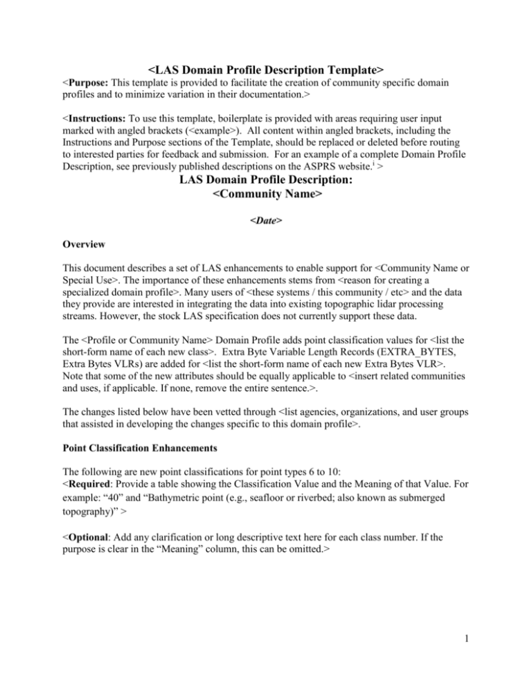
<LAS Domain Profile Description Template> <Purpose: This template is provided to facilitate the creation of community specific domain profiles and to minimize variation in their documentation.> <Instructions: To use this template, boilerplate is provided with areas requiring user input marked with angled brackets (<example>). All content within angled brackets, including the Instructions and Purpose sections of the Template, should be replaced or deleted before routing to interested parties for feedback and submission. For an example of a complete Domain Profile Description, see previously published descriptions on the ASPRS website.i > LAS Domain Profile Description: <Community Name> <Date> Overview This document describes a set of LAS enhancements to enable support for <Community Name or Special Use>. The importance of these enhancements stems from <reason for creating a specialized domain profile>. Many users of <these systems / this community / etc> and the data they provide are interested in integrating the data into existing topographic lidar processing streams. However, the stock LAS specification does not currently support these data. The <Profile or Community Name> Domain Profile adds point classification values for <list the short-form name of each new class>. Extra Byte Variable Length Records (EXTRA_BYTES, Extra Bytes VLRs) are added for <list the short-form name of each new Extra Bytes VLR>. Note that some of the new attributes should be equally applicable to <insert related communities and uses, if applicable. If none, remove the entire sentence.>. The changes listed below have been vetted through <list agencies, organizations, and user groups that assisted in developing the changes specific to this domain profile>. Point Classification Enhancements The following are new point classifications for point types 6 to 10: <Required: Provide a table showing the Classification Value and the Meaning of that Value. For example: “40” and “Bathymetric point (e.g., seafloor or riverbed; also known as submerged topography)” > <Optional: Add any clarification or long descriptive text here for each class number. If the purpose is clear in the “Meaning” column, this can be omitted.> 1 Extra Byte Variable Length Record Enhancements The following are proposed new point attributes to be added via Extra Bytes VLRs: <Required: Provide a table listing all of the variables of the EXTRA_BYTES structure that are relevant to the new VLR. For the options field, use “x” to denote bits that can be set, and “1” or “0” as appropriate for values required by that VLR. For a list of all variables within the EXTRA_BYTES structure see the LAS 1.4 Specificationi. Variables not used by any VRLs can be omitted from the table, but must be set to zero. The LAS 1.4 specification requires that the reserved and unused fields be set to zero. On a case by case basis, the LAS group may approve populating the reserved field if the attribute being added is broadly applicable to the extent that it merits inclusion in future versions of LAS.> <Optional: It can be helpful, but is not required, to have the first column of the table display the units used for that field. While this is not coded into the EXTRA_BYTES structure, it promotes consistency and minimizes confusion. > <Required: For each row, provide a text description of the purpose of the VLR, with a justification of the values given, if applicable.> References: i American Society for Photogrammetry and Remote Sensing. (2012). LAS File Format Specifications. Retrieved from ASPRS Website: http://www.asprs.org/CommitteeGeneral/LASer-LAS-File-Format-Exchange-Activities.html 2


