File - Bishwas Sharma
advertisement

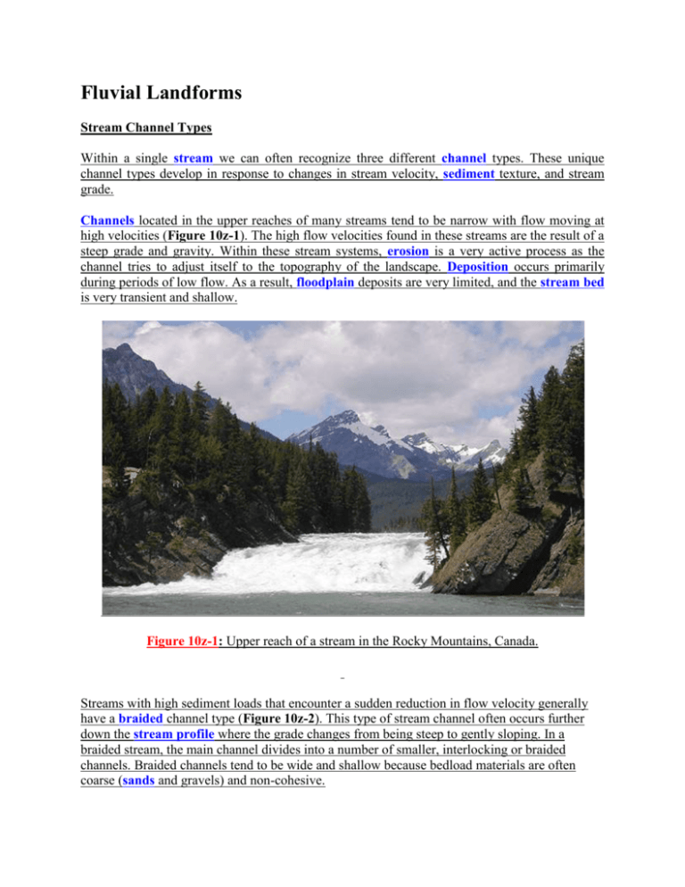
Fluvial Landforms Stream Channel Types Within a single stream we can often recognize three different channel types. These unique channel types develop in response to changes in stream velocity, sediment texture, and stream grade. Channels located in the upper reaches of many streams tend to be narrow with flow moving at high velocities (Figure 10z-1). The high flow velocities found in these streams are the result of a steep grade and gravity. Within these stream systems, erosion is a very active process as the channel tries to adjust itself to the topography of the landscape. Deposition occurs primarily during periods of low flow. As a result, floodplain deposits are very limited, and the stream bed is very transient and shallow. Figure 10z-1: Upper reach of a stream in the Rocky Mountains, Canada. Streams with high sediment loads that encounter a sudden reduction in flow velocity generally have a braided channel type (Figure 10z-2). This type of stream channel often occurs further down the stream profile where the grade changes from being steep to gently sloping. In a braided stream, the main channel divides into a number of smaller, interlocking or braided channels. Braided channels tend to be wide and shallow because bedload materials are often coarse (sands and gravels) and non-cohesive. Figure 10z-2: Braided stream channel. Meandering channels form where streams are flowing over a relatively flat landscape with a broad floodplain (Figure 10z-3). Technically, a stream is said to be meandering when the ratio of actual channel length to the straight line distance between two points on the stream channel is greater than 1.5. Channels in these streams are characteristically U-shaped and actively migrate over the extensive floodplain. Figure 10z-3: Meandering stream channel. Stream Channel Features Within the stream channel are a variety of sedimentary beds and structures. Many of these features are dependent upon the complex interaction between stream velocity and sediment size. Streams carrying coarse sediments develop sand and gravel bars. These types of bars seen often in braided streams which are common in elevated areas (Figure 10z-4). Bars develop in braided streams because of reductions in discharge. Two conditions often cause the reduction in discharge: reduction in the gradient of the stream and/or the reduction of flow after a precipitation event or spring melting of snow and ice. Figure 10z-4: Braided stream channel with gravel bars. Point bars develop where stream flow is locally reduced because of friction and reduced water depth (Figure 10z-5). In a meandering stream, point bars tend to be common on the inside of a channel bend. Figure 10z-5: Meandering stream channel as seen from above. In straight streams, bar-like deposits can form in response to the thalweg (red arrows Figure 10z-6) and helical flow. Figure 10z-6 below shows an overhead view of these deposits and related features. Figure 10z-6: Overhead view of the depositional features found in a typical straight stream channel. In this straight channel stream, bars form in the regions of the stream away from the thalweg. Riffles, another type of coarse deposit, develop beneath the thalweg in locations where the faster flow moves vertically up in the channel. Between the riffles are scoured pools where material is excavated when the zone of maximum stream velocity approaches the stream's bed. The absolute spacing of these features varies with the size of the channel. However, the relative distance between one riffle and the next is on average five to seven times the width of the channel (exaggerated in diagram). Both of these features can also occur in sinuous channels. Dunes and ripples are the primary sedimentary features in streams whose channel is composed mainly of sand and silt. Dunes are about 10 or more centimeters in height and are spaced a meter or more apart. They are common in streams with higher velocities. Ripples are only a few centimeters in height and spacing, and are found in slow moving streams with fine textured beds. Both of these features move over time, migrating down stream. Material on the gently sloping stoss-side of these features rolls and jumps up the slope under the influence of water flow. Particles move up the slope until they reach the crest of the feature and then avalanche down the steeper lee-side to collect at the base of the next dune or ripple. This process is then repeated over and over again until the material reaches a location down stream where it is more permanently deposited. The Floodplain Alongside stream channels are relatively flat areas known as floodplains (Figure 10z-7). Floodplains develop when streams over-top their levees spreading discharge and suspended sediments over the land surface during floods. Levees are ridges found along the sides of the stream channel composed of sand or gravel. Levees are approximately one half to four times the channel width in diameter. Upon retreat of the flood waters, stream velocities are reduced causing the deposition of alluvium. Repeated flood cycles over time can result in the deposition of many successive layers of alluvial material. Floodplain deposits can raise the elevation of the stream bed. This process is called aggradation. Figure 10z-7: The following Landsat 5 image taken in September 1992 shows a section of the Missouri River at Rocheport, Missouri. The oblique perspective of this image is looking westward or upstream. This image has been color enhanced and modified to show an exaggerated topographic relief. Bare soil and plowed land appears red, vegetation appears green, and water is dark blue. A flat river flood plain can be seen in the center of the image. Because of the season, most of the farmland located on the rich and fertile soils of the floodplain is plowed and devoid of vegetation. (Source: NASA Scientific Visualization Studio). Floodplains can also contain sediments deposited from the lateral migration of the river channel. This process is common in both braided and meandering channels. Braided channels produce horizontal deposits of sand during times of reduced discharge. In meandering streams, channel migration leads to the vertical deposition of point bar deposits. Both braided and meandering channel deposits are more coarse than the materials laid down by flooding. A number of other geomorphic features can be found on the floodplain. Intersecting the levees are narrow gaps called crevasses. These features allow for the movement of water to the floodplain and back during floods. Topographical depressions are found scattered about the floodplain. Depressions contain the some of the finest deposits on the floodplain because of their elevation. Oxbow lakes are the abandoned channels created when meanders are cut off from the rest of the channel because of lateral stream erosion. Alluvial Fans and Deltas Streams flowing into standing water normally create a delta (Figure 10z-8 and 10z-9). A delta is body of sediment that contains numerous horizontal and vertical layers. Deltas are created when the sediment load carried by a stream is deposited because of a sudden reduction in stream velocity. The surface of most deltas is marked by small shifting channels that carry water and sediments away from the main river channel. These small channels also act to distribute the stream's sediment load over the surface of the delta. Some deltas, like the Nile, have a triangular shape. Streams, like the Mississippi, that have a high sediment content and empty into relatively calm waters cause the formation of a birdfoot shaped delta. Figure 10z-8: Nile Delta (Source: NASA). Figure 10z-9: Mississippi Birdfoot Delta (Source: NASA). Most deltas contain three different types of deposits: foreset, topset and bottomset beds. Foreset beds make up the main body of deltas. They are deposited at the outer edge of the delta at an angle of 5 to 25 degrees. Steeper angles develop in finer sediments. On top of the foreset beds are the nearly horizontal topset beds. These beds are of varying grain sizes and are formed from deposits of the small shifting channels found on the delta surface. In front and beneath the foreset beds are the bottomset beds. These beds are composed of fine silt and clay. Bottom set beds are formed when the finest material is carried out to sea by stream flow. An alluvial fan is a large fan-shaped deposit of sediment on which a braided stream flows over (10z-10). Alluvial fans develop when streams carrying a heavy load reduce their velocity as they emerge from mountainous terrain to a nearly horizontal plain. The fan is created as braided streams shift across the surface of this feature depositing sediment and adjusting their course. The image below shows several alluvial fans that formed because of a sudden change in elevation. Figure 10z-10: Alluvial Fans - Brodeur Peninsula, Baffin Island, Canada. (Source: Natural Resources Canada - Terrain Sciences Division - Canadian Landscapes).


