LOMR Following CLOMR
advertisement
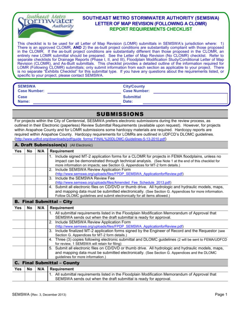
SOUTHEAST METRO STORMWATER AUTHORITY (SEMSWA) LETTER OF MAP REVISION (FOLLOWING A CLOMR) REPORT REQUIREMENTS CHECKLIST This checklist is to be used for all Letter of Map Revision (LOMR) submittals in SEMSWA’s jurisdiction where: 1) There is an approved CLOMR, AND 2) the as-built project conditions are substantially compliant with those proposed in the CLOMR. If the as-built project conditions are substantially different than those proposed in the CLOMR, an entirely new LOMR submittal should be prepared. See the Letter of Map Revision (No CLOMR) checklist. Refer to separate checklists for Drainage Reports (Phase I, II, and III), Floodplain Modification Study/Conditional Letter of Map Revision (CLOMR), and As-Built submittals. This checklist provides a detailed outline of the information required for LOMR (Following CLOMR) submittals; only submit information from each section as applicable to your project. There is no separate “Exhibits Checklist” for this submittal type. If you have any questions about the requirements listed, or specific to your project, please contact SEMSWA. SEMSWA Case Number: City/County Case Number: Case Name: Submittal Date: SUBMISSIONS For projects within the City of Centennial, SESMWA prefers electronic submissions during the review process, as outlined in their Electronic (paperless) Review Submittal Requirements (available upon request). However, for projects within Arapahoe County and for LOMR submissions some hardcopy materials are required. Hardcopy reports are required within Arapahoe County. Hardcopy requirements for LOMRs are outlined in UDFCD’s DLOMC guidelines. (http://www.udfcd.org/downloads/pdf/guide_forms/ FINAL%20DLOMC-Guidelines-5-13-2010.pdf) A. Draft Submission(s) (All Electronic) Yes No N/A Requirement 1. Include signed MT-2 application forms for a CLOMR for projects in FEMA floodplains, unless no impact can be demonstrated through technical analysis. (See Note 1 at the end of this checklist for more information on impacts; see Section G. Appendices for MT-2 form details.) 2. Include SEMSWA Review Application Form (http://www.semswa.org/uploads/files/FPDP_SEMSWA_ApplicationforReview.pdf) 3. Include the SEMSWA Review Fee (http://www.semswa.org/uploads/files/Amended_Fee_Schedule_2013.pdf) 4. Submit all electronic files on CD/DVD or thumb drive. All hydrologic and hydraulic models, maps, and mapping data must be submitted electronically. (See Section G. Appendices for more information. Follow DLOMC guidelines and submit electronically for all items allowed.) B. Final Submittal – City Yes No N/A Requirement 1. All submittal requirements listed in the Floodplain Modification Memorandum of Approval that SEMSWA sends out when the draft submittal is ready for approval. 2. Include SEMSWA Review Application Form (http://www.semswa.org/uploads/files/FPDP_SEMSWA_ApplicationforReview.pdf) 3. Include finalized MT-2 application forms signed by the Engineer of Record and the Requestor (see Section G. Appendices for MT-2 form details.) 4. Three (3) copies following electronic submittal and DLOMC guidelines (2 will be sent to FEMA/UDFCD for review, 1 SEMSWA will retain for filing) 5. Submit all electronic files on CD/DVD or thumb drive. All hydrologic and hydraulic models, maps, and mapping data must be submitted electronically. (See Section G. Appendices and the DLOMC guidelines for more information.) C. Final Submittal – County Yes No N/A Requirement 1. All submittal requirements listed in the Floodplain Modification Memorandum of Approval that SEMSWA sends out when the draft submittal is ready for approval. SEMSWA (Rev. 3, December 2013) Page 1 LOMR (FOLLOWING CLOMR) REPORT CHECKLIST SEMSWA Case Number: Yes No N/A 2. Include SEMSWA Review Application Form (http://www.semswa.org/uploads/files/FPDP_SEMSWA_ApplicationforReview.pdf) Requirement 3. Include finalized MT-2 application forms signed by the Engineer of Record and the Requestor. There must be a copy of Form 1 signed by each affected community. (See Section G. Appendices for MT-2 form details.) 4. Four (4) copies. 2 full hard copies and 2 copies following DLOMC guidelines. (The DLOMC copies will be sent to FEMA/UDFCD for review, 1 each of the hard copies will be retained for filing by SEMSWA and the County. ) 5. Submit all electronic files on CD/DVD or thumb drive. All hydrologic and hydraulic models, maps, and mapping data must be submitted electronically. (See Section G. Appendices and the DLOMC guidelines for more information.) D. Final Submittal – FEMA/UDFCD (SEMSWA staff will submit LOMR to FEMA/UDFCD) Yes No N/A Requirement 1. Consultant to submit FEMA review fee, except for CIP projects. (Verify the correct fee on FEMA’s website at: http://www.fema.gov/plan/prevent/fhm/frm_fees.shtm. Obtain fee from project owner/developer. For CIP projects, the fee may come from SEMSWA, City, County or be paid by consultant as negotiated in the approved scope of work for the project.) 2. For CIP projects, the fee may come from SEMSWA, City, County or be paid by consultant as negotiated in the approved scope of work for the project. Verify the requirement with SEMSWA. E. Final Data Yes No N/A Requirement 1. Provide any changes made to the submitted information after issuance of an approval by SEMSWA, for SEMSWA’s records. (For example, when additional data has been submitted in response to an AD letter from FEMA.) 2. Provide final 100-year floodplain delineations and cross section cutlines to SEMSWA in GIS format. Also provide final 0.5 ft. floodway delineations, 500-year floodplain delineations and BFEs, in GIS format. REPORT REQUIREMENTS A. Title Page Yes No N/A Requirement 1. Name of Project 2. Address 3. Property Owner & Property Jurisdiction 4. Developer/Project Owner 5. Engineer 6. Submittal date and revision dates, as applicable B. Certification Statement Yes No N/A Requirement Include a Certification Statement page, signed and stamped by the responsible Professional Engineer, registered in the State of Colorado. (Example statement at http://www.semswa.org/uploads/files/Engineer_s_Certification_Statement.pdf) D. Updated Report Information Yes No N/A Requirement 1. Provide an updated copy of the report prepared for the CLOMR. Highlight any changes in the below sections from that presented in the CLOMR: - Introduction (especially Project Description and Study Limits) - Analysis Criteria SEMSWA (Rev. 3, December 2013) Page 2 LOMR (FOLLOWING CLOMR) REPORT CHECKLIST SEMSWA Case Number: - Topographic Mapping - Hydrology Yes No N/A Requirement - Hydraulics - Sediment Transport & Fluvial Geomorphology - Floodplain Mapping - Conclusions 2. Within each section, discuss all tables, figures, charts, drawings, etc. that were used and describe the information included in the appendix of the report that is relevant to that section. 3. Include a descriptive file name on all model files. 4. Include a description within the model files (Include who, what, why, version, and vertical datum.) E. CLOMR Determination Requirements Yes No N/A Requirement 1. Comply with the requirements listed in the FEMA determination letter for the CLOMR. Common requirements include: - If Section 65.12 of the NFIP Regulations applied to the CLOMR, provide evidence that the community’s ordinance has been updated to include the project. - Provide a copy of Form 1 for every jurisdiction impacted by the change in flood hazard, including all impacted jurisdictions outside of SEMSWA’s boundary, such as Aurora, Denver, and/or Douglas County. (Every impacted community needs to sign a copy of Form 1. Requestor and Engineer of Record signatures should be completed. The Requestor should be the primary point-of-contact for the project who receives project correspondence. This can be the project owner, developer, consultant, etc. This may be the SEMSWA Project Manager for SEMSWA CIP projects.) - If as-built conditions differ from those proposed in the CLOMR (this is for minor differences), provide updated and/or annotated copies of FEMA’s MT-2 Application Forms – Forms 2 and 3. - Submit hydraulic analyses for as-built conditions - SEMSWA approved (SEMSWA “Final” Stamp) as-built plans, certified by a registered professional engineer, for all project elements (See Note 4.) - Community acknowledgment of the map request (usually provided through execution of MT-2 Form 1 by all impacted jurisdictions) - Copies of Impact Notification Letters sent to each property owner impacted by the modified floodplain/floodway or a sample letter and a list of affected property owners, listed by parcel number. (May submit electronic or hard copies per DLOMC guidelines. See the MT-2 Instructions for letter requirements and examples. SEMSWA prefers not to provide notification through newspaper notices. SEMSWA prefers that each property owner be provided individual notification for all impacts (e.g. both floodplain and floodway) in a single letter. Include a property-specific map showing the impacts. Submit the letters to SEMSWA on CD/DVD for review with draft submission. For CIP projects, the consultant will prepare the letters for signature by the SEMSWA Floodplain Program Manager. For non-CIP projects, the consultant or project owner should sign the letters. Include digital copies (PDFs) of the executed letters in the submittal. The consultant is responsible for mailing all notification letters, even those signed by SEMSWA.) 2. List any additional requirements from the CLOMR determination on the following lines and indicate compliance. - SEMSWA (Rev. 3, December 2013) Page 3 LOMR (FOLLOWING CLOMR) REPORT CHECKLIST SEMSWA Case Number: F. References Yes No N/A Requirement Update references provided with CLOMR to include the CLOMR report and any additional criteria, master plans, reports, or other technical information used in development of the concepts discussed in the LOMR report. G. Appendices Yes No N/A Requirement 1. Appendix A – Photos (May submit electronic or hard copies per DLOMC guidelines.) A. Project Area Photos 2. Appendix B – FEMA’s MT-2 Application Forms, as applicable (Hardcopies required per DLOMC guidelines. These can be annotated copies of the forms submitted for the CLOMR or can be new copies of only those forms that have changed.) A. Provide a copy of Form 1 for every jurisdiction impacted by the change in flood hazard, including all impacted jurisdictions outside of SEMSWA’s boundary, such as Aurora, Denver, and/or Douglas County. (Every impacted community needs to sign a copy of Form 1. Requestor and Engineer of Record signatures should be completed. The Requestor should be the primary point-of-contact for the project who receives project correspondence. This can be the project owner, developer, consultant, etc. This may be the SEMSWA Project Manager for SEMSWA CIP projects.) B. Complete Section D (Common Regulatory Requirements) of Form 2. C. Forms 3-6, as applicable. (Provide only those forms that apply to the project. For Form 3, only provide those pages of the form that are applicable to the project, e.g. there is no need to submit the levee forms if the project does not include levees.) 3. Appendix C – Effective Floodplain Information (May submit electronic or hard copies per DLOMC guidelines.) A. Effective Map (DFIRM or FHAD) B. FIS/FHAD Report information, as applicable - Summary of Discharges Table - Floodway Data Table - Profile 4. Appendix D – Hydrologic Reference Data (if using published flows from a FHAD or Master Drainage Plan, or other non-FIS source, etc.) OR Hydrologic Computations (if submitting new analysis) (May submit electronic or hard copies per DLOMC guidelines, except for model files which MUST be submitted electronically.) A. Provide updated information for any part of the hydrologic analysis that changed from that submitted for the CLOMR. 5. Appendix E – Hydraulic Computations (Provide information for all models submitted. May submit electronic or hard copies per DLOMC guidelines, except for model files which MUST be submitted electronically.) A. Provide updated information for any part of the hydraulic analysis that changed from that submitted for the CLOMR. 6. Appendix F – Plans & Work Maps (Update all plans and maps as needed to reflect as-built conditions. Items marked “Digital optional” may be submitted electronically or hard copy, per DLOMC guidelines. Work maps MUST be submitted BOTH electronically [shapefiles or geodatabase] and hard copy, per DLOMC guidelines.) A. SEMSWA-approved (SEMSWA “Final” Stamp) as-built plans for project (See Note 4 and separate LOMR As-built Plans Checklist. Digital optional.) B. Overall Drainage Plan, as applicable (Digital optional.) C. Comparison Work Map, showing effective, existing & post-project conditions (Required) D. Existing Conditions Floodplain work map (If needed to provide a clear understanding of impacts, e.g. when there are Effective, Corrected Effective, and Existing Conditions models.) F. Provide completed mapping agreement table for each map submitted. (See sample table in UDFCD G. H. I. J. DLOMC Guidelines, or at http://www.udfcd.org/downloads/down_guide_forms.htm Digital optional.) Water surface elevation profiles for all submitted models (Digital optional) Annotated DFIRM (Hard copy required, per DLOMC guidelines.) Annotated Profile, as applicable (Digital optional) Annotated Floodway Data Table, as applicable (Digital optional) SEMSWA (Rev. 3, December 2013) Page 4 LOMR (FOLLOWING CLOMR) REPORT CHECKLIST SEMSWA Case Number: Yes No N/A Requirement 7. Appendix G – Referenced Information (May submit electronic or hard copies per DLOMC guidelines.) A. Copies of pertinent portions of all referenced materials, if not already included elsewhere in the appendices. Notes: 1. An impact to the floodplain is defined as: a. An increase in the 100-year water surface elevation (BFE). An increase in BFE is any increase (i.e., any rise over 0.00 ft.). b. An increase in width and/or shift of the floodplain boundary. 2. Decreases in BFE are considered impacts if they are equal to or greater than 0.3 ft., as provided for in the Colorado State Floodplain Regulations. 3. There is no distinction in the level of analysis and/or submittal requirements for projects that are proposed in: a. A floodplain with no defined floodway b. A floodplain with a defined floodway c. The floodplain fringe. d. Unmapped floodplains 4. All development projects should have received SEMSWA approval for as-builts through the SIA “Probationary Acceptance Process”, and CIP projects through the “Substantial Completion Process”. SEMSWA (Rev. 3, December 2013) Page 5
