National Weather Service
advertisement
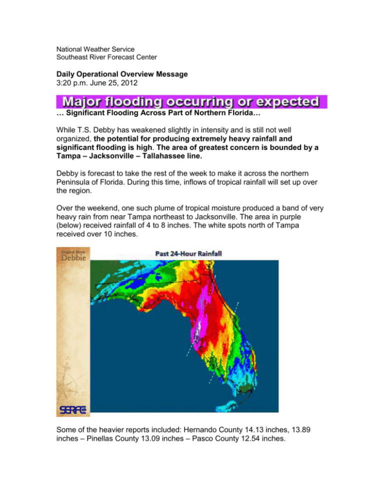
National Weather Service Southeast River Forecast Center Daily Operational Overview Message 3:20 p.m. June 25, 2012 … Significant Flooding Across Part of Northern Florida… While T.S. Debby has weakened slightly in intensity and is still not well organized, the potential for producing extremely heavy rainfall and significant flooding is high. The area of greatest concern is bounded by a Tampa – Jacksonville – Tallahassee line. Debby is forecast to take the rest of the week to make it across the northern Peninsula of Florida. During this time, inflows of tropical rainfall will set up over the region. Over the weekend, one such plume of tropical moisture produced a band of very heavy rain from near Tampa northeast to Jacksonville. The area in purple (below) received rainfall of 4 to 8 inches. The white spots north of Tampa received over 10 inches. Some of the heavier reports included: Hernando County 14.13 inches, 13.89 inches – Pinellas County 13.09 inches – Pasco County 12.54 inches. Most rivers within this band of heaviest rainfall (generally the dark red and purple) are rising fast and will exceed flood stage. Keep in mind that this rain event will continue for at least 4 more days! Here is the rainfall potential for the next 5 days. In the near term, the two areas of greatest concern are the regions that received the highest amount of rain over the weekend and the areas that are receiving the heaviest rainfall today. The northern Gulf Coast, near Tallahassee, is receiving a steady inflow of tropical rainfall today. Rainfall rates will be high for the rest of today and tonight from Tallahassee to Lake City. Extensive pooling of water, as well as urban and flash flooding can be expected near and along Interstate 10. Rainfall rates up to 3 inches per hour are occurring near and south of Tallahassee. Due to the slow and uncertain movement of Tropical Storm Debby, changes in the rainfall and river forecasts can be expected over the next several days. SERFC Water Watch Team Main stem rivers within this area can also expect to experience fast rises, likely exceeding flood stage. SERFC Water Watch Team

