THE LIFE AND TIMES OF THE BURWOOD LANDFILL
THE LIFE AND TIMES OF THE BURWOOD LANDFILL, CHRISTCHURCH.
The Burwood landfill site is within 10km of central Christchurch, behind the sand dunes, only a few hundred meters from the coast at North Shore. Filling began in
July 1984 and continued until July 2005. Annual fill rates were 210,000-260,000 tonnes/year of non-putrescible waste. The fill footprint is about 55ha.
The soil at the site is a medium marine sand up to
40m thick overlying the
Riccarton gravel aquifer which is flowing artesian. A shallow unconfined water table exists within the sand and in fact surface water sits in the depressions. There is no lining beneath the fill and the prior available piezometric information suggested that the leachate would flow slowly towards the coast and be dispersed in the surf.
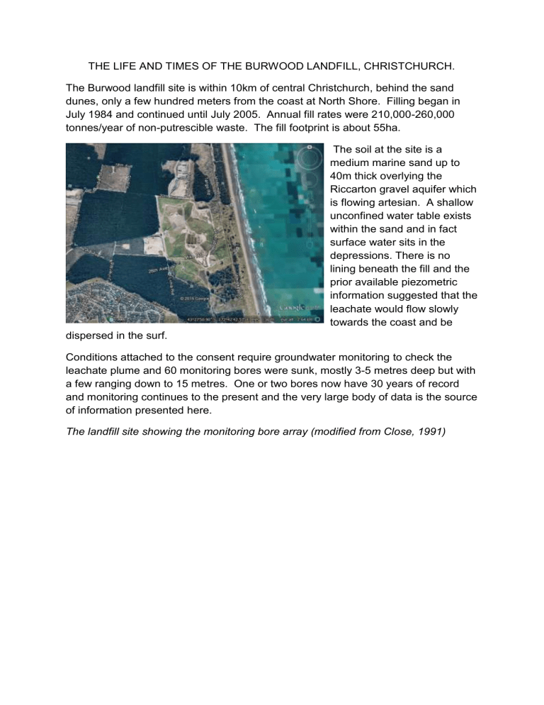
Conditions attached to the consent require groundwater monitoring to check the leachate plume and 60 monitoring bores were sunk, mostly 3-5 metres deep but with a few ranging down to 15 metres. One or two bores now have 30 years of record and monitoring continues to the present and the very large body of data is the source of information presented here.
The landfill site showing the monitoring bore array (modified from Close, 1991)
Broadly speaking the leachate plume behaved much as expected i.e. moving on an angle towards the coast but at a somewhat slower rate than calculated prior to filling beginning (Hunt and
Young, 1980). The landfill footprint is so large that it is difficult to calculate the pore velocity because filling was progressive in four very large cells so defined points of origin for the leachate cannot be determined. It is however possible to discern two plumes, one originating at each end of the site and pore velocities were calculated from the times of first and peak arrival at pairs of observation bores along the line of maximum observed concentrations. Given that the filling of each cell took several years there were, in many cases, several peaks and it is probably more reliable to calculate velocities from the times of first arrivals. Velocities calculated from first arrivals are in the range 25-40 metres per year.
Many analytes travelled well enough in this environment to be used as tracers but total alkalinity seemed to generally travel slightly faster and most clearly and will be used to illustrate ground water behaviour. Numerous organics were analysed but results were generally below the limit of detection. Exceptions were vinyl chloride and bromo fluoro benzene occasionally, in a few bores at very low levels. The leachate penetrated the sand to significant depth e.g. 8-10m below ground, possibly driven by mounding of leachate beneath the filled cells.
Presumably leachate generation built up, maintained a level and then tapered off but this is not always reflected in the breakthrough curves many of which show the classic shape of growth and decay back to low levels. Others curves displayed sustained elevated values suggestive of lengthy periods of leachate generation.
Double peaks could be an indication of adjacent plumes merging sideways.
Given the 30 years of rain falling on the area since filling began a significant amount of groundwater recharge must have occurred. Assuming a 600mm annual rainfall,
100mm recharge and 40% porosity an annual thickness of 250mm of sand would be saturated. Some will have flowed coastward but over 30 years this could have filled a significant thickness of aquifer with fresh water and may have depressed the leachate plume below water table. There is some suggestion that this could be true in that concentrations in a few deeper bores are higher than in adjacent shallow bores but the evidence is not conclusive.
Extrapolating from the plotted contours using the velocities calculated it would seem that the leachate plume is now at or close to the coast. This is of no great
significance as the concentrations are low, the flow rate slow and the dispersion by the surf and long-shore current would be enormous.
The data used in this paper is publically available and was obtained by URS on contract to the Christchurch City Council.
References
Hunt, B. & Young R. E. (1980) A landfill groundwater study in Christchurch New Zealand.
Fluid Mechanics Conference, Brisbane, 18-22 August 1980.
Close, M. E. (1991), Assessment of Christchurch metropolitan landfill groundwater quality data.
Contract report 1991/53. Prepared for the Canterbury Regional Council.
