Jakten på det försvunna skeppet
advertisement
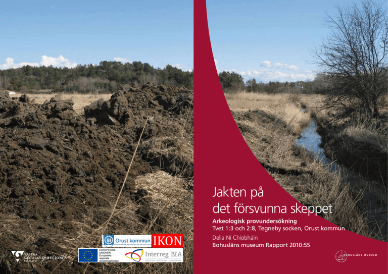
Jakten på det försvunna skeppet Arkeologisk provundersökning Tvet 1:3 och 2:8, Tegneby socken, Orust kommun Delia Ní Chíobháin Bohusläns museum Rapport 2010:55 Jakten på det försvunna skeppet Arkeologisk provundersökning Tvet 1:3 och 2:8, Tegneby socken, Orust kommun Bohusläns museum Rapport 2010:55 ISSN 1650-3368 Författare Delia Ní Chíobháin Layout, grafisk form och teknisk redigering Gabriella Kalmar Omslagsbild Foto taget av Staffan von Arbin. Fotot visar Strane å mot sydost. Illustration Författaren om inget annat anges Tryck Bording AB, Borås 2011 Kartor ur allmänt kartmaterial, © Lantmäteriet medgivande 90.8012 Kartor godkända från sekretessynpunkt för spridning. Lantmäteriet 2010-10-14. Dnr 601-2010/2579 Bohusläns museum Museigatan 1 Box 403 451 19 Uddevalla tel 0522-65 65 00, fax 0522-126 73 www.vastarvet.se, www.bohuslansmuseum.se Innehåll Svensk sammanfattning........................................................................................................... 5 Background..................................................................................................................................................... 5 Landscape........................................................................................................................................................... 8 Natural landscape.................................................................................................................................. 8 Cultural landscape................................................................................................................................ 8 Ancient monuments and previous investigations...................................... 9 Method.................................................................................................................................................................... 9 Results. ...................................................................................................................................................................... 9 Magnetometry. .......................................................................................................................................... 9 Georadar........................................................................................................................................................ 10 Test trenches...............................................................................................................................................11 Conclusion and recommendations.................................................................. 13 References...................................................................................................................................................... 15 Literature........................................................................................................................................................ 15 Unpublished sources...................................................................................................................... 15 Technical and administrative data...................................................................... 16 Appendices................................................................................................................................................... 17 4 Bohusläns museum Rapport 2010:55 Figure 1. Section of GSD-Property map with the location of the investigation area marked. Figur 1. Utsnitt ur GSD-Röda kartan/Fastighetskartan med platsen för undersökningen markerad. Jakten på det försvunna skeppet Svensk sammanfattning I samarbete med Orust kommun har Bohusläns museum utfört en provundersökning på fastigheterna Tvet 1:3 och 2:8, Orust kommun. Syftet med initiativet var att undersöka traditionsuppgifter rörande ett fynd av ett skeppsvrak, vilket skall ha gjorts omkring 1920 i samband med rensning och fördjupning av Strane å. Provundersökningen utfördes i form av sökschaktsgrävning med grävmaskin och placeringen av sökschakt baserades på resultatet av tidigare genomförd kartering med magnetometer och georadar. Vid undersökningen påträffades inga fynd av arkeologiskt intresse. Eftersom fyndplatsen endast har kunnat pekas ut ungefärligt av ortsbefolkningen behöver det negativa resultatet enligt Bohusläns museums uppfattning inte nödvändigtvis innebära att traditionen om fartygsfyndet saknar substans. Museets bedömning är att uppgifterna även fortsatt är av intresse och att de därför måste beaktas i händelse av framtida exploatering i området. Background Between 2007 and 2010 archaeological and geophysical investigations were carried out in an area of land in the parish of Tegneby, Orust kommun, Västra Götalands län (figures 1–3), in order to relocate old ship remains that were originally discovered in the 1920s. The investigations were carried out in cooperation between Bohusläns museum and Orust kommun and were conducted in two stages. First a geophysical survey was conducted as a feasibility study prior to any excavations after which a series of test trenches were dug in areas identified by the geophysical works. The investigations were part of the “Orust-båtbyggarland” project, which aims to identify and highlight Orust’s boatbuilding and maritime history, and were part-financed by the Interreg IV A project IKON. During the 1920s farmers in Tvet, Rom and Nötskär began to clear and deepen the streams and brooks of Strane å in an effort to drain their land. During the work they encountered what was interpreted as part of a large shipwreck in the brook bank. Concerned that the discovery would halt their work, they covered up the remains with soil, changed the route of their digging and kept the discovery a secret. The site first came to the attention of Orust kommun in the autumn of 2006, when the current land owners reported that a shipwreck had been found on their property. The details of the discovery had been passed down through local family members and the site location was said to be on the banks of the brook Strane å in properties Tvet 1:3 or 2:8. The investigations included magnetometry and georadar surveys along with test trench excavation in areas where anomalies were highlighted in the geophysical surveys. 5 6 Bohusläns museum Rapport 2010:55 Figure 2. Section of GSD-Property map with the location of the investigation area marked. Scale 1:20 000. Permission for distribution approved by the Security Officer. Lantmäteriet 2010-10-14. Dnr 601-2010/2579. Figur 2. Utsnitt ur GSD-Fastighetskartan med platsen för undersökningen markerad. Skala 1:20 000. Godkänd ur sekretessynpunkt för spridning. Lantmäteriet 2010-10-14. Dnr 601-2010/2579. Jakten på det försvunna skeppet Figure 3. Section of GSD-Property map, sheets 8A 0j, 8B 0a, with the investigation area and nearby ancient remains marked. Scale 1:10 000. Permission for distribution approved by the Security Officer. Lantmäteriet 2010-10-14. Dnr 601-2010/2579. Figur 3. Utsnitt ur GSD-Fastighetskartan, blad 8A 0j och 8B 0a, med översikt över undersökningsområdet samt närliggande fornlämningar markerade. Skala 1:10 000. Godkänd ur sekretessynpunkt för spridning. Lantmäteriet 2010-10-14. Dnr 601-2010/2579. 7 8 Bohusläns museum Rapport 2010:55 Landscape Natural landscape The investigation area is located to the southeast of a valley that runs northwest–southeast in the southwest of Orust. In the valley bottom runs the brook Strane å which leads to Nedre Strand, a bay sheltered by Ängholmen as it runs to sea. The highest areas are dominant toward the coast in the east, where the Strane brook runs through two steep hills between 35 and 70 meters above sea level. The valley is comprised of cultivated farming land on the valley floor, with pasture and fodder activities on the slopes. The soils in the valley consist of sandy silt and clay. The height above sea level around the investigation area varies between 5 and 10 meters. During the Iron Age the Strane valley would have been a shallow bay which was connected to the salt lake by a narrow strait at Strands kvarn. As the brook is a nursery environment for trout, the excavations were limited to its banks and did not extend into the brook. Cultural landscape Figure 4. Glenn Envall, Skandinavisk Arkeo­ logisk Geofysik AB (SAGA), conducting a survey with a magnetometer. Photo Staffan von Arbin, Bohusläns museum. Figur 4. Glenn Envall, Skandinavisk Arkeologisk Geofysik AB (SAGA), genomför undersökning med magnetometer. Foto Staffan von Arbin, Bohusläns museum. The investigated area is located to the south of Tvet, to the north of Nötskär and to the east of Rom, in the parish of Tegneby. It is most likely that the word Tegneby is derived from the word thegn, which was in Viking times the name for a local executive in the king’s service. One of the tasks possibly accorded to an executive was to equip ships in the king’s service. This would suggest that this region of Orust would have held importance since at least the late Iron Age (Löfving 2001:79–102). Many of the ancient place names in the area have maritime connotations, for example Nötskär, which was written as Naust kiarr in the 1300s and means “marsh with boathouse”. A naust was a boathouse used by the Vikings to keep their ships stored over winter (Westerdahl 1989:246–258). Other examples of place names associated with maritime activities include Leby, Knarrevallen, and Snäckehålssiken. The name element le-, as in the place name Leby, could be indicative of a fareway or sailing route, whilst knarr and snäcka are names of ship types that were commonly used during the late Iron Age and early medieval period (Westerdahl 1989:139pp, 152p, 191p). Orust has a long tradition of boatbuilding stretching back centuries and it has been an important industry for the island. The earliest known record of boatbuilding related to the island is from 1253 when the king Håkon Håkonsson had a ship built on Rafnshollt, which is most likely Ramshult in Lyresund. During the medieval period the right to build boats lay with city dwellers; however boats were still built in the countryside. These were mostly for private use although there is some evidence that some were also commissioned. There was an increase in the building of boats within the fjords of Orust after Bohuslän’s transition to Sweden in 1658. From the early modern period onwards fishing Jakten på det försvunna skeppet 9 villages were established along the outer coast of Orust, where as small cargo boats and other boats were commissioned in areas within the fjords (Carlsson 1994:144 pp). Ancient monuments and previous investigations The surrounding area is characterized by a large number of ancient monuments and archaeological finds, consisting mainly of remains from prehistory but also from the medieval period and later. Tegneby 344:1 is the find spot of a gold neck ring discovered in 1769 and dated to the Migration Period. It is situated on the banks on the southwestern side of Håbergskulle, opposite the investigation area (FMIS). During drainage works in the 1930s four Arabic silver coins from the 900s were found near Tegneby church. They were stored in the attic of the church and rediscovered in 1971. They have been dated to the rule of Abu Ibrahim Isma’il I ibn Ahmad, 892–907 AD. During his rule over the city of Khurasan – the capital of Bukhara, which was also located along the Silk Road – it became a centre of commerce and Isma’il had an abundance of coinage struck (The David Collection). It is thought that these coins made their way to Orust with Viking traders, thus strengthening the Viking link with the island. Method In September 2007 a magnetometry survey was carried out by Skandinavisk Arkeologisk Geofysik AB (SAGA) using a Grad 601 fluxgate gradiometer (figures 4 and 6). The purpose of the survey was to measure any minor variations in the earth’s magnetic field, which can be caused, among other activities, by soil disturbance or the presence of artefacts. Some anomalies were noted but none which were positively identified as being of archaeological significance. In November 2008 a georadar survey was conducted by GeoNova Consulting (figure 7). An additional attempt was made to detect areas of previous soil disturbance and possible objects using a GeoScope ground penetrating radar. This survey revealed the presence of some anomalies which were interpreted as possible archaeological features. In April 2010 a series of test trenches (figure 5) were dug mechanically by an excavator whilst monitored by archaeologists from Bohusläns museum (appendix 1). The locations of the trenches were based on the knowledge gained from the previous magnetometry and georadar surveys. Results Magnetometry Figure 5. Test trench excavation. Photo Delia Ní Chíobháin, Bohusläns museum. The magnetometry survey covered an area of 500 square meters, which was divided into five grids of 30 × 30 meters in size, three of which were Figur 5. Bild från sökschaktsgrävningen. Foto Delia Ní Chíobháin, Bohusläns museum. 10 Bohusläns museum Rapport 2010:55 Figure 6. Results of the magnetometry survey. Scale 1:10 000. Permission for distribution approved by the Security Officer. Lantmäteriet 2010-10-14. Dnr 601-2010/2579. Figur 6. Resultatet av magnetometerundersökningen. Skala 1:10 000. Godkänd ur sekretessynpunkt för spridning. Lantmäteriet 2010-10-14. Dnr 601-2010/2579. partially surveyed (figure 6). Five anomalies were detected which were interpreted as possibly being of archaeological nature, one ridge which ran northwest – southeast and four single objects. However, the survey revealed no conclusive evidence of where a possible site may be located. Georadar The georadar survey spanned an area on both sides of the brook and identified an area of 475,000 square meters which indicated disturbed or redeposited soil. A large portion of this disturbance ran parallel to the Jakten på det försvunna skeppet Figure 7. Results of the georadar survey. Scale 1:10 000. Permission for distribution approved by the Security Officer. Lantmäteriet 2010-10-14. Dnr 601-2010/2579. Figur 7. Resultatet av georadarundersökningen. Skala 1:10 000. Godkänd ur sekretessynpunkt för spridning. Lantmäteriet 2010-10-14. Dnr 601-2010/2579. current course of the brook and further area expanding to the northeast. A total of sixteen points also detected were preliminarily interpreted as possible archaeological objects (figure 7). Test trenches The locations chosen for the test trenches were based on the results of the magnetometry and georadar surveys. A total of 25 test trenches were excavated, 23 along the route of the brook Strane å and two located further 11 12 Bohusläns museum Rapport 2010:55 Figure 8. Investigation area with test trenches marked. Scale 1:10 000. Permission for distribution approved by the Security Officer. Lantmäteriet 2010-10-14. Dnr 601-2010/2579. Figur 8. Undersökningsområdet med schakt. Skala 1:10 000. Godkänd ur sekretessynpunkt för spridning. Lantmäteriet 2010-10-14. Dnr 601-2010/2579. within the field, with a total of 245 cubic meters excavated (figure 8). The layers consisted of topsoil 10 cm deep, silt from 10 cm to between 70 cm and 180 cm and clay from between 70 cm and 180 cm (appendix 2). The trenches did not yield any evidence of archaeological remains. The few features that were discovered, such as the stone concentrations in trenches 8 and 9 had been identified on the georadar survey and were interpreted as having functioned as a modern water drain for the field. While all trenches were geo-referenced using a DGPS, there were some technical difficulties in positioning the trenches over some of the selected anomalies (figure 9). Test trenches were situated over the larger anomalies and the majority of anomalies. Jakten på det försvunna skeppet Figure 9. Investigation area with test trenches and geophysical results marked. Scale 1:10 000. Permission for distribution approved by the Security Officer. Lantmäteriet 2010-10-14. Dnr 601-2010/2579. Figur 9. Undersökningsområdet med schakt och g geofysiska resultat markerade. Skala 1:10 000. Godkänd ur sekretessynpunkt för spridning. Lantmäteriet 2010-10-14. Dnr 601-2010/2579. Conclusion and recommendations Contrary to the local tradition, no evidence of a shipwreck was found. This could be for a number of reasons. The location description of the find was given as a general location between two properties and Strane å, and while the geophysics and the test excavations focused on this 13 14 Bohusläns museum Rapport 2010:55 area, the find spot may have been mistaken as the knowledge was passed down. The timbers which were redeposited by the local workers may also have been placed in a different area than was mentioned, or they may also have been removed from the area though this is not thought to have happened. Finally, as the streams and brooks in the farm lands were being redirected for better drainage the route of Strane å may also have been changed, resulting in a difficulty when attempting to define the possible site location. There was also no description given in the tradition as to how deep in the ground the ship was found. While the test excavations did not result in any positive site location, the possibility of ship remains in the area is still high and any future development in the vicinity should observe the tradition. Jakten på det försvunna skeppet References Literature Carlsson, H. 1994. Orust. Historia och miljö. Bohusläns museum. Uddevalla. Löfving, C. 2001. Gothia som dansk/engelskt skattland. Ett exempel på heterarki omkring år 1000. GOTARC: Series B. Gothenburg Archaeological Theses No 16. Institutionen för arkeologi, Göteborgs universitet. Diss. Westerdahl, C. 1989. Norrlandsleden I. Källor till det maritima kulturlandskapet. Arkiv för norrländsk hembygdsforskning XXIV 1988–89. Härnösand. Unpublished sources FMIS, Digitala fornminnesregistret, Riksantikvarieämbetet, Stockholm. The David Collection. The David Collection museum, Copenhagen. Handlingar hämtade från [http://www.davidmus.dk/en/collections/islamic/dynasties/abbasiderne ] 24 augusti 2010. 15 16 Bohusläns museum Rapport 2010:55 Technical and administrative data Lst dnr: Västarvet dnr: Västarvet pnr: Fornlämningsnr: 431-82444-2010 NOK 925-2006 E100 - Län: Kommun: Socken: Fastighet: Västra Götalands län Orust Tegneby Tvet 1:3 och 2:8 Ek. karta: Läge: Meter över havet: Koordinatsystem: 8A 0j och 8B 0a X: 6452995, Y: 1249880 10–15 RT 90 2,5 gon V Uppdragsgivare: Ansvarig institution: Projektledare: Fältpersonal: Orust kommun Bohusläns museum Staffan von Arbin Staffan von Arbin, Delia Ní Chíobháin (Bohusläns museum) Fältarbetstid: Arkeologtimmar i fält: Undersökt yta: Undersökt volym: 9–10 april 2010 32 175 m2 245 m³ Arkiv: Fynd: Bohusläns museums arkiv Inga fynd omhändertogs Jakten på det försvunna skeppet Appendices Appendix 1. Plan of investigation area. Scale 1:3 000. Permission for dis- tribution approved by the Security Officer. Lantmäteriet 2010-10-14. Dnr 6012010/2579. Bilaga 1. Plan över undersökningsområdet. Skala 1:3 000. Godkänd ur sekretessynpunkt för spridning. Lantmäteriet 2010-10-14. Dnr 601-2010/2579. Appendix 2. Table of test trenches Bilaga 2. Schakttabell 17 Appendix 1. Plan of investigation area. Scale 1:3 000. Permission for distribution approved by the Security Officer. Lantmäteriet 2010-10-14. Dnr 601-2010/2579 Bilaga 1. Plan över undersökningsområdet. Skala 1:3 000. Godkänd ur sekretessynpunkt för spridning. Lantmäteriet 2010-10-14. Dnr 601-2010/2579. Appendix 2. Table of test trenches Bilaga 2. Schakttabell Nummer 1 2 3 4 5 6 7 8 9 10 11 12 13 14 15 16 17 18 19 20 21 22 23 24 25 Längd (m) 5,5 5,5 7,5 9 8 12 9 8 7,5 7,4 3 2 5 5 3,5 4 2,5 2,5 7 4 4,5 5,5 5 7 5 Bredd (m) 1,3 1,3 1,3 1,3 1,3 1,3 1,3 1,3 1,3 1,3 1,3 2,6 1,3 1,3 1,3 1,3 1,3 1,3 1,3 1,3 1,3 1,3 1,3 1,3 1,3 Djup (m) 1,5 1,5 1,5 1,5 1,5 2 1,5 1,5 1,5 1,5 1,5 2 1,5 1,5 1,5 1,5 1,5 1,5 1,5 1,5 1,5 1,5 1,5 1,5 1,5 Kommentar Inga fynd Inga fynd Inga fynd Inga fynd Inga fynd Inga fynd Inga fynd Stenpackning (dränering/täckdike) Stenpackning (dränering/täckdike) Inga fynd Inga fynd Inga fynd Inga fynd Inga fynd Inga fynd Inga fynd Inga fynd Inga fynd Inga fynd Inga fynd Inga fynd Inga fynd Inga fynd Inga fynd Inga fynd Jakten på det försvunna skeppet Arkeologisk provundersökning Tvet 1:3 och 2:8, Tegneby socken, Orust kommun Delia Ní Chíobháin Bohusläns museum Rapport 2010:55
