to view Powerpoint: highline final
advertisement
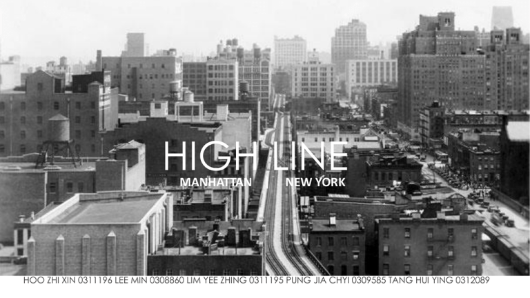
HIGH LINE MANHATTAN | NEW YORK HOO ZHI XIN 0311196 LEE MIN 0308860 LIM YEE ZHING 0311195 PUNG JIA CHYI 0309585 TANG HUI YING 0312089 MANHATTAN Area: 33.77 sq mi (87.5 km2) Density: 27,345.9/km2 GRID SYSTEM,1811 -New York utilize the most versatile grid system for its urban planning during the 19th century. -Planned under French-American architect Pierre Charles L’enfant in 1811 -The streets are arranged in numerical / alphabetical order -Although the system is very efficient, in streets’ characteristics wise it is lack of identity since most of the arrangement of buildings are identical. MANHATTAN Area: 33.77 sq mi (87.5 km2) Density: 27,345.9/km2 TRANSIT ORIENTED DEVELOPMENT (TOD) MODEL,1993 As time goes by, world population increased and Manhattan as an emerging city with skyscrapers, TOD model is used for urban planning. Land use -Mixed use development Structure -Located on an existing/planned trunk transit line -Interconnected local streets Architecture -Human scale buildings -Roads to form vistas MANHATTAN Area: 33.77 sq mi (87.5 km2) Density: 27,345.9/km2 CONTEMPORARY TRENDS The authority is now focus more on district level development, about consensus-based planning and zoning changes for individual neighborhoods and business districts, as well as establishing policies and zoning regulations applicable citywide. Examples: -Sustainable communities -Waterfront development -Green Manhattan DEVELOPMENT STATUS -Steady state & organic -Preserving initial concept at the same time embed post modernism elements in it HIGH LINE INTRODUCTION -A linear park(1.6km) built on a historic freight rail line(2.33km) elevated above the streets on Manhattan’s west side that spans through 22 blocks. -Owned by the city of New York, and maintained and operated by friends of the high line. -The historic structure was under the treat of demolition, now maintained by the community, It serves as an extraordinary public space for all visitors to enjoy. HIGH LINE HISTORY 1930s Built as part of a massive public-private infrastructure project called the west side improvement. Lifted freight traffic 30 feet in the air, removing dangerous trains from the streets of Manhattan's largest industrial district. 1980s Faced threatens of demolition since no train has run on it. 1999 Friends of High Line founded by the residents of high line neighborhood. Advocated preservation of high line and to be reuse as public open space. 2006 Construction of section 1 begins, open to public in 2009. 2011 Section 2 opens to the public 2014 Section 3 under construction HIGH LINE SITE & ACCESSIBILITY The high line is highly accessible with the transport system and public amenities it provided. It is also a very user friendly space. -Runs from Gansevoort street in the meatpacking district to west 34th street, between 10th and 11th avenues. -Access points at various nodes: Gansevoort St., 14 St., 23 St., West 18,20,26,28,30 St. -Fully wheel chair accessible, with elevator services provided at some of the access points -Street furniture & public amenities provided -Bike racks & parking available -Able to reach by subway & bus HIGH LINE DESIGN CONCEPT Combining agriculture and architecture, the high line is a very sustainable structure which emphasize horizontal green scape in the vertical city. - AGRI-TECTURE - - Combines organic and building materials into gradients of changing proportions that accommodate a variety of natural and programmatic conditions. Surface material : Individual pre-cast concrete planks with open joints (to encourage emergent growth like wild grass through cracks in the sidewalk) -Tapering units : Comb into planting beds creating a “pathless” landscape HIGH LINE LANDSCAPE – Various kind of combinations and designs which merged the man-made structure and the nature perfectly, and it’s aesthetic and practical. HIGH LINE SPACES & PROGRAMMES The high line has different kind of spaces which house different activities. There are mean for gathering spots or walkways for strolling. It accommodate a group of people and also provide spaces for individual. Grassland grove -Gathering space, secluded seating, picnic area Rail track walk -Linear walks, exposed & revealed rail tracks -Evoking high line’s history as an active freight rail line HIGH LINE SPACES & PROGRAMMES 11th Avenue Bridge: -Elevated cat walk -Overlooking the city scape & Hudson river Pershing Square beams: -High line’s concrete deck stripped away, original framework of steel beams & girders is shown -Play elements developed exclusively for high line, unique design features for kids HIGH LINE SPACES & PROGRAMMES Interim walkway : - Simple path through the existing self-seeded plantings -Celebrating the urban landscape that emerged on the High Line after the trains stopped running in 1980. Others: -Free tours, workshops, field trip, festivals -Encourages communities to explore contemporary arts, horticulture, and urban preservation, creating innovative experiences that highlight the distinctiveness of the park. The activities engaged users to the nature and the structure itself and prompted human’s awareness towards revitalization of unused open spaces which create different perceptions and this makes people rethink about negative spaces in urban design. HIGH LINE OBJECTIVES AND AIMS OBJECTIVES Form, Activity, Movement pattern AIM A: CONNECTING PEOPLE FOR A DIVERSE CITY Emerged a gathering space in the middle of city Engaging communities HIGH LINE OBJECTIVES AND AIMS OBJECTIVES Form, Activity, Movement pattern AIM B: PROMOTE SUSTAINABILITY FOR A HELTHY CITY Revitalized abandoned open spaces, lengthened lifespan of the structure Promote landscape design in the midst of sky scrappers HIGH LINE OBJECTIVES AND AIMS OBJECTIVES Form, Activity, Movement pattern AIM C: DECREASE CRIME RATE FOR A SAFER CITY Redefine unused open spaces Constant activities held , public surveillance FORM ‘Human perception’ Aim A: Connecting People FOR A DIVERSE CITY (A) Height – from ground level -Can be seen in various streets far away due to Manhattan’s grid pattern. -Elevated shrubs and trees can be easily noticed from street level giving out vibrant color, contrasting with overloading skyscrapers. -‘Denial and reward’ effect inviting them for the urge of greenery and breathing space. Aim A: Connecting People FOR A DIVERSE CITY (B) Height – from Highline -Floating 25 feet above the ground, connected to street life yet far away from it. -Promotes eye contact (void interaction) in different angles and directions. Aim A: Connecting People FOR A DIVERSE CITY (C) Facade - Art deco masterpiece of industrial design. - A sense of security through the sturdy color and skin -Creates identity and pride for Manhattan Aim A: Connecting People FOR A DIVERSE CITY (D) Typology - Linear -Stretches linearly above street horizon. -Provides seating and several viewing spots framing streets and buildings activities within linear typology, emphasizing movement and vision linearly. -Plants planted in linear congregate pattern to shape the focal point. - Balances optic perception between horizontal (street) and vertical (skyscrapers). Aim B: PROMOTE SUSTAINABILITY FOR A HEALTHIER CITY (A) Technology -The plants purify urban air, absorbing pollutant -Highline is considered as a walkable green roof/landscape with all the variety of plants and gives out oxygen decreasing urban heat island effect in Manhattan. inserted into the construction system. Aim B: PROMOTE SUSTAINABILITY FOR A HEALTHIER CITY (B) Height & Facade -Vertical/elevated soft scape emit a frequent green image imprint to people, satisfying them and filling their urge for nature. Hence, promotes wellbeing and improve the life style of people in Manhattan. Aim C: DECREASE CRIME RATE FOR A SAFER CITY (A) Height -Elevated above ground, the activities are exposed which create public surveillance on criminal cases Aim C: DECREASE CRIME RATE FOR A SAFER CITY (B) Typology -Shaped in linear directions, this open space increases public surveillance due to little wide angle turning points. -Straight forward circulation, making crime harder to take place due to fast pace. Aim C: DECREASE CRIME RATE FOR A SAFER CITY (C) Technology -Lights at the Highline illuminating the streets below, improved street safety. -Elevators and stairs are installed in several spots for easy accessibility. ACTIVITY ‘Architecture seems to create a particular space where people can display their activities efficiently, not only daily lives, but also to impact on society, economy, and culture as a whole.’ Aim A: Connecting People FOR A DIVERSE CITY (A) Recreation -Each setting of the micro landscapes and outdoor rooms facilitates different tempos and densities of activity, from quiet strolling and placid sunbathing to promiscuous picture-taking and voyeuristic viewing. Aim A: Connecting People FOR A DIVERSE CITY (B) Interaction -It offers doubly abundant opportunities for looking (at the city, at each other, at oneself), moving (aimlessly or purposefully), and gathering (with friends, with strangers, with one's thoughts). Aim A: Connecting People FOR A DIVERSE CITY (C) Rehabilitation -People has brought together to advocate for the High Line's preservation when the structure was under threat of demolition. -It is agreed to utilize the preserved iron tracks and the hulking black steel structure built in 1934 as building components. Aim B: PROMOTE SUSTAINABILITY FOR A HEALTHIER CITY (A) Recreation -Planting selections for the recreational park are determined according to their ranging responses to, and durability throughout the seasons. 161 out of the 210 plant species in the design of High Line are native to New York. Aim B: PROMOTE SUSTAINABILITY FOR A HEALTHIER CITY (B) Interaction -Being a public park, it serves as nodes for the preservation of nature in the city where people gravitate toward social hot spots and the park thus extends the city's multi-layered density. “Urban life was defined by the urge to be among other people, including strangers”. -William H. Whyte Aim B: PROMOTE SUSTAINABILITY FOR A HEALTHIER CITY (C) Rehabilitation -Besides its continuation to historic context, High Line repurposes of a piece of industrial infrastructure as public green space. -It is inherently a green structure with its landscape functions essentially like a green roof. Aim C: DECREASE CRIME RATE FOR A SAFER CITY (A) Recreation -The recreational garden may propose or even instruct its visitors about the garden art, with the green stimuli that provokes ‘green visionary psychology’. “This is an aesthetic that celebrates motion and change, that encompasses dynamic processes rather than static objects, and that embraces multiple, rather than singular”. -Anne Whiston Spirn Aim C: DECREASE CRIME RATE FOR A SAFER CITY (B) Interaction -Parks Enforcement Patrol officers walk the High Line all day. -City parks patrol officers at the High Line also operate crowd control and manage numbers on the High Line, limiting access at peak periods. “The police, the city’s Department of Parks and Recreation and the founders of the High Line all say there have been no reports of a major crime since its opening”. -The New York Times, 2011 Aim C: DECREASE CRIME RATE FOR A SAFER CITY (C) Rehabilitation -This declined railway offers opportunity of luxurious makeover from an abandoned elevated railroad into a favourite among its residents. -Not only does it appreciate its surrounding land, but it also gives the city a new image by providing comfortable outdoor space for people. And thus, new employment opportunities and economical benefits come along with the development. Movement Pattern ‘Line’ that connecting one element to another Linear Movement Pattern: A response to NYC of grid pattern urban layout Aim A: Connecting People FOR A DIVERSE CITY (A) Linkage -Linear linkage which provides alternative entrances and exits to various destinations throughout whole stretch of High Line. These points form nodes that people are meant to be congregated at these nodes to enter High Line. -Connecting people from various part of city. Aim A: Connecting People FOR A DIVERSE CITY (A) Linkage -It is a point of convergence by providing seating area to the public. People are able to interact with others that makes this to become a gathering place for community. Aim A: Connecting People FOR A DIVERSE CITY (B) Layering -Due to the concept of lifting up pedestrian, High Line has successfully created another layer vertically apart from the traffic road below. Aim A: Connecting People FOR A DIVERSE CITY (B) Layering -Good use of space that build up a pedestrian pathway/recreational area vertically within high dense New York City. Aim A: Connecting People FOR A DIVERSE CITY (C ) Pedestrianization -Provision of alternative pathways to various destination for pedestrian. This makes High Line transformed from train road into pedestrian pathway. -Separation of vehicle and pedestrian that secured pedestrian. Aim A: Connecting People FOR A DIVERSE CITY (C ) Pedestrianization -Walking instead of driving within enclosed metal case. -Speed of walking is slower compared to the vehicle speed. Therefore, pedestrian will have more chances to interact with each other. Aim A: Connecting People FOR A DIVERSE CITY (D) Accessibility -Easy access to High Line from various entrances that connects people from different direction of the city. -Walkable distances from entrances to various exits that which corresponds to theory of movement distance is inversely proportional to density of city. This feature of High Line attracts pedestrian to utilize it. Aim B: PROMOTE SUSTAINABILITY FOR A HEALTHIER CITY (A) Greeneries -Increasing area for plantation within compact city scape. -Greeneries along pathway attract users therefore decrease usage of petrol by vehicle. Aim B: PROMOTE SUSTAINABILITY FOR A HEALTHIER CITY (B) Decreasing Traffic Congestion -By minimizing traffic load, consumption of petrol is reduced thus decreasing emission of CO2 and preventing hot island effect. Aim C: DECREASE CRIME RATE FOR A SAFER CITY (A) Linkage -As a linkage to various streets, High Line has high flow rate of people, hence decreases criminal issues. -With its linear movement pattern, criminals have not much alternative route to escape away. Aim C: DECREASE CRIME RATE FOR A SAFER CITY (B) Layering -As it is elevated from ground, High Line has a high visibility from different viewpoints that is easy to be discovered by people. Aim C: DECREASE CRIME RATE FOR A SAFER CITY (C) Accessibility -It is highly accessible that can be reached by people and guards in minutes, hence enhance its security. COMPARISONS BETWEEN URBAN STRUCTURING PRINCIPLES COMPARISONS BETWEEN URBAN STRUCTURING PRINCIPLES FORM Linear typology ACTIVITY Recreational Height Pedestrianization Layering Interaction Technology Facade MOVEMENT PATTERN Linkage Accessibility Rehabilitation - CONNECTING PEOPLE - PROMOTE SUSTAINABILITY - REDUCE CRIME RATE CONCLUSIONS AND IMPACTS MOVEMENT PATTERN- Linear IMPACTS movement provides direct integration ACTIVITY- FORM- Connecting Volunteering work gather neighbourhood together people from different points and directions Aim A: Connecting People FOR A DIVERSE CITY Form, movement patterns and activities offer to success to connect people for a better neighbourhood experience as these 3 aspects provide safety from busy street, linkage from point to point that is easily accessible as well as gathering people with same interest. MOVEMENT PATTERN- Layering FORM- Vertical & of the city provides more area from greeneries planting elevated softscape emit a frequent green image imprint to the city IMPACTS ACTIVITYProvides comfort spaces for outdoor activities therefore reduce indoor energy consumption Aim B: Promote Sustainability FOR A HEALTHY CITY Sustainability achieved from the 3 main aspects of urban structuring principles: form, movement patterns and activities. By making the abandoned trail track into walkable recreational space to decrease usage of vehicle, emission of CO2 can be reduced. The space was contextually designed to provide high accessibility to promote healthy city lifestyle. MOVEMENT PATTERN- Linkage IMPACTS between points increases public surveillance FORM- Linear ACTIVITY- typology provides clear vision through the space Transforming the identity from (-) to (+) Aim C: Decrease Crime Rate FOR A SAFER CITY Crime rate is effectively reduced due to the effects of urban structuring principles directly. Transforming the function of Highline from negativity into positivity has successfully induced the usage of the space as recreational park and attracts local users, avoiding misuse of the trail track. High visibility at higher level enhance site safety. OTHER IMPACTS -A new identity -Job opportunities -Proposals for museums along its path -Promotes art in the Highline Video: http://www.youtube.com/watch?v=7CgTlg_L_Sw CONCLUSION Harmony between manmade structures and natural elements has to be emphasized within this compact urbanization era of New York city. The Highline successfully improved quality of urban life by bringing back nature into the heart of the city to achieve a diverse city, healthy city and safe city. REFERENCES “Designing the High Line.” Revisiting a funky idea called Agri-tecture. | High Line Blog. (n.d.). Retrieved from http://friendsofthehighline.wordpress.com/2008/08/12/designing-the-high-line-revisiting-a-funky-idea-called-agri-tecture/ High Line (New York City) - Wikipedia, the free encyclopedia. (n.d.). Retrieved September 15, 2014, from http://en.wikipedia.org/wiki/High_Line_%28New_York_City%29#Description The High Line | Friends of the High Line. (n.d.). Retrieved from http://www.thehighline.org/ The High Line by James Corner Field Operations and Diller Scofidio + Renfro. (n.d.). Retrieved from http://www.dezeen.com/2009/06/15/the-high-line-by-james-corner-field-operations-and-diller-scofidio-renfro/ The High Line Section 2 opens - Dezeen. (n.d.). Retrieved from http://www.dezeen.com/2011/06/13/the-high-line-section-2-by-dillerscofidio-renfro-and-james-corner-field-operations/ REFERENCES Fink Shapiro, G. (2011, June 10). Looking, Moving, Gathering: Functions of the High Line. Retrieved September 14, 2014, from http://www.domusweb.it/en/architecture/2011/06/10/looking-moving-gathering-functions-of-the-high-line.html High Line. (2014). Friends of High Line. Retrieved September 13, 2014, from http://www.thehighline.org/galleries/images Martin, A. (2011, May 14). Virtual Progression: The High Line as Verdant Infoscape. Southern Methodist University. Retrieved September 13, 2014, from http://www.academia.edu/1287635/Virtual_Progression_the_High_Line_as_Verdant_Infoscape?login=&email_was_tak en=true&login=&email_was_taken=true McEntee, P. (2012, April 12). Deconstructing The high Line: The Representation and Reception of Nature In PostIndustrial Urban Park Design. Binghampton University, Retrieved September 13, 2014, from http://digitool.library.colostate.edu///exlibris/dtl/d3_1/apache_media/L2V4bGlicmlzL2R0bC9kM18xL2FwYWNoZV9tZW RpYS8xNzUwMTA=.pdf Watson, V., & Rutherfold, N. (n.d.). Functional Conversion: The High Line Park. Retrieved September 14, 2014, from http://2012-2013.nclurbandesign.org/generic-post/functional-conversion-the-high-line-park/
