Slide 1 - ESSIE at the University of Florida
advertisement

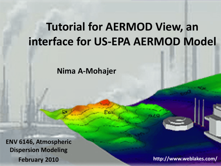
Tutorial for AERMOD View, an interface for US-EPA AERMOD Model Nima A-Mohajer ENV 6146, Atmospheric Dispersion Modeling February 2010 http://www.weblakes.com/ Outline Introduction to AERMOD Installation, AERMOD View environment AERMET Making the model in AERMOD View AERMOD pathways AERMAP Running AERMOD View Goal Pursuing an example for air dispersion modeling by using the AERMOD short-term model An introduction to AERMOD AERMOD stands for American Meteorological Society/ Environmental Protection Agency Regulatory Model COMPONENTS 1) AERMET – a meteorological preprocessor 2) AERMAP – a terrain data preprocessor 3) AERMOD – a dispersion model SUPPORT TOOLS 1) AER-SURFACE – processes surface characteristics data 2) AER-SCREEN – provides a screening tool AERMOD View, an interface for US-EPA AERMOD Model AERMET environment AERMOD View, an interface for US-EPA AERMOD Model Minimum AERMET input data 1) Hourly surface data 2) Upper air data 3) Location of the pertinent site, sectors and surface data 4) On-site data Hourly surface data 1) Cloud cover (Tenth) 2) Dry bulb temperature (o C) 3) Relative humidity (%) 4) Station pressure (mb) 7) Ceiling height (m) 8) Precipitation amount (hundredths of inches) 9) Global horizontal radiation (wh/m2) 5) Wind direction (deg) 6) Wins speed (m/s) AERMOD View, an interface for US-EPA AERMOD Model AERMET (Hourly surface data) AERMOD View, an interface for US-EPA AERMOD Model Input hourly surface data AERMOD View, an interface for US-EPA AERMOD Model Quality assessment feature QA is an optional process helping potential problems in data to be excluded or included. AERMOD View, an interface for US-EPA AERMOD Model AERMET (Upper air data) AERMOD View, an interface for US-EPA AERMOD Model Input upper air data How does it look after clicking preview button? http://www.webmet.com/MetGuide/TD6200.html AERMOD View, an interface for US-EPA AERMOD Model Quality assessment for upper data QA is an optional process helping potential problems in data to be excluded or included. AERMOD View, an interface for US-EPA AERMOD Model Application site, sectors and surface parameters Site of model (application site) AERMOD View, an interface for US-EPA AERMOD Model Application site, sectors and surface parameters AERMOD View, an interface for US-EPA AERMOD Model Application site, sectors and surface parameters 1) Albedo for each land type → reflective power of the surface 2) Bowen ratio for each land type → portion of transferred energy from the surface to the atmosphere 3) Surface roughness foe each land type A combination of different types of land use data may be used for a particular case. AERMOD View, an interface for US-EPA AERMOD Model Running the AERMET/Outputs Output files 1) Surface file, *.SFC 2) Profile file, *.PFL 3) Wind rose AERMOD View, an interface for US-EPA AERMOD Model AERMOD View Assumptions 3) SO2 as pollutant in flue gas 1) A factory in a rural area 4) Assumed value for stacks 2) 2 stacks with a building 5) Surface file, *.SFC in between 6) Profile file, *.PFL AERMOD View, an interface for US-EPA AERMOD Model Defining initial parameters UTM (Universal Transverse Mercator) Zones http://en.wikipedia.org/wiki/Universal_Tran sverse_Mercator_coordinate_system AERMOD View, an interface for US-EPA AERMOD Model Defining initial parameters Site geometry AERMOD View, an interface for US-EPA AERMOD Model AERMOD environment AERMOD View, an interface for US-EPA AERMOD Model Importing base map A raster map as an image file (JPEG, TIFF, DXF, …) should be imported Import → Base maps… Then, map extents should be geo-referenced AERMOD View, an interface for US-EPA AERMOD Model Importing stacks and building Extents of the building foundation and stacks are imported by a DXF file. Import → base maps… AERMOD View, an interface for US-EPA AERMOD Model Defining building Drawing tools AERMOD View, an interface for US-EPA AERMOD Model Defining stacks Zooming to the extents of interest AERMOD View, an interface for US-EPA AERMOD Model Defining stacks Drawing tools AERMOD View, an interface for US-EPA AERMOD Model 3-D Visualization Export → Google Earth AERMOD View, an interface for US-EPA AERMOD Model AERMOD pathways 1) Control pathway 2) Source pathway 3) Receptor pathway 4) Meteorology pathway 5) Output pathway Control pathway Dispersion options Pollutant/Averaging Terrain options Source pathway Source summary Building downwash Receptor pathway Receptor summary Grids Meteorological pathway Met input data Data period Wind speed categories AERMOD View, an interface for US-EPA AERMOD Model Control pathway 1) Dispersion options AERMOD View, an interface for US-EPA AERMOD Model Control pathway 2) Pollutant/Averaging AERMOD View, an interface for US-EPA AERMOD Model Control pathway 2) Pollutant/Averaging If the land use types including industrial, commercial and residential uses account for 50% or more of an area within 3 km radius from the source, the site is classified as urban; otherwise, it is classed as rural. AERMOD View, an interface for US-EPA AERMOD Model Control pathway 3) Terrain options AERMOD View, an interface for US-EPA AERMOD Model Source pathway 1) Source summary AERMOD View, an interface for US-EPA AERMOD Model Source pathway 2) Building downwash Will be calculated later on by the software AERMOD View, an interface for US-EPA AERMOD Model Receptor pathway 1) Receptor summary AERMOD View, an interface for US-EPA AERMOD Model Receptor pathway 2) Grids or AERMOD View, an interface for US-EPA AERMOD Model Meteorology pathway 1) Met input data AERMOD View, an interface for US-EPA AERMOD Model Meteorology pathway 2) Data period AERMOD View, an interface for US-EPA AERMOD Model Meteorology pathway 3) Wind speed categories AERMOD View, an interface for US-EPA AERMOD Model Output pathway 1) Tabular outputs AERMOD View, an interface for US-EPA AERMOD Model Terrain, (AERMAP processor) Terrain or AERMAP feature of AERMOD, is used for processing the elevated terrains. It creates a digital terrain file that covers modeling domain. Digital Elevated Maps (DEM) AERMOD View, an interface for US-EPA AERMOD Model Terrain, (AERMAP processor) Determining the extensions in DEM AERMOD View, an interface for US-EPA AERMOD Model Terrain, (AERMAP processor) Import elevations/hill heights Reviewing Receptor pathway, Source pathway, and Building Inputs, shows the imported elevations and hill heights generated by AERMAP AERMOD View, an interface for US-EPA AERMOD Model AERMAP output AERMOD View, an interface for US-EPA AERMOD Model Running BPIP BPIP is an acronym for Building Input Profile Program and it is for obtaining building downwash calculation results. AERMOD View, an interface for US-EPA AERMOD Model Running BPIP Run → BPIP AERMOD View, an interface for US-EPA AERMOD Model Running AERMOD AERMOD View, an interface for US-EPA AERMOD Model Final output AERMOD View, an interface for US-EPA AERMOD Model Thank you for your attention.


