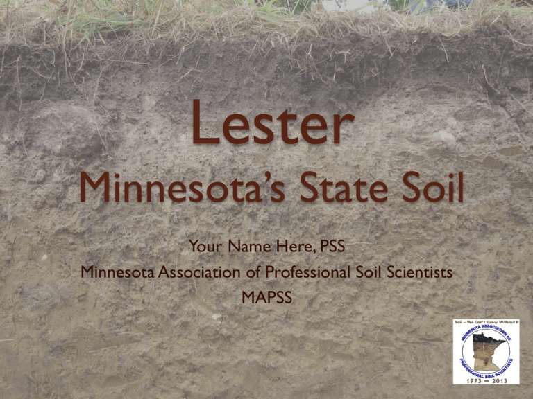
Lester
Minnesota’s State Soil
Your Name Here, PSS
Minnesota Association of Professional Soil Scientists
MAPSS
The Naming of Lester Prairie
John & Maria Lester
Lester Prairie was named “Lester” in honor of
John and Maria Lester and their family, who
settled in the area, and “Prairie” for the little
prairie on which it was situated.
In 1856 when the prairie opened up, they staked
their homestead.
The Lester farm is on the NW ¼ of the section
that the town of Lester Prairie sits on.
Photo of John and Maria Lester used with permission from the
Lester Prairie Herald Journal/McLeod County Historical society
© 2013 MAPSS All Rights Reserved
2
Sioux Uprising In August of 1862 the Sioux Uprising flared up,
starting out in Meeker County, close by where
some settlers were killed. The Lester’s fled to
Hutchinson after reportedly burying their
wagon.
Maria Lester was related to 2 U.S. Presidents: She
was the Niece of John Adams; and the first cousin
of John Quincy Adams.
We name soils after the place it is first recognized
and since Lester Prairie is named after the Lester
farm on the prairie, it is a natural fit to talk about
the pre-settlement vegetation and how this soil is
located near the edge of the forest
© 2013 MAPSS All Rights Reserved
3
The Lester Farm Near Lester Prairie
Key:
Areas mapped as Lester Soil
Location of the Lester Homestead
© 2013 MAPSS All Rights Reserved
4
The Story of Lester
The Lester soil was first proposed in 1939, in McLeod
County – near Lester Prairie, Minnesota.
Lester was established in 1945, in Dakota County
Minnesota.
Lester developed at the prairie/forest interface and is
currently mapped on approximately 400,000 acres in 16
Minnesota Counties.
Lester soils have properties
developed from both grassland and
forest environments and are primarily
used for forage, corn and soybean
production.
Ron E.VanNimwegen
© 2013 MAPSS All Rights Reserved
5
The Story of Lester
In 1985, the Minnesota Association of
Professional Soil Scientists (MAPSS), formed a
committee to designate a state soil.
Selection criteria was that the soil had to be:
1.
2.
3.
4.
A Minnesota Soil Series;
Extensive;
Economically important;
‘Teachable’ (photogenic).
The members voted to designate Lester as their state soil in
1987.
In 2012, a significant legislative effort was undertaken to
establish Lester as the "Official Minnesota State Soil".
Legislation establishing Lester as the "Official Minnesota State
Soil" was signed by Minnesota Governor Mark Dayton on
April 28, 2012
© 2013 MAPSS All Rights Reserved
6
Why is soil important? Just ask yourself:
Where does food come from?
Where does paper and wood come from?
How is spent water and our waste water cleaned or filtered
before entering streams, rivers, lakes, and groundwater?
What supports our homes and buildings, gardens, lawns, parks,
and recreation areas?
The answer is Soil - Without soil, clean water and air we can
not exist.
© 2013 MAPSS All Rights Reserved
7
What is soil?
All natural resources...are soil or derivatives of soil. Farms,
ranges, crops, and livestock, forests, irrigation water and even
water power resolve themselves into questions of soil. Soil is
therefore the basic natural resource. --- Aldo Leopold
Soil - The unconsolidated mineral or organic material on the
immediate surface of the earth that serves as a natural medium
for the growth of land plants.
© 2013 MAPSS All Rights Reserved
NRCS Photo
Photo by L. Clarke
8
or…. What is soil ?
The unconsolidated mineral or
organic matter on the surface of
the earth that has been subjected
to and shows effects of genetic
and environmental factors of:
1.
2.
3.
4.
5.
Climate;
Organisms;
Relief;
Parent Material; &
Time
© 2013 MAPSS All Rights Reserved
9
What is a soil series
Soil series as established by the
National Cooperative Soil Survey of
the United States Department of
Agriculture (USDA) Natural Resources
Conservation Service (NRCS) are a
level of classification in the USDA Soil
Taxonomy classification system
hierarchy.
The actual object of classification is the
so-called soil individual, or pedon.
Soil series consist of pedons that are
grouped together because of their
similar pedogenesis, soil chemistry, and
physical properties.
© 2013 MAPSS All Rights Reserved
10
Clarion Soil Series
A Soil Series
More specifically, each soil series consists
of pedons having soil horizons that are
similar in
◦
◦
◦
◦
◦
◦
A prairie soil
soil color,
soil texture,
soil structure,
soil pH,
mineral and chemical composition
arrangement in the soil profile.
A forest soil
These result in soils which perform
similarly for land use purposes.
There are approximately 963 different soil
series mapped in Minnesota
© 2013 MAPSS All Rights Reserved
Nebish Soil Series
11
Field Determination of Soil Properties
Soil Scientists have to study the soil in the field. They will use soil
pits, soil probes or road cuts to sample the soil horizons.
The soil is next classified using field techniques:
Soil Texture - soil scientists push moist soil between their thumb
and index finger to form a ribbon. The length of the ribbon along
with if the soil feels gritty, sticky or smooth will determine the
soil texture.
◦ Click to play Soil Texture Ribboning Video:
Soil Color -A ‘Munsell’ soil color book is used to determine the
soil color (soil is held behind the hole in the page to determine
the color).
Soil Structure – Soil peds are the shape of the
soil,
blocky, platy and prismatic are some of
the shapes.
© 2013 MAPSS All Rights Reserved
12
* describes the
characteristics of the
soils in a given area.
* plots the boundaries of
the soils on a map, the
map uses an aerial photo
as the base
* makes predictions
about the behavior of
soils
© 2013 MAPSS All Rights Reserved
13
Properties and Interpretations For Lester
Slope
2 -70%
Depth to Seasonal High
> 6 feet in normal years
Water Table
Drainage Class
Well Drained
Parent Material
Calcareous, loamy glacial till
Potential for Frost Action Moderate
Acres Mapped in MN
Approximately 400,000
Prime Farmland
On slopes of less than 6%
Scientists classify soils according to a National taxonomic key (NRCS
Keys to Soil Taxonomy, 11th Edition, 2010 ). Lester is classified as a:
Mollic Hapludalf, fine-loamy, mixed, superactive, mesic.
© 2013 MAPSS All Rights Reserved
14
A Lester Soil Profile
• This monolith is a Lester soil
profile as it would look if you
dug a hole straight down into
the soil to 78 inches.
• The color, texture and structure
change as you go deeper into
the earth.
• Soil scientists describe the layers
as “horizons” using the scientific
notation on the right side of the
monolith.
© 2013 MAPSS All Rights Reserved
15
Lester Soil Horizons
The following is a brief description of
each horizon:
The A Horizon – This is the surface
horizon. It is darker than other
horizons as it contains the most
organic matter.
Organic matter coats and stains the
soil particles.
The organic matter comes from
annual accumulation of plant
material that decomposes
in the soil each year.
© 2013 MAPSS All Rights Reserved
16
Lester Soil Horizons
The E Horizon – This horizon is
lighter in color than horizons above or
below. The E has been leached of clay
and organic matter by water movement
through the soil.
Soils that have formed under a
forest have these horizons as the
decomposing leaf litter is more
acid creating a more intensive
leaching zone.
Soils that have formed under prairie
grasses typically lack E horizons.
© 2013 MAPSS All Rights Reserved
17
Lester Soil Horizons
The Bt Horizon – This horizon
has clay accumulation that leached
from the horizons above. ( t = clay)
This layer has the most clay in the
Lester profile and has the most effect
on water movement, (slower) density
(higher), and ease of root movement
(harder).
The lower part of this horizon
has the most clay and organic
coatings in root and earth worm
pores and faces of peds, thus
it looks a little darker
© 2013 MAPSS All Rights Reserved
18
Lester Soil Horizons
The Bk Horizon – Calcium
carbonate (lime) accumulates in this
horizon. (k = calcium carbonate)
The parent material (till) was high in lime and
the lime leached from the surface when the
soil was first forming about 12,000 years
before present.
Because of the lime this horizon
has a higher pH than horizons above.
This horizon will bubble or fizz when HCl is
added to the soil.
© 2013 MAPSS All Rights Reserved
19
Lester Soil Horizons
The C Horizon – This is the
unaltered parent material (Des
Moines Lobe glacial till) produced
by glaciers grinding up rocks,
boulders and stones as they
bulldozed their way through
Minnesota.
The till originated in Canada north
of Lake Winnipeg.
The C has had little or no soil
development and looks much like
it did when first deposited by the
glacier.
© 2013 MAPSS All Rights Reserved
20
Physical and Chemical Properties
Horizon Textures Clay CEC CaC pH AWC OM % M-BD
%
O3 %
Loam
A
20-27 10-24
0 5.6-7.3 .20-.22 1.0-4.0 1.30-1.40
E
Loam
20-27 10-20
0
5.1-7.3 .15-.19 .05-1.0 1.45-1.55
Bt
Loam,
Clay Loam
Loam,
Clay Loam
Loam,
Clay Loam
24-32 10-20
0
5.1-7.7 .15-.19 .05-1.0 1.45-1.55
Bk
C
20-30 10-20 15-25 7.4-8.4 .15-.19 .01-.50 1.35-1.55
20-30 10-20 10-20 7.4-8.4 .15-.19 .01-.50 1.35-1.55
CEC = Cation Exchange Capacity (meq/100 grams)
CaCO3 = Calcium carbonate (percent)
AWC = Available Water Capacity (inch/inch)
OM = Organic Matter (percent)
M-BD = Moist Bulk Density (grams/cubic centimeter).
© 2013 MAPSS All Rights Reserved
21
Soil our Sustainable Resource
All of our soils in Minnesota directly
support crop production, horticulture,
livestock, energy production, forestry and
fiber production, home lawns, recreation
areas and parks, wastewater and biosolid
treatment;
The indirect benefits of this primary
production include the production of food,
meat and dairy products, and wood and
paper products;
With careful and wise management that
includes soil and water conservation
practices, our critical soil resources,
highlighted by the Minnesota State Soil Lester, are sustainable for us and future
generations.
© 2013 MAPSS All Rights Reserved
22
Soil Education Websites
MN Association of Prof. Soil Scientists (MAPSS)
www.mnsoilscientist.org
Places to see Lester in MN (Google Maps App)
https://www.google.com/maps/ms?msid=202692426412454181396.0004cdc
6fe1f86c0566f0&msa=0
Soil Science Society of America (SSSA)
www.soils.org
www.soils4teachers.org
www.iheartsoil.org
www.facebook.com/IheartSoil#!/IheartSoil
Global Soil Partnership www.fao.org/globalsoilpartnership/home/en/
Web Soil Survey
http://websoilsurvey.nrcs.usda.gov/app/HomePage.htm
UC Davis Soil Web
http://casoilresource.lawr.ucdavis.edu/soilweb/
Lets Talk about soil video
http://vimeo.com/iasspotsdam/letstalkaboutsoil-english
Smithsonian Forces of Soil Website
http://forces.si.edu/soils/
© 2013 MAPSS All Rights Reserved
23
For Additional Information
Visit with MAPSS members to:
◦ -Learn more about Soil Science and our
organization;
◦ -Learn about soil science careers;
◦ -Get a copy of up the state soil poster and
postcard.
To Download this Presentation go to:
www.mnsoilscientist.org/resources-for-teachers
© 2013 MAPSS All Rights Reserved
24
Questions?
Your Name, yourmail@???.???
(###) ###-####
MAPSS Website: www.mnsoilscientist.org
MAPSS e-mail: mapss@mnsoilscientist.org
© 2012 MAPSS All Rights Reserved
25


