NOAA Earth Information Service (NEIS) Lightning Talk EDM
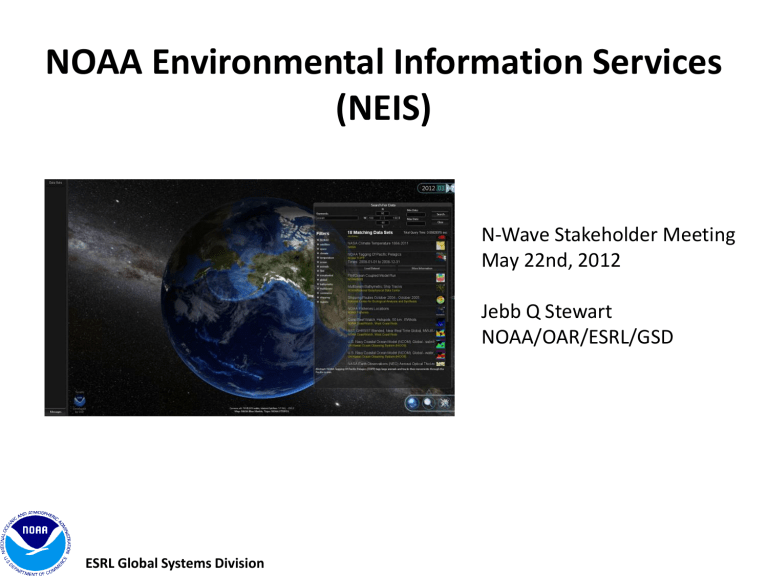
NOAA Environmental Information Services
(NEIS)
N-Wave Stakeholder Meeting
May 22nd, 2012
Jebb Q Stewart
NOAA/OAR/ESRL/GSD
ESRL Global Systems Division
What is NEIS?
--
A framework of layered services designed to help NOAA’s mission by facilitating the discovery, access, integration, and understanding of all NOAA data (past, present, and future).
ESRL Global Systems Division
Data Integration
Chemical
Physical
Biological
FIM
Carbon Tracker
Biological, Chemical, and Physical data are all interrelated
ESRL Global Systems Division
3
Lots of Great Technology Exists.
THREDDS
Google Earth
MERMAid
Grads Data Server
ESRL Global Systems Division
LAS
NASA World Wind
REVERB
OGC Services
More… xkcd.com
ERDDAP
GeoPortal iRODS
NEIS Concept
Take advantage of existing technology where we can to quickly find and access to data 100 of years in the past to 100 years in the future, from the top of the atmosphere to the bottom of the ocean in a single application.
Framework provides capability to answer questions that require data from different data sources.
ESRL Global Systems Division
New Visualization Tools
TerraViz – Created by GSD
• A system developed from the ground up by GSD based on Unity3D.
• There are no licensing restrictions in distributing the TerraViz executable.
• Unity3D is a well supported commercial game and data visualization engine with 750,000 active users
• Unity/C# is designed for 3D development, making it easy to create multiple views, create 3D meshes representing environmental objects, etc.
• Develop once, then will run under Windows, Mac, web browsers, iPhones, iPads, Android devices, and even game systems (Wii, Xbox 360, etc.)
• We can modify the user interface and add any feature we need.
• TerraViz Handles millions of polygons and performs quickly
TerraViz is one possible visualization tool built to develop, test, and showcase
NEIS framework.
6
Dealing with Big Data
Data are ever increasing in size.
• New Polar Orbiting NPP data (~ 4 TB / day)
• GOES-R
• New Global Forecast Models, rapidly increasing in size.
We want to:
• Minimize data we transfer.
• Avoid data duplication.
• Make data appear local to users.
• Allow users to collaborate.
Looking to the Future
Build new Graphical User Interface system integrating and leveraging new and emerging technologies to meet NEIS goal ‘any data, any location, any platform, now’
• Perform processing within cloud environment and with high speed connectivity to data sources (N-Wave), taking advantage of large processing power within clouds.
• Send graphics and server side processed/rendered/streamed data to GUI, improving bandwidth utilization.
• Take advantage of fast networking to make remote requests and processing appear like local application.
• Similar to how the new Amazon Silk Browser works.
Demonstration
ESRL Global Systems Division
Questions?
Jebb.Q.Stewart@noaa.gov
http://www.esrl.noaa.gov/neis
ESRL Global Systems Division
ESRL Global Systems Division
Backup Slides
NEIS – Features
Integrates data from disparate data sources synchronized both temporally and geospatially.
Quick access data through time using “Time Wheel” with dynamic time striding.
12
ESRL Global Systems Division
ESRL Global Systems Division
NEIS - Features
3D KML with Metadata overlays
Integrated data plotting
13
NEIS - Features
Annotation – Basic drawing capabilities
Multiuser/Collaboration – real time screen sharing with web cams
ESRL Global Systems Division
14
ESRL Global Systems Division
NEIS - Future
What’s next?
Understand more data access protocols. Eventually support ERDDAP and variety of OGC services
Cross Service Processing
Continued improvement for data discovering and searching
More …
15
NEIS/TerraViz in Action
TerraViz – Developed by GSD is a show case of NEIS capabilities
ESRL Global Systems Division
