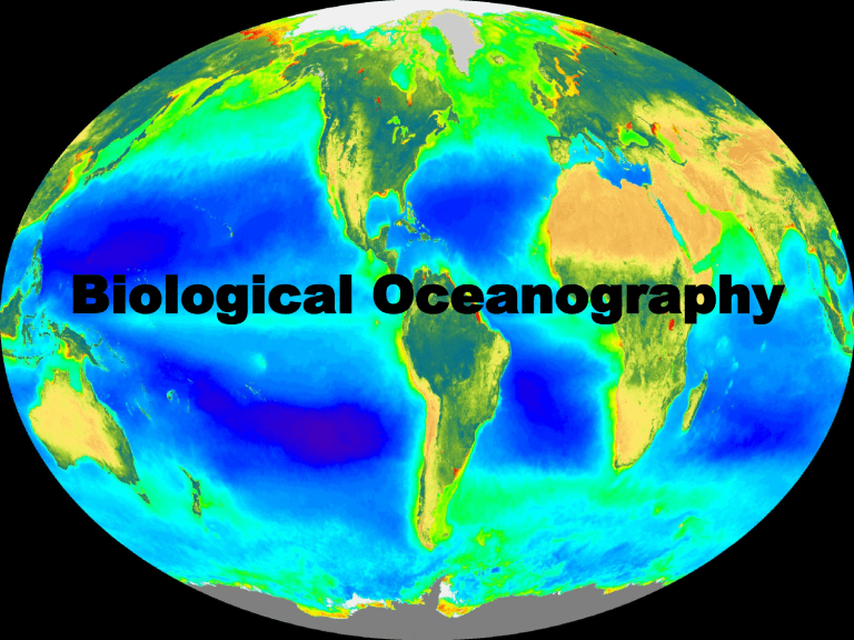
Biological Oceanography Course Outline Instructor introductions COVID: in person option does not look promising https://www.uaf.edu/uafgov/faculty-senate/COVID%20Committee%20Statement%20and%20Recommendations.pdf Zoom: Mute when not speaking. Use Speaker view. Turn off video when not speaking (bandwidth). Post a clear headshot to Zoom profile. Speak loud and clear. If raising hand does not work, just interrupt. Weekly discussion? (optional) Student Introductions Definition • Biological Oceanography: The study of why we find organisms where and when we do. In particular, how are distribution, abundance, biomass and production influenced by the physical (and chemical) environment and the interaction with other organisms. • Virtually all of the production in the oceans begins with phytoplankton, and the majority of that flows through the zooplankton – Phyto ~50 Pg C yr-1, all macrophytes ~1.2, coral reefs 0.7 Sunlight to carbon • In general ocean productivity is limited by light & nutrients: • Sunlight heats the oceans, leading to stratification, and subsequent depletion of plant nutrients • Loss of light leads to cooling, mixing and nutrient replenishment • A major theme will be factors moving nutrients from where they are plentiful to where they are needed. Oceans • Life originated in oceans (or at least in a ‘wet’ environment) ~3.5 BYBP when the ocean was more energetic (30+ m tides) • Virtually all know phyla (extinct & extant) exist & originated in the sea. Relatively few phyla exist in terrestrial environments, but most species are terrestrial…. Why? • Oceans provide a more stable and protected environment than land, – limited daily (±2°C) & global (–2 to ~35°C) range of temperature, land varies –60 to +50°C. – UV radiation rapidly attenuated in water • Most of sun’s energy only penetrates relatively little compared to the ocean’s depth. Virtually all oceanic life is therefore dependent on what happens in these shallow surface waters. • Unlike land, gravity does no constrain morphology or size in oceans (but diffusion may). Changing the planet • Life on earth has reshaped the functioning of this planet. Oceans (and land) would be very different place if life did not exist. • Physical oceanography might be the similar. • Chemistry would be very different: O2, N2, CO2 Nutrients, dissolved compounds (oxic vs anoxic) e.g. iron. • Early autotrophs did not produce O2! • Geological features would be very different (no carbonates) Distribution of organisms • Most of the living space on the planet is in the oceans (>99.5%). Average depth of oceans is ~3800 m, maximum ~11000 m – Average land elevation ~840m – why are we not underwater? • Distribution is governed by 2 sets of variables: • Tolerances to abiotic factors – temperature, salinity, UV, pressure, oxygen, pH • Interactions with biotic factors – abundance & types of predators, prey & competitors Oceanic realms Classification: • Size (usually on log scale) • Function: Autotroph (Chemotrophic, Phototroph), Heterotroph, Mixotroph • Taxonomic (classically morphological, increasingly molecular) Were are we now? • For early expeditions, it was a challenge to simply know where one was (c.f. GPS). • Things we take for granted were all complex undertaking: soundings, sub surface temperatures, salinity (surface and subsurface), tides, currents, bottom type and overall topography. • All were known at such poor temporal and spatial scales that the big picture could not be seen. Positioning • Requires knowledge of direction to North pole • Exact time • Exact day-length • (sun up/down) • Angle of sun • Great training • Problems? Radio • 1912- Titanic sinks, 1913 all ship install wireless telegraph to be manned 24hrs per day • 1920s voice over radio begins • Navigation begins to rely on radio triangulation & accurate timekeeping • Radar (1937 – Navy prototype) • Loran-A WWII (DOD only - 1942) • Loran-C 1950s – DOD and commercial shipping – 0.1-0.3 miles at distances up to 100 miles in US coastal zones (with lots of transmitters) – 0.5-1 mile at ranges up to 900 miles from the transmitter in open sea – 2-5 miles from 900 to 3,000 miles from the master station GPS • 24 satellites, triangulation yields ~10m resolution • DGPS: land-based correction 1-3m resolution latitude, longitude & altitude Ships can get weather forecast by radio continuously, and can be faxed details, and maps twice daily (pictures can download if even more info in needed) WindyTY: realtime Communication • Once you went to sea, and had no contact with family /work until you returned • 20 years ago ships only had telex (some had fax! via MarSAT $$$$) • New ships have broad-band internet 24/7 (good enough for videochat) • Transponders Aug 21, 2020 Data Systems • Early data largely unavailable and simply archived • Global consolidation of existing data and rescue of older data is underway • Modern computing power makes it possible to find patterns Currently >61 million records http://www.nasa.gov/centers/goddard/mpg/143498main_SeaSurfaceTemperatures.mpg AND ALSO http://www.youtube.com/watch?v=vTig9gKegQk AND http://podaac.jpl.nasa.gov/AnimationsImages/Animations http://www.nasa.gov/centers/goddard/mpg/146191main_GlobalPhytoplankton.mpg http://www.argo.ucsd.edu The oceans are increasingly “wired” UAF Gulf of Alaska Moorings • • https://portal.aoos.org/?&sensor_versio n=v2#metadata/100704/station/data https://portal.aoos.org/?&sensor_versio n=v2#metadata/100703/station/data So… • We now understand the overall patterns of the physical environment, although we struggle at the finer scales and to understand the mechanisms • Biological patterns are much less clear, despite better toys (why?) – although we are on the threshold of technologies… • We are now entering a period of renewed exploration and basic “monitoring” Automatic identification of plankton • Various imaging technologies both in situ and for sample processing combined with “AI” neural nets • Molecular (i.e. genetic) identification of samples via reference to sequence libraries Floatation, Electronics, and Payload Flight control (yawn, pitch, roll) Tow Cable, I/O Secondary Imaging 50x100mm (24µm Px) Primary Imaging 140x400mm (68µm Px)
