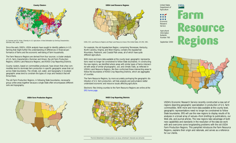
County Clusters USDA Land Resource Regions United States Department of Agriculture Economic Research Service Agricultural Information Bullentin Number 760 J.E. Sommer and F.K. Hines. Diversity in U.S. Agriculture: A New Delineation by Farming Characteristics. AER-646, ERS, USDA, 1991. Since the early 1900’s, USDA analysts have sought to identify patterns in U.S. farming that might further the understanding of differences in financial performance of farms and the economic well-being of farm households. The Farm Resource Regions are derived from four sources: a cluster analysis of U.S. farm characteristics (Sommer and Hines), the old Farm Production Regions, USDA’s Land Resource Regions, and NASS Crop Reporting Districts. County clusters, based on commodities produced, have shown that a few commodities tend to dominate farm production in specific geographic areas that cut across State boundaries. The climate, soil, water, and topography in localized geographic areas tend to constrain the types of crops and livestock that will thrive there. The old Farm Production Regions, in following State boundaries, necessarily group unlike areas together because a single State often encompasses different soils and topography. USDA, SCS. Land Resource Regions and Major Land Resource Areas of the United States. AH-296, 1981. For example, the old Appalachian Region, comprising Tennessee, Kentucky, North Carolina, Virginia, and West Virginia, contains the Appalachian Mountains, Piedmont, and Coastal Plain areas, all of which have quite different agriculture. September 2000 Farm Resource Regions With more and more data available at the county level, geographic representations need no longer be constrained to follow State boundaries. In constructing the new regions, we identified where areas with similar types of farms intersected with areas of similar physiographic, soil, and climatic traits, as reflected in USDA’s Land Resource Regions. We then conformed these intersecting areas to follow the boundaries of NASS Crop Reporting Districts, which are aggregates of counties. The Farm Resource Regions, by more accurately portraying the geographic distribution of U.S. farm production, will help analysts and policymakers better understand economic and resource issues affecting agriculture. Electronic files linking counties to the Farm Resource Regions are online at the ERS home page. USDA Farm Production Regions NASS Crop Reporting Districts USDA’s Economic Research Service recently constructed a new set of regions depicting geographic specialization in production of U.S. farm commodities. With more and more data available at the county level, geographic representations need no longer be constrained to follow State boundaries. ERS will use the new regions to display results of its analyses in a broad array of venues—from briefings to publications, our Web site, and journal articles. The new regions take advantage of both new capabilities and standards in the resolution of the data we work with and overcome some longstanding problems with the old USDA Farm Production Regions. This pamphlet introduces the Farm Resource Regions, explains their origin and rationale, and serves as a reference for our clients. THE U.S. DEPARTMENT OF AGRICULTURE IS AN EQUAL OPPORTUNITY PROVIDER AND EMPLOYER Farm Resource Regions Northern Great Plains • Largest farms and smallest population. • 5% of farms, 6% of production value, 17% of cropland. • Wheat, cattle, sheep farms. Basin and Range • Largest share of nonfamily farms, smallest share of U.S. cropland. • 4% of farms, 4% of value of production, 4% of cropland. • Cattle, wheat, and sorghum farms. Heartland • Most farms (22%), highest value of production (23%), and most cropland (27%). • Cash grain and cattle farms. Northern Crescent • Most populous region. • 15% of farms, 15% of value of production, 9% of cropland. • Dairy, general crop, and cash grain farms. Eastern Uplands • Most small farms of any region. • 15% of farms, 5% of production value, and 6% of cropland. • Part-time cattle, tobacco, and poultry farms. Fruitful Rim • Largest share of large and very large family farms and nonfamily farms. • 10% of farms, 22% of production value, 8% of cropland. • Fruit, vegetable, nursery, and cotton farms. Southern Seaboard Prairie Gateway • Second in wheat, oat, barley, rice, and cotton production. • 13% of farms, 12% of production value, 17% of cropland. • Cattle, wheat, sorghum, cotton, and rice farms. Electronic files linking counties to the Farm Resource Regions are online at the ERS home page. Mississippi Portal • Higher proportions of both small and larger farms than elsewhere. • 5% of farms, 4% of value, 5% of cropland. • Cotton, rice, poultry, and hog farms. • Mix of small and larger farms. • 11% of farms, 9% of production value, 6% of cropland. • Part-time cattle, general field crop, and poultry farms. For more information about ERS publications and data, see our home page.


